Wednesday, September 29, 2010

Franconia Ridge Trail

Cathy, Aaron and I did one of the more aggressive day hikes in the Whites today. Up Falling Waters trail, across Franconia Ridge trail, then down Greenleaf/Bridle Path trails. It was the first time hiking the ridge for all of us.  All I can say is I faired worse than Cathy or Aaron. They both run and had knees for the descent. Treking poles weren't enough for this one. It didn't help that it rained three days straight up there. It sure made for some pretty waterfalls though. I'll let the photos tell the rest of the story.

First falls on Falling Waters with Cathy and Aaron

Wet leaves on slimy granite were a constant battle heading up

Third falls on Falling Waters

Approaching summit of Little Haystack. We were bumming that
the ridgeline was socked in with clouds. The Franconia Ridge
is supposed to be one of the most spectacular ridges to hike in
New England.

Approaching The Gargoyles (I think) on the ridge

A balancing rock on the ridge

Moist air would approach the ridge at 50mph, rise and condense
in a flash. Moments of clarity like this were fleeting instances, but
it gave us hope we might see more.

Heading north along the ridge with a bit of sun even poking though

Working our way towards Lafayette. Skies were clearing.

Lafayette in background finally in the clear

Aaron and Cathy on final approach to Lafayette summit with
Mt Lincoln in background. Midweek, we nearly had the ridge
to ourselves.

The wind was so strong at the summit of Lafayette that it was
risky to stand in it. Plus it was quite cold. Cathy and Aaron
taking shelter with Mt Washington visible in upper left.

Initial descent off Lafayette

Mt Lafayette and Eagle Lake from the Greenleaf Hut

More hands and feet on the descent. I-93 in upper right, looking
south. The Old Bridle Path Trail we took down follows the
ridge that obstructs view of I-93. There were numerous vistas of the
Franconia Ridge to the east along the way.

Peak color in Franconia Notch with Mt Truman and Mt Lincoln

New feature of GE shows profile and speed. Hike took 7.3hrs
with probably less than 5.5hrs moving time to cover the 9 miles.
We hiked loop in CCW direction.

Monday, September 27, 2010

More on tires

This weekend was not a good tire weekend for me. Both cars had punctured tires Saturday. Sunday, I finally got around to mounting Stan's Raven tires on my 29er. I bought these tires with one purpose in mind: fast non-technical courses like Ironcross, Leadville or the VT50. I was primarily concerned with rolling friction. Reviews suggested Raven's had an efficient casing. The barely-there tread helps too.

Published weights of tires are usually bogus. Tires always weigh more.  The Raven's are claimed to weigh 520g, which is silly light for a tubeless ready 29" tire. I don't even own any tube type 26" tires that are this light.

When the Raven's came in several weeks ago, I immediately weighed them on a tool every cyclist has, even if they don't wrench their own bikes - the gram scale. First tire, 520g exactly. Nice. Second tire, 470g. Uh, oh. I suppose Stan's lists this as the lower limit for the tire, so maybe it is not a defect.  The sidewalls of both tires were little more than onion skin. They were flimsier than Michelin Pro 3 Race tires I run on the road. I had extreme reservations using these tires for any kind of riding, let alone a 62 mile cyclocross race on fire roads, ATV trails and singletrack.

I pulled the Bontrager 29-3's off. These tires hook up quite well on the trail, but they are quite slow on pavement and hardpack. They take noticeably more energy to wind up when accelerating too. I put the heavier of the two Raven tires on the rear wheel. An extra generous serving of Stan's sealant was poured in. As I do with all tubeless tires, I try the hand pump first. This wasn't even close. I fired up the compressor, waiting until it hit 125psi.

I could not get the bead to seat. You'd think a Stan's tire on a Stan's rim would be a perfect marriage. Nope. I spent at least 10 minutes with the compressor running continuously trying to get even the slightest bit of air in the tire. I kept loosing sealant. Finally the bead caught. What a PIA.  I shook the tire all the way around to spread the sealant around. There were numerous little pinholes with white bubbling out. My reservations about these tires grew.  I worked on the front tire next, taking almost as long to inflate. They are rated to 40psi, I stopped at 35.

I figured if I was going to race on these essentially innertubes with a decorative tread pattern on them, I would have to give them a serious test. I thought the probability of walking out of the woods would be high, so I picked a place where I would never be too far from my car. Willowdale State Forest in Mass would work. For the most part, the trails are buff at Willowdale, but there are many rooty sections and a few follow glacial eskers, which are comprised of sharp, rocky material.

Not two miles from my house, I heard a sudden psfffffffft. What the...  I pulled into a state line beer store, opened the hatch, and too my horror, the rim beads of both tires were leaking. If I didn't address this then and there, the tires would go flat and I'd never be able to inflate them without a compressor. I removed the wheels and proceeded to shake the crap out of them to move more sealant around. I'm sure patrons of the party store wondered why this skinny old white dude in spandex was having a hissy fit with his bike tires. The leaking stopped for the time being. I kept the windows up so I could hear another leak if one started.

I got to Willowdale with air still in the tires. I did have to top them off again though. I hadn't been to Willowdale since late last fall. The trails were dry and almost as firm as concrete. You could fly. I putzed around at first, as I was pretty wrecked from the 50 miler the day before. About 40 minutes in, I felt the rear tire bottom out hard on a rock. It didn't cut. But it was down to about 15psi. I topped it off again.

A while later I met up with this couple. They both could really move. They showed me a new trail that had just been cut this summer. Very sweet stuff. The woman asked me to ride ahead of her. This made me nervous, as she had no problem staying on my wheel for a while. No more putzing around. I chased her significant other around at near race pace on a trail they knew and I've never been on.  Forget about onion skin tires. I feared a meet-up with a tree.

I finished a two hour ride with all limbs still intact. The tires held air for the rest of the ride. There is hope for them. The Raven's do feel exceptionally fast, probably faster than the Racing Ralph CX tires I used at Ironcross last year. The supple casing allows for surprisingly good grip.  They also wind up about as fast as heavy 26" tubeless tires. It made my Superfly feel quite snappy.  The tires have a very lively feel too, kind of like latex tubes in Michelin Pro 3 Race clinchers. That tells me the casing returns energy from impacts rather than absorbing it. This is good if you want a low loss tire. Not good if downhill is your gig.

The first time I raced Ironcross, I was on my Dean hardtail. I did well that year, but it was a much more brutal course, probably more technical than the VT50 course is today. The past two years I rode my Ridley CX bike.  To try something different this year, I'd like to try a MTB again. I know there are several sections I can ride faster on a fat tire bike. The question is, will being on a fat tire bike get me popped out of the lead group sooner, such that I'll lose significant drafting benefit later in the race? Hard to say. Of course, if I flat, the experiment will be a failure. I haven't flatted at Ironcross yet. What usually gets riders are the embedded rocks in 40mph fireroad descents, not the gnarly two mile singletrack descents.

Saturday, September 25, 2010

What are the odds?!

I recently put new tires on both of our vehicles. The Matrix got new tires just last month in fact, to make sure it passed inspection. I just may have to drive that car for more than another year to get my money's worth out of that rubber. I tend to put decent tires on our cars, as I drive like a maniac most of the time, including a lot of winter miles. I put Pirelli P4's on both cars. They do quite well in rain and snow, conditions where I demand the most from my tires.

My son finally got an extended leave from the Navy as he transfers from Pensacola to Norfolk to begin his next training sequence. Cathy and I picked him up in Boston late last night. We waited in the cell phone lot until his flight came in around midnight. It was a warm, breezy night, so we had the windows down in the Scion xD.  When we pulled out to pick him up, I noticed a right tire was making a racket. Cathy said "it's just a stone, new tires always pick up stones." Yeah, but this sounded different, and when I sped up to 50+, the tire didn't spit the stone out. It was dark and there wasn't a decent, well lit place to check it out.

I could hear the ticking all the way home. It was past 1:30am when we pulled into the garage, thanks to night time construction on I-93. The tire would have to wait until Saturday.

Saturday morning - Aaron sleeps in, a luxury he's not enjoyed in quite some time. Earlier in the week before I knew which day Aaron was coming home, I toyed with going up to ride the Kingdom Trails. That wasn't going to happen now, so something closer would have to do. I quickly scanned the xD tires and didn't see anything unusual.  I threw my dualie in the back of the Matrix, which has more bike room, and headed for FOMBA. I nearly stalled the Matrix backing out of the garage. It moved a little bit and made a funny crunching sound, like I ran over something. WTF.  I get out, and what do I find? The left, rear tire is flat! The teenage neighbors across the street surely wondered what my problem was.  Cathy didn't have any immediate plans, so I transferred the bike to the xD. Just in case, I backed out into daylight to verify the tires were clean.

Well SOB! There was a screw in the right, rear tire! It was still holding air, but this could not be trusted. What are the odds that both cars we own with new tires puncture the same day? I can't even remember the last time I flatted. It might have been 8yrs ago on my Ford Ranger when I found a flat tire in the garage.

Horseshoe nail on left is about 2" long

Even though car tire flats are rare, I always keep a radial tire plug kit on hand. It was going to pay off big today. I pulled the tire off the xD and pulled the screw out with a long nosed pliers. Yep, it went all the way through alright. Took a few minutes to plug, air back up, and remount. I figured I might as well do the Matrix while all the stuff was out. I found it to have a horseshoe nail in the tread, over 2" long. There's only one area I could have picked this up, Great Poop Farm State Park, er, I mean Great Brook Farm State Park. Seems the parking lot is always full of horse trailers and the trails full of poop when I go there these days. The hoof nail was much bigger than the screw. Hope the plug holds. It is a $150 tire. I don't buy tire hazard insurance. It's a total rip-off. Maybe once in 32 years of driving did I damage a tire when I hit a curb one time. Hazard insurance over all those years could have purchased at least a couple sets of tires by now.

So anyway, in about 45 minutes I plugged both tires, in less time than it would have taken just to drive to and from a tire center. I did still mange to get a good ride in, a fury fueled ride. Nothing gets my blood boiling quicker than misbehaving cars. Since I cannot do the VT50 this year, I rode 50 miles on mix of singletrack and logging roads in 4.6 hours, linking up sweet bits of FOMBA and Bear Brook via Trail 15.

Sunday, September 19, 2010

Lincoln Gap for Breakfast

I didn't think a 6-gaps ride was going to happen for me this year. We normally put a gap ride together over Memorial Day weekend, but this year I booked a trip to Italy over that weekend. Then I went ahead and broke my ankle, completely messing the season up.

A while back I learned Eric Brandhorst was organizing a September 18 gap ride. I was still recovering from my injury and figured Eric invites a pretty broad spectrum of riders, so maybe I'd have somebody to ride with. My recovery progressed much more rapidly than I expected. When other 6-gaps enthusiasts learned I was doing the ride on the 18th, they asked if they could join. Before I knew it, we had a pretty good size group. Many of the riders were not interested in starting before sunrise with Eric's group, so we decided to start closer to our normal starting time and see if we could catch up with them. We learned later that Eric's group rolled out at about 6am. We didn't roll out until 8:45. That was a pretty big gap to make up.

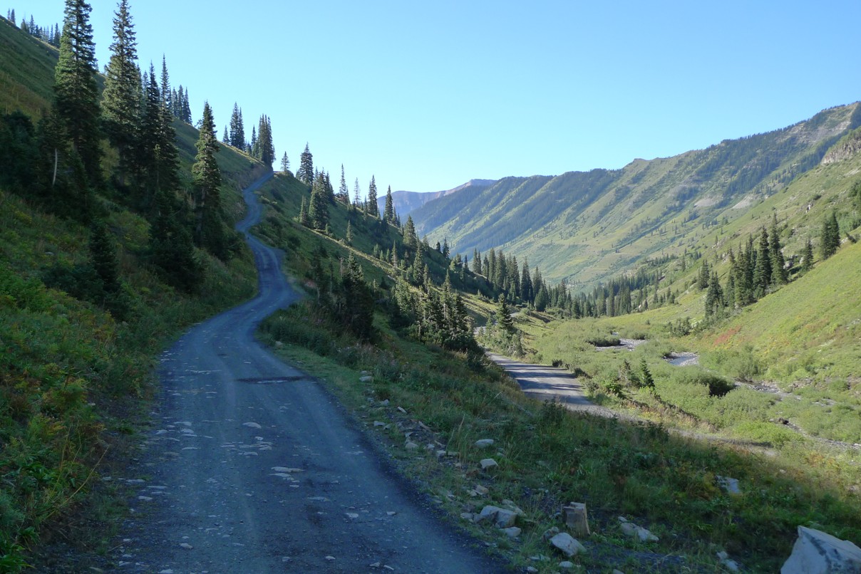
It was expected to be a pristine day for a long ride, although there was frost on the ground driving up. I did not bring suitable layers for that kind of coldness. My fingers were going to freeze. We had eight riders, Aaron, Alex, Paul, Charlie, Greg, Dave, Brett and me.  For the first time, we were starting in Warren where the other group started and would be hitting Lincoln Gap first. We barely had one mile on the odometer turning onto Lincoln Gap road. This was going to be interesting.

The group stayed together until the steep part. We really didn't bust up that much even though the pace was much harder than in past 6-gaps rides. I was amazed at how much easier Lincoln Gap is when it is the first climb of the ride. Normally it is the third. I summitted mid pack, with Charlie taking the honors on this one. After Alex's facebook comment, I floated the idea of each putting $6 into a hat, raising $48, then paying out a dollar per KOM point. First place is 3 point, second is 2 points, and third is 1 point for each of the six climbs. Then at the end, whoever had the most KOM points took the remaining $12. But no. I guess the ride is scary hard enough without these shenanigans going on. Deep down though, each of us wants to come away from a ride like this with some bragging rights. KOM points or not, each climb was a KOM contest.

There was no more than a minute spread from fastest to slowest guy up Lincoln Gap. This was looking like the tightest group I've ever ridden with on 6-gaps. That's good and bad. It's good, as you tend to stay together and on 10% of the route you might even be able to work together. But it is mostly bad. You see, when you point a group of guys with matched fitness up a hill, they will kill each other on the way up. Each climb becomes a throw down. For example, Charlie was about half a minute faster than me at the Mt Greylock TT and Aaron half a minute slower last weekend. Greg, Brett, Alex and Dave all finish very closely to each other in hillclimb events. I let Charlie and Aaron beat up on each other up App and Rox gaps. They couldn't resist.  I've learned my lesson going out too hard on these rides. If we had a rider that was a lot faster than the rest of us, the tendency is to just let him go. The ride actually gets easier when abilities are grossly mismatched. Our group was optimized for maximal suffrage.

Brett on 18% section of App Gap

Aaron didn't actually come up the same side of Lincoln as us, as he was time constrained in meeting us. We scooped him up while descending the west side of Lincoln Gap. App Gap went well. After Aaron and Charlie bolted with 4km to go (per GMSR markings), I upped the intensiometer a notch. I at least wanted to claim table scraps on this one, being the third to summit. It hurt. As the rest of the gang summitted, we agreed our pace was unsustainable. Super hard on the climbs, but civil on the flats. Think a truce was called? Noooo.

View from Appalachian Gap

We stopped briefly in Waitsfield to refuel and then again at our cars in Warren to ditch unneeded layers. It was warming up nicely. I started to wonder if we'd every see anybody from Eric's large group with the extra stop and civil pace between climbs.

Roxbury Gap had recently been graded, so the gravel was considerably more chunky than Lincoln Gap. Still not bad, but no 40mph descending on dirt. I think Aaron said he claimed this climb between him and Charlie. I was starting to feel it already, and we were only a third of the way into the ride mileage-wise.

Summit of Roxbury Gap. Left to right: Brett Rutledge, Dave Penney,
Greg Larkin, Charlie Casey, Aaron Hall, Paul Zackin, Alex Combes
and the Hill Junkie.

Dropping down onto Rt 12a, we were faced with a nasty head wind. Most times, we can get a paceline going here and maintain 28mph without too much work. Today, 20mph was a struggle at times. In Randolph, we made an unplanned stopped due to minor mechanical. Crappy Mavic hubs. Steve Gauthier and I rented bikes in Maui once with this problem. While coasting on a descent, the freehub howls, binds, makes the chain sag. You're certain the wheel is going to explode and cause you to crash. Mavic uses cheap plastic bushings that wear out quickly. Greg drowned his freehub in WD40, which maybe helped slightly. Perhaps this is why Greg was motoring so strongly into the wind - he couldn't coast anyway.

Dave and I got a bit of an accidental gap on the others riding out of Randolph. We kept it going, seeing how long we could stay away from the other six in this headwind. We got a ways up Rochester Gap before they caught us. Once we got into the earnest part of the climb, Pain Cave Dave and I realized that stunt was probably not the best use of several matches.

Rochester Gap was not as kind to our group. Cracks were appearing. The order of riders ascending became rearranged. I think 17% extended grades had something to do with it.  I fared better than I expected. Perhaps not going ballistic on the first couple climbs was starting to pay off for me. We regrouped up top.

Last four riders summitting Rochester Gap

Dropping down into Rochester, I hoped to see remnants of Eric's group there. Supposedly they take a longer lunch stop at the park. But the place was devoid of cyclists.  Perhaps I was a wee bit presumptuous in thinking we'd catch them.

There really is no flat time between Rochester Gap and Brandon Gap. Brandon is the easiest of the six and is the one our ride normally starts with. The grade is mellow enough that you can paceline most of the way up it. Even so, our group fragmented. We also started passing other riders. I recognized Raniel, who said he was part of Eric's group.  Somehow I found myself ahead of the others from our group with Aaron, who's half my age and close to upgrading to Cat 2. Aaron had Lincoln Gap on his mind, as when we roll in to our cars, he still had to ride over Lincoln Gap to get back to his car. At the pace we hit some of these climbs, I couldn't fathom doing Lincoln last.

We started passing a lot of riders as we neared the summit of Brandon Gap. Eric was one of them. I entertained challenging Aaron at the summit, but he would have none of it despite backing it down a notch. He handidly outsprinted me to the top.  Dave was right there too, so we decided to keep going over the top and regroup at the bottom, our final water stop for the ride. When we got to the store at the junction of Rt 53, there must have been 20+ riders there, many in Monsters jerseys.  Now we had caught the bulk of the early group.

We spent a little more time at this stop, since many of us knew each other. Turns out Eric was having exactly the same problem as Greg with his Mavic freehub. Greg still had the tiny can of WD40. Not sure if it helped Eric out or not.

Eric's group pushed off a couple minutes before we did. It didn't take long to catch them on the flats along Lake Dunmore. I was still felling pretty good on the flats and took some firm pulls. I wanted to take the back roads way that Andrew Gardner showed us to Rt 125 last year, but I wasn't sure which turn to take. We ended up on Rt 7 for a mile or two anyway, which isn't too bad, as it has a wide shoulder. We finally scored a bit of tail wind here. Somehow in overtaking the other group, we lost Paul from our group. Alex said he knew the roads, and Paul would have more than enough company with 30 other riders just behind us.

Gap riders had sent me reports over the summer on Middlebury Gap road reconstruction. The state is still feverishly working on it, late on a Saturday even. I suppose it is fine to put up with a one-time inconvenience, as the road badly needed repair. It will be superb when complete. We had to wait in a long queue of cars and RVs until they let our direction through, and then only after the last car passed. We could have ridden faster than the traffic was going up hill. Once past the active paving section where 10 asphalt trucks were lined up, we had mint surface to ride on. Most of the group was cracking by this point. Aaron, Dave and I crested the initial steep section and kept the power on through the college campus. By the time we got to the upper steep section, the rest of the group was not in sight. No KOM contesting for me this time.

Aaron was now faced with a dilemma. He was fading fast, not having eaten nearly enough during the ride, and daylight would soon end. If he descended the east side of Middlebury Gap, he was committing to climbing back over the mountain range to get to his car. This meant Lincoln Gap late in the day. He was pushing monster gears. In a bonked state, descending with us was risky. He could bomb back down through the paving section and just take flat Rt 116 to his car. But no. He had too many devils whispering in his ears. I promised him we'd work hard to pull him quickly to base of Lincoln Gap, where the rest of our cars were.  Aaron decided to descend with us.

A deep chill was settling into the air on Rt 100. I love that feeling this time of year. The sun was getting low, so the valley floor was shadowed but the mountains on the opposite side were still brilliantly illuminated. Initially, the group worked together on Rt 100. But as we neared the 500ft Granville Gulf climb, it became clear than nearly everyone had cracked. I pondered for about a millisecond if there was anything I could do about the situation. Nope. I thought maybe Pain Cave Dave would humor me and hammer over this blip of a climb. Nope. So I went it alone. Soon nobody was in sight. I was amazed that I still was not cramping. Perhaps all these 15-20 hour weeks I've been putting in to regain lost fitness have paid huge dividends. I buried myself the last five miles of the ride, head down, in TT mode. I got to the turn-off at Main St in Warren and waited. My ride was done. Alex was first to show up. Some of the others were quite far back.  Aaron was done too. Lincoln Gap was not going to happen for him. Fortunately, Charlie graciously offered him a ride over since they both live in NY anyway. This ride was part of Aaron's final prep for the Everest Challenge stage race in California next weekend. He probably gained some valuable experience in nutrition during this ride.

Wrapping up the ride on Rt 100

I logged 134.1 miles in 7:36 hours riding time. Not my fastest 6-gaps, but close, and when you factor in the added mileage from course change and the brutal headwind on Rt 12a, it is easy to understand why it was the hardest. I was more wrecked from this gap ride than any of the others I've done. Perhaps the cool weather kept me more hydrated and cramp free so I could maintain a harder pace to the end. This was my best 6-gaps yet - nobody flatted, only one nuisance mechanical issue to deal with, perfect weather, and most importantly, a riding group that shared similar passions and worked really well together on such a tough ride.  Long, hard rides like these are intoxicating. The endorphins were flowing freely after the ride. When you think about it, older guys like me shouldn't be allowed to do stuff like this. We could easily OD on endorphins. Or destroy our bodies trying. Sometimes I feel like a minor getting away with alcohol consumption.

Sunday, September 12, 2010

I'm Back

Mt Greylock Hillclimb Time-Trial

The holiday last weekend screwed my training schedule all up. Normally, Monday's are active recovery days. Having taken Saturday off and Sunday really easy, I was itching to do something really long on Labor Day. I pummeled myself on my 29er for five hours in the White Mountains. So how do you do VOmax intervals on Tuesday after that? You don't. I deferred to Wednesday, which left only two days to taper for the Mt Greylock hillclimb. I wasn't going to give up interval work. I'm still rapidly regaining fitness lost to injury. I've only done a few interval sessions since May. I needed it.  So Greylock was relegated to a "B" event, but only a slight B event. I still wanted to do well.

Not only was I feeling guilty about blowing off interval work thus far, I also was feeling guilty for not using my Ski Erg or doing any kind of core work for over two months now. So Wednesday night I did 15 sit-ups and 5 push-ups. I could have done more push-ups, but about 15 was my limit for sit-ups.  Paltry, eh?  But you wouldn't believe the damage the sit-ups did to my abs. The next day wasn't too bad, but by Friday, I couldn't even get in and out of the car right. And do you think this was cleared up by Saturday morning? Not a chance. Man I suck. It is Sunday night, and I still hurt leaning forward in my chair.

My hillclimb start time was 10:09:30am.  A rider was sent off every 30 seconds. The weather was perfect. Ideal temp, clear skies, negligible wind. Warming up, I was dismayed to still feel Wednesday's intervals in my legs. No surprise really.  Greylock falls pretty deeply into the anaerobic regime, being only 45 minutes or so. I had a goal to break 47 minutes. My prior best was 45:07 in 2004. In 2005, I came within 3 seconds of that at 45:10. The race wasn't held the last several years due to road reconstruction and other issues, so I don't have more recent history on the mountain.

I warmed up for 18 minutes with just one stiff one minute effort before queuing up. I know this climb very well, from both the three prior times I was timed on it and the numerous times I've ridden it as part of long Berkshires rides. The steepest grades by far were in the first mile. Many riders go out way too hard here. New signs have been added on the descent that indicate 17% and 14% grades. These aren't for just 50 meters either. These are sustained sections.

I eased into the climb. I felt guilty about how easy I was going, You have to, if you want an optimal finishing time. I go purely by perceived effort and do not use a power meter in competition. I passed two riders in the first half mile.  In a mile or so, the course levels off, even dropping a few times. On one of these descents, I went over 36mph. You need all the gears for this climb.

After a sharp right-hander, the course goes up and stays steep for the next three miles, around 9% grade. It is much easier to get into a steady climbing groove here. I began picking riders off regularly in this section. I was breathing very deeply and was feeling surprisingly good. The anaerobic burn ran deep, and the hurl factor was ever present. I've learned over the years to thrive on that feeling.

The course starts to level off again, and speeds of 20-25mph can be held on some upper portions of the climb.  I was still passing riders regularly, at least 20 by this point. Nobody was coming up behind me. I've learned you can't judge how well a climb is going by this, as riders around me are randomly picked. Some of the faster riders I knew were staged well ahead of me.

When I reached the left hand turn for the summit with 40:30 on the clock, I thought wow, I'm potentially in a position to PR this thing. I know that it typically takes 4-5 minutes to hammer out this last 0.8 miles. To PR, I would have to do it in 4:30 minutes or less. I was in a similar situation in 2005 when I missed my PR by 3 seconds. I wasn't going to let that happen again. But how much harder can you go when you've been breathing with your tongue wrapped around your chin for the last 40 minutes? A lot harder. I could see a large glut of riders ahead of me, no doubt in their last ditch efforts to trim seconds off the clock. At one point, riders were four across in my lane in front of me, a car was right on my wheel trying to pass along side us, and we're supposed to adhere to yellow line rules. The passers weren't making nearly fast enough progress, so in my adrenaline hopped state, I screamed "GO!" at them. It worked. I continued to belt out the last couple hundred meters, mostly out of the saddle, at a hugely anaerobic level. I reached a point where I knew I clinched a PR but didn't let up anyway. You can always pass out or throw up after you stop. I crossed the line in 43:59.25, taking more than a minute off my previous best and good for 6th place overall. I was too wasted to rejoice just then.  I'm sure more than a few spectators and other riders wondered if I needed help, hanging over my bars, audibly gasping for air. It took me a couple minutes to regain my composure.

Pefect conditions at the summit

It is important to not read too much into this PR. I suspect if the race was running when I was PRing the other climbs, my prior PR would have been better. There are still some cracks in my fitness foundation. I think my VO2max is still off a bit, and I haven't gotten back onto rollerskis yet.  The important thing here is it feels like I'm back. If I can derive the same pre-injury enjoyment from cycling now, then essentially I'm back to where it matters.  Cycling is very important to me. Time will soon tell if can can transition to skis without issues. My limited range of motion is not an issue at all on the bike.

The event, run for the first time by the Northhampton Cylcing Club, appeared to be flawlessly executed. A record number of riders signed up for it, over 200. I suspect this number will grow dramatically next year, although there may be a limit on how many riders an individual start format can support.  I didn't stick around for results, awards or the food afterwards. Up top there was a lot of fruit and fruit drinks to choose from. Perfect to begin recharging the 1000 calorie deficit incurred on the climb.

So how do you top off a hillclimb PR? You go boondoggling of course, as in a Berkshires Boondoggle! Alex, Paul, Aaron and myself went on a 50 mile loop after the race to hit three more climbs, including the infamous Kingsley Hill Rd, aka "The Meanest Mile in Massachusetts." I had severe reservations about riding with three slow twitch freaks after a race, as I just fired my one bullet on Greylock. I usually have nothing left after a 30 or 60 minute effort. Alex is usually one of the fastest guys at D2R2, and Aaron is half my age and training for the Everest Challenge stage race in a couple weeks.

I suffered mightily up our first climb, Hoosac Hill. Aaron handily bolted from the rest of us. I think Alex felt sympathy for me and hung back. I felt bonky and ate most of the available calories I brought with me. After some paceline work on Rt 116, we took Rt 8A down, the same descent used in Tour of the Hilltowns race. It is a much nicer descent than the Black Brook Rd we typically take. Next up was the Zoar/Brittingham Hill/Monroe Hill climb. Again, Aaron rode away from us and Paul started having trouble. We only had a few more miles to get back to the cars, but there was something in our way: Kingsley Hill Rd.

I had never ridden Kingsley after racing. I had adequate gearing, 34x32 min ratio, but my legs were trashed. Aaron had severe reservation about Kingsley too. He's done it before, but he essentially had standard road gearing with a 39t ring up front.  So we start off. Aaron gets on ahead but soon realizes his gearing was no match for 25% grade. He resorted to walking. No shame there, as I would not be able to push his gearing up this climb with my best legs. Paul cramped up and put a foot down. Only Alex and I cleaned it. It is surreal, going all-out as hard as you can and only going 3-4mph. If you sit, your front wheel comes up. Your bike stops between each pedal stroke. I didn't dare zig-zag across the road. It was too narrow, and I was afraid I'd fall over. It is tricky turning on such a steep grade. I topped out less than 10 seconds behind Alex, totally gassed.

The climbing wasn't all over though. We still had Tilda Hill Rd which goes to high-point of the loop at around 2400ft I believe. Aaron effortlessly rode away from us on this. I could tell he was hoping to keep the pace more steady to maximize training value out of it, so I told him to keep going when I got to the top. I have a feeling all three of these slow twitchers will punish me at 6-gaps next weekend.

I finished the day with about 76 miles and 4.6 hours on the computer. Alex recorded over 8000ft of climbing.  A good day indeed. I figured Sunday's weather looked wet, so I'd put must of my riding eggs in Saturday's basket.  So while the rest of us were packing it in back at the cars, Aaron was heading back out with full water bottles. Yep, he was going back up Mt Greylock a second time. I couldn't fathom doing that after what we just did.

Notice I put a link to planned 6-gaps ride on the right. If you'd like to join us, send me an email. We have at least six, maybe nine guys now planning to ride next weekend.

Thursday, September 9, 2010

100km Soft Landing

Riding around home territory sucks for a while after spending a week in Colorado. After a rest day traveling back on Saturday, then an easy day on the tandem with Cathy in an urban environment, I got a little stir crazy. I wanted to ride something I hadn't ridden before.

Two things on my list were Russell Crag near Lincoln, NH and Flat Mountain Pond Trail off of Sandwich Notch Road. I've had reports both were rideable, although maybe challenging. Turns out I tried two new things I never need to try again.

My dualie is still in transit back from Colorado, so I prep'd up the Superfly hardtail. I was doing mostly road(ish) kind of riding anyway. Monday's planned route would go over rough seasonal Sandwich Notch Rd, pick up the Flat Mountain Pond Trail that hugs wilderness area on the other side, then take gated doubletrack Algonquin Road back.

I learned at sea level, there is air to breath again. I went hard up the 1000ft Sandwich climb. My body did not deal well with it. Came the closest to hurling in a long time. Seems I could actually go hard enough to lactate up, something I couldn't do with all that climbing I did in Colorado's thin air. I've actually done very little anaerobic work since May, just three rides with focused VOmax work. No surprise I went into immediate deflection.

I've ridden past the Flat Mountain Pond Trail many times. It is open to bikes. It starts on an old rail grade. Parts deviate from the rail grade to avoid marshy areas. It rides like singletrack. Many other trails spur off this one to go into the adjacent wilderness area. Flat Mountain Pond is supposedly 8 miles in. Photos look nice. About 2.5 miles in, I encountered an obstacle. It seems beaver have built a cascade of dams in the drainage this route follows.  You could see clearly where the trail went, maybe 30 years ago, through the middle of large beaver bonds. The trees have died decades ago. The maps I referenced do not show this. I suspect they are 30 years out of date. There were no obvious work arounds. I bushwacked around a large pond for 15 minutes, only to find an even more challenging pond to get around. My legs were already bloodied up. I abandoned the effort and bushwacked my way back to rideable trail. That was a waste. The wilderness trails sure looked tempting though. Lots of hikers were out on the holiday.

You can kind of see a corridor through the middle here where the
trail used to go. Bush wacking around this mess was very intense.

Algonquin Rd is a hoot on a cross bike and even better on a hardtail. It is upwards of 10 miles of gently downhill doubletrack along a stream. You can rip 25mph along much of it. I did flat one time on my cross bike here though. The bigger volume tires and suspension of a mountain bike have value.

I came back through Campton where I parked and topped off my water before heading out on the bigger portion of the route. I logged 24 miles on this first part. I headed north on Rt 175, went past Tripoli Rd to dirt Cox Farm Rd, which climbs to base of Russell Crag climb. Russell Crag is shown on some maps. You see it prominently from I-93 heading north past the Tripoli Rd exit. There is a nice rock face to get a view from. Reports were some of the steepest switchbacks around lead to the cell tower at the top. Um, yeah. Seems in recent history a bed of crushed asphalt was put down on the steepest parts. This was not only impossible to ride up, it was nearly impossible to walk up. I saw persistent grades of 30-35% on my Garmin on the lower portion. The middle set of switchbacks were rideable, but it got nasty steep again with crushed asphalt near the top. The climb was equal equal hike-a-bike and rideable parts. The view was nice up there, but not nice enough that I'd have to try that again. I killed myself trying to clean this climb, and I still had the monster Tripoli Rd dirt climb to go.

Nice view from top of Russell Crag, but not worth the hike-a-bike.
This interchange 1000ft below is bottom of Tripoli Rd.

Tripoli Rd was in fairly descent shape considering it was dry out and it saw a very busy weekend's worth of traffic. I was in limp mode going up it, taking 46 minutes from low point on Rt 175 to summit, a 1620ft net gain climb. At least it was all down hill back to my car in Campton. Right.... Straight into a 30mph headwind.

The ride went 64 miles (103km) with >5000ft of climbing in just over 5hrs riding time. Not quite Colorado, but I got one heck of a workout with some air to breath. I'm now regretting I didn't sign up for the Vermont 50 MTB race when I had the chance in May. I'm feeling ready for that level of punishment now.

Saturday, September 4, 2010

Doctor's Park Loop

Distance: 22.5 miles
Climbing: 3050 feet
Riding Time: 2:50 hours
Min to Max: 8300 to 11,100 feet

Friday needed to be a wind-down day for me. The spirit was willing, but the body was wrecked. Heinously steep climbs to high altitude were out of the plan. Uber technical descents didn't seem very attractive either. I read there is another popular loop not far from Gunnison. It is called Doctor's Park. The loop is known for its fast, flowy descent through aspens. The ride can be shuttled, but the climbing was supposedly easy, all on gravel or forest service roads.

Being a short ride day, I started the day later. I parked on Taylor River Rd near the junction with Spring Creek Rd. Spring Creek Rd follows the creek all the way up at mostly 3-5% grades. There was a 12% section up top, but a granny gear on good surface meant I didn't have to push very hard on that. A little over half the climbing was gained in about 9 miles of gravel road. That meant the other climbing half would be gained in many fewer miles.
Spring Creek Rd passes near the popular Reno/Flag/Bear/Deadman loop that I've done a couple times. Shortly after this, forest service road #554 is taken the rest of the way up. This is little more than an ATV trail in a gully initially, and much of it climbs at 10% or steeper grades. There were a gang of mountain bikers camping out at the base of this road in the open valley. Spring Creek had to be crossed. A guide book says not to attempt it in spring, it can be too deep and too fast to be safe. It has rained a lot recently in these parts, and all the streams and rivers were really flowing. It was completely safe to cross, but it meant wet feet. I can't believe I actually cleaned the 50ft wide crossing, rotors submerged, with a very rocky bottom. With an audience, I had to give it my best shot. There was still frost on the ground in the shadows further up. Needless to say, my feet froze.

Being a short loop to begin with, I decided to add a small extension to the loop, a piece of the Gunnison Spur of the Colorado Trail (GSCT). Views were claimed to be nice. I reached the top of the GSCT at 10,950ft. I thought I've ridden above 11,000ft three days in a row now, so was there any way to squeeze 50 ft more out of this? I continued a bit further on FS554, and sure enough, it climbed to an open knob at 11,080ft. I was surprised the guide book I have doesn't mention this. This knob offered about a 300 degree view of surrounding wilderness areas. I hung out a while up there. There was no wind, and the temp was in the 60's. This spot offered supreme tranquility.

The climbing to the high point held true to the description. It was 100% rideable by a tired, sea level dweller like me.  Dropping back down a bit, contouring singletrack of the GSCT is picked up. This alternated between open meadows and forest. There were bits of climbing, but nothing strenuous. This trail had a lot of the same vibe Trail 401 and Deer Creek have.  Many flowy, big sky sections benchcut into steep slopes.

The GSCT merges back into the Doctor's Park trail descent. Doctor's Park, as most trails in this area, are open to motos. The upper portion was very steep, rutted, and very technical. It was not what I expected, but rideable. The guide book said I would be giggling going so fast through aspen forest. Instead, my sphincter was getting a workout from fear of going over the bars. Despite the roughness, the trail was heavily armored around the numerous hairpin switchbacks. It was the concrete blocks on edge, metal staked into the trail tread type armor, to sustain dirt bike abuse. If it hadn't been armored this way, I think many of the switchbacks would have been unrideable.

I stopped once the initial rough stuff leveled out to take a photo. To my surprise, another rider came flying down behind me. He was with a group of four others, all from Florida. Henry was on a Titus 6" dualie, and he rubbed it in that his 50% more travel had considerable value over my Titus 4" travel XC bike in this terrain. I couldn't argue with that. I wouldn't want to pedal his bike all the way up though. Henry also has a Titus Racer-X just like mine back home he races on.  I was surprised by the skill level of these guys, being from Florida. They were at the end of a 10 day tour of Colorado and Utah.

I hung with this group the rest of the way down. Except for Henry, they seemed to be a bit gravity challenged. Henry did complain about the altitude effects. We got into the middle flowy part the guide book said would have me giggling. It was good, scare yourself silly fast. The prospects of meeting up with an aspen at 20-25mph gave me pause though. I had no idea what the lower portion of the trail would bring. This was some of the most extreme stuff yet for the trip. We basically came down a near vertical giant boulder slide, that somehow trail designers managed to benchcut a trail through. The switchbacks folded straight back. They were armored with blocks. Some had a 20ft near straight drop-off to the outside, and the rideable tread was only 2ft wide. Riding in the middle of this group, I took more risk than I would have riding alone. I cleaned most of the switchbacks, dabbed on a couple, and dismounted and walked two. Henry cleaned all of it.

After about a dozen of these extreme switchbacks, the trail terminates near a campground off Taylor River Rd. While waiting for the others, Henry commented that the ride was too short. Turns out he and his gang shuttled the trail. Not just to the top of Spring Creek Rd, but all the way to 11,000ft. I commented the ride isn't short at all if you start from the bottom. The whole ride took me nearly three hours.  We agreed the trail was a real hoot. I'd do it again in a heartbeat, but I'd try to make an epic out of it by including Matchless Trail or some of the other singletracks in the Taylor Reservoir Basin. It was fun to descend with other riders for a change, as I didn't have to obsess over safety. It was a mile or so back to my car. The day was still young, but I wanted to get my bike packed up, shipped, and relax.

Having gone through airport screening twice now, I'm surprised my new ankle hardware didn't trip any alarms. In Boston, I was randomly picked to go through the new body scan machine. I know a little bit about that technology and can understand why it would not detect titanium in my ankle. However, coming back through Denver security, I deliberately picked a lane that did not have one of the new body scan machines. The kid in front of me kept tripping the metal detector. He stripped almost everything off. He said he had two screws in his foot. He got pulled aside for a body rub-down. Then I go through. Nothing. I have a plate, six screws and two pins. Maybe the kid's screws are a different alloy? Go figure. I'm sure the stuff is really in my ankle. I can feel the hardware on both sides.

It's always a downer heading home after a trip like this. I feel the most alive when I am unplugged on the trail - no cell phone, no music device, no noise of modern human activity at all. I never turned on the TV in my room either. I did blog and check email though.  Next week it is back to work where I sit in front an array of LCD displays pushing polygons around.  Time to start thinking about the next trip. In the mean time, here are a few select photos from Friday's ride.

Looking down 12% section of Spring Creek Road

Spring Creek Rd where it levels off. Deadman Gulch is to right
where road curves to left

FS554 about mile up from Spring Creek

Top of FS554 at 11,080 feet. Windless and mild. I did not
want to leave this spot.

GSCT just below 11,000ft

GSCT just before merging with Doctor's Park Trail.

Doctor's Park Trail, one of the open chunky spots

Bottom trail head of Doctor's Park Trail. There is a rider in this photo,
but you'll probably never be able to pick him out at the resolution I posted.
Cliche, but this is way steeper than it looks here.

Friday, September 3, 2010

Deer Creek/Teocalli Ridge Super Loop

Distance: 37.6 miles
Climbing: 5340 feet
Riding Time: 5:06 hours
Min to Max: 8800 to 11,300 feet

Guide books talk about the Deer Creek Trail being one of the classic Crested Butte rides. It can be shuttled, but any honest XC rider will ride it as a loop. It circumnavigates Mt Crested Butte. I've read the scenery is nice, but sometimes the cows can chop it up in late summer. The trail passes through many expansive open meadows that are used by free-range ranchers.

Guide books also speak highly of the Teocalli Ridge loop. It too can be partially shuttled, but the climbing finishes on a grunt and a half singletrack gradient. I had no idea how good the views would be from this portion of the ride. They were spectacular.

My plan was to link both of these classics up into a single loop on Thursday. My legs were wrecked from 6.4 hours of riding on Wednesday. If needed, I could always bail after finishing the Deer Creek portion of the ride. The temperature was expected to be ideal again, so I was hoping a single 100oz Camelbak would get me through the ride.

I parked at the visitor center in CB again. This time I rode up the paved bike path that meanders away from the main road through pasture land. It rejoins the road in the ski village of Mt Crested Butte. About half way up, I hear heavy breathing behind me. It was a small woman on 29er MTB hauling-A. I was going fully aerobic, but she passed me at 2x speed differential. The bike dominated her, looking like a 10yr old on full size mountain bike. My comment yesterday held true: at altitude everybody is faster than me. She did look like the hard core competitive type though.  I picked up the pace a bit (no ego involved...). I did start to gain on her towards the top of the 500ft climb. At the top, she stopped and turned around. I guess she was doing intervals. Glad that was over with. Now I could resume my sorry pace.

The road turns to dirt above Mt Crested Butte. A few miles of gravel through early morning illuminated mountains brought me to the Deer Creek trail head. I had it in my head that all of the climbing was done now, and there was nothing but contour singletrack through grazing land. Boy was I wrong. Horribly wrong. The climbing only began. It came in fits, often at grades exceeding 20%. Above 10,000ft with trashed legs, I was no match for these punchy bitches. I had to do the walk of shame. As the trail climbed, the open grasslands displayed an ever increasing expanse of mountains. That helped take my mind off the suffering. Two guys passed me from the opposite direction. I gathered I was was riding this in the wrong direction, from Gothic Rd to Brush Creek Rd, as anything I was going down seemed to be imminently rideable going up in the other direction.

I learned cows are prolific poopers. The skinny ribbon of singletrack often masked fresh deposits. These stick to tires just long enough to be flung onto bike and body. I thought a dusty chain was my biggest concern with the epic weather I was experiencing. But nope. Poop plastered bike was. One particularly nasty flap manage to fling up and fall into the mesh part of my Camelbak. It had the consistency of brownie mix, so there was no hope in extracting it cleanly. Good thing I grew up in Michigan, where cow pie fights were a form of fun. I do not get readily weirded out by cow poop like some city slickers do. Not until I take a drink from my Camelbak only to find there was a piece of poop on the bite valve...

Mid way on Deer Creek was this black talus washout. It was massive.  The trail went up the mountain fall line to get around it. This turned into a mother of a push-a-bike. I was so regretting riding the trail in this direction at this point. Until the trail started going down. It went down with such a vengeance that I would never have been able to ride all the way up that side either. Sucks for a sea level dweller like myself. I did enjoy the trail though. It was my first time on it. It was in good shape too, only a few minor sections were chopped up by cows. I'd do it again.

Deer Creek terminates on a doubletrack, which goes down to West Brush Creek Rd. I was hoping to maintain that elevation so I wouldn't have to make it up when climbing to the top of Teocalli Ridge. No such luck. I lost a lot of vertical on doubletrack. This was decision time. I could continue down West Brush Creek back to CB or head up. Water was still good. I was riding really slow, but holding steady energy-wise. I decided to turn up.

Climbing on West Brush Creek is gradual at first. I began to fear that all of the vertical would hit me at once near the end, a justified fear. Towards the upper end of West Brush Creek, expansive views of high peaks opened up. This took my mind off the suffering again. West Brush Creek Rd terminates at the wilderness boundary. Teocalli Mountain Trail is taken for about a mile and a half to reach Teocalli Ridge Trail. It hugs the wilderness boundary.  I thought this would top out around 10,700ft for some reason or another. I was totally wrong. Grades held at 15-20+% on this skinny benchcut singletrack. The views were stunning, but I was too hypoxic to appreciate them. A pattern was forming on this ride. A large percentage of vertical gain was at grades too steep for me to ride. I'll have to do the math sometime, but I bet 2.5mph at 20% grade on loose soil requires well over 300 Watts. I cannot sustain this at 11,000ft. I believe performance takes about 30% hit at this altitude for non-acclimated athletes.

Back in the trees, I thought surely the top must be here, as I was already above 10,700ft. At 11,000ft, I was pushing my bike again on a heinously steep grade. My Garmin showed 34% at one point. I can't even maintain 1.5mph walking speed on this. My frustration resulted in verbal expletives. I finally reached the sign for Teocalli Ridge Trail. I stopped to eat, then thought I was all set to bomb back down. Nope again. There were more steep hike-a-bikes along the ridge line. One gained nearly 200ft at sliding and stumbling steep grades. These trails are open to dirt bikes, so they get chewed up.

Eventually the descent ensues. I freaked. It was the gnarliest 2000 feet I've ever ridden down. I dismounted several times, wondering how I'll get down that without going for a slide. There was one stretch further down that was in a 1-2ft deep rut of powdery soil. The average grade had to be at least 30-40%. I could not ride it without both tires skidding almost continuously. This was totally insane, being out here all by myself. I never saw another person on the Teocalli loop.


Garmin data. Note many sections of 2-3mph climbing speed.
Hairball descents weren't much faster. One of my hardest
trail rides ever.
Teocalli Ridge finally pops out into a meadow with huge, sweeping switchbacks that can be ridden at insane speed. It terminated on the jeep road that I believe goes over Pearl Pass. I was trembling by the time I got to the bottom. I can't believe my brakes didn't fade. That was the most extreme braking for the longest time I've ever done by a huge factor. Maybe a full DH run at Killington or Mt Snow comes close. Nothing I've ridden though. I'd have to think real hard about doing this trail again.

Heading back on Brush Creek Rd, I thought maybe I could avoid riding along Hwy 135 back into Crested Butte by taking the Upper Upper Loop that flanks Mt Crested Butte. I didn't have this in my GPS track I was following. My Latitude 40 map suggested it contoured, not climbed Mt Crested Butte. I was not in the mood for more steep push-a-bike, but that is what I got. There were some 15+% sections, gaining at least a few hundred feet. Once on contour, I found the trail to be quite technical. It was just like riding back east, non-stop chunky talus. It was all rideable, but in my tired state I had to be very careful I didn't make a sloppy mistake. I hadn't crashed yet on this trip. This trail wraps right around the bottom of the rock face of Mt Crested Butte. Some glimpses through the aspens were quite spectacular. Eventually my drop back to the car was reached, Tony's Trail. I had come down this from the opposite direction on a prior trip, so I knew to expect giant, sweeping switchbacks on buff trail. Although brief, it was a nice note to finish such a long ride.

After changing and cleaning up at the visitor center, I walked up Elk Ave to eat at Teocalli Tamale again. I sat on a bench for a good while after eating to soak up CB atmosphere during the brilliant 70F afternoon. I really dig this town. Here are a few observations:
  • The locals all look really fit. Only tourists were fat.
  • Everybody gets around town on a cruiser bike, one speed, fenders, and giant basket.
  • There is a bike rack about every 100ft on both sides of the road. They were full of bikes. None were locked.
  • Many women zip around town on cruisers with dogs in tow.
Durango's size seems to wash out some of the grassroots vibe that Crested Butte still posses. It would be really cool to live here, but I'm years from retirement and the field I specialize in doesn't exactly locate in places like CB. Probably a good thing, because then CB would be just like any other city.

After 11.5hrs of hard riding in the last two days, riding plans for Friday weren't even on my mind. The capstone ride for the trip, a triple pass ride between Crested Butte and Aspen, wasn't going to happen. My fear was I'd get over the 4000ft climb and wouldn't be able to make it back. Something much easier would have to be the plan. I'll leave you with a little eye crack from this ride.

Deer Creek Trail with Gothic Mountain in background

Poopers on Deer Creek Trail

High point of Deer Creek Trail with Maroon Bells Snowmass
Wilderness in background

Climbing West Brush Creek Rd

Looking down uber steep Teocalli Mtn Trail. West Brush
Creek Rd visible in lower left.

Teocalli Ridge just before the plummet begins

View from Teocalli Ridge into the Maroon Bells Snowmass
Wilderness. Pearl Pass Rd thousands of feet below is visible.
Pearl Pass is just to the right of Crystal Peak (a 14er) in upper
right of photo.

Looking up at Mt Crested Butte from Tony's Trail

Teocalli Tamale is tiny side building with yellow sign above door

Thursday, September 2, 2010

Wednesday Double Header

Paradise Divide/Trail 401 Loop
Distance: 36.4 miles
Climbing: 4620 feet
Riding Time: 4:19 hours
Min to Max: 8800-11,400 feet

There was heavy frost on everything when I left for Crested Butte. There wasn't a cloud in the sky, and there was zero percent chance for rain. Riding conditions were expected to be flawless by midday.

I parked at the visitor center in Crested Butte, just 30 minutes from Gunnison where I'm staying. Dozens of great rides can start right from town. I had a Trail 401 variant planned for this morning. Trail 401 has been rated the best trail in the country by various magazines over the years. It really is that good. This isn't just from the drop-dead views and buff surface. It can also be shuttled for the gravity challenged, or for the XC weenies, the vertical is easily earned on dirt road.  I've ridden Trail 401 twice before, as a trail 403/401 loop. I wanted something a little different today.

Five minutes out of Crested Butte you can be riding on this.

I headed out of CB early, with frost still on the ground. In five minutes, I was on Lower Loop singletrack. With the sun partially to my back, the lighting was superb. I got goosebumps, not because it was cold out, but because I was riding in such a cool place.  Lower Loop pops out on Slate River Rd, which becomes a single lane jeep road over Paradise Divide. I had never ridden all the way up this. I speculated that anything that goes over a 11,000ft pass must look pretty cool. It did not disappoint. The views of the surrounding peaks were crack for the eyes. I could never get weary of riding in terrain like this.

Climbing Slate River Rd is not for the weak legged, weak of mind, or altitude challenged. It climbs steeply and persistently. I nearly failed to make it through a few loose spots.

Slate River Rd. 20% grade at beginning of steep stuff.

A small convoy of ATVs passed me as I reached the summit. They were seeking the same thing I was, although I think powering one's self up to such heights make the views all that much more rewarding. In my GPS track, I marked a spur trail out to Yule Pass. It climbs to above 12,000ft as it wraps around Cinnamon Mtn. Wilderness starts at the pass, so this would be just a 4mi round trip out and back for me. I didn't get far. There was a major rock slide. I managed to get my bike down into the crevasse, but then didn't dare climb up the other side. The crevasse was nearly vertical, and it was all loose talus. A fall could easily have been fatal. I struggled mightily just to get my bike out. I had to kick new toe holds into the packed talus to climb my way out. I was trembling I was so scared. Oh well. I'll save those kilojoules for an evening ride.

Looking down Paradise Basin towards Schofield Pass.

Bombing down Paradise Basin was sweet. Nice double track, crazy speed, more crack for the eyes along the way. Slate River Rd terminates on Gothic Rd at Schofield Pass. This is where Trail 401 is picked up. Those that shuttle still have to negotiate 500ft vertical of steep switchbacks. My legs were feeling pretty wimpy already, and climbing at 11,000ft doesn't help. But the rest is pure bliss. Miles and miles of buttery smooth, foot wide singletrack that flows gently down hill. The whole time you are looking down the East River Valley with Mt Crested Butte at the far end. The mountain never seems to get any closer even though you are just ripping through singletrack.

Trail 401. Mt Crested Butte at far end of valley.

Eventually you reach the Rustlers Gulch trail end and the bliss comes to an end. To continue on Trail 401, you have to climb a bunch. The next segment is not nearly as scenic or flowy as the first. It pops out at the base of Gothic Mtn. Gothic Rd is taken back to town.

Even though this loop cuts out the Trail 403 section, I think I much prefer it. It adds more distance and gives greater diversity in scenery. This 4.3hr ride took a lot out of me. It was still early, and I hoped to squeeze one more ride in. To refuel, I walked a couple blocks up Elk Ave in Crested Butte to Teocalli Tomali's. A tiny little place, but they make the best burritos around. I topped that off with a large malt from Sonic in Gunnison. That outta sit nice when I jump back in the saddle.

Hartman Rocks
Distance: 18.9 miles
Climbing: 2160 feet
Riding Time: 2:05 hours
Min to Max: 7700-8400 feet

I've ridden at Hartman Rocks once before. It is a massive playground for dirt bikes and mountain bikes. There's slickrock, trialsy stuff, climbs, but mostly just buff, flowy, screaming fast singletrack. There are all kinds of race events here.

From Beck's trail with Gunnison in distance.

With such a dense maze of trails, I didn't have any plan. I just went out and winged it, heading out for an hour then back for an hour. The sun was still brilliant, even low in the sky, and the temperature was perfect around 70F. There were many other riders out here, with a few motos. I'm amazed how skilled some of the singlespeed riders were. One thing I notice at altitude is everybody is faster than me. Old guys with guts, kids with saddles dropped down to the rear wheel, and small girls. I'm sucking wind when they ride past talking. Its not fair.

Self portrait in Hartman Rocks.

I parked at the main parking area. This meant a brutal 250ft climb to get over the wall into the riding area. This also meant I could take Collarbone Alley back down to the car when I was done. This is the closest thing to NEK's Sidewinder trail.

I got back to the car with over 2hrs riding time. 55 miles in 6.4hrs trail riding made for a long day. I had to eat massive calories all over again. It was one of my best trail riding days ever.