A battle has been raging in my head and body. I registered for the August Mt Washington bicycle hillclimb race after a few-year hiatus from the August event. I'd like to give it my best shot, maybe even strive for a new best time if the weather gods smile on the Rock Pile on August 17. I feel I still have some unfinished business there. My current best of 1:05:33 was when I broke a rear spoke and my wheel went totally wonky. I had to stop twice to apply medieval techniques to coerce my wheel to stop rubbing the frame. Of course, without a spoke wrench, I was only partially successful. The rear tire still nearly rubbed through the carbon chain stay by the time I reached the summit. What did I leave on the table that day?
Also in August, nine days before Mt Washington, I plan to to run the CIGNA 5k again in Manchester, NH. I did very well last year with minimal training. Just days away from turning 50, I would have handily won the 50+ age category out of hundreds. Seems my VOmax training on the bike carries over nicely to running. I ran sub-18 minutes last year. This year I'd like to run sub-17:30, or about a 5:38 pace. I can break 18 minutes running an hour a week with minimal speed work, but not 17:30. That will take some serious commitment, particularly speed work starting about now.
So therein lies the conundrum. How can I peak for both of these events so close to each other? I would need to do speed/intensity work in each discipline 2-3x per week, which is simply not sustainable. Tri-guys do training bricks, but their events aren't 17 or 60 minute anaerobic puke fests. I need to train at higher intensities than at what triathletes train. I'm not sure which one is more important to me, PR the 5k or PR Mt Washington.
My cycling form is quite good right now, hitting power numbers consistent with very good results in seasons past. I find, however, that I'm tired almost all of the time. Too often, I attempt or plan a VOmax workout on the bike on Tuesdays, only to quickly learn it just isn't happening. I shut it down or don't even attempt intensity work. Mondays and Thursdays used to be my recovery days when I did not run. Now I run 5mi or 10k on those days. I simply don't get rest. And I haven't even started speed work on foot yet. So something has to give. If I continue down the current path, I will surely self destruct and fail to do well in either event.
A new 5k best is probably more attainable. I'd trade one of my bike VOmax sessions for, say, a 4x1200m session on foot. Done deal. But I'd be lucky to break 1:10 on Mt Washington under that program, or be a contender in any number of other cycling events later this summer. Running is a new world, full of all kinds of pitfalls and pleasant rewards. There are not as many mysteries left in cycling endeavors. Over the 12 years I've been competing in hillclimb events, the training process is pretty well dialed. A new PR at 50 would be quite satisfying though.
My triathlete friends say I need to combine riding and running on my hard days so I can get rest days back into my week. I've tried running after a hard bike workout. It sucks. A typical VOmax workout on the bike completely depletes me. How can one get high value speed work on foot in that state? If I backed off on the bike work some, say did only four instead of six intervals, I'd leave something for the run, but then I wouldn't reach the same level of proficiency on the bike. The only way going for bests in both events could work is if speed work on the bike and running substantially compliment each other, in that trading bike VOmax time for running speed work is almost as good as doing all of the bike VOmax work. I don't know.
Historically, I've always focused more on the process than results. There's a lot less stress and let down that way, and burn-out is much less likely to occur. Strange how something I picked up only to improve bone density came to such a lofty level in my psyche. Any thoughts how to get through the next two months without imploding?
Thursday, May 30, 2013
Monday, May 27, 2013
Not what I expected
The Hill Junkie blog ain't dead... yet. Back-to-back proposals at work and lack of inspiring short topics to share relegates blog time far down on the pecking order. Income, sleep, riding and home projects leave no bloggy time. I do have a few important topics brewing, including one that I've done a fair amount of research on and will no doubt be a polarizing topic like gun control or other ideological controversies of the day.
But this post is not about that. The weather this holiday weekend thwarted best crafted plans. Just like they say in war, battle plans never survive contact with the enemy. The enemy this weekend was the weather - perhaps the suckiest Memorial Weekend weather since I moved to New England in 1997. We had a group ride planned in northern Vermont on Saturday. The forecast called for lots of rain and frigid temps. We're not stupid. We don't go out on 200km misery fests just so we can brag about how "epic" it was to those who opted out. The ride was cancelled.
So I did solo repeats on nearby Pack Monadnock instead. Short, but potent workout. I brought my hardtail MTB so I could have assurance of controlling my speed on the descents with disc brakes. A couple portions of Pack exceed 20% grade. When wet with tree debris on it, coming down can be quite terrifying on 23mm tires with caliper brakes. Naively, I didn't think I needed booties. I wore other winter gear. My feet promptly froze. The dense drizzle quickly saturated everything and added 10 pounds to the weight I had to carry up each time. I felt a little wobbliness in my legs on the fourth climb, so I called it good and headed back down to Wilton where I started. It took the whole drive home with floor heat on high before I got all the feeling back in my feet.
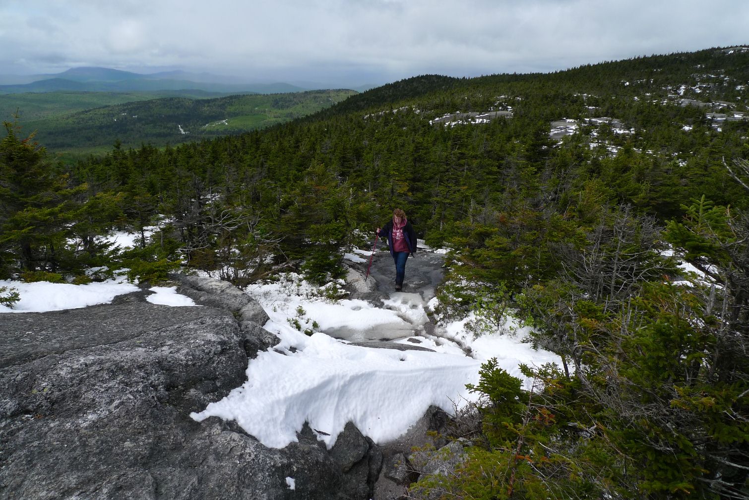
Sunday afternoon, the weather finally broke. The sun made an appearance. Cathy and I decided to get in a hike. We attempted Mt Cardigan a couple years ago in the fall. We had to turn around half way up because there was too much ice and we didn't have spikes. Other than being wet, it didn't even register that conditions might not be much better this Memorial Day weekend...
We parked at the AMC lodge on the east side. Driving in, I said to Cathy, "Is that snow up there?" She said no way. It sure did look like it. Cardigan just breaks 3000ft. I knew northern VT got snow, lots of it in places. I didn't think this far south and this low was at risk.
We no more than started hiking than we encountered snow. The snowline was down to 1500ft. I got pretty pissed, as I was hiking in an old pair of running shoes (open mesh top, but grip extremely well on wet granite). Plus, it was way colder than at home. I didn't bring hat or gloves. Silly me.
About half way up the Manning Trail, the snow got deeper, making climbing treacherous. I gave up trying to avoid the water running down the middle of the trail. You could get traction there, not in the snow to the side. My feet were soaked anyway. Two days in a row with numb feet. Grrrrrrr!
We kept going and eventually reached the open slickrock ledges approaching the Firescrew summit. We had to hike and scramble against rushing torrents of water in many places. Guess the warm granite was melting the snow quickly. Didn't warm the water any. I'm sure it was 32F.
The wind was ridiculous up top. You had to brace yourself to stand. Maybe 50mph? The windchill had to be in the teens too. I didn't know how I was going to keep warm if we traversed over to the Cardigan summit along the exposed ridgeline. To make matters dicier, random bursts of rain and stinging sleet moved through too. Unbelievably raw. I wondered why, in an hour of hiking, we hadn't seen another soul...
I wasn't going to let the mountain beat me again. Cathy was certainly good to go, as she wore more layers, including an outer Goretex shell with a hoody. Smaht, unlike me.
There were many deep pools of frigid water and knee deep slushy snow drifts to plod through in between the two peaks. The final scramble to the summit was really going to suck. Zero trees to break the wind, just bare granite. I made haste and took shelter behind the fire tower base while Cathy made her way up. There was nobody else at the summit, which I thought very unusual for a holiday weekend. But then other would-be hikers weren't standing there shivering with frozen feet, hands and ears like some dimwit cyclist dude either.
We started heading down the other side as soon as Cathy made it up. We saw the first people of the hike a ways below us. Looked like they were skipping the summit. We planned to take Clark and Holt trails back down. They looked a little less steep than Manning. They were, but they were also much wetter and snowier.
It was so good to get back below treeline. My feet were never going to be the same, as I had to continually tromp through water. Cathy wore Goretex hiking boots. Smaht girl. Her feet eventually got wet too, but not cold.
There was a really cool waterfall most of the way down. It doesn't show on any maps, and I suspect it is only an intermittent waterfall, such as during a rain storm or heavy snow melt. I had to scramble down to get a photo of it.
We got back to the car with 5.8 miles in 2.6hr moving time on the Garmin. Cathy said it was a hard hike and wasn't sure she'd do it again. I was worried about her knee that she had routed out a couple years ago, but it gave her no grief during or after the hike. Just lots of DOMS the next day. I too worried about my knees that have been finicky lately (maybe a post on that later this week). I did ok. Normally, steep descents wreak havoc on my knees and give me shin splints. At least this time the score was Mr & Mrs Hill Junkie: 1, Cardigan 0. Here's a photo dump from the hike and a couple I stole from the Internet.


But this post is not about that. The weather this holiday weekend thwarted best crafted plans. Just like they say in war, battle plans never survive contact with the enemy. The enemy this weekend was the weather - perhaps the suckiest Memorial Weekend weather since I moved to New England in 1997. We had a group ride planned in northern Vermont on Saturday. The forecast called for lots of rain and frigid temps. We're not stupid. We don't go out on 200km misery fests just so we can brag about how "epic" it was to those who opted out. The ride was cancelled.
So I did solo repeats on nearby Pack Monadnock instead. Short, but potent workout. I brought my hardtail MTB so I could have assurance of controlling my speed on the descents with disc brakes. A couple portions of Pack exceed 20% grade. When wet with tree debris on it, coming down can be quite terrifying on 23mm tires with caliper brakes. Naively, I didn't think I needed booties. I wore other winter gear. My feet promptly froze. The dense drizzle quickly saturated everything and added 10 pounds to the weight I had to carry up each time. I felt a little wobbliness in my legs on the fourth climb, so I called it good and headed back down to Wilton where I started. It took the whole drive home with floor heat on high before I got all the feeling back in my feet.
Sunday afternoon, the weather finally broke. The sun made an appearance. Cathy and I decided to get in a hike. We attempted Mt Cardigan a couple years ago in the fall. We had to turn around half way up because there was too much ice and we didn't have spikes. Other than being wet, it didn't even register that conditions might not be much better this Memorial Day weekend...
We parked at the AMC lodge on the east side. Driving in, I said to Cathy, "Is that snow up there?" She said no way. It sure did look like it. Cardigan just breaks 3000ft. I knew northern VT got snow, lots of it in places. I didn't think this far south and this low was at risk.
We no more than started hiking than we encountered snow. The snowline was down to 1500ft. I got pretty pissed, as I was hiking in an old pair of running shoes (open mesh top, but grip extremely well on wet granite). Plus, it was way colder than at home. I didn't bring hat or gloves. Silly me.
About half way up the Manning Trail, the snow got deeper, making climbing treacherous. I gave up trying to avoid the water running down the middle of the trail. You could get traction there, not in the snow to the side. My feet were soaked anyway. Two days in a row with numb feet. Grrrrrrr!
We kept going and eventually reached the open slickrock ledges approaching the Firescrew summit. We had to hike and scramble against rushing torrents of water in many places. Guess the warm granite was melting the snow quickly. Didn't warm the water any. I'm sure it was 32F.
The wind was ridiculous up top. You had to brace yourself to stand. Maybe 50mph? The windchill had to be in the teens too. I didn't know how I was going to keep warm if we traversed over to the Cardigan summit along the exposed ridgeline. To make matters dicier, random bursts of rain and stinging sleet moved through too. Unbelievably raw. I wondered why, in an hour of hiking, we hadn't seen another soul...
I wasn't going to let the mountain beat me again. Cathy was certainly good to go, as she wore more layers, including an outer Goretex shell with a hoody. Smaht, unlike me.
There were many deep pools of frigid water and knee deep slushy snow drifts to plod through in between the two peaks. The final scramble to the summit was really going to suck. Zero trees to break the wind, just bare granite. I made haste and took shelter behind the fire tower base while Cathy made her way up. There was nobody else at the summit, which I thought very unusual for a holiday weekend. But then other would-be hikers weren't standing there shivering with frozen feet, hands and ears like some dimwit cyclist dude either.
We started heading down the other side as soon as Cathy made it up. We saw the first people of the hike a ways below us. Looked like they were skipping the summit. We planned to take Clark and Holt trails back down. They looked a little less steep than Manning. They were, but they were also much wetter and snowier.
It was so good to get back below treeline. My feet were never going to be the same, as I had to continually tromp through water. Cathy wore Goretex hiking boots. Smaht girl. Her feet eventually got wet too, but not cold.
There was a really cool waterfall most of the way down. It doesn't show on any maps, and I suspect it is only an intermittent waterfall, such as during a rain storm or heavy snow melt. I had to scramble down to get a photo of it.
We got back to the car with 5.8 miles in 2.6hr moving time on the Garmin. Cathy said it was a hard hike and wasn't sure she'd do it again. I was worried about her knee that she had routed out a couple years ago, but it gave her no grief during or after the hike. Just lots of DOMS the next day. I too worried about my knees that have been finicky lately (maybe a post on that later this week). I did ok. Normally, steep descents wreak havoc on my knees and give me shin splints. At least this time the score was Mr & Mrs Hill Junkie: 1, Cardigan 0. Here's a photo dump from the hike and a couple I stole from the Internet.

Part way up Manning trail in stream of water. This rock is were we were forced to turn
around last time hiking here.

Near the Firescrew summit at just over 3000ft
In the saddle between Firescrew and Cardigan on Mowglis Trail.

Cardigan summit. Frozen water. Rain/sleet squalls in distance.

Looking back up at Cardigan summit from south face. Hard to tell, but quite steep. Cathy
is leaning into the wind to stay upright.

Clark trail. Water running down everywhere. Surprisingly, my Nike Structura's gripped extremely
well on wet granite. Cathy did slip and fall once.

Around 2000ft elevation. Absolutely treacherous. No water running down here to carry snow away.
There's something wrong with this scene...

Unnamed water fall close to junction of trails called Grand Junction.

Jay Peak, from their FB page. Powder skiing on Memorial Day weekend!

Whiteface Mountain near Lake Placid, NY. 30" of new snow!! There's a bike race up this
in less than three weeks. I'll probably be doing the MTB race at Whiteface that weekend.
Sunday, May 12, 2013
Wa Wa Wachusett
Multi-disciplinary cyclists had many competition choices this past Saturday. New Englanders had no less than three MTB, one road and one hillclimb race to chose from. I've raced the Sterling Road Race before. Doesn't suit me well. Chance for wet roads compounded an already risky course. The Weeping Willow MTB race is drawing ever bigger fields. Again, lots of fast singletrack and periodic sketchy passes had risk painted all over it. How have I become so risk adverse?
Over at Wachusett Mtn was the first hillclimb race of the 2013 BUMPS challenge. This race was added to the series last year. I did it then, it was a good time. Several people I hadn't seen in a while would be there. An uphill race is ideal when weather is foul. Risk is very low. The decision was easy.
I wasn't stressing over this race at all. My plan was to train right through the weekend. No taper. I'll save the stressing for events later this summer, like the Washington hillclimb or CIGNA 5k run.
Warming up, the roads were wet and it was a bit misty out. The summit was socked in. At least it wasn't raining. There were several names I didn't recognize signed up, some from out of the area. I didn't bother to research if they were threats. The usual local threats were not signed up this time. Even though beating my time last year was pretty much out of the question and not a goal, I at least stood a chance to win the age group and some swag.
About fifty 50-59 year old men and women queued up. Richard Fries MC'd the event. After pre-race instruction, I asked him if race organizer Marti Shea was racing, as I didn't see her. Richard asked if I was afraid of getting "skirted." Yep. It was a mass start race with mixed experience riders, but I was at the front and Mile Hill Rd would bust things apart in one minute anyway. We go off, Brett Rutledge leads out initially, then I take over. When it got steep, I stood to string things out. After a couple minutes, one rider was left on my wheel. Who was he? I went pretty hard.

The most persistent gradient of the climb is on Mile Hill Rd outside the state park. I maintained a firm pace, but another rider quickly rolled up out of nowhere. Now I had two clingers on my wheel. I knew the grade would slacken further up on the mountain and we'd probably encounter some stiff headwind. There were many opportunities to draft on this mountain. Since I was not going for a PR, I at least wanted to race smartly enough to protect a potential win.

So I did something I almost never, ever do in a hillclimb. I capitulated and forced the other two to come up. They were Tom Fagan and Dave O'Keeffe. I shamelessly sat on wheels for the next 3-4 minutes, no doubt losing seconds against the clock had I continued to kill myself. But I knew this climb well. I knew where the steepest part was and it would not be into the wind. I would seal the deal there, about half a mile before the finish line.
Earlier in the week during my lunch interval loop, I averaged 483W for two minutes in one of my intervals. I just needed to do that again and I'd be all set. I did exactly that, and Tom and Dave started to fade in the fog behind me. I finished in 16:45, about 30 seconds slower than last year, but a solid win with about 15sec gap. Tim Ahearn won overall in 14:37, a new course record.

I won a 12-pack of Wachusett Brewery beer. Forget which brew. Brett promptly laid claim to it, since I don't imbibe. Had I not messed around mid race and came in another five seconds faster, I could have earned cash for 3rd place overall, assuming Tom didn't pip me at the line. A lesson for next time.
We had great food at awards with Richard funny as heck as always. There were auctions and raffles for MS too. Bill Dunkerley won a trip to Mallorca next spring. Marti, Joe, Mary and many others did a great job organizing and executing this event. It was refreshing to see so many first timers there, including young people.
Over at Wachusett Mtn was the first hillclimb race of the 2013 BUMPS challenge. This race was added to the series last year. I did it then, it was a good time. Several people I hadn't seen in a while would be there. An uphill race is ideal when weather is foul. Risk is very low. The decision was easy.
I wasn't stressing over this race at all. My plan was to train right through the weekend. No taper. I'll save the stressing for events later this summer, like the Washington hillclimb or CIGNA 5k run.
Warming up, the roads were wet and it was a bit misty out. The summit was socked in. At least it wasn't raining. There were several names I didn't recognize signed up, some from out of the area. I didn't bother to research if they were threats. The usual local threats were not signed up this time. Even though beating my time last year was pretty much out of the question and not a goal, I at least stood a chance to win the age group and some swag.
About fifty 50-59 year old men and women queued up. Richard Fries MC'd the event. After pre-race instruction, I asked him if race organizer Marti Shea was racing, as I didn't see her. Richard asked if I was afraid of getting "skirted." Yep. It was a mass start race with mixed experience riders, but I was at the front and Mile Hill Rd would bust things apart in one minute anyway. We go off, Brett Rutledge leads out initially, then I take over. When it got steep, I stood to string things out. After a couple minutes, one rider was left on my wheel. Who was he? I went pretty hard.

Brett Rutledge killing himself to keep Bill Dunkerley behind him. Bill came out ahead in the end.
Photo by Heather Dunkerley.
The most persistent gradient of the climb is on Mile Hill Rd outside the state park. I maintained a firm pace, but another rider quickly rolled up out of nowhere. Now I had two clingers on my wheel. I knew the grade would slacken further up on the mountain and we'd probably encounter some stiff headwind. There were many opportunities to draft on this mountain. Since I was not going for a PR, I at least wanted to race smartly enough to protect a potential win.

Shortly after turning into the state park, being shadowed by Tom Fagan and Dave O'Keeffe.
Photo by Heather Dunkerley
So I did something I almost never, ever do in a hillclimb. I capitulated and forced the other two to come up. They were Tom Fagan and Dave O'Keeffe. I shamelessly sat on wheels for the next 3-4 minutes, no doubt losing seconds against the clock had I continued to kill myself. But I knew this climb well. I knew where the steepest part was and it would not be into the wind. I would seal the deal there, about half a mile before the finish line.
Earlier in the week during my lunch interval loop, I averaged 483W for two minutes in one of my intervals. I just needed to do that again and I'd be all set. I did exactly that, and Tom and Dave started to fade in the fog behind me. I finished in 16:45, about 30 seconds slower than last year, but a solid win with about 15sec gap. Tim Ahearn won overall in 14:37, a new course record.

Fries @ awards
I won a 12-pack of Wachusett Brewery beer. Forget which brew. Brett promptly laid claim to it, since I don't imbibe. Had I not messed around mid race and came in another five seconds faster, I could have earned cash for 3rd place overall, assuming Tom didn't pip me at the line. A lesson for next time.
We had great food at awards with Richard funny as heck as always. There were auctions and raffles for MS too. Bill Dunkerley won a trip to Mallorca next spring. Marti, Joe, Mary and many others did a great job organizing and executing this event. It was refreshing to see so many first timers there, including young people.
Wednesday, May 8, 2013
Klonzo, Sovereign, Brands Trail Systems
This is the final installment from my Utah trip. I've been missing all the novel riding terrain and thinking about where my next travels may take me.
Last week Monday's Rim ride broke Dave's frame. He was set on riding the La Sal Mountain road loop before we even left on the trip. Road bikes are much cheaper to rent than a high-end MTB, so that pretty much clinched the deal for Dave. He'd rent a road bike for Tuesday while waiting for warranty replacement parts to come in.


I wasn't as interested in the loop. I still had a functioning MTB. I'd seen half the loop three times from a car on Monday (shuttling). Sure, I hadn't seen Castle Valley from below yet, but there were so many trails to ride that one couldn't possibly ride everything in one trip. Dave was cool with riding the La Sal loop solo. I too, do not mind riding in remote areas by myself. Half my MTB trips are solo. The other three New Englanders in Moab were going to do something short and easy in anticipation of a White Rim Trail ride on Wednesday.
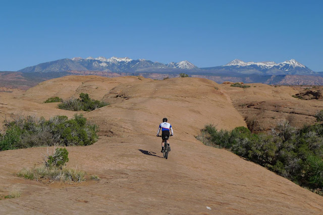
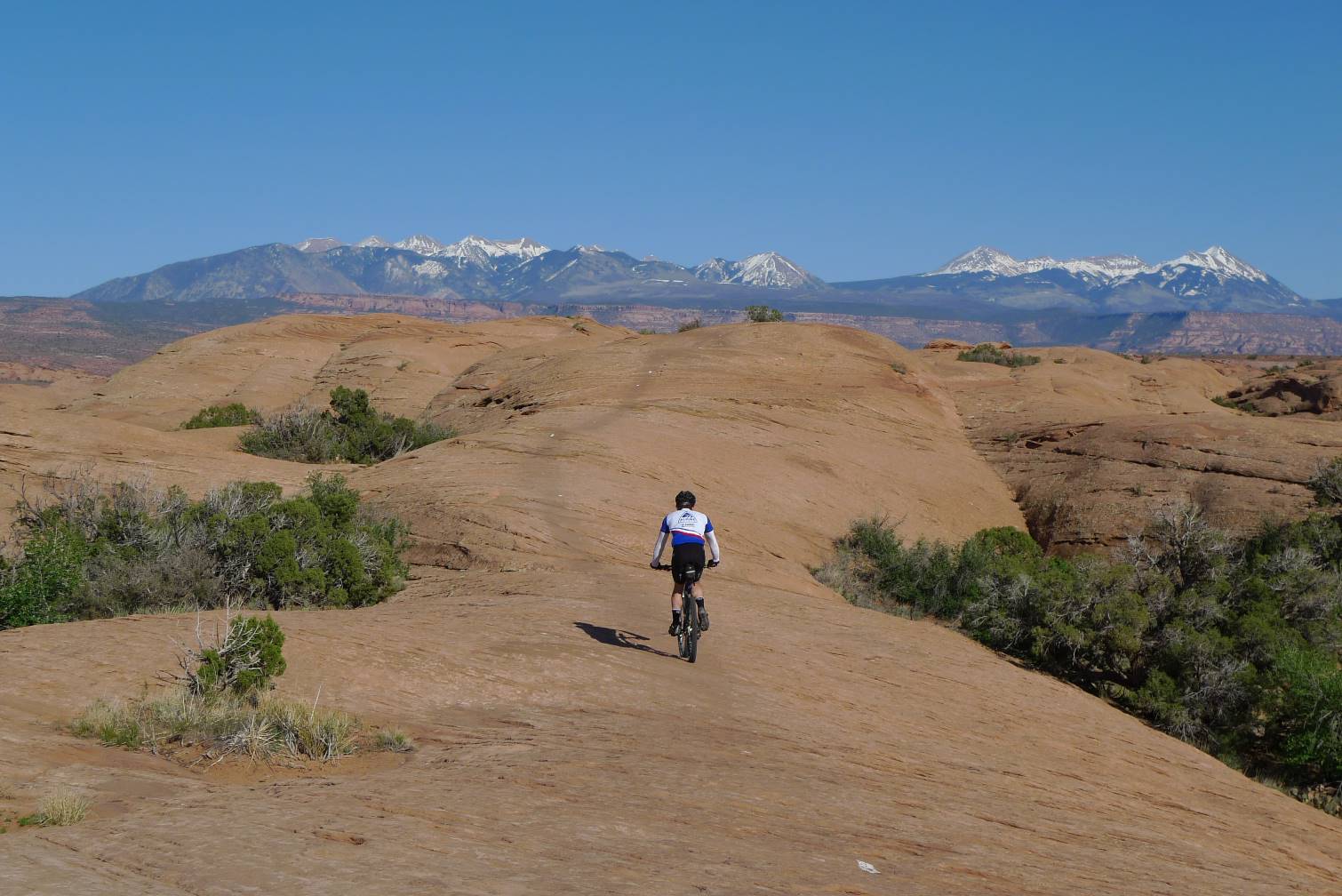
I decided to hit the Sovereign Trails, which have been in place for a while now. Two new areas near the Sovereign trails have been built up more recently, one still a work in progress. These are the Brands trails and the Klonzo trails. I parked at the Bar M parking area, which affords access to all three trail systems.
I hit Klonzo first. This is mostly dirt riding and beginner to intermediate terrain. These trails are not open to motorcycles. Refreshing after riding the partial Whole Enchilada the day before. Bombing back down was a blast, all high-speed carving.
Next up was a Sovereign/Salt Wash trail loop, much longer and more technical. Sovereign Trail was mostly slickrock, mostly intermediate terrain, with a couple challenging step-up/step-down sections. Crossing over to Salt Wash Trail at the far end of my planned route, there were the infamous switchbacks. Not sure if anybody can clean these going up. Stupid steep moon dust. Don't think I would try to ride down them either. I was warned that Salt Wash would be all sand and suck. There were sandy bits, but the direction I rode it put almost all of the sand downhill. I had no trouble cleaning all of it. In fact, Strava tells me I was the second fastest to date riding this trail in that direction. Kind of boggling, really, as I even stopped a couple times to take photos. Strava segment timing does not stop when you stop. The clock keeps running from start until finish. It's not moving time, like Strava gives for the whole ride.
It was getting seriously hot, and I was enjoying myself way too much. Going 3+ hours on what was supposed to be a recovery day for the White Rim Tail didn't add up. Did I really think I could do a 80-100 mile MTB ride after riding hard five days straight?
I decided to do a truncated loop through the relatively new Brands trails. More beginner/intermediate terrain here, although I believe there is some expert material too, which you can see from the road. I finished with 32 miles in 3.5hrs on the Garmin. A few pics from last week Tuesday:

Self portrait at Klonzo Trails

Klonzo descent to trailhead a couple miles in distance

Sovereign trail with some color

Looking down on the Sovereign moon-dust switch backs

Salt Wash Trail

View of La Sal mountains from Salt Wash trail

On either the EZ or Lazy trail at Brands riding area.
I moved to New England just over 16 years ago, when I was still pretty much brand new to off-road riding. Mountain bike racing was in its heyday, but riding opportunities were limited. Nearly all trails were created by non-mountain biking users for other purposes. Much has changed in the last 16 years.
I've been fortunate to be able to visit many states with the primary purpose to go trail riding. Both locally and in my travels, I've noticed a huge increase in trail development specifically for mountain biking. Most of the trails I rode in Moab last week did not exist 14 years ago when I last visited Moab. Communities, parks and land managers have warmed up to the mountain biking community developing and maintaining trails on public land. We know how to build sustainable trails for all passive recreational use.
This trend especially holds locally. Most trails I ride these days did not exist when I moved here. There's been an explosion of trail building, really, in just the last five years, and the momentum is still building. There are almost too many places to name just within an hour's drive of my house. Bear Brook, Willowdale, Russell Mill, Horse Hill, Great Brook, Lowell Dracut, Georgetown Rowley, Harold Parker are just a few places that have seen recent trail work. NEMBA is the catalyzing force behind this.
Durango is seeing new trails emerge too. One would think with hundreds of miles of singletrack in the mountains, why would you need more trails? The new trails are being built closer to town, like Twin Buttes and in the Horse Gulch area. Kansas City, a less likely MTB destination, has seen a plethora of new riding opportunities pop onto the scene recently. Swope Park is a fine example.
This bodes well for the future of mountain biking across the country. While there is growth in certain racing formats, like enduro, ultra-endurance and multi-day stage racing, the greatest interest in riding off-road seems to be just going out on challenging terrain with friends. Strava seems to scatch the competitive itch for many. Half of my "training" hours last year were off-road cycling. That ratio may increase this year
Monday, May 6, 2013
Twist & Shout/Butterknife Loop
Back in New Hampshire, I thought I'd catch up on a couple rides I missed posting while in CO/UT. Dave and I spent the first two nights in Grand Junction, CO and had just enough time in the evening we arrived to squeeze in a quick "shake-down" ride.
Now shake-down rides are supposed to make sure your bike is in full working order after unpacking it from the shipping box. It should not make you tired or work too hard. But the short loop I picked out was a bit of a beat-down ride. Bikes worked fine, bodies took more of a beating than anticipated on the first ride of a 10 day trip.
I picked out a loop near the famed Lunch Loops, which local riders supposedly hit on their lunch breaks. The terrain can be uber technical. A trail called Butterknife was more recently constructed and claimed to be less technical than some of the others. We drove up Little Park Rd, as trail access is only from the top on this side. We'd descend Twist & Shout, pick up Butterknife, then climb all the way back up on Billings Canyon Jeep Rd. 13 miles, how hard could that be?
Twist & Shout started out innocuous enough. We then merged into Butterknife. We had to pick up our game a bit to ride this trail. Considerable work went into it, armoring the descents, transitions and other off-camber ledgy bits. Butterknife proved to be just a small foretaste of many hours of riding coming up.
Dave set a pretty high pace climbing back up to the trail head. We had big rides planned in the Fruita area over the next two days, and I didn't want to start the trip in a recovery deficit. We thought about riding the trail call Ribbon on the other side of Little Park Rd but called it a day. Didn't want to risk running out of daylight or injury on first day. Here are four pics from Butterknife and the Shake down ride on Strava.


With the crappy internet service at our next hotel in Moab, I was not able to upload a few video bits I captured from our Edge Loop ride in Fruita. Here is a short clip from the initial portion of the Zippety Do Da trail. Note this is from my Panasonic Lumix LX3 camera, a high-end point and shoot camera. I mounted it on my helmet and disabled the optical image stabilization (not meant for this kind of motion). It shoots a pretty wide angle, but not a fish-eye lens like GoPro uses, which grossly distorts how steep things look. If it looks steep with a non-distorting lens, it is actually steep. Check it out in full HD on Vimeo. The LX3 does ok for a point and shoot.
Dave led. He was worried he'd go too fast and ride out of view, but instead, he went too slow and stayed too close. Need to choreograph these things better next time. Video should always be no-holds-barred IMO, increases the odds of capturing a boo-boo;)
zippety from D. Jansen on Vimeo.
I hope to post one more ride I did solo on Tuesday last week on the Sovereign and new Klonzo trails along with some observations about the vitality of mountain biking and proliferation of technical trail building going on around the country right now.
Saturday, May 4, 2013
Kondike Bluffs
For our ninth and final riding day of the trip, Dave and I decided to hit the Klondike Bluffs trail system just north of Moab. It looked big enough to get 4-5hrs riding time out of it without repeating anything. There were already many cars in multiple parking lots at our late morning start.
We parked by the highway rather than taking the small rental SUV off-road on potentially rough surface to the closer-in trailhead parking lot. Might as well get a warm up in those three miles instead of going not much faster sitting in the car.
We went out on Dino Flow, described at a "flow" trail, 95% on dirt. It was exactly that. You'd never know Dave had been riding nine days straight by how he took off on this trail. It was wicked fun and polar opposite from the Captain Ahab trail we rode the day before.
At the far end of the trail system, we reversed direction on a parallel trail called EKG. It didn't take long to learn why it was thus named. It travelled much higher up on the bluff and was almost entirely on white slickrock. It carved sizeable chunks of vertical up and down while working in a southerly direction. Deep digs were required every 2-3 minutes for the next half hour. Not good for weary legs.
Back near the main trailhead, we took 4WD track Klondike Bluffs up to the height of land. This started as dirt but soon gave way to 100% slickrock. I think we gained over 400ft on white slickrock. Near the top was a spur out the bluffs viewing trail. We had to ditch the bikes at the boundary to Arches National Park, as bikes are not allowed off-road in the park. This was far from paved tourist road and the arches, but national park land nonetheless.
A half-mile hike brought us to a good vantage point. Seems other riders had the same idea, as about 20 bikes were ditched at the park boundary. Interesting rock formations. We hung out there for a while, ate, and just enjoyed being outside in ideal conditions.
Back on the bike, we worked our way over to a trail called UFO. Marvelously fun. Lots of speed. Some more doubletrack climbing brought us back up to the ridge line where we picked up Mega Steps. This trail traversed the ridge for a while before beginning a ruckus multi-mile plummet back to the bottom, much of it on slickrock. Nothing very frightening here, although a mistake at speed would come with severe consequences. Here's a photo dump in no particular order.


Back at the bottom, we snaked around a bit on Agate and Jasper trails, all on gravelly surface, buff and fast. I was out of water and needed to rap up the ride with over four hours moving time already on the Garmin. We finished with 38.2 miles, 3900ft, 4.4hrs moving time on the Garmin. This included the hike out to the bluffs.
We parked by the highway rather than taking the small rental SUV off-road on potentially rough surface to the closer-in trailhead parking lot. Might as well get a warm up in those three miles instead of going not much faster sitting in the car.
We went out on Dino Flow, described at a "flow" trail, 95% on dirt. It was exactly that. You'd never know Dave had been riding nine days straight by how he took off on this trail. It was wicked fun and polar opposite from the Captain Ahab trail we rode the day before.
At the far end of the trail system, we reversed direction on a parallel trail called EKG. It didn't take long to learn why it was thus named. It travelled much higher up on the bluff and was almost entirely on white slickrock. It carved sizeable chunks of vertical up and down while working in a southerly direction. Deep digs were required every 2-3 minutes for the next half hour. Not good for weary legs.
Back near the main trailhead, we took 4WD track Klondike Bluffs up to the height of land. This started as dirt but soon gave way to 100% slickrock. I think we gained over 400ft on white slickrock. Near the top was a spur out the bluffs viewing trail. We had to ditch the bikes at the boundary to Arches National Park, as bikes are not allowed off-road in the park. This was far from paved tourist road and the arches, but national park land nonetheless.
A half-mile hike brought us to a good vantage point. Seems other riders had the same idea, as about 20 bikes were ditched at the park boundary. Interesting rock formations. We hung out there for a while, ate, and just enjoyed being outside in ideal conditions.
Back on the bike, we worked our way over to a trail called UFO. Marvelously fun. Lots of speed. Some more doubletrack climbing brought us back up to the ridge line where we picked up Mega Steps. This trail traversed the ridge for a while before beginning a ruckus multi-mile plummet back to the bottom, much of it on slickrock. Nothing very frightening here, although a mistake at speed would come with severe consequences. Here's a photo dump in no particular order.

4WD track up to Klondike Bluffs. Many riders heading up.

Myself on EKG

Dave and others further up on Klondike Bluffs track. All slickrock, steep at times.

Boundary of Arches. Dave entertaining which high-end bike he wanted to ride back down.

The Bluffs with La Sal's in background

Dave on the Bluffs from further back on the ridge

UFO trail

Jasper Trail. Very barren area. Reminded me of Haleakala.
Back at the bottom, we snaked around a bit on Agate and Jasper trails, all on gravelly surface, buff and fast. I was out of water and needed to rap up the ride with over four hours moving time already on the Garmin. We finished with 38.2 miles, 3900ft, 4.4hrs moving time on the Garmin. This included the hike out to the bluffs.
Friday, May 3, 2013
Captain Ahab
While Dave was perusing riding destinations on the web last night, he stumbled upon a new trail that was just constructed this year. It is called Captain Ahab, out on Amasa Back just outside of Moab. A nicely edited video of construction of the trail was made. The extraordinary measures taken to open up trail-lines is impressive. Some of the rocks moved must weigh many tons. Take a look.
Captain Ahab Trail from Tyson Swasey on Vimeo.
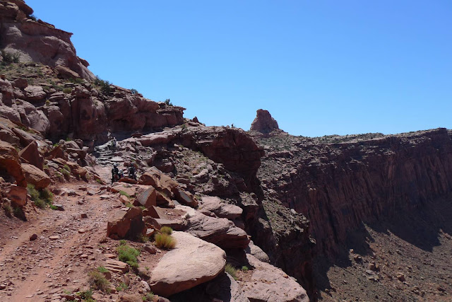
This piqued our curiosity. Not doing the White Rim Trail opened up a day to explore other terrain. I was game, even though this trail is listed as "Extreme" on some trail ranking websites. Advanced trails in Moab generally put me at my skill and wit limits. Extreme likely meant I would be doing more walking and less riding.
Amasa Back is close enough to town, about 5mi from our hotel, that we could ride to the ride. We waited for the temp to rise a bit, another cold morning at about 40F. The relative humidity was going to be extremely low today, dipping into single digits. This usually raises havoc with my throat and nasal passages. It is great for taking crisp photos of far away features.
We headed up Amasa Back Rd, not only popular with mountain bikers, but also the moto set. It climbs to the height of land from the Colorado River, about 1200ft net gain. We were not able to ride 100% of it. Even trail bikes struggled on one section.
Both Dave and I had no desire to push pace today. The non-stop anaerobic digs on Slickrock Trail last night had us searching for muscle fibers left intact. We dilly dallied about on this ride. It was so peaceful being out here in ideal conditions. Perfect temp, light winds and see forever views.
After hanging out for half an hour or so up top, we headed out on the Pothole Arch trail. This rode very nicely with very little elevation change. Most of it was on slickrock. Pothole Arch is essentially a large pothole in sandstone with a drain hole out the bottom. A bunch of mountain bikers were here. Great lunch spot.
Heading back, we took Rockstacker. I did zero research on this trail. Turned out to be over our heads, requiring many dismounts/hike-a-bikes. Great views of the Colorado River though, riding the rim about 1000ft up.
We picked up the new Captain Ahab trail next. A bunch of climbing started things off. I read the lower portion had more flow, but I found the upper portion more rideable. The extensive rock-work was evident everywhere. Often we rode the worked areas without hesitation, other times self-preservation and family responsibilities got the better side of us. Dave and I took turns cleaning and dabbing various features. Good times. I experience more adrenaline coming down Capt Ahab and any other trail in a while.
I'm sure we came across as roadies or not really belonging out there. We were the only ones in spandex out of many riders. Baggies dominate the scene out here. Several riders were in body armor.
Here's a photo dump. You never know how Blogger is going to place these. I name them in chronological order with 1_x, 2_y, etc, and Blogger usually places them in that order. Not this time. Too big of a hassle to shuffle them around once placed.


We finished the ride with 30 miles, 3400ft of climbing, in 3.9hrs moving time on the Garmin. A very slow ride to be sure, especially considering that about 10 of those 30 miles were flat pavement. One more riding day left in the trip. Saturday will most like be a day out at Kondike Bluffs, or maybe doubling up between Klondike and Brands trails nearby.
Captain Ahab Trail from Tyson Swasey on Vimeo.
This piqued our curiosity. Not doing the White Rim Trail opened up a day to explore other terrain. I was game, even though this trail is listed as "Extreme" on some trail ranking websites. Advanced trails in Moab generally put me at my skill and wit limits. Extreme likely meant I would be doing more walking and less riding.
Amasa Back is close enough to town, about 5mi from our hotel, that we could ride to the ride. We waited for the temp to rise a bit, another cold morning at about 40F. The relative humidity was going to be extremely low today, dipping into single digits. This usually raises havoc with my throat and nasal passages. It is great for taking crisp photos of far away features.
We headed up Amasa Back Rd, not only popular with mountain bikers, but also the moto set. It climbs to the height of land from the Colorado River, about 1200ft net gain. We were not able to ride 100% of it. Even trail bikes struggled on one section.
Both Dave and I had no desire to push pace today. The non-stop anaerobic digs on Slickrock Trail last night had us searching for muscle fibers left intact. We dilly dallied about on this ride. It was so peaceful being out here in ideal conditions. Perfect temp, light winds and see forever views.
After hanging out for half an hour or so up top, we headed out on the Pothole Arch trail. This rode very nicely with very little elevation change. Most of it was on slickrock. Pothole Arch is essentially a large pothole in sandstone with a drain hole out the bottom. A bunch of mountain bikers were here. Great lunch spot.
Heading back, we took Rockstacker. I did zero research on this trail. Turned out to be over our heads, requiring many dismounts/hike-a-bikes. Great views of the Colorado River though, riding the rim about 1000ft up.
We picked up the new Captain Ahab trail next. A bunch of climbing started things off. I read the lower portion had more flow, but I found the upper portion more rideable. The extensive rock-work was evident everywhere. Often we rode the worked areas without hesitation, other times self-preservation and family responsibilities got the better side of us. Dave and I took turns cleaning and dabbing various features. Good times. I experience more adrenaline coming down Capt Ahab and any other trail in a while.
I'm sure we came across as roadies or not really belonging out there. We were the only ones in spandex out of many riders. Baggies dominate the scene out here. Several riders were in body armor.
Here's a photo dump. You never know how Blogger is going to place these. I name them in chronological order with 1_x, 2_y, etc, and Blogger usually places them in that order. Not this time. Too big of a hassle to shuffle them around once placed.

Dave on Rockstacker trail

Dave dropping on Captain Ahab trail

Myself on a rare flat spot on Captain Ahab

Viewpoint on Capt Ahab

Exposure on Capt Ahab. Off-camber, covered with slippery moon dust, precipitous drop
to right. I walked it.

Kane Creek Rd heading back out after riding up top

Kane Creek Rd in morning, initial gradual climbing from the Colorado River

Amasa Back Rd, climbing in earnest

Section of Amasa Back Rd that gave experienced moto riders pause. We hiked middle rough
section. When we got to the end of Amasa Back Rd, we talked a good while with this group of four.
Good guys.

These little lizards are everywhere. Rarely do they pause exposed long enough to capture photo.

Dave on Capt Ahab

View from high point of Amasa Back Rd

Looking towards La Sal Mountains from terminus of Amasa Back Rd

I could not look down while Dave took this photo. 1000ft straight down between my knees.

Dave on Rockstacker

Dave on one of many hike-a-bikes on Rockstacker trail
We finished the ride with 30 miles, 3400ft of climbing, in 3.9hrs moving time on the Garmin. A very slow ride to be sure, especially considering that about 10 of those 30 miles were flat pavement. One more riding day left in the trip. Saturday will most like be a day out at Kondike Bluffs, or maybe doubling up between Klondike and Brands trails nearby.
Thursday, May 2, 2013
Pipe Dreams and Slickrock
Vacillating big time on whether to still do White Rim Trail. Getting up Thursday morning, I talked myself into trying the full 100 mile loop on Friday. Dave, of course, is always game for such shenanigans. Thing is, these days my body can't always cash the checks my spirit is willing to write. Not getting any younger.
We decided to hit the new Pipe Dream trail right across Main St from our hotel late morning, call it a recovery day, then put legs up until hitting WRT early Friday. Pipe Dream is described as an "advanced" trail, and for Moab, that means a lot. And despite riding it from south (high end) to north (low end), it was wicked climby. Hardly a recovery ride.
I tried my hardest to not go anaerobic on the constant micro-bursts needed to punch over features and grade reversals. Dangerous thing, I learned, when momentum is your friend in this kind of terrain.


There was ever-present exposure. Sometimes extremely steep talus fields, other times boulder slides. Neither would be good to ragdoll down. Going slow in hopes of attaining recovery meant riding wobbly at times on a very narrow trail tread. That just added to my apprehension of going over the edge.


Pipe Dream no doubt took massive hours per mile to build. Extensive armoring was present around every bend and through every dip. Massive rocks appeared to have been moved to open a path in places. It is truly a masterpiece of a trail. Not really my first pick in riding terrain, but a good test of skill. Glad I made it through the 5 mile segment unscathed.
Heading out for some lunch with Dave, I began to self doubt riding the WRT on Friday. Big commitment, it will leave me trashed, and vacations shouldn't induce stress. Dave was cool with any kind of riding, as long as it didn't suck and we got in 4-5hrs per day on average. So I caved and we pulled the plug for good (on this trip) on doing the full WRT loop. Another time, maybe with some non-rider support, and on fresher legs.
So that opened up Thursday for a second, late-day ride. The infamous Slickrock Trail is literally right behind our hotel. We kitted up again and headed up the Sand Flats road to the trail head. I've ridden Slickrock once before, over 14 years ago.
It takes a little bit to gain confidence on slickrock. The marked trail goes up ridiculously steep grades. The tires will hold. Only the rider can fail. You have to reset your notion of what is climbable. I think there were only couple things on the loop that we petered out on. Failing to clean a couple pitches was not an option. You'd almost certainly topple over backwards or not be able to have enough foot traction to avoid going for a slide. Slickrock is like 80 grit sandpaper. It has no qualms about paring down skin to the bone, as I learned 14 years ago. Here are a few pics from our late day ride.


We finished with 19 miles, over 3700ft of climbing in less than 2.5hrs on the Garmin. That is a crazy amount of climbing for the distance. Seems like all of it was at 20-30% grades in 50-100ft increments. The ride turned my quads into mashed potatoes. Nearly four hours of challenging riding for the day. I'll feel that on Friday.
We decided to hit the new Pipe Dream trail right across Main St from our hotel late morning, call it a recovery day, then put legs up until hitting WRT early Friday. Pipe Dream is described as an "advanced" trail, and for Moab, that means a lot. And despite riding it from south (high end) to north (low end), it was wicked climby. Hardly a recovery ride.
I tried my hardest to not go anaerobic on the constant micro-bursts needed to punch over features and grade reversals. Dangerous thing, I learned, when momentum is your friend in this kind of terrain.

Initial switchbacks climbing from southern trailhead on Pipe Dream

Dave is in there. A trail runs through it all.
There was ever-present exposure. Sometimes extremely steep talus fields, other times boulder slides. Neither would be good to ragdoll down. Going slow in hopes of attaining recovery meant riding wobbly at times on a very narrow trail tread. That just added to my apprehension of going over the edge.

Near precipitous drop-off just around bend with handlebars barely clearing protruding rocks

Near mid-point of Pipe Dream look south toward La Sal's.
Pipe Dream no doubt took massive hours per mile to build. Extensive armoring was present around every bend and through every dip. Massive rocks appeared to have been moved to open a path in places. It is truly a masterpiece of a trail. Not really my first pick in riding terrain, but a good test of skill. Glad I made it through the 5 mile segment unscathed.
Heading out for some lunch with Dave, I began to self doubt riding the WRT on Friday. Big commitment, it will leave me trashed, and vacations shouldn't induce stress. Dave was cool with any kind of riding, as long as it didn't suck and we got in 4-5hrs per day on average. So I caved and we pulled the plug for good (on this trip) on doing the full WRT loop. Another time, maybe with some non-rider support, and on fresher legs.
So that opened up Thursday for a second, late-day ride. The infamous Slickrock Trail is literally right behind our hotel. We kitted up again and headed up the Sand Flats road to the trail head. I've ridden Slickrock once before, over 14 years ago.
It takes a little bit to gain confidence on slickrock. The marked trail goes up ridiculously steep grades. The tires will hold. Only the rider can fail. You have to reset your notion of what is climbable. I think there were only couple things on the loop that we petered out on. Failing to clean a couple pitches was not an option. You'd almost certainly topple over backwards or not be able to have enough foot traction to avoid going for a slide. Slickrock is like 80 grit sandpaper. It has no qualms about paring down skin to the bone, as I learned 14 years ago. Here are a few pics from our late day ride.

Dave early in loop on first test of wits on steep pitch

Dave descending toward a bottomless crevasse

Myself cresting a deep dig climb with the La Sal mountains in background

Swooping over, around and through these mounds was a blast

Myself on steep plummet. Camera angle doesn't do it justice. Huge pucker factor.
Dave framed by La Sal's

Colorado River
We finished with 19 miles, over 3700ft of climbing in less than 2.5hrs on the Garmin. That is a crazy amount of climbing for the distance. Seems like all of it was at 20-30% grades in 50-100ft increments. The ride turned my quads into mashed potatoes. Nearly four hours of challenging riding for the day. I'll feel that on Friday.
Subscribe to:
Posts (Atom)