Sunday, September 27, 2015

VT50 2015 - continuing my love-hate relationship with endurance racing

Back in May was the race to get into the VT50 mountain bike race. Something like 750 spots sell out in minutes. I got in. That kept the door open for me to race it if I wanted to. I bail when conditions are greasy. Don't need a 2009 repeat.

The weather has been spectacular all week, and it was an off-Friday weekend for me. I seriously contemplated doing a big ride on Friday, big hike on Saturday, then another big ride on Sunday. There are so many things I haven't hit yet this season. Snow will be here before we know it.

But how could I abandon the VT50 with possibly the best course conditions and best weather ever? I just couldn't. I worried a little about my bike coming back from Utah in time. It arrived on Friday, just enough time to re-assemble it and make sure it still worked. The sofa bike (Santa Cruz Tallboy, a long-travel 29er) worked so well last year at the VT50 that I had to use it again. It was set up identically with 2.35" wide Racing Ralph tires. I went a little higher in pressure since I thought the course would be even drier, something like 21psi front/25psi rear. With saddle bag for spare and DiNotte light, it weighed almost 29lbs, a tank!

Lining up, some people's Garmin's said it was as cold as 32F. Think mine said 34F, but I don't trust my Garmin thermometer anymore. Regardless, it was freaking cold. I was shivering. I pitched my wind shell just before we went off, not wanting to shed layers later in the race.

It wasn't quite as dark as years past going off at 6:05am. Hint of morning light in the east, and more importantly, no fog. My 1200L light was total overkill, but it sure let me bomb the initial descents in the woods where it was still pretty much completely dark.

I tend not to get too excited at the start. Way too many riders go out too hard. At one point, I was very near the back of my wave of over 100 riders. I'll be seeing and passing most of you before the finish! There is a penalty for not going out too hard though. "Conga Line" hill early in the race becomes just that. Invariably, somebody will rub wheels, spin out on a wet root, or just plain peter out and start walking. This causes a backward travelling shock wave down the hill, forcing almost everybody to dismount and start walking. This climb is completely rideable, but I have never ridden the whole thing because of early race CF antics.

Shortly after this, my front brake started squeaking. Just a little chirp each revolution. Things like that get in my head and bug the shit out of me. Why now? I rode 50,000ft out west in two weeks with perfect brake behavior, and now they act up? As I started picking riders off, more than once riders looked down at their bikes to figure out what was squeaking, then go oh, it's you. Most of the time, this is just nuisance rubbing and deprives you of negligible kilojoules.

I was feeling pretty good, trading places with the usual suspects over miles 10-30. Steadily I was putting people behind me.  I had no inkling of how I was doing compared to myself though. Didn't really matter. I try to ride the VT50 like it is a 4.5 hour time-trial. I could feel hamstring fatigue building though. Barely a moment to drink, as I was breathing so hard almost continuously.

I pulled into the Greenall's feed stop where I had a Camelbak dropped. Started with 64oz in my first Camelbak and had another 50oz in second. Took less than a minute to exchange, but at least three riders I had put behind me now had a gap on me.

Getting back to work, the first hamstring spasms occurred. Almost like clockwork. Suddenly, I knew the rest of my race would focus on damage control. There's a very steep, sustained climb at the 35mi mark. I walked all of it. I could not pedal while seated without my hamstrings locking up and the climb wasn't amenable to out of the saddle climbing. Bye-bye everybody. I've learned over the years that walking really helps to relax and recharge the abused muscles. I was hoping an extended walk would get me going for a while again.

While walking, I thought deep thoughts about why am I doing this again? A lot of endurance racers have dark spells during events. It's a question not easily answered and always forgotten once the suffering is over.

My brake chirp had turned into an incessant squeal by this point in the race. While off my bike, I checked it out a bit. I lifted the front wheel and gave it a good spin. Not even two revolutions! That was no nuisance rub. There was nothing I could do about it because I forgot to throw my multi-tool in jersey pocket. I did slightly loosen the thru-axle. That seemed to help a little. At least it reduced the amount of squealing.

The hike-a-bike did wonders for my legs, but I hemorrhaged many places, including Michel Lablanc from Quebec, who I just edged out by seconds last year. Did a podium spot just go up the trail?? Hmmm, that's not why I keep coming back to the Vermont 50, but I wondered.

My legs were touch and go for the rest of the race. I stood to climb everywhere possible. This is more like going up stairs or hiking, it is all quads and no hamstrings. Pushed a big gear too. Had to lock out the suspension while doing this, else wallow would just swallow up half my Watts.

With about five miles to go, I knew I would be slower than last year. I also knew that almost all of the finishing climb could be done out of the saddle, so I would probably not suffer any cataclysmic muscular lock-up. I caught glimpses of a Bikeway Source teammate further up. Who could it be? Hard to keep track of where everybody is in the dark starting out. It was Tom Casparis, who was having a good race. Tom let me by as I was emptying the tank on this last climb, as long as the spasms stayed at bay.

I had hoped to catch Michel after he motored ahead during my cramping episode. At one point, he dangled just 20 seconds ahead of me. But it wasn't in the cards. Once you top out above the finishing line on Mt Ascutney, the race is essentially over. It's nothing but sweeping switchbacks for a mile down to the finish.  I finished in 4:40:42, about four minutes slower than last year.

When results were posted, I was shocked to see this was good for only 10th place in the Master I division, 45-54 year olds. Former pro-tour rider Andy Bishop won the age group with a time of 4:20. And to think I might have been chasing a podium spot. Silly me! Nobody broke four hours this year. Comparing to my peer group, I actually did pretty well relative to my PR finish last year. Came out a little further ahead against some, a littler further back against others. A wash, really. Have to be happy with that. I did move up four spots overall from last year to 26th.

Some of the team present today: Mike, Josh, PJ, Susan and Skip.

Susan won her age group. Wifey gives me dirty looks when I post
photos like these...

Doesn't get any nicer than this. No fall foliage showing yet.
Three years in a row!

So this cramping business. I've gotten so much advice from well meaning folks over the years. I can say this with no doubt. It is not hydration, electrolytes, nutrition, temperature, intensity or duration. So you may say "Come on now Hill Junkie, that rules out everything." Not exactly.

I cramp on hottest summer days and in frigid ski races. I cramp when I'm well hydrated and can't wait to pee at the finish like today. I've added all manner of electrolytes in all manner of concentrations. Today I used liberal amounts of "lite" salt, which has a lot of potassium in it. I can eat too much or nothing at all and cramp. I can do training loops many hours long, hitting every climb at high anaerobic intensity and not cramp. I can ride 6-8hrs and not cramp. What is the single best predictor of cramping? Riding at moderate to high intensity with zero recovery time. I think something electrically gets out of whack that can't be fixed just be digesting "electrical" type compounds. It's like a battery with too much load on it. You can bring a battery to its knees if you try to take too many amp-hours out of it too quickly. Give the battery short breaks, it has time to bounce back and do it all over again. I studied deep-cycle batteries back when I did robotics work, and my cramping problems mimic this behavior very closely. I'm a microcircuits electrical engineer these days. Wish I could apply that knowledge to biological circuits.

Thursday, September 24, 2015

Cedar City

In Utah, I did a couple short rides on days where full plans were thwarted by rain. One was just a few minutes out of town call the Three Peaks area. The other was right from the hotel call the C-trail. Although short, the trails were primo material on BLM land

At Three-Peaks, I basically rode a perimeter Three Peaks/Big Hole loop counter-clockwise. I avoided the "whale trails" on the southeast side, tech material chocked full of bridges and slickrock stunts. There was rain coming down in all direction and I knew I barely had an hour to ride before getting soaked. When I saw the mountains over the city disappear behind a veil of rain, I knew my time was up. I high-tailed it back to the car. Got a decent ride in with some climbing, tech and flow. Something for everybody at Three Peaks.

Another quick ride I got in late one day was the "C" Trail. Presumably it gets its name because it starts right above the big "C" high up on the mountain you can see from anywhere in Cedar City. Seems all mountain towns have to conspicuously place their initial on a peak. This ride was even more speculative. Had rained a lot earlier in the day. Red clay does not drain quickly, and when wet, becomes utterly unrideable and will glob tires and shoes up the point of rendering you immobilized. The C-trail can be shuttled, but that is not my way. I pedaled 2200ft up a heinously steep dirt road to reach the top. It was wicked windy, cold and spitting rain the whole time. Squalls were visible just a couple miles away. Would I be walking out in a really bad mood past dark?

On the trail with bird's eye view of town, I found the surface almost perfect, like hero dirt back east. It had dried out just enough to not be greasy nor loose. The descent grade was very well engineered, never too steep, plenty of grade reversals and switchbacks to control erosion. It was very fun to bomb down. Even half way down, I still wasn't sure I would beat the rain back, looking down on my hotel the whole time. I was relieved once I made it down to the paved bike path with just a mile back. It could have rained all it wanted at that point.  I really liked that short loop. Pure Hill Junkie material.

Three Peaks. Starting out on Practice Loop trail

No horses!

Can find similar art at Fantasy Island trails in Tucson. Much of the same vibe
riding at Three Peaks. Decomposed granite surface.

On Three Peak trail "technical" section


I took the bridge

Slickrock area, starting to rain, downpour wall minutes away.

The "C" of the C-trail 2200ft up. Spitting rain and cold.

Heading up Cedar Highlands Dr.

From overlook just above the C, overlooking Cedar City

Heading down, tacky red clay and rock

One of many, many switchbacks

Part way down looking south(ish) on C-trail

Part way down looking north(ish) on C-trail

Sunday, September 20, 2015

Brian Head

The weather didn’t fully cooperate for the second week of my trip when Cathy and mom joined me. Had to shuffle activities around weather and Zion river levels.  I had planned to do a couple local Cedar City rides on Friday before heading back to SLC later in the day. But I hadn’t hit Brian Head yet, the highest elevation ride I had planned. The weather was going to be flawless, so I had to get this ride in even if it made the day a bit rushed.

Brian Head is only 50 minutes away. I saw 37F on car thermometer driving over. Also saw a cyclist in shorts coming over the pass. That would have to be one chilly descent! On UT-143, I encountered mule deer and cattle in the road many times, none too eager to get out of the way. Sometimes the deer and cattle were together. I would begin my ride by climbing a couple thousand feet back up this road and have to ride through all these animals again.

I resisted the urge to put long layers on. The temp was in the 40’s, but the ride goes right into a 3000ft climb. Will only freeze for a few minutes until the blood gets flowing. Two weeks of continuous activity put me in a pretty ragged state. Despite being on a “schedule,” I wasn’t pushing any harder than a light tempo pace up this climb. At least I could go minutes at a time without a car passing.

The top of UT-143 touches into Cedar Breaks National Monument. There was a pull-off right there, so I checked it out. I never made it into Bryce. Cedar Breaks must be a taste of what Bryce is like.

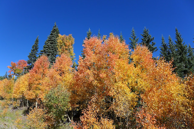
Up on the plateau, Brian Head prominently jutted out. Almost a thousand feet to go on a gravel access road. Fall colors were starting to show, and leaf peepers were out. A few cars headed to the summit. As I approached the summit, a group of a dozen or so mountain bikers were just beginning to head down, obviously having been shuttled up there. There were only two women up there while I hung out at the summit for a while. Might have been 50F but zero wind and so quiet. Visibility was easily over 100 miles.

Beginning the descent, a brief chunky hike-a-bike was encountered. I thought oh no, is that a taste of more to come? No, the descent had something else in store. The large pack of riders appeared to have turned on Dark Hollow descent, which was fine by me. I ended up having the remaining 95% of the descent to myself.

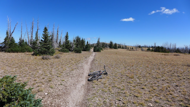
Riding along the Sidney Peaks ridgeline trail at 11,000ft, the views were comparable to Salida or Crested Butte ridgeline riding. Just spectacular on this crisp brilliant day. 

Splitting off onto the Left Fork Bunker Creek Trail, things got interesting. This cut into forested patches. The area experienced extreme wind for a couple days  earlier in the week when all the torential rain fell. I encountered a couple downed trees and hoped that was it. Then I encountered a tangled mess so thick, you couldn’t even poke an arm into it. I could not find a way through the forest around it. I tried multiple lines, each time getting my bike so stuck I thought I’d have to abandon it in place. I was not too happy. I had just crossed a double track and though about back tracking and taking the road back down. I did get around the mess, only to find tree after tree down. Half of the trees were live trees, not just beetle dead trees.

Once I got a little further down off the ridge, the flow improved. Lots of derailleur destroying debris to watch out for, but some ruckus speed could be carried. Left Fork pops out on Bunker Creek jeep road, which I was parked at the bottom of. No more trees to dismount for! There was still a surprising amount of water on the doubletrack, fortunately all of it avoidable.


I finished the nearly 30mi ride in 2.9hrs, much less time than I would have thought with all the bush-whacking up top. Now it was time for the gloomy process of packing up the bike and heading back to the “real” world. Or was I in the real world for the last two weeks? I could easily become a MTB bum.

Zion National Park from UT-14 on drive to Brian Head. 
Think that is West Temple poking up in far distance.

Color while riding up UT-143 approaching 10,000ft


Cedar Breaks National Monument. Less than ideal lighting, but pretty cool.
On right in distance is blowhard mountain, where Luke and I bombed down
as thunder was starting.


Brian Head from plateau on UT-143

From summit of Brian Head looking north. Several hundred feet vertical drop
to ski area below.

View from Brian Head looking over Cedar Breaks.


Brian Head Ski area. Lift service does not go to summit

Summit shelter

Sidney Peaks Trail along 11,000ft ridgeline


Riding on Sidney Peaks trail was comparable to Crested Butte or Salida


Love alpine riding


View north along Sidney Peaks Trail

The blow-down section on Left Fork Trail. Forest was so dense here with so many trees down
that it was almost impossible to bush whack around this mess

Frequent dismounts for a while on Left Fork Trail

Nearing the bottom on Bunker Creek jeep road

Saturday, September 19, 2015

Zion National Park

The planned high-point of my trip was a visit to Zion National Park with Cathy and my mom. None of us had been to this part of the country before. The Narrows hike in a 2000ft deep slot canyon looked like a really cool thing to do. But wouldn’t you know it, we picked a week where it rained every day for four days in a row. Didn’t rain all the time, but when it did, it really came down. 20 people lost their lives in and near Zion due to flash floods. 13 were in vans that got swept away, 7 parished in a slot canyon in Zion. Sobering thought.

The hike up the Virgin River Narrows supposedly gets shut down when river flow exceeds 150 cubic feet per second. Before the rain, the river flow was around 30cfps, very low, as it typically is around this time of year. But when the canyon flashed, the flow exceeded 2500cfps! That is a lot of volume in a narrow slot. We had to wait a couple days after the rain stopped until the flow dropped to a level we felt safe with and there was no threat of additional rain.

Staying just an hour away, we were able to get an early start in Zion. This was important in being able to park in the park and get a head start on the masses. It was a bit chilly, and I wondered how mom and Cathy would handle chilly air while wading in frigid water. Being from Michigan, we were used to chilly water, as some years Lake Michigan never warms up much. The water was fine once you got used to it. You could stay in it indefinitely.

Seems a lot of people just hike to the end of the Sinawava paved path and don’t enter the water. You miss the best part! Mom and Cathy both have bad knees and didn't care much for the inability to see submerged rocks. The water was still murky from storm run-off. We all brought two poles along, so we used them as a blind person would, feeling for deep holes and submerged rocks.

We made it deep into The Narrows, the junction with Orderville Canyon, a side slot canyon that some venture into. Mom and Cathy figured that was far enough, given they had to go back through 1.5 miles of river walking to get back to the paved path. They did alright with their handicaps.

While they worked their way back, I went up into Orderville Canyon. You can hike up to a falls where a permit is required to go further. I didn’t realize that even to reach that point was a bit challenging. This canyon was much narrower, had chest deep pools, rock scrambles and cascading falls. There were logs and other tree debris to work around too. Fun stuff. I couldn’t help but think about the 7 that perished nearby in a similar canyon. There is absolutely no escape if the flow suddenly increased. You really have to be sure of the forecast and your ability if doing a long traverse through one of these canyons. Orderville goes for many miles, requiring rappels in places.

When I reached the turn-around falls, I was tempted to scale up the tiny footholds cut into the slimy sandstone, but I read warnings against doing so. I might have been able to get up just fine, but many have gotten hurt trying to get back down and required rescues. There was nobody in the canyon with me at this point. It was nice to have such a wild, confined space to myself. The water was almost clear too, with a bit of emerald glow to it.

As I headed back down Orderville, I passed a large group coming up, apparently led by a guide. The water suddenly became murky. I wondered if the water in the main canyon is murky only because hundreds or thousands of feet are churning up the bottom.

I made very good pace heading back down, almost maintaining running pace at times. I stayed in the water much of the time because now the masses were heading up and used any bits of dry ground around the edges. So many people. There could easily have been over 1000 people in that 1.5mi stretch of canyon. I caught mom and Cathy just as we reached the end of the paved path. Perfect timing.

I had my hopes set on a more strenuous hike in the park during our visit too. When I saw Luke had done the Angel’s Landing hike a few weeks earlier, I pondered whether I had the guts to do it. Extreme exposure doesn’t describe it with justice. I’ve read six people have perished on this hike in the last 10 years or so. Why am I doing these things people die on again?

Mom and Cathy found a couple of less strenuous sights to visit while I gave Angel’s Landing a go. I was surprised to find the first two-thirds a wide, paved path. This actually weirded me out. There was constant stream of hikers heading up and down. There were many places where the path drops 200ft straight down to switchback below with nary a lip or railing. What if somebody tripped coming down and knocked me over the edge? The pavement was busted up in places and I could easily see this happening. What if somebody just pushed me over the edge for kicks? Weird thoughts ran through my head. Guess that shows how much faith I have in people.

I maintained a pretty good pace up the first 1000ft of the 1500ft climb. A guy stopped right in front of me to take a picture, blocking the path, not realizing somebody was right behind him. When he noticed, he said “you’re not breathing, you must be verty fit!” in a foreign accent. I told him I race bicycles up mountains for fun. He got chuckle out of that.

Once you reach the saddle at the junction with West Rim Trail, there is a respit in climbing. There were a lot of people sitting about. I later learned why. From there, you get a taste of what is to come: exposure while hanging onto chains with barely a foot hold and 1000ft to the bottom.  A few sections of this are traversed when a false summit is reached. You think oh, I finally made it. Then you crest over this false summit only to have a horror of horrors revealed. The real summit requires a near vertical scale on knife edge.

Comments from people when first setting eyes to what lies ahead were priceless. “No f’ing way!”  “Nope, how about we just say we did it!” I was hiking at a similar pace on this rough part with Lawrence from the west coast. His friend sat out this last part. Lawrence and I shared similar “respect” for exposure. We informally formed a buddy system for the rest of the hike.

Traversing the knife edge scale was a bit of a conga line. Lots of waiting for people coming down or going up. There was no room to pass on much of it, so you had to wait for a group at a time to get through sections. It was mostly a pretty young crowd, although there was one guy shadowing Lawrence and I that was at least as old as I was. You could tell he was a seasoned pro. I kept thinking what if somebody above me slipped and fell? They’d take me right over the edge with them. Again, not liking not have full control of the risk. A lot like a road bicycle race really, where a mistake well ahead of you takes you down. Except here, the stakes were much, much higher.

Reaching the landing was all I thought it would be. Great views over much of the park, north and south through the canyon. There were maybe 20-30 people up there at any one time, a bit crowded given how small of an area it was.

I feared the descent more than the climb, but strangely, I got a bit used to the exposure on the way up. I wouldn’t say I became cavalier in my descent, but I relied on the chains much less than I thought I would. Looking down all that exposure didn’t freak me out. I had on my good Scarpa hiking shoes (which were still wet from the river) with tenacious grip on sandstone. That instilled some confidence.

When I got back down to the saddle, I still had some time left before heading back to rendezvous with the women. I hiked up West Rim Trail. On the shuttle bus out to the Narrows in the morning, the driver pointed hikers out on the rim. It was so high and so straight up, you could barely make them out. Yeah, I wanted to experience that too. Like the first 1000ft to Angel’s Landing, West Rim was partially paved and wide. Gone was the exposure. Plateauing on the ridge, I found nobody up there. Awesome! Because of the domed top, I didn’t quite dare go to where you could see straight down into the canyon. The bare dome was slightly higher than Angel’s Landing and provided a stark viewpoint of how crazy that hike was. I hung around for bit up there, basking in full sun, eating a couple poptarts before heading back down.

I lightly ran parts of the descent. I felt pretty nimble on my feet and prayed I didn’t catch a toe and face plant. The initial part was a pretty rough natural surface. With the sun getting to late afternoon position, the switchbacks in Refrigerator Canyon below the saddle were getting dark and chilly. Sound really lingers in there, sometimes hearing an echo reverberate 4 or 5 times. Many people were entertained by this. You’d hear a voice that seemingly came right out of thin air hundreds of feet above the slot floor, but it really came from a hiker on a switchback a hundred feet under you and bounced off the opposite canyon wall.

My knees were trashed by the time I got back to the bottom. That was some steep descent and I took it kind of fast. I got back on the shuttle on time to meet the women back at the visitor center.

Hard to say what the total stats were for the visit. As expected, the GPS went bonkers in the narrows. The barometric altimeter almost worked, that is until I think I submerged it and got water in the breather port. Not much elevation change there, maybe a couple hundred feet total including Orderville Canyon. The hike up Angel’s Landing fared much better, being more exposed to the sky.

I really liked this place. Much different than visiting say Yellowstone, in that you interact with the environment in a very direct way. There more risk in making a mistake or having the weather turn against you. I’d probably come back here again when I could do deeper excursions into the canyons or visit another slot canyon that requires a permit by lottery system, like the one called “The Subway.”

Cathy and mom starting out in the water from end of the Sinawava path

Cathy and mom ahead of the masses

Sometimes wall to wall water


Mom on section that might be called "Wall Street"


Still pretty good flow to the Virgin River, about 55cfps that morning

Never deeper than thigh deep

Mom and Cathy in The Narrows

At the turn-around point in Orderville Canyon

Obstacle course through Orderville Canyon. Approaching some of these
falls were chest deep pockets

Orderville was much narrower


Look up at Angel's Landing. A path goes up that somehow?

The bottom 500ft of vertical

The middle 500ft of vertical

The top 500ft of vertical. When people crested this point and realized
there was still this to go, the expletives flew.

Lawrence on final bit to top looking north through canyon

View south through the Zion canyon


Looking straight down 1500ft on shuttle busses

Angel's Landing crest


This point of the knife edge was no more than two feet wide with only wobbly chain
to grasp

Not a knife edge but almost vertical

Up on West Rim Trail, looking back at Angel's Landing

Solitude on West Rim

Another perspective of Angel's Landing and the knife edge that has to be
scaled to get up there.