Saturday, November 13, 2010

Without a Leg to Stand On

As Steve Gauthier and I were rolling out of the parking lot Wednesday, Jim Kingston drives by and rhetorically hollers to me "didn't you learn anything this spring riding with that guy?" Steve and I were headed into Mine Falls on our lunch break. I had my newly repaired Titus daulie back on line finally. I had no idea how ominous Jim's comment would be.

Like usual for the past few weeks, I was riding a tad tired. I did a hard 65 minute rollerski workout the day before and hadn't really recovered from the weekend. I typically have an aerobic superiority over Steve, as he's a track specialist. But this advantage has diminished recently. He's been doing a lot of sculling on the Merrimack river. I've also learned over the years that guys who've raced motorcycles, whether track or off-road, tend to have superior handling skills in the woods. Steve used to race at Loudon years ago. I think it is a combination of genetically missing the fear gene and genuine acquired skill. So when you couple skill, lack of fear and improved cardio ability, you get somebody like national champion Kevin Hines, or Steve Gauthier to beat me up on local rides.

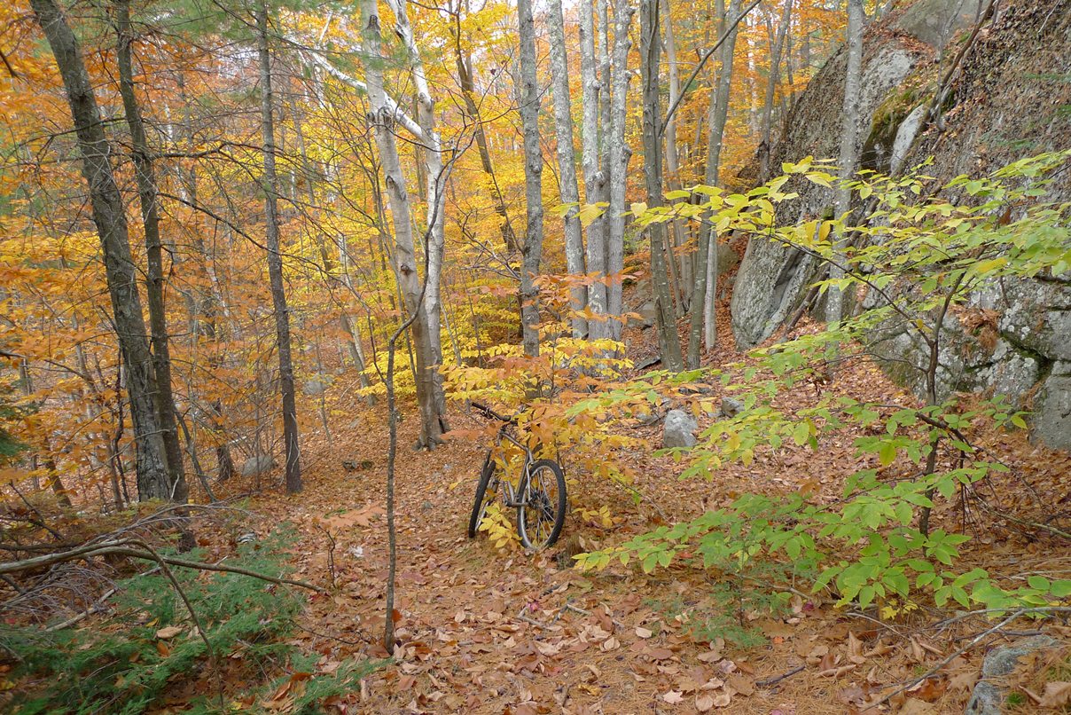
We get into the woods to find it deeply blanketed in oak leaves. I was still sporting girlish tires, 1.95" Mutanoraptors. I really like them a lot, but hook up in deep oak leaves, they do not. Steve was railing the turns at anaerobic effort. I was making all kinds of mistakes trying to stay with him. This is exactly how I was riding back in May when I shattered my left ankle.

A tricky section near the Mine Falls Dam got a bit more tricky this summer due to a blow-down. Steve had crashed there a few weeks ago, narrowly escaping serious injury. I had ridden through that section a couple times with no issues. On Wednesday though, somehow I ended up in front of Steve in this section and didn't want to slow him down. I went a little faster than I would have riding alone and botched the maneuver. Of course, was going to dab to the right, which meant I was going for a big tumble into rocks.

I got my right foot out but had no chance to ditch the bike. There was nothing but air to put my foot into. It was a big drop to rocks and tree debris. It seemed I had eons of time to ponder how badly this was going to suck. My leg promptly crumpled and I rolled into rocks. It was one of those situations where one assesses bodily parts before moving anything. My knee hurt. My right ankle, my GOOD ankle, hurt a lot. Amazingly, things like my back, shoulders and pelvis missed the pointy rocks. I surmised my ankle wasn't broken, but I couldn't stand for a while. My whole lower leg was searing in pain. A fractured fibula crossed my mind. This is the little bone that doesn't bear much weight.

I was able to get riding again in a diminished capacity. It hurt a lot to put any pressure on the front or side of my foot. Doing so sent stabbing pains down the outside of my lower leg. We finished the ride. I took a small handful of Ibuprofen when I got back to the office. I couldn't find any localized pain, other than both my knee and ankle were moderately swollen. My plan was to see how I felt in the morning and decide then if I needed to go in for xrays. Jim Kingston was right. I hadn't learned a thing.

Being the stubborn idiot I am, I packed a bike Thursday morning. I figured if I could ride trails back from my mishap on Wednesday, I couldn't be seriously hurt. But as the morning dragged on, I realized something was far from right. I could not put any weight on my right leg going up and down stairs. I called to see the doctor. I was in a state of panic, as if I broke my fib, that would kill the whole ski season. I got xrays that afternoon. Before leaving radiology, I had to know if there was an obvious fracture or not, so I asked the xray tech if I might have a look before leaving. She was totally cool with that. My fib looked fine to my completely untrained eye. Ankle looked good too. My incident in May had bones at almost right angles. None of that this time. I felt some relief already. Of course, a radiologist still had to review the images to make a diagnosis.

Friday was a scheduled off-day. I had planned to do a big ride in the mountains, especially since it would be so pleasant out. I had no idea if I could even make the pedals go around. I wasn't going to let the day go to waste though. After getting impatient waiting for the doctor's office to call back with results, I packed a bike and headed for Lincoln, NH. A White Mountains west half loop sounded nice. This meant riding up the Franconia Notch bike path (which I normally avoid in season), bombing down Rt 18 to Franconia, climbing up and over the dirt Long Pond Rd mountain pass, then finishing over Gonzo Pass. I have pretty low gears on my Dean road bike, so I figured I could always soft pedal if my leg was too ornery.

Franconia, Long Pond and Gonzo passes

Starting out was touch and go. I could only put a fraction of the force on my right pedal. For six months now, I got used to my left leg being my bad leg. But now my bad leg was my good leg. It seemed I didn't have a leg to stand on. Fortunately, the bike path was free of leaves and ice. That would have been more than I could handle. The frost heaves were something else though. Each one would send piercing pain through the side of my calf. It seemed like one of my ankle stability muscles was f'd up. The primary calf muscles seemed fine.

Top of Franconia Notch from bike path

By the time I made it to the top of Franconia, my leg had loosened up considerably. 600mg of Ibuprofen might have helped too. Riding south to the next climb felt semi-normal. Long pond was a bit of a disappointment. It looked like frost was coming out of the gravel. Many areas were wet and had the firmness of crunchy style peanut butter. It was all rideable, but demanded 50% more kilojoule expenditure than normal. Fortunately the south side was mostly dry. It probably took me better part of an hour to ride up and over this 9 mile dirt mountain pass. Only one car passed me the whole time.

Ok, blogger picture loader is broken right now. Any other app
opens this pic rotated 90deg. Long Pond Rd, note tire imprint.

Next up was the biggest climb of the ride, 1700ft up and over Gonzo Pass. Even though it had reach low 50's in sunny areas, there was still frost on the ground on north facing slopes. I started the ride late. The sun was getting low, and the temp was plummeting. I bonked horribly climbing Gonzo. No apparent reason for it. I rode recreational pace for most of the ride. I did eat next to nothing during the ride though and ate almost no carbs the night before. Cresting the summit was heavenly. The view of the Presidential's was quite spectacular with the sun setting behind me. Bombing 40mph back to Woodstock touched on all the senses. It smelled like fall. There were pockets of ice cold air. The gravity induced wind pushed back on me. It was one of my better descents all year.


"Is it Memorex or is it Live?" Remember that commercial?
So of these two photos, which is correct? There was nary
a hint of wind in the Whites on Friday. This is Baker Reservoir.

I wrapped up with 58.6mi, nearly 6000ft of climbing, in 3:40 riding time. This was about half and hour slower than I planned. Bum leg, tricky bike path, mushy dirt climb and bonking all were a factor. On the drive back, my wife informed me the xrays were negative. Good to know after I climbed three mountain passes.

Franconia Ridge with Mt Washington in distance from
Gonzo Pass after 3pm

My injury now seems to be consistent with a pulled muscle. Anytime that muscle fires to maintain stability, my knee buckles from automatic pain reflex. Things were a little better Saturday. At first I wrote off the Kearsarge rollerski race on Sunday, but after trying rollerskis Saturday, I might be alright. It seems the laterally rigid skate boots actually help me out and I had little pain skating. We'll see how race pace goes. I might be using a lot more upper body than normal.

Monday, November 8, 2010

Whites by CX

It's transition season here in New England, that period between short sleeve riding and Nordic activities.  Many gravitate towards cyclocross competition. CX perhaps stirs more enthusiasm than road and mountain bike competition combined. Given my genetic predisposition and training habits, CX could potentially be a good fit for me. But it requires considerable handling skill, and I need some portion of the year where I need not stress over competition. I choose fall. I prefer to take advantage of the cooler temps, usually dry conditions and lack of bugs by riding off road.  No training pressures, no racing, just pure riding bliss.

Saturday Dave P and I finally hit the White Mountains on cross bikes. After two full days of rain, local trail riding was not viable.  Scouring over Google Earth maps, I scouted out some new terrain in the Whites to sample. Our plan was to hit as much back road material as possible that is not suitable for road bikes but a mountain bike would be overkill on. One of my favorite such loops is Sandwich Notch/Campton Mountain. This loop can be extended by going over Tripoli Road, but that involves a lot of paved riding for a few miles of gravel that is usually road bikeable. Another area I've never ridden is west of I-93. Over the last couple years, readers have recommended climbs on that side. My plan was to ride up Ellsworth Hill Rd, wrap around Stinson Lake on dirt road of same name, then on way back down from Rumney, pick up wildcard East Rumney Rd. I had no idea of condition of this last road. Was it paved? Did it even go through? All I knew is it had a sizable climb in it.

I suspected double track Algonquin Rd would be very wet along the Beebe River. Thus Dave and I opted to ride the Sandwich Notch loop in reverse and climb upstream along the river. This would reduce the wetness factor. It proved to be a wise choice with lots of standing water. Algonquin Rd is a gated forest service road. On Saturday, however, there was some equipment back in there brushing out a power line through the mountains. Algonquin Rd ends on Sandwich Notch Rd, which climbs more earnestly. Dave turned on the afterburners for the last few hundred feet of climbing. I called him names upon summitting between gasps. I secretly hoped he'd pay for that later.

Algonquin Rd along the Beebe River

Still on dirt, we bomb down the north side of Sandwich Notch. Pretty dicy on cross bikes at 20% grade, high speed and rutted out surface. After very brief stint on Rt 49, we're back on dirt on Chickenboro Rd climbing Campton Mtn. This is the second climb in the profile below. It's a total spanker that keeps on giving. Reaching the highest point by bike is a bit questionable. If ever asked, "I have a map that shows it as public land access." The view is nice.

Sandwich Notch on the left, Stinson lake on the right

A mostly paved descent took us back to the car to top off water and head out for stage two of our ride. Ellsworth Hill threw some deliciously steep pitches at us. MattK says he hits 55mph coming down this road. That kind of speed would seem pretty sketchy to me with blind dips and bends. As we neared Stinson Pond, the road turns to dirt and undulates. Wouldn't you know it, a town line appears when we're already pretty much tapped out. We go for it anyway. I held about a 4" lead over Dave for the longest time to the line. Stupid. We both wobbled all over the road cross-eyed after that one. This gravel section lasted only a few miles before picking pavement up around the lake. The climb offered many views to the north and east, and the lake was highly scenic too.  The gravel was well groomed with minimal traffic.

View from Campton Mtn

Coming into Rumney, we took Quincy Rd down to East Rumney Rd. This quickly turned to gravel. It was the very bumpy, large aggregate kind of surface, something you'd never want to ride a road bike on. A couple miles in the climbing began, often steep. We were in Rumney and heading back to the car in Campton. There had to be another town line around here, right? We were both trigger happy. Dave got me going on a green house number sign one time.  When the town line finally came into sight, it was on the descent and I was ahead. No killing each other this time.

Brown Brook Falls near Stinson Lake

We got back to the car with nearly 56 miles on the odometer in 3.9hrs riding time. The ride entailed around 6000ft of climbing, mostly on dirt. I'd guess about 40% of the route was gravel, but well over 50% of the time was spent on gravel. A chilly day with temps only in the 30's, but a great day to be on two wheels.

Friday, November 5, 2010

Double Dipping Dilemma

It's that time of year again, where I refuse to let go of cycling yet ramp up rollerskiing efforts. I call it double dipping, where I go to the intensity well twice as many times per week than when I'm just riding. This has an accumulative effect on the body. After a couple weeks, you don't feel so well anymore. Rest days have all but disappeared recently.

Last weekend was particularly tough. I rode and rollerskied hard four days in a row leading up to the Wicked Ride of the East on Sunday. Of course, I hooked up with Steve Gauthier who felt quite snappy. That was exactly how I broke my ankle in May. Dougie trashed, Stevie fresh, let's go out ballistic and see if we can turn Dougie into minced meat. I might have learned a thing or two since May. Ending Sunday's ride with a crash was not in the plan. I've crashed each of the last four or five years during the Wicked Ride of the East.  So I backed down.  I ended up riding by myself (with 500+ other riders in the woods that day) for the first hour. Steve was on a Yeti 575 (almost 6" travel front and back) while I was perched on my Dean 26" hardtail. My Titus dualie was waiting on fork parts, and I still have the onion skin tires on my Superfly 29er.  Yeah, I totally was in the minority in the equipment department. Almost nobody rides 26" hardtails anymore, although I did run into another rider on a Dean Ti hardtail just like mine. He's had his for 14 years.

Steve's enthusiasm eventually wore him down so I could keep up with him without risking life and limb on that grim terrain. This year's route contained only the "good stuff," thanks to feedback from riders that don't like any fireroad content. So my body got pummelled for over 2.5hrs on nothing but rocks and roots. Nary a hill to be found anywhere. Not really my riding style anymore. Perhaps if I bought a real trail bike sometime, I'd enjoy it more. Trails being built these days are matching the capability of bikes. 6" travel bikes have become the norm, so to keep riders entertained, terrain must scale proportionately.

This past Tuesday, I did one of my most punishing 1hr rollerski workouts yet this fall. What is my reward on Wednesday? Get schooled some more by Steve on new trails by work. Guess the trails were mostly new to him too, but we still had an equipment mismatch. Something tells me when I get back on my Titus dualie with fresh legs, Steve is still going to be doing the schooling.

I have this very simple rollerski loop I do near work. It is about 1.2km around and has some modest grade variations. Min to max elevation change is about 60 feet I think. One side is slightly up hill and makes for a great 40-50sec double pole interval. Around the back side, there's a 30-40 second hill at 5-7% grade that is perfect for a V2 interval. I usually do about 14-15 laps. These intervals are very short, stuff I never do on the bike, but it's the best I've got within five minutes drive from work and doesn't require speed reducers. 15 times around (30 total intervals) usually does a nice job leaving my body in shambles.

Steve joined me with rollerskis on Friday and stopped before I did to capture some video. I always cringe when I get video feedback on my form. It always sucks, but I have to say I'm starting to suck a little less. The clip below was taken on my 13th lap, so I was pretty much imploding at this point.


Whittier Rd Rollerski Loop from D. Jansen on Vimeo.

Any skiers care to critique technique? Hoping for an early winter again like last year when I was skiing by Thanksgiving. I'm also finally doing some things I haven't done in over 25 years: push-ups and sit-ups. When I first did sit-ups a few weeks ago, I had to stop after five! I was pretty sure something was starting to tear. Now I can do 34. Yeah, still a pittance, but a 600% increase from where I started. For push-ups, I can do 24 now. This is a 100% increase in a few weeks.  That medicine ball I bought more than a year ago, well, maybe that will get some use soon too.

Sunday, October 31, 2010

Mt Kearsarge Test Run

The Cambridge Sports Union ski club is running two rollerski hillclimb races up Mt Kearsarge on Oct 31 and Nov 14. Since I already committed to doing the Wicked Ride of the East on Halloween, I had to settle for getting just one timed shot on the mountain in on the 14th. This didn't stop me from heading there this past Saturday though. The state park website said they'd be open through Sunday the 31st. Cathy was willing to drive up so I wouldn't have to hike back down.

Upon arrival, the gate was locked. Ugh. There was no notice or anything about it opening this weekend. This sucked for two reasons. One is I didn't want to hike 3.4 miles down a paved road. The other was I feared that with no auto traffic, there could be lots of tree debris on the summit road.

My wonderful wife is willingly adaptive in these situations. She would get a head start up the road with some dry clothes and sneakers for me. We'd then hike the trail from the upper parking lot to the summit and walk all the way back down to the car. We'd both get a superb workout.

I brought my Pursuit rollerskis with no speed reducers and really slow wheels on them. Even so, I found I could not get any warmup in, as the road in either direction from the gate was too steep to control speed on, especially coming down into a locked iron gate. I gave up and went right into the climb with no warmup. To compound matters, I did nearly three hours of tough mountain biking the day before and an hour of rollerski drills the day before that. I was feeling pretty beat up and tight.

There is a mile long stretch at the bottom that averages nearly 12% grade. There are many sustained sections over 15%. With no warmup, this truly put me in a hole from the get-go. About 0.2 miles into the climb, I nearly gave up. I was ready to pull the phone out to call Cathy to abandon. The road was covered in slippery oak leaves and I could get no traction. Double poling on 15% grade just doesn't work, especially for a upper body cycling wuss like myself. I slipped so badly once I barely got hands down in time to keep my face from hitting the pavement. I persevered a bit longer though. I was glad I did. The leaf density thinned out about a half mile into the climb, and a mile into it, the road was bare. This was due to altitude, as trees there had dropped their leaves much earlier and there were more fir trees and fewer oaks.

Lower portion of road. Strip in middle was too narrow to skate.
Push-off was in the deep stuff on sides.

Cathy snapped photos of me as I passed. I surely have some technique deficiencies to work on. I went out too hard on the steep lower portion and had to back down a bit as the grade slackened some. There are a few minor downhills to recover on, if you take the bait. On a bicycle hillclimb, I never take the bait. You tend to go too hard again after a brief lull and hit deflection, which always costs seconds on the clock. Today was exploratory, so I didn't care. The final downhill has a steeper drop in it with a turn at the bottom. I actually scrubbed speed on this one because I didn't know how fast I would go. I realized this was completely unnecessary. Good to know come November 14. After reading about Alex's downhill mishap, I take even less chances on downhills.


I nearly ran over a porcupine. I failed to keep my head up on a steep section, then realized a porcupine was in the middle of the road and was in no hurry to get out of my way. He didn't seem very afraid. Cathy came within a few feet of him a few minutes later too. And no, porcupines cannot throw quills. This is a myth. It would suck to fall on one though.

Probably 17% grade here

From the last dip to summit is less than a mile at moderate grade. I ramped the pace back up again, going deeply anaerobic.  From toll gate at the bottom to end of pavement at the parking lot took me exactly 36 minutes. It is about 1500ft net gain.  This was the hardest effort I put in since the Allen Clark bicycle hillclimb at the beginning of the month.

For the CSU timed event Sunday morning, I hear they took a leaf blower to the course. Based on some of the finishing times, I should be able to break 34 minutes when I come back on the 14th. I'll come with fresher legs and I may put the faster tires back in my Pursuits, although then I would lose my apples to apples comparison.

Soaking wet in howling wind, I nearly froze waiting for Cathy to reach the upper lot. I put dry uppers on, laced up AATD's (ankle anti-taco devices) on both ankles, puts sneakers on, then headed the rest of the way to the summit. With the gate locked, we were the only ones out here on Saturday. This was a first for me.

Cathy on summit, taken from fire tower

I wanted to climb at a brisk pace, maybe even encroach on trail running pace. With ankle supports on both ankles, I was quite confident I wouldn't sustain a serious injury. I need more impact time on my feet, and the technical climb would offer lots of agility practice. It took me upwards of 8 minutes to reach the summit at a steady aerobic pace. For the first time in many years, I actually felt confident on my feet on a steep, technical hiking trail. It was bitter cold up top. The water in rock crevasses was frozen solid. Heavy overcast diminished the 100 mile view.

Snow capped Mt Cardigan (I think) in distance

Now it was a four mile hike back to the car. Cathy has no trouble staying with me on the descents. There was a steady stream of walkers coming up on our way down. The porcupine was still milling about too. The descent hurt far more than the TT up. The front of my knees got very ornery on the paved 12-15% grades. Overall, it turned out to be a great morning. Cathy and I both got a workout. At least with the gate locked, I had no auto interference during my climb. We got to enjoy the summit without a soul around. Normally, this summit is crowed on weekends.

Saturday, October 30, 2010

When in Maine, Ride in Maine

Having purchased a pair of high zoot poles from Boulder Nordic Sport online, I thought I'd check out their new store in Portland, Maine. I desperately need new boots, as my Salomon RS Carbon's hurt my feet and my only other pair of boots are several years old and falling apart. I also wanted to have my training RS:11 skis ground. BNS-Portland is a drop-off point for Nordic ski grinding performed at their Boulder facility.

I was a bit underwhelmed by the Portland shop. It was very small and basically just a bay in a old shipping warehouse building. I drove past it three times, stopped and asked for directions, then realized the BNS taped on a door was the right place. Perhaps the store is still being remodelled or built up. They did have the sizes in the Salomon boot lineup I needed to try on though. I ended up in a newer version of the RS Carbon, but 2/3 size bigger than what I have now. It is possible that my current boot is too small and that is why it hurts my talus protrusion so much. The higher end S-lab model boots have too narrow of a heel cup to work with my titanium reinforced ankle. If the larger size RS Carbon's don't work, I'm not sure what my options will be. All my skate and roller skis have pilot bindings, so I'm kind of stuck with Salomon. I'll try the new boots out this week on rollerskis.

On my way back, I stopped at Mt Agamenticus in the very southern part of Maine to ride. I've ridden here only once or twice maybe eight years ago. NEMBA has broadened the riding options here considerably in the years since. I knew Mt Aggie to be a pretty technical place. Being alone, I wouldn't know where all the good stuff was. It is not on the official park map, as that just covers the immediate summit area. So I went data mining on the Internet. I found GPX track files on Bikemag.com and GarminConnect. With no descriptions, you have to treat this info as suspect at best.

One promising track was a 10+ mile loop on the south side of Mountain Rd, where I have never ridden previously. There are several lakes in this vast, undeveloped area. Google Earth indicated the topography is steeply corrugated. Looked enticing, maybe some views available, but potentially quite brutal. I saved this track and a few others that canvased the more typical Mt Agamenticus side of Mountain Rd.

Folly Pond still very low

I parked at the base of the summit road, quickly changed, then headed off to the south side. I figured I'd bang out that 10 mile loop as a one hour warm-up for the steeper, climbier stuff on the north side. Yeah, right. The first few miles were all ATV track, wicked steep in spots, water crossings, and almost all loose rutted out rock. Throw in nearly complete leaf drop, I had no idea what was passing under my tires.

There was one section of spaghetti track that almost surely would be MTBer built singletrack, as ATVers just don't ride that way. I went past this trail twice before finding it. It must be quite new or infrequently ridden, as it was barely discernible under the leaves. But it was goooood - clearly built by mountain bikers. All rideable save for a few dabs, but very challenging. I was running about 18psi front and 20psi in my rear tire. I surprised myself by some of the stuff I managed to scale.  I cringed repeatedly from bottoming out the rear tire.  This trail had a lot in common with the one called Evil FOMBA. Due to leaf drop, I did repeatedly go off the trail. I would never have been able to follow it without my GPS.

It was back onto ATV track for a while. It seems most of the ponds are man-made. There is a large network of dams in this place. No water was flowing though. Fall rains still haven't made up for the drought this summer. I had no GPX track for it, just a suggestive rough track I manually entered for a loop around Middle Pond. It took me forever to find the trail. Leaf drop again. But this was sweet. Nice flow, all rideable. It popped out by a large dam. One of the tracks I noted on Dirtrag.com showed the route crossing this dam. It looked sketchy to me. There was nobody out here and nobody knew exactly where I was. I decided to see if I could ride further downstream and cross without walking atop a skinny concrete wall with big drops to either side.

A tidbit that was nice along east side of Middle Pond

I found a route to the other side. The stream crossing was completely dry. It was decent riding. Now I had to find the singletrack back on the east side of Middle Pond. The topography on this side was essentially a cliff that drops straight down to water. The Bikemag map showed a track for it, so guys must be riding it, right? The next 1-2 miles took me an hour! At one point, I had to let my bike slide down a rock face, then slide on my butt after it. The trail disappeared at times and I went into full bush whack mode. The singletrack goodness I rode earlier was quickly being negated by this suckfest. There were some nice views high above the pond from rock outcroppings. But these only meant rock scrambling up and down to reach them. Eventually I found a faint ATV trail and bailed out on it, in the opposite direction I wanted to go. I was done hugging the pond on a barely there trail. The ATV track eventually popped out on the Yellow Trail, which looked like a sanctioned ATV trail that was well maintained. As I climbed back up to Mountain Rd, it started to sprinkle. I had 2.5hrs of riding in and only covered about 16 miles so far.

Summit of Mt Agamenticus looking north

The drizzle stopped before things got too wet, so I at least had to summit Mt Agamenticus before heading home. I rode up the east side of Ring Trail. This was super chunk much of the way up, but at least I could attempt it without fear of death like along Middle Pond. I dabbed only twice before reaching the summit. Every way down from there had "No Bikes" signs posted. I don't remember those from eight years ago. They went down some of the abandoned ski slopes. I opted to call it a ride and ripped back down the paved summit road to my car.

Mt Agamenticus in upper left, Middle Pond in upper right, Folly
Pond in upper center

After last weekend's Wapack granite skills ride, I was hoping for something a little more tame today. I ended up with a more extreme ride. I never got to hit Second and Third hill on the north side. Exeter Cycles does fall rides here, so maybe I'll have to hook up with them to learn where the good stuff is. I managed 18.5 miles in 2:50 riding time. There were a lot of minutes hiking not accounted for on the Garmin. Still a good ride. It perplexes me how I escaped rides the last two weekends unscathed but suffered a catastrophe at Yudicky Farm in May.

Sunday, October 24, 2010

The Quintessential New England Fall Ride

As for many riders, fall is my favorite time of year to be a cyclist. The air is cool again, the bugs are gone, and the trails are typically dry. Fall is designed for long trail rides. DaveP and I bounced a few long ride ideas around. We considered a dirt road CX ride in the Whites. Ultimately, simple logistics won. We'd ride the Wapack Trail from Temple Mtn in NH to Mt Watatic in MA and take dirt roads back. It is close by.  I have ridden all portions of the Wapack but in previous rides. At the state line, the Wapack Trail continues on as the Midstate Trail in Massachusetts and goes to Rhode Island. I have not ridden the Midstate south of Wachusett Mtn.

Few ride the Wapack. It is quite brutal. Riders unwilling to frequently carry their bikes will hate this trail. You must approach the Wapack with reasonable expectations. It is primarily a hiking trail after all. If you consider the ride a hybrid hike and bike, you will do fine. It pays to know your limits too. There are sections where once you commit, you will either roll out the other end or need a rescue.

So why ride here? Simply for the stunning beauty along 20 miles of ridge top riding and the need to challenge one's self once in a while. Views from the trail are not to be found any place closer to Boston or Nashua. Of the six or seven times I've ridden bits of the Wapack or Midstate in the past, encounters with other trail users were infrequent, especially in sections between distant trailheads. There were no other cars in the Temple Mountain parking lot when Dave and I rolled off at 8am. I found this very unusually for a pristine Saturday during peak color season. I'm going to let pictures tell the rest of the story.

Profile of the ride. Eight named peaks were crested. Notice the steepness of each cluster. The fire road climb to the ridge line from the Temple Mtn parking area was 100% rideable, as was most of the descent from Burton Peak. A re-route of the climb to Barrett Mtn was mostly rideable. Only cardio ability on the 30% grade was the limiter.  The descent from Pratt Mtn was nearly all hike-a-bike.

Dave cresting Holt Peak with Pack Monadnock in the background. All of the peaks entail slickrock riding, presumably scraped bare from a previous ice age.

Near Temple Mountain. Lobster mitts and booties. There was ice on the rocks in places and the wind was really moving up here. The windchill might have been 20F. A shock to the face so early in the season.

Mt Monadnock in the distance.

There were many, many short sections like this. No doubt some folks can ride this. Needless to say "it is much steeper than it looks."

I failed to follow my GPS track and we ended up taking the wrong trail down from the Temple Mtn ridge line. This is the Berry Pasture Trail. We didn't do any less singletrack, but some extra road had to be taken to get back on the Wapack. This was very easy on the eyes with Mt Monadnock in the distance.

Hill Junkie on the New Ipswich Mtn section of the Wapack. Lots of buff slickrock up here.

Mt Monadnock on left. Dave somewhere near Barrett Mtn.

Dave heading towards Pratt Mtn, the prominent knob in the distance.

New Ipswich Mtn in the background.

Binney Pond and Mt Watatic in the distance. Still some color left below, but up top, leaf drop was nearly complete.

Binney Pond. Climbing from here to the Mt Watatic summit, I heard very heavy breathing coming up behind me. I was cruising along pretty good, and I thought Dave must really be drilling it to come up that fast on me. Then a voice speaks, inquiring which fork I was going to take. I nearly fell of my bike. It was a runner, maybe 6ft-6in tall. He was moving at twice my speed. Granted, on around 10% grade on rough terrain, runners achieve parity with mountain bikers, and this was much steeper than 10%. But the speed with which this guy passed us was humbling nonetheless. Dave laughed hysterically when he saw my reaction to this guy coming around me. In less than a minute, he was out of sight.

From summit of Mt Watatic. Boston skyline is just visible in center of image. Since there is a parking lot at the base right on Rt 119, this is a very popular hiking mountain. I've ridden up Watatic many times, usually as an out and back before heading south on the Midstate Trail. This time I cleaned far more than I ever have, on both the ascent and descent. I missed only one thing on the initial plummet. The consequences of failure here are extreme. I was wearing a support on my left ankle, but I think it is safe to say the last vestiges of fear from my fracture this spring are gone.

Looking north from summit of Mt Watatic. Nearly the entire Wapack range is in view here.

Mountain Road through Calasis State Park. Only place we rode though a canopy of color.

GPS track of ride. Blue path in center is where we deviated from Wapack. This meant we short-circuited the ride, no longer making it a true loop. No biggie. The views on this west facing descent were worth it. The short blue segment on left is where my Garmin failed to direct me (blame the tool, not the user;) This meant we descended all the way through Calasis SP and had to climb all the way back up on Rt 101.

This was one of my better rides this season, although off-the-charts brutal. No crashes, but many close calls. We logged about 38 miles in 5.2 hours moving time. Total time was close to 7hrs. I suspect we were moving too slow some of the time for my GPS to even count distance. The first 18 miles of this ride took 3.7hrs moving time and entailed nearly 5000ft of climbing. I thought to myself this was just like riding in Pisgah National Forest late last fall. Terrain, vegetation and hike-a-bike content is almost identical. And I did this on a 80mm travel hardtail! Dave was riding 5+ inches travel front and rear.  Not a ride I would want to do regularly, but great for this time of year when there is no focus on training and it is ok to take on a little more risk.

Friday, October 22, 2010

Bad tread streak

Can anybody identify this object? It is about the size of a quarter.


It is a growth of sorts.
It is not a cat brain.
It is not cauliflower.
Nor a cancerous tumor.
It isn't even biological.
Give up?

Riders who run Stan's sealant in their tires have probably seen these before. These are the growths that seal around leaks in tubeless tires. It seems once a leak is plugged and there is a wad of Stan's there, it just keeps growing.

I've had an exceptionally bad season for tires. I've nearly gone a whole season without a road flat before. Now I'm making up for it.  I've suffered four road flats since coming out of my cast in July. Two were the result of hitting things. One was several weeks ago when I hit a submerged pothole in a rain storm. Today I don't know what I hit. Had my head down going into the wind, when suddenly both hands were nearly ripped from the bar and the rear wheel kicked over a foot. I momentarily skidded. Very close. Thought for sure that was good for a double flat. Had no idea what I hit. It must have flown off into the ditch, as there was nothing there when I looked back. I soft pedalled for a bit, bouncing on bike, fully expecting a squishy tire or two. Seemed ok. But a minute later I got that squirmy feeling in the back. While changing the tire along busy Continental Blvd, the wind blew my bike over, the wheel tipped while I was pumping it, driving my knuckles into the cassette, then I could not pull off the pump nuzzle and completely broke off the presta valve nut. I carry only one spare. Amazingly, it held air for the three miles back to work.

Off-road, I've had two failures in the last couple weeks. I noticed on my Dean hardtail a 1" long slice in the rear tire where some Stan's had leaked out. Have no idea what ride this happened on, it was proably that way when I did a 50 mile loop last weekend.  It was this tire the Stan's tumor above came out of. I plan to ride that bike this weekend while waiting on dualie fork parts. The tire was cut so badly I didn't trust it and put a new one on. I have a bunch of WTB Mutanoraptor UST tires on hand I bought for $19.95 each. The Mutanoraptor's go on easily without using a lever and inflate readily with a hand pump.

While riding my Superfly in Mine Falls on Wednesday, I went through the gnarly section by the dam pretty hard. I ran the onion skin Stan's Raven tires pretty soft and felt them bottom out hard a few times. Sure enough, when I popped out in the parking lot by the dam, I heard the tell-tale sign of psssssssssss. I pinched through the rear sidewall. For the first time ever riding tubeless tires, I went into a frantic shake the tire around routine to get Stan's sealant to plug the whole. It worked just in time, but I had to re-inflate the tire. I was skeptical of those tires to begin with and had ridden them only one other time. They are wicked fast on gravel and hardpack, but I doubt they would have gotten me to the finish of the Ironcross race without a catastrophe. Spent big bucks on them, now I don't know what to do with them. The Raven's are "Tubeless Ready," not UST certified tires. This means the side walls are super thin and porous and sealant is require to hold air. In the last six years, I've never flatted or burped a UST tubeless tire. It's a love hate thing. Full UST compliant tires are heavy and often not the fastest rolling tires, but they so friggin reliable.