Several people have notified me that my Northeastcycling.com website is down. Lycos provides the hosting and domain name registration service. I am working with them to get it restored. Lycos lost control of my domain name and has requested I contact a third party to regain control of it. Of course, that third party is requesting money. Basically my domain name is being held hostage. I don't know how Lycos let this happen. I suspect it may involve others whose domain names were registered through this third party foreign registrar company. I'm still working to get it back but won't pay extortion fees to do so. Don't know where this will end up yet. I invest little time in Northeastcycling these days and certainly don't have time to reconstruct the entire site with another host. Any suggestions for painless transition are welcome.
One reader pointed out an archiving site has a fairly recent archive of my site. It appears to all be there. You will find it at Way Back Machine.
Tuesday, May 31, 2016

Sunday, May 29, 2016
Wa-Wa What?
Back in 2012, I made the lottery selection for the Mt Washington foot race. I dabbled in running, mainly to combat low bone density, which I was diagnosed with two years earlier. I ran up to an hour once a week and did some repeats on nearby Mt Pack Monadnock several times. Then a week before the 2012 Mt Washington race, I injured my calf. Out just like that. I pretty much said eff this running business.
I kept entering the Mt Washington lottery, as I've always wanted to see what I can do on foot relative to my many bicycle times. Finally in 2016, I got in again. I pretty much stopped running when I started hiking last summer. I have to think 5-10 hour hikes will do more for bone health than 25 minute lunch runs once or twice a week.But can it prep you for something as grueling as running up Mt Washington?
Hiking has brought about positive adaptations. My dorsilflexion has improved. My achilles and calves are considerably stronger. I think risk of calf injury is very low now.
I started running repeats on Pack Monadnock again. I haven't done much focused VOmax work the last couple years. Running up a mountain is a sure way to get your hurt on! Going down was a problem in 2012. I would get excruciating shin splints and DOMS a couple days later. I found all the descending in hiking made me DOMS proof now. I also noticed the increased dorsilflexion changed my uphill running technique. On Pack, there are sections on the paved road to the summit that are 15-20% grade. Before, I could not heel plant. I'd end up running on the balls of my feet on the steepest parts, which was extremely stressful on my calves, and it also felt like I couldn't engage my hamstrings fully.
Three weeks out from the Mt Washington race, I signed up for the Mt Wachusett 10k race with great hesitation. The course goes up and over the summit, all the way back down. I suck at downhill running, or downhill anything for that matter. But I wanted some pacing experience in a race situation before Mt Washington. I could always walk/run the descent.
Wouldn't you know it, the temp was expected to rise well into the 90's on Saturday for the race. I tolerate heat more poorly than most. The race wasn't that early either, starting at 9:30am. The skies cleared and the sun turned the mountain into an oven as 300+ racers lined up for a mass start.
We go off and I find myself about 50 runners back. The grade kicks up on Mile Hill Rd, the breathing around me gets louder. I started reeling people in. I maybe gained 10-15 spots by the time we turned into the state park. After a brief downhill, the climbing resumes. We turn left onto the one-way "down" road, which is uber steep. Are we hurting yet? The discomfort level went beyond anything I experienced on my Pack training repeats. I felt like a liter a minute was dripping off my hands and elbows.
A right turn onto the summit spur had us face-to-face with 15% grade in full sun. I just wanted to hit that mat up top, get my summit split and stop. The heat was giving me abdominal cramps. My thermal governor had kicked in, and it took only 23 minutes. I crossed the mat, ran around the tower, and headed down. Why was I still running?
The 15% grade heading down didn't freak me out like I thought it would. There was some braking going on, but not jack-hammer kind of stuff. I still felt somewhat fluid. The least steep parts I kind of ran wide open without pushing it. Maybe I keep this race going for bit to see how this descent business works. My biggest concern was my knees giving me the big f-you, but there was no hint of that.
Half way down, the course veers left onto gravel fire road. The surface was pretty predictable, there were areas of loose ankle biter rocks. Again, I think the hiking over the past 10 months gave me the confidence and stability in my ankles to maintain a decent pace. It's amazing how hard you can still breath running downhill. I was surprised only one person passed me on the 3.2mi descent.
I finished in 45:33, good for 18th/311 finishers overall, about what I thought was possible. I was pretty happy with that, especially given the oppressive heat. My hamstrings were in a bit of a funk after I finished, but my knees were fine. I guess sometimes you just have to step outside of your comfort box if you want to learn new things about yourself. I'm not about to take up trail running though, at least not downhill.

There's really no good way to extrapolate this result to how I might do on the big Rock Pile in three weeks. I do have a goal, and that is to gain the 4700ft in less than 80 minutes. Hopefully we don't get a scorcher like Saturday. I'd DNF running that long in heat. I do plan to run a couple of the other mountain climbs, like Loon and the Whiteface Vertical K in NY. Off road, and the finish is at the top for these events!
I kept entering the Mt Washington lottery, as I've always wanted to see what I can do on foot relative to my many bicycle times. Finally in 2016, I got in again. I pretty much stopped running when I started hiking last summer. I have to think 5-10 hour hikes will do more for bone health than 25 minute lunch runs once or twice a week.But can it prep you for something as grueling as running up Mt Washington?
Hiking has brought about positive adaptations. My dorsilflexion has improved. My achilles and calves are considerably stronger. I think risk of calf injury is very low now.
I started running repeats on Pack Monadnock again. I haven't done much focused VOmax work the last couple years. Running up a mountain is a sure way to get your hurt on! Going down was a problem in 2012. I would get excruciating shin splints and DOMS a couple days later. I found all the descending in hiking made me DOMS proof now. I also noticed the increased dorsilflexion changed my uphill running technique. On Pack, there are sections on the paved road to the summit that are 15-20% grade. Before, I could not heel plant. I'd end up running on the balls of my feet on the steepest parts, which was extremely stressful on my calves, and it also felt like I couldn't engage my hamstrings fully.
Three weeks out from the Mt Washington race, I signed up for the Mt Wachusett 10k race with great hesitation. The course goes up and over the summit, all the way back down. I suck at downhill running, or downhill anything for that matter. But I wanted some pacing experience in a race situation before Mt Washington. I could always walk/run the descent.
Wouldn't you know it, the temp was expected to rise well into the 90's on Saturday for the race. I tolerate heat more poorly than most. The race wasn't that early either, starting at 9:30am. The skies cleared and the sun turned the mountain into an oven as 300+ racers lined up for a mass start.
We go off and I find myself about 50 runners back. The grade kicks up on Mile Hill Rd, the breathing around me gets louder. I started reeling people in. I maybe gained 10-15 spots by the time we turned into the state park. After a brief downhill, the climbing resumes. We turn left onto the one-way "down" road, which is uber steep. Are we hurting yet? The discomfort level went beyond anything I experienced on my Pack training repeats. I felt like a liter a minute was dripping off my hands and elbows.
A right turn onto the summit spur had us face-to-face with 15% grade in full sun. I just wanted to hit that mat up top, get my summit split and stop. The heat was giving me abdominal cramps. My thermal governor had kicked in, and it took only 23 minutes. I crossed the mat, ran around the tower, and headed down. Why was I still running?
The 15% grade heading down didn't freak me out like I thought it would. There was some braking going on, but not jack-hammer kind of stuff. I still felt somewhat fluid. The least steep parts I kind of ran wide open without pushing it. Maybe I keep this race going for bit to see how this descent business works. My biggest concern was my knees giving me the big f-you, but there was no hint of that.
Half way down, the course veers left onto gravel fire road. The surface was pretty predictable, there were areas of loose ankle biter rocks. Again, I think the hiking over the past 10 months gave me the confidence and stability in my ankles to maintain a decent pace. It's amazing how hard you can still breath running downhill. I was surprised only one person passed me on the 3.2mi descent.
I finished in 45:33, good for 18th/311 finishers overall, about what I thought was possible. I was pretty happy with that, especially given the oppressive heat. My hamstrings were in a bit of a funk after I finished, but my knees were fine. I guess sometimes you just have to step outside of your comfort box if you want to learn new things about yourself. I'm not about to take up trail running though, at least not downhill.

Gaunt from dehydration and rocking the goofy cyclist's tan
There's really no good way to extrapolate this result to how I might do on the big Rock Pile in three weeks. I do have a goal, and that is to gain the 4700ft in less than 80 minutes. Hopefully we don't get a scorcher like Saturday. I'd DNF running that long in heat. I do plan to run a couple of the other mountain climbs, like Loon and the Whiteface Vertical K in NY. Off road, and the finish is at the top for these events!
Friday, May 27, 2016
GPS Frustrations
Most engineers obsess over measurement accuracy. In my line of work as a research engineer, we often push against the limits of what's doable. Sometimes independent verification of our results is required. It should not be surprising then, if some of this rubs off into tracking recreational pursuits.
I used a Garmin Edge 705 GPS unit for many years. I loved that unit. It produced impeccably accurate tracks in even adverse conditions. Well sealed, the unit was not. After one too many deluges in Colorado, the 705 gave up the ghost.
I transitioned to a Garmin 510, which added Russian GLONASS reception to the US-based GPS constellation. I was pleased with the 510's track accuracy too, perhaps comparable to the 705. Under tree cover or heavy overcast, the 510 consistently produced smooth, tight tracks exactly where I went.
Garmin does have a reputation, though, and not all good. They are notorious for releasing buggy products to the market. Basically, they make consumers like me their beta test group even though we did not agree to provide this service. Software updates often come fast and furious for newly released Garmin products.
Some bugs (or maybe Garmin thinks they're features?) never seem to get fixed. I have a major peeve with my 510. It does everything I want it to for cycling, the activity the unit was designed for. But I also use the 510 for running, hiking and Nordic skiing. During hiking, I've notice very large variation in my recorded distances, even for same hikes. One time I'll log 9mi, another time 11mi for exactly the same route. What gives?
I learned to turn off auto-pause when hiking. Sometimes you go so slow in technical sections that the unit will pause and stop logging data. However, upon probing into suspect track files, I noticed something peculiar. The 510 appears to stop distance tagging when speed drops below a certain value, say 2mph, but it continues logging lat/lon coordinates, barometric altimeter and time stamps. Only distance tag stays stuck. It appears turning off auto-pause only partially turns it off. The result is the distance tally displayed ends up way short for most hikes. Further, when posting to websites like Strava, Strava blindly follows the distance tagging and reports incorrect distance - most of the time. I've had a few instances where GPS distance was so short that Strava recognized a discrepancy, threw out the distance tagging, and recalculated actual distance from lat/lon coordinates.
So then I got smart and found a way to strip distance tags from my 510 hiking track files before posting to Strava, forcing Strava to compute distance from raw data. But this also stripped barometric altimeter data, which is far more accurate when hiking rugged terrain than what can be calculated from a digital elevation map that uses 30 meter or 100 meter grid. This situation sucked! I could either get accurate climbing or accurate distance, but never both!
Faced with this frustration, I decided to buy a running/hiking specific GPS. I picked up the recently introduced Suunto Traverse. It comes with barometric altimeter and tracks both GPS and GLONASS satellites. This sounded really good, although reviews were pretty negative on battery life. Suunto has a much better reputation for releasing new products with few bugs, unlike Garmin.

My first test of the Suunto Traverse was on Mt Pack Monadnock, running repeats on the autoroad to the summit. I liked the less bulk on my wrist. The user interface is vastly different from Garmin and requires a learning curve. I couldn't wait to get home to see the results, of both GPS performance and my performance. I expected to have run a PR lap, and Strava was going to tell me this after uploading to their site.

When I first saw the track, I thought this can't be right. It is so awful there must have been an error uploading. But no. I looked at it multiple ways. Track accuracy sucked donkey balls! Because of such poor positional accuracy, the climbing segment I was tracking my performance on was either missed completely or didn't start/stop in the right places. None of the three repeats I did had useful data. And I buried myself on the second one to see where my fitness was at! The Suunto didn't nuisance auto-pause on me though. Fix one problem, end up with an even bigger one.
So what should this track look like? Image below is from my Garmin 510 on the same course. It is almost perfect. Segments started and stopped where they were supposed to.

So maybe this was an anomaly. If a GPS gets a bad initial fix, it's accuracy can be FUBAR for the entire use cycle. So I gave it another chance on a lunch ride, off-road in the woods. This time I ran both my 510 and the Traverse. The results were revealing. This first image shows start and finish of my ride at the office. Blue is the Garmin 510, red the Suunto Traverse. I started both units at my car, and the fixes are within 5ft of each other. I was rolling when I stopped the two units coming back, so the 6 car spots difference is real.

This next photo shows open road tracking heading out and returning from my woods ride. Tracks are literally on top of each other and on the shoulder of the road exactly as I rode. So far, so good.
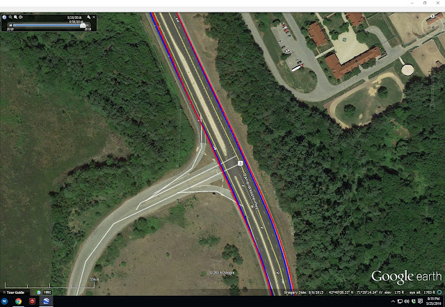
In the woods is where things got interesting. This first is a trail called Pipeline, which is mostly canopied in hardwoods. The leaves were just starting to bud out. Note there are many discrepancy areas. I've ridden this trail many, many times and can attest to the accuracy of the blue Garmin track, especially in upper left area of image. The trail comes out along a fence line. The red Suunto track comes up way short. Many other wiggles in the blue that are real, mysteriously get straight-lined out in the red Suunto. Why?
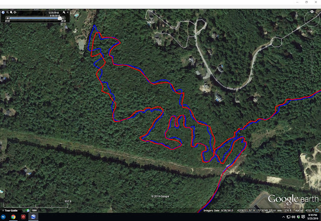
Here's another woods comparison. This is the Loop Trail in Horse Hill Preserve. Again, error on order of 100ft and smoothed out ripples.
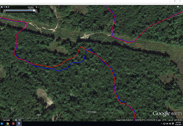
And a final woods difference. Notice the S-curve near the tip of the lake on Duster Trail. It is accurately recorded by the blue Garmin track but missed completely by the red Suunto trace. The discrepancy grows very large later in the track as I traveled toward the upper right of the image. I had recording interval set to 1sec on the Suunto, the max rate. This is not at all what I expect from an expensive, latest generation GPS technology device.

As a radio-frequency engineer, I understand trees can attenuate GPS signals. I've always been selective on buying GPS units with high sensitivity, units with a lot of performance margin so they work well in less than ideal conditions. Antennas are an extremely important part of a GPS receiver. When you have a unit the size of the Garmin 510, or especially the 705 I used to have, you have some area to work in to make a decent antenna. These plots suggest the Suunto Traverse has marginal sensitivity. Get under trees where the signal becomes weaker, performance goes to crap. It was perfect on the road.
After poking around on Suunto sensitivity, I made some discoveries. The predecessor to the Traverse, the Suunto Ambit3, used an external nub to house the antenna. It protruded into the wrist band area. Apparently consumers thought this looked stupid. So Suunto moved the antenna into the bezel of the unit and TRASHED the receiver sensitivity. I'm an engineer. I want performance, not something that looks pretty and doesn't fucking work! I guess you could say consumers did it to themselves on this one. If you research this, you will find that Garmin wrist-watch products suffer similar poor performance.
This shouldn't be difficult to get right. If Garmin products weren't so buggy, I'd be happy continuing to wear the bulky 510 on my wrist. It offers so many benefits over a watch-sized unit anyway, like useful screen size for navigation. I could move away from wrist unit altogether. This would likely get me the sensitivity I desire for accurate tracks. There'd be more product lines to chose from, maybe some less buggy. But where do you put it, say when you are running? XC skiing? The wrist is really convenient. The Traverse is going back. I may exchange it for a Suunto Ambit3. Track files for this unit look pretty clean, and the Ambit doesn't even use the Russian GLONASS constellation. Much longer battery life too. Maybe there is no such thing as a perfect GPS unit out there. Or maybe I'm just too picky...
I used a Garmin Edge 705 GPS unit for many years. I loved that unit. It produced impeccably accurate tracks in even adverse conditions. Well sealed, the unit was not. After one too many deluges in Colorado, the 705 gave up the ghost.
I transitioned to a Garmin 510, which added Russian GLONASS reception to the US-based GPS constellation. I was pleased with the 510's track accuracy too, perhaps comparable to the 705. Under tree cover or heavy overcast, the 510 consistently produced smooth, tight tracks exactly where I went.
Garmin does have a reputation, though, and not all good. They are notorious for releasing buggy products to the market. Basically, they make consumers like me their beta test group even though we did not agree to provide this service. Software updates often come fast and furious for newly released Garmin products.
Some bugs (or maybe Garmin thinks they're features?) never seem to get fixed. I have a major peeve with my 510. It does everything I want it to for cycling, the activity the unit was designed for. But I also use the 510 for running, hiking and Nordic skiing. During hiking, I've notice very large variation in my recorded distances, even for same hikes. One time I'll log 9mi, another time 11mi for exactly the same route. What gives?
I learned to turn off auto-pause when hiking. Sometimes you go so slow in technical sections that the unit will pause and stop logging data. However, upon probing into suspect track files, I noticed something peculiar. The 510 appears to stop distance tagging when speed drops below a certain value, say 2mph, but it continues logging lat/lon coordinates, barometric altimeter and time stamps. Only distance tag stays stuck. It appears turning off auto-pause only partially turns it off. The result is the distance tally displayed ends up way short for most hikes. Further, when posting to websites like Strava, Strava blindly follows the distance tagging and reports incorrect distance - most of the time. I've had a few instances where GPS distance was so short that Strava recognized a discrepancy, threw out the distance tagging, and recalculated actual distance from lat/lon coordinates.
So then I got smart and found a way to strip distance tags from my 510 hiking track files before posting to Strava, forcing Strava to compute distance from raw data. But this also stripped barometric altimeter data, which is far more accurate when hiking rugged terrain than what can be calculated from a digital elevation map that uses 30 meter or 100 meter grid. This situation sucked! I could either get accurate climbing or accurate distance, but never both!
Faced with this frustration, I decided to buy a running/hiking specific GPS. I picked up the recently introduced Suunto Traverse. It comes with barometric altimeter and tracks both GPS and GLONASS satellites. This sounded really good, although reviews were pretty negative on battery life. Suunto has a much better reputation for releasing new products with few bugs, unlike Garmin.

Suunto Traverse vs Garmin 510 on the wrist
My first test of the Suunto Traverse was on Mt Pack Monadnock, running repeats on the autoroad to the summit. I liked the less bulk on my wrist. The user interface is vastly different from Garmin and requires a learning curve. I couldn't wait to get home to see the results, of both GPS performance and my performance. I expected to have run a PR lap, and Strava was going to tell me this after uploading to their site.

First Suunto Traverse track. Only lap missed summit by hundreds of feet.
When I first saw the track, I thought this can't be right. It is so awful there must have been an error uploading. But no. I looked at it multiple ways. Track accuracy sucked donkey balls! Because of such poor positional accuracy, the climbing segment I was tracking my performance on was either missed completely or didn't start/stop in the right places. None of the three repeats I did had useful data. And I buried myself on the second one to see where my fitness was at! The Suunto didn't nuisance auto-pause on me though. Fix one problem, end up with an even bigger one.
So what should this track look like? Image below is from my Garmin 510 on the same course. It is almost perfect. Segments started and stopped where they were supposed to.

So maybe this was an anomaly. If a GPS gets a bad initial fix, it's accuracy can be FUBAR for the entire use cycle. So I gave it another chance on a lunch ride, off-road in the woods. This time I ran both my 510 and the Traverse. The results were revealing. This first image shows start and finish of my ride at the office. Blue is the Garmin 510, red the Suunto Traverse. I started both units at my car, and the fixes are within 5ft of each other. I was rolling when I stopped the two units coming back, so the 6 car spots difference is real.

This next photo shows open road tracking heading out and returning from my woods ride. Tracks are literally on top of each other and on the shoulder of the road exactly as I rode. So far, so good.

In the woods is where things got interesting. This first is a trail called Pipeline, which is mostly canopied in hardwoods. The leaves were just starting to bud out. Note there are many discrepancy areas. I've ridden this trail many, many times and can attest to the accuracy of the blue Garmin track, especially in upper left area of image. The trail comes out along a fence line. The red Suunto track comes up way short. Many other wiggles in the blue that are real, mysteriously get straight-lined out in the red Suunto. Why?

Here's another woods comparison. This is the Loop Trail in Horse Hill Preserve. Again, error on order of 100ft and smoothed out ripples.
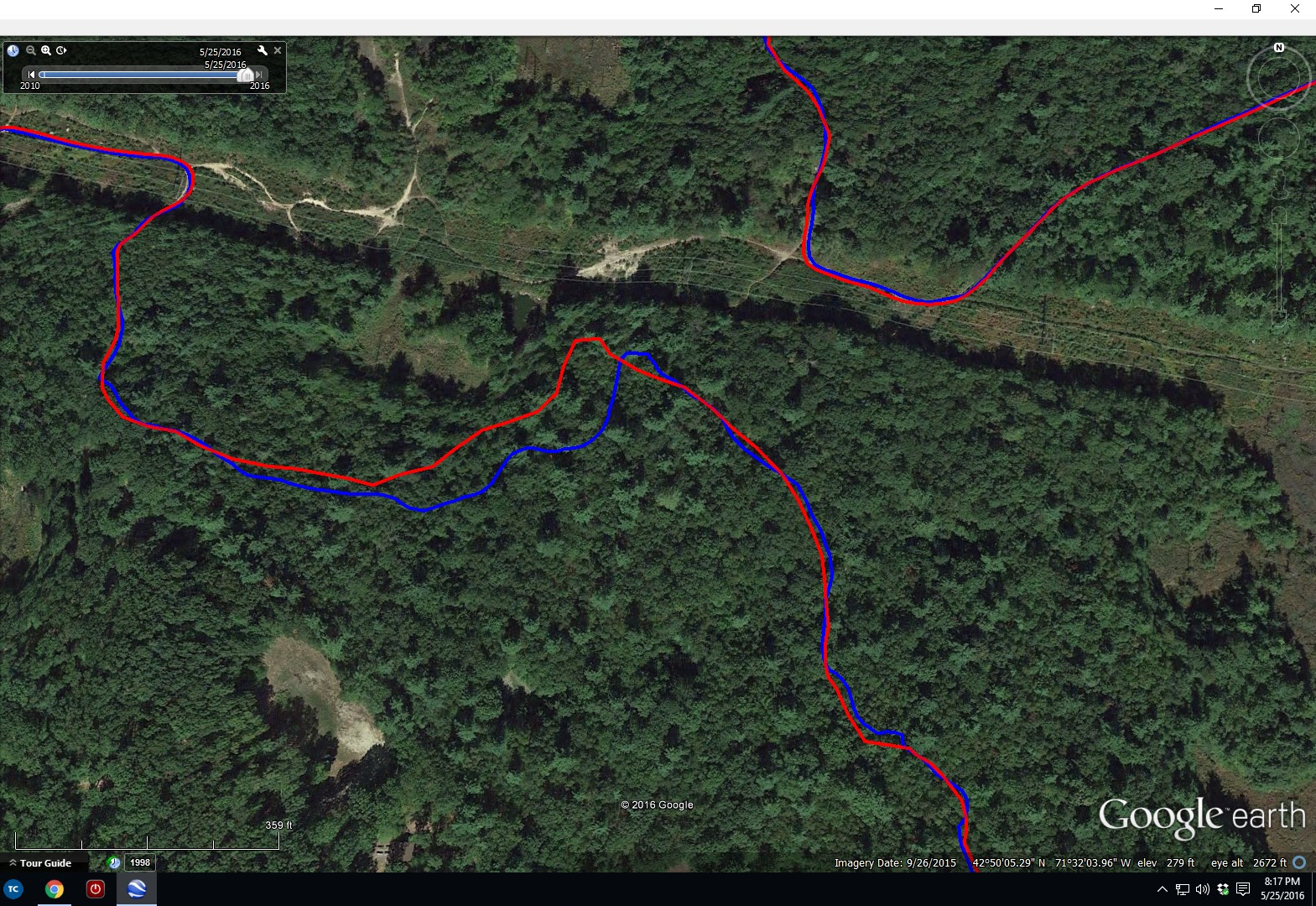
And a final woods difference. Notice the S-curve near the tip of the lake on Duster Trail. It is accurately recorded by the blue Garmin track but missed completely by the red Suunto trace. The discrepancy grows very large later in the track as I traveled toward the upper right of the image. I had recording interval set to 1sec on the Suunto, the max rate. This is not at all what I expect from an expensive, latest generation GPS technology device.

As a radio-frequency engineer, I understand trees can attenuate GPS signals. I've always been selective on buying GPS units with high sensitivity, units with a lot of performance margin so they work well in less than ideal conditions. Antennas are an extremely important part of a GPS receiver. When you have a unit the size of the Garmin 510, or especially the 705 I used to have, you have some area to work in to make a decent antenna. These plots suggest the Suunto Traverse has marginal sensitivity. Get under trees where the signal becomes weaker, performance goes to crap. It was perfect on the road.
After poking around on Suunto sensitivity, I made some discoveries. The predecessor to the Traverse, the Suunto Ambit3, used an external nub to house the antenna. It protruded into the wrist band area. Apparently consumers thought this looked stupid. So Suunto moved the antenna into the bezel of the unit and TRASHED the receiver sensitivity. I'm an engineer. I want performance, not something that looks pretty and doesn't fucking work! I guess you could say consumers did it to themselves on this one. If you research this, you will find that Garmin wrist-watch products suffer similar poor performance.
This shouldn't be difficult to get right. If Garmin products weren't so buggy, I'd be happy continuing to wear the bulky 510 on my wrist. It offers so many benefits over a watch-sized unit anyway, like useful screen size for navigation. I could move away from wrist unit altogether. This would likely get me the sensitivity I desire for accurate tracks. There'd be more product lines to chose from, maybe some less buggy. But where do you put it, say when you are running? XC skiing? The wrist is really convenient. The Traverse is going back. I may exchange it for a Suunto Ambit3. Track files for this unit look pretty clean, and the Ambit doesn't even use the Russian GLONASS constellation. Much longer battery life too. Maybe there is no such thing as a perfect GPS unit out there. Or maybe I'm just too picky...
Wednesday, May 25, 2016
Bear Standoff in the NEK
I made the first pilgrimage of 2016 up to the Northeast Kingdom of Vermont on my off-Friday with Connecticut riding buddies Alex and Jason. Like the mountains I've been hiking in, not all of the Kingdom Trails have dried out yet. Some of my favorite trails on Burke Mountain are still closed. All of the Darling Hill trails were open though, and there are many miles of great riding outside of the NEK trails network.
One feature I've hit many times is East Mountain, aka "Radar Mtn." East Mountain is the site of an abandoned cold war era military radar installation. It is in a remote area, not easily seen from most valleys where people live. A timber company now owns most of the woodland around the installation, with a private owner owning the buildings.
With Burke Mountain singletrack being closed, the three of us thought a big loop out to Radar Mtn would help fill out a big ride in the Kingdom. We'd roughly follow the Rasputitsa course in reverse out to Radar Mtn in East Haven. For about 10 years, I've wanted to ride through Victory Basin on the back side of Burke Mtn. It's all dirt roads, some narrow seasonal roads. None of us have any aversions to riding mountain bikes on roads. They work just fine, unlike road bikes on a trail.
A sporty pace quickly developed on the first climb up Kirby Mountain Rd. I didn't exactly taper for a race for this ride but started wondering if I should have. The descent to River Rd was sweet. The open views in the basin were gorgeous. We might have seen one or two cars looping around Burke Mtn on this Friday morning.


We reach Gallup Mills and the entrance to Radar Rd in no time. The lower gate was open. I was surprised to find the road vastly improved. It had been a few years since the last time I rode up Radar Mtn. Then it was a doubletrack. Now it was a full width improved gravel road. The climbing along the brook was very gradual.
Less than a mile in, we spooked a black bear in the road. Looked like a young one, probably two years old. He bolted into the woods quickly. I was just thinking earlier that I hadn't seen a bear in quite a while, especially with all of the hiking I've done since last summer. True, bears hibernate, but they've been active for a while now this spring.
At the T-junction in Radar Rd, we found the next gate heading up to also be open. I hadn't seen that before. The road here too was improved to the point where ordinary cars could go up. Why all this improvement? This section used to be eroded, rutted out jeep track. I knew one thing for sure, the descent was going to be so much nicer.
Upon reaching the barracks area, one car was parked. Spooky there, many old buildings that haven't been used in over half a century. We then encountered the new barrier I read about. A massive tank bolstered by huge rocks was placed across the road where it is swamp on either side. Yeah, that will quite effectively prevent car loads of partiers from going the last two miles up the mountain. Vandalism and destruction of property has been a problem, and the private owner had enough of it. Passive recreational use is still permitted. I hope we don't lose it.

It was a bit of a hassle to carry bikes around the barrier, but we were into the final 20 minute push to the summit. The grade hovers in the 12-20% range the whole way. A real spanker of a climb. Spooky up top too, with the abandoned big structures that supported the radars to detect Russian bombers coming over the north pole. I've never dared climb any of these to take in the panoramic view that is available. On the ground, trees have grown in to block the view from the summit.


Bombing down, we crossed paths with a couple hiking up with their dog. The light tree debris on the upper paved switchbacks sketched me out a bit. Jason ripped those turns, commenting later his bike got a little loose on him. Yeah, I wasn't ready to become one with the forest just yet.
Passing the T-junction we earlier turned right at, we continued straight to take a different way back down, the way I always come off this mountain. We quickly came to a massive mountain of crushed granite, resembling something you'd find on a summit cone of a 5000 footer in the White Mountains. It was hike-a-bike talus field. WTF! It was where the road used to go. Did the road resume on the other side? Only one way to find out. I hiked and stumbled my way up to see the road did resume its old, non-improved state on the other side of the talus field. Only problem was the talus grade was so steep we had to hunt for a different way down.


Once back on rideable terrain, we continued up the climb to crest a ridge we had to get over before bombing the rest of the way down to Rt 114. Bear! Wait, no, mama bear with two cubs! My first reaction was cool, two bear sightings in one ride. But this quickly turned to dismay. The cubs immediately bolted up the nearest big tree on right side of road. In seconds, they were 50ft off the ground. Mama stayed right there near the tree for a moment.
Then mama stormed into the road and stared us down. Alex was on the verge of soiling his chamois with his bike pointed downhill and ready to bolt. You know that saying, where you only have to be faster than the slowest guy when a bear chases? Well, Alex was not going to be that guy.
Just then, mama bear bolts off into the woods on the left side of the road. Great. Now what? Cubs on right, mama bear lying in wait on left. We couldn't see mama, but assumed she was right there in the dense forest watching us. That kind of eliminated bush-whacking far to the left to go around cubs and mama bear. It was rough terrain and sight distance limited. Alex suggested we just go all the way back out the way we came and take Victory Rd to Rt 114. That would be like 15+ miles! We'd never get to the NEK singletrack, for which we bought trail passes.
Of course, my nature is to find a "quicker" way. We had no map of the area, no knowledge of what went where. We only knew there was a fork a little further back that kind of angled off in the right direction.

Just then, mama bear re-appears in the road, staring us down again, clearly agitated. She was giving us the look, "like why are you still here, don't you know I can f you up?" Of course, mam bear bolts back into the woods on the left side of the road, opposite the cubs. Clearly, we were not going out that way. I convince Alex and Jason to give the other fork a try.
Starting out, it seemed nice, improved gravel surface and all. But then it starts veering east, and we needed to go west. Was not looking good. These roads are all winter snowmobile routes. We spotted a sign with map. It was very hard to decipher, as where we needed to go was off the map. In fact, we were barely on the edge of the map. Then Jason spotted sharpie markings on an orange arrow sign that said "Burke." Well, that's the way we're going, so it can't be wrong, can it? See where this is going?
That "trail" was far from improved. In fact, it is a winter only trail and does not get summer travel. it was weedy, wet and mud to rotors at times. We spent almost as much time off the bike filling our shoes with stinky quagmire as we did riding our bikes. Rolling resistance was so high that even going down 20% grades required work. Not being on the map we saw, there was no telling how many miles of this we would have to suffer through.


We suffered through a good amount before the grassy surface "improved" a little. But it went straight up an almost impossibly steep fall-line grade. You could see a mile up the trail. It was so disheartening it was laughable. I think after a while my pedaling degenerated to linked track stands. Eventually, all good boondoggles come to an end. We regained the road just over the ridge from where we encountered the three bears. It took 1.2hrs to span 0.5mi on planned route. Burned a huge number of kilojoules in those 1.2hrs going 3mph too.
We had planned to ride a full 100km without stopping for water in town, but now that was out of the question. After hitting the NEK Whiteschool trails, we popped into town for a quick water fill. Alex was content with the 50+ miles we already rode and didn't want to risk injury. Jason and continued on to Darling Hill with some reservations.
What occurred over next 15 miles can be best described as death march punctuated with bouts of adrenaline rush. We hit many of the classic berm-fest trails, down Troll Stroll, up Tap & Die, down Tody's, up Hogback, down Sidewinder, the new Bear Back flow trail, then over to the east side of Darling Hill. Jason nor I were feeling that chipper any more. We had just ridden over 30 minutes on the most popular trails at NEK and hadn't seen a person. That never happened before. As nice as the riding conditions were, thoughts transitioned to how we get back with the least amount of climbing.
When on east side of Darling Hill, you can't skip the Ridge/Rim descent. Of course, to do the descent meant you had to haul your ass up top first. Pretty much all trails on Darling Hill worth riding require a 200-300ft climb to beginning the fun. Ridge was pretty much the last nail for both of us. We got back to town with 65+ miles and 7600ft of climbing, possibly my biggest MTB ride in the New England to date. We discovered where all the riders were: at the Tiki Bar. So many people and not a whole lot of English being spoken.
I always get a country turkey sandwich at the cafe after riding NEK. It is a whole Thanksgiving Day meal on a sub roll - turkey, stuffing, cranberry sauce and more. Must have weighed a kilo. It was gone in 10 minutes. Always a great way to cap off an excellent adventure in the kingdom.
One feature I've hit many times is East Mountain, aka "Radar Mtn." East Mountain is the site of an abandoned cold war era military radar installation. It is in a remote area, not easily seen from most valleys where people live. A timber company now owns most of the woodland around the installation, with a private owner owning the buildings.
With Burke Mountain singletrack being closed, the three of us thought a big loop out to Radar Mtn would help fill out a big ride in the Kingdom. We'd roughly follow the Rasputitsa course in reverse out to Radar Mtn in East Haven. For about 10 years, I've wanted to ride through Victory Basin on the back side of Burke Mtn. It's all dirt roads, some narrow seasonal roads. None of us have any aversions to riding mountain bikes on roads. They work just fine, unlike road bikes on a trail.
A sporty pace quickly developed on the first climb up Kirby Mountain Rd. I didn't exactly taper for a race for this ride but started wondering if I should have. The descent to River Rd was sweet. The open views in the basin were gorgeous. We might have seen one or two cars looping around Burke Mtn on this Friday morning.

Kirby Mtn Rd

Descent to River Rd

Alex and Jason in the Victory Basin

River Rd
We reach Gallup Mills and the entrance to Radar Rd in no time. The lower gate was open. I was surprised to find the road vastly improved. It had been a few years since the last time I rode up Radar Mtn. Then it was a doubletrack. Now it was a full width improved gravel road. The climbing along the brook was very gradual.
Less than a mile in, we spooked a black bear in the road. Looked like a young one, probably two years old. He bolted into the woods quickly. I was just thinking earlier that I hadn't seen a bear in quite a while, especially with all of the hiking I've done since last summer. True, bears hibernate, but they've been active for a while now this spring.
At the T-junction in Radar Rd, we found the next gate heading up to also be open. I hadn't seen that before. The road here too was improved to the point where ordinary cars could go up. Why all this improvement? This section used to be eroded, rutted out jeep track. I knew one thing for sure, the descent was going to be so much nicer.
Upon reaching the barracks area, one car was parked. Spooky there, many old buildings that haven't been used in over half a century. We then encountered the new barrier I read about. A massive tank bolstered by huge rocks was placed across the road where it is swamp on either side. Yeah, that will quite effectively prevent car loads of partiers from going the last two miles up the mountain. Vandalism and destruction of property has been a problem, and the private owner had enough of it. Passive recreational use is still permitted. I hope we don't lose it.

The new barrier to keep hooligans out. Not that we're saints...
It was a bit of a hassle to carry bikes around the barrier, but we were into the final 20 minute push to the summit. The grade hovers in the 12-20% range the whole way. A real spanker of a climb. Spooky up top too, with the abandoned big structures that supported the radars to detect Russian bombers coming over the north pole. I've never dared climb any of these to take in the panoramic view that is available. On the ground, trees have grown in to block the view from the summit.

Sustained double-digit grades on final push to summit

The tallest structure. May be possible to go to top, but I was too scared:(

A couple other radar platforms in this photo

Part way up the tall structure, there is opening to snap this view to the east
Bombing down, we crossed paths with a couple hiking up with their dog. The light tree debris on the upper paved switchbacks sketched me out a bit. Jason ripped those turns, commenting later his bike got a little loose on him. Yeah, I wasn't ready to become one with the forest just yet.
Passing the T-junction we earlier turned right at, we continued straight to take a different way back down, the way I always come off this mountain. We quickly came to a massive mountain of crushed granite, resembling something you'd find on a summit cone of a 5000 footer in the White Mountains. It was hike-a-bike talus field. WTF! It was where the road used to go. Did the road resume on the other side? Only one way to find out. I hiked and stumbled my way up to see the road did resume its old, non-improved state on the other side of the talus field. Only problem was the talus grade was so steep we had to hunt for a different way down.

Looking down the "talus" field

Pain in ass to get over, loose and cycling shoes suck
Once back on rideable terrain, we continued up the climb to crest a ridge we had to get over before bombing the rest of the way down to Rt 114. Bear! Wait, no, mama bear with two cubs! My first reaction was cool, two bear sightings in one ride. But this quickly turned to dismay. The cubs immediately bolted up the nearest big tree on right side of road. In seconds, they were 50ft off the ground. Mama stayed right there near the tree for a moment.
Then mama stormed into the road and stared us down. Alex was on the verge of soiling his chamois with his bike pointed downhill and ready to bolt. You know that saying, where you only have to be faster than the slowest guy when a bear chases? Well, Alex was not going to be that guy.
Of course, my nature is to find a "quicker" way. We had no map of the area, no knowledge of what went where. We only knew there was a fork a little further back that kind of angled off in the right direction.

Well, would you???
Starting out, it seemed nice, improved gravel surface and all. But then it starts veering east, and we needed to go west. Was not looking good. These roads are all winter snowmobile routes. We spotted a sign with map. It was very hard to decipher, as where we needed to go was off the map. In fact, we were barely on the edge of the map. Then Jason spotted sharpie markings on an orange arrow sign that said "Burke." Well, that's the way we're going, so it can't be wrong, can it? See where this is going?
That "trail" was far from improved. In fact, it is a winter only trail and does not get summer travel. it was weedy, wet and mud to rotors at times. We spent almost as much time off the bike filling our shoes with stinky quagmire as we did riding our bikes. Rolling resistance was so high that even going down 20% grades required work. Not being on the map we saw, there was no telling how many miles of this we would have to suffer through.

Let the boondoggle begin!

Doesn't show, but this had to be 20%, very soft, and went forever.
We suffered through a good amount before the grassy surface "improved" a little. But it went straight up an almost impossibly steep fall-line grade. You could see a mile up the trail. It was so disheartening it was laughable. I think after a while my pedaling degenerated to linked track stands. Eventually, all good boondoggles come to an end. We regained the road just over the ridge from where we encountered the three bears. It took 1.2hrs to span 0.5mi on planned route. Burned a huge number of kilojoules in those 1.2hrs going 3mph too.
We had planned to ride a full 100km without stopping for water in town, but now that was out of the question. After hitting the NEK Whiteschool trails, we popped into town for a quick water fill. Alex was content with the 50+ miles we already rode and didn't want to risk injury. Jason and continued on to Darling Hill with some reservations.
What occurred over next 15 miles can be best described as death march punctuated with bouts of adrenaline rush. We hit many of the classic berm-fest trails, down Troll Stroll, up Tap & Die, down Tody's, up Hogback, down Sidewinder, the new Bear Back flow trail, then over to the east side of Darling Hill. Jason nor I were feeling that chipper any more. We had just ridden over 30 minutes on the most popular trails at NEK and hadn't seen a person. That never happened before. As nice as the riding conditions were, thoughts transitioned to how we get back with the least amount of climbing.
When on east side of Darling Hill, you can't skip the Ridge/Rim descent. Of course, to do the descent meant you had to haul your ass up top first. Pretty much all trails on Darling Hill worth riding require a 200-300ft climb to beginning the fun. Ridge was pretty much the last nail for both of us. We got back to town with 65+ miles and 7600ft of climbing, possibly my biggest MTB ride in the New England to date. We discovered where all the riders were: at the Tiki Bar. So many people and not a whole lot of English being spoken.
I always get a country turkey sandwich at the cafe after riding NEK. It is a whole Thanksgiving Day meal on a sub roll - turkey, stuffing, cranberry sauce and more. Must have weighed a kilo. It was gone in 10 minutes. Always a great way to cap off an excellent adventure in the kingdom.
Sunday, April 24, 2016
Unexpected 48
I've identified as a cyclist for two decades now. Back in 1996, a poor health wake-up call prodded me into finding an activity to lose weight and improve fitness. I rode bikes as a kid, no differently than most. It is part of growing up. In my 30's I rediscovered the joy of riding, especially off-road. It quickly became a passion that my life evolved around.
I moved from Michigan to New Hampshire in 1997. The decision to relocate to the northeast was driven in part by the topography. There are real mountains here! Southwest Michigan is pretty flat, and I was excited to explore more challenging terrain on my mountain bike.
As I lost weight and gained fitness, I discovered I didn't suck going up hill. Not only that, I enjoyed suffering on long, steep climbs. I sought out ski area service roads to ride up. There were only so many place you could ride up hill to summits, especially off-road.
I chose my parents wisely. I seem to have a genetic predisposition to turn large volumes of oxygen into power. I got involved with cycling competition and won a lot of races.
I dabbled in hiking over the years. I never solo hiked. It usually was a family or couples thing. There were a couple of non-trivial hikes, like the time I took my wife and mom up Tuckerman Ravine to the summit of Mt Washington. My mom still jokes that I was trying to get my inheritance early. The climb was a bit much for mom, but the descent left me with crippling DOMS for days afterward. Not mom.
Last year a cycling buddy who hiked regularly asked if I was interested in a Presidential Traverse. My first reaction was yeah, right, I wouldn't get half way across without being crippled. Even though I was highly fit as a cyclist, there's something about going downhill that debilitates unconditioned muscles. The motion is called eccentric muscle contraction, and it causes delayed onset muscle soreness (DOMS).
If there was one hike to do before leaving this great state, it would be the Presi traverse. My wife and I may retire before too long, and now was the time to do this nearly 20 mile hike with upwards of 10,000ft of climbing. Early August 2015 was the date. It was less than two months away. Could I build any modicum of hiking specific fitness in time?
It wasn't the 10,000ft of climbing I feared. Cycling ensured I would handle that just fine. But what the bicycle can't give you is the ability to slow yourself down with your legs (not with any of my bikes anyway). So I set out on some training hikes.
I picked the Tripyramids for my first training hike on the first weekend of July. I was familiar with the Waterville Valley area from Nordic skiing. Hike up Livermore Rd, north slide, the peaks, south slide, how hard could that be? It was "only" 10 miles. I hadn't hiked solo before, and I had never hiked a slide before. I quickly learned this is one of the scarier slide trails to scramble up. I was terrified. Not having the right shoes didn't help matters. I finished the loop at a respectable pace. The following days were a nightmare. Each day the DOMS got worse. I think it took a full week before my legs felt normal again. Six hour bike ride in the mountains? Could do it again the next day. A 3-4hr hike? Crippled for days.
I was aware the Tripyramids were 4000-footers. I don't think I was aware of how many 4000 footers there were in NH though. It didn't concern me.
The following four weekends I hiked locally, Mt Monadnock, the Pack Monadnocks and Cardigan in southern NH. The DOMS became progressively less severe with each hike. Would these five hikes be enough to tackle the big one on August 8?
The big day arrived. I didn't sleep well, and it was a very early start to the day, driving up the morning of. Three of us were making the traverse, starting on Valley Way and finishing on Crawford Path. At least we were blessed with near ideal weather conditions.
The hike went well, although my knees and ankles were ready to crap out descending Crawford Path. The sound of motor vehicles on Rt 302 was music to my ears that day. I was moderately crippled for a few days after, but not like after the Tripyramids hike.

I was left pondering deep thoughts after that epic hike. I had hiked every weekend six weeks in a row. It would be kind of a shame to throw what little fitness I had built up away. And besides, I kind of liked it. I got to peaks I can't ride to and saw sights I would not have seen otherwise. I did another local hike the following weekend while contemplating the future.
While still unsure if I wanted to continue hiking, I found myself on the Osceolas the following weekend. I found some more sketchy scrambling there on The Chimney. Of all the times I've skied at Waterville Valley, both alpine and Nordic, I had no idea there were such fantastic views so close by. The people you'd meet on the trail didn't suck either. Maybe there's something to this hiking business.
I headed out west for vacation the first half of September. I actually packed my shoes and hiking poles! What did that mean? I was confused. I go on cycling trips, not hiking trips. To continue the momentum, I solo hiked one of Idaho's nine 12,000 footers. It was a beaut of a day, and that hike put me in a zen state that I thought only long trail rides through remote terrain could do.
After a hiatus for the Vermont 50 mile mountain bike race, I resumed hiking in the Whites. Flume and Liberty looked cool, easily accessible. More sketchy slide scrambling again!

I started noticing physiological changes in my body. I was gaining range of motion in certain movements. My sense of balance seemed to be improving. Most importantly, I was starting to feel agile on my feet. I've always had unstable ankles and suffered a severe double-fracture several years ago. In fact, I always carried lace-up ankle braces with me on hikes for when my ankles started rolling. But the rolling wasn't really happening anymore. I think there were two factors behind it, both which hiking brought about. One was simply strength. Strength in the stabilizing muscles, strength in the connective tissues. The other was a neurological, or motor reflex response thing. I found that when my ankle started to roll, there was quicker response to correct it. These physiological adaptations helped fuel my stoke for hiking.

I still had no goals for hiking. I was just going with the flow. Somewhere around this time I printed out the list of 48 4000 footers. I mainly wanted to see what the biggest peaks were and wanted to hike something new each weekend. Some of the hikes seemed lame, like Owl's Head or Mt Isolation. Why would I want to do those? Big commitment, little reward.
Winter came, or what little there was to this winter. People die hiking in the winter. Heck, people even die in the summer from exposure. I hiked mostly solo. If I was going to continue, I needed to buy more gear. And buy I did. A bigger backpack. Snowshoes. Microspikes. Down jacket, Goretex and more. I generally avoided the most treacherous conditions by hiking more locally when it was tough in the Whites.

The list of 48 started accumulating a lot of check marks. Am I really chasing a list, something I said did not interest me? Maybe I shouldn't have left that list on my desk where I saw it all the time. Before I knew it, I had hiked Owl's Head, Cabot, Isolation and other out of the way peaks. A group hike netted the Carters. The list was becoming tantalizing close to being completed over the winter. I crossed a threshold where I might as well hike all of New Hampshire's 48 highest.

I was down to three remaining peaks, the Bonds. I had hoped for a group traverse, but I have only a few friends into hiking at that level. Then I thought I'll wait until this summer, when talk of Pemi Loops start. I didn't really want to do a 20+ mile hike on snow and ice anyway.
As avid hikers know, this winter was almost a non-season. Rarely were snowshoes needed. When a nice weekend opened up in mid-April, I decided to give the Bonds a go. I hadn't hiked in two weeks and just got back from an 8-day MTB cycling trip. How hard could a 24 mile hike be? My plan was to hike the three Bonds as an out-and-back from Lincoln Woods. That means I hit two of the three peaks twice, for five summits total. There isn't a whole lot of climbing once up on the ridge though.

That hike was a marvelous experience. Short sleeve weather at the summits, barely a breeze and clear skies. The ice was softened up and very manageable with microspikes. The hike went much more quickly than I expected. I left home from southern NH after sunup and got back home before sunset. The views along Bondcliff are dramatic, among the best in the White Mountains. Was a treat to finish the 48 this way.
So now what? I kind of feel lost without some new direction. For some, completing the 48 is a huge goal. It is a very attainable for most people. Around 12,000 people have hiked the 48. I don't need a goal to push myself, I've done that to a fault on the bike for years. I need ideas for new pursuits. There are many other lists out there, There's the winter 48, which I'm probably half way through just chasing the 48. Then there's the grid, doing each of the 48 climbs in each of the months of the year. I just don't see myself as a gridder, or gridiot as some might say. But then again, I didn't see myself hiking 48 peaks in short order either. The New England 67 looks interesting, as it adds the 4000 footers in VT and ME to the list. Lot more driving to reach some of those peaks though, probably requiring overnight stays. Maybe roll-your-own hikes, bushwhacks or slide scrambles to get off the oft traveled path. Nothing wrong with repeating favorite hikes. I hit the same trails over and over again on my bike and do not tire of them.
One thing is certain. Future trips won't solely be cycling. Hikes will be planned into the itinerary. I hope to visit Colorado again this fall. The places I like to ride have many 14ers nearby, the equivalent to New Hampshire's 4kers. Only there is a lot less air to breath two vertical miles higher above sea level! My time is becoming evenly split between on-wheels and on-foot. This makes me wonder, is hiking my primary passion and cycling that other thing I do? Hard to tell where this goes from here.
I moved from Michigan to New Hampshire in 1997. The decision to relocate to the northeast was driven in part by the topography. There are real mountains here! Southwest Michigan is pretty flat, and I was excited to explore more challenging terrain on my mountain bike.
As I lost weight and gained fitness, I discovered I didn't suck going up hill. Not only that, I enjoyed suffering on long, steep climbs. I sought out ski area service roads to ride up. There were only so many place you could ride up hill to summits, especially off-road.
I chose my parents wisely. I seem to have a genetic predisposition to turn large volumes of oxygen into power. I got involved with cycling competition and won a lot of races.
I dabbled in hiking over the years. I never solo hiked. It usually was a family or couples thing. There were a couple of non-trivial hikes, like the time I took my wife and mom up Tuckerman Ravine to the summit of Mt Washington. My mom still jokes that I was trying to get my inheritance early. The climb was a bit much for mom, but the descent left me with crippling DOMS for days afterward. Not mom.
Last year a cycling buddy who hiked regularly asked if I was interested in a Presidential Traverse. My first reaction was yeah, right, I wouldn't get half way across without being crippled. Even though I was highly fit as a cyclist, there's something about going downhill that debilitates unconditioned muscles. The motion is called eccentric muscle contraction, and it causes delayed onset muscle soreness (DOMS).
If there was one hike to do before leaving this great state, it would be the Presi traverse. My wife and I may retire before too long, and now was the time to do this nearly 20 mile hike with upwards of 10,000ft of climbing. Early August 2015 was the date. It was less than two months away. Could I build any modicum of hiking specific fitness in time?
It wasn't the 10,000ft of climbing I feared. Cycling ensured I would handle that just fine. But what the bicycle can't give you is the ability to slow yourself down with your legs (not with any of my bikes anyway). So I set out on some training hikes.
I picked the Tripyramids for my first training hike on the first weekend of July. I was familiar with the Waterville Valley area from Nordic skiing. Hike up Livermore Rd, north slide, the peaks, south slide, how hard could that be? It was "only" 10 miles. I hadn't hiked solo before, and I had never hiked a slide before. I quickly learned this is one of the scarier slide trails to scramble up. I was terrified. Not having the right shoes didn't help matters. I finished the loop at a respectable pace. The following days were a nightmare. Each day the DOMS got worse. I think it took a full week before my legs felt normal again. Six hour bike ride in the mountains? Could do it again the next day. A 3-4hr hike? Crippled for days.
I was aware the Tripyramids were 4000-footers. I don't think I was aware of how many 4000 footers there were in NH though. It didn't concern me.
The following four weekends I hiked locally, Mt Monadnock, the Pack Monadnocks and Cardigan in southern NH. The DOMS became progressively less severe with each hike. Would these five hikes be enough to tackle the big one on August 8?
The big day arrived. I didn't sleep well, and it was a very early start to the day, driving up the morning of. Three of us were making the traverse, starting on Valley Way and finishing on Crawford Path. At least we were blessed with near ideal weather conditions.
The hike went well, although my knees and ankles were ready to crap out descending Crawford Path. The sound of motor vehicles on Rt 302 was music to my ears that day. I was moderately crippled for a few days after, but not like after the Tripyramids hike.

The Presidential Traverse, August 8, 2015
I was left pondering deep thoughts after that epic hike. I had hiked every weekend six weeks in a row. It would be kind of a shame to throw what little fitness I had built up away. And besides, I kind of liked it. I got to peaks I can't ride to and saw sights I would not have seen otherwise. I did another local hike the following weekend while contemplating the future.
While still unsure if I wanted to continue hiking, I found myself on the Osceolas the following weekend. I found some more sketchy scrambling there on The Chimney. Of all the times I've skied at Waterville Valley, both alpine and Nordic, I had no idea there were such fantastic views so close by. The people you'd meet on the trail didn't suck either. Maybe there's something to this hiking business.
I headed out west for vacation the first half of September. I actually packed my shoes and hiking poles! What did that mean? I was confused. I go on cycling trips, not hiking trips. To continue the momentum, I solo hiked one of Idaho's nine 12,000 footers. It was a beaut of a day, and that hike put me in a zen state that I thought only long trail rides through remote terrain could do.
After a hiatus for the Vermont 50 mile mountain bike race, I resumed hiking in the Whites. Flume and Liberty looked cool, easily accessible. More sketchy slide scrambling again!

The Twins, Dec 13, 2015
I started noticing physiological changes in my body. I was gaining range of motion in certain movements. My sense of balance seemed to be improving. Most importantly, I was starting to feel agile on my feet. I've always had unstable ankles and suffered a severe double-fracture several years ago. In fact, I always carried lace-up ankle braces with me on hikes for when my ankles started rolling. But the rolling wasn't really happening anymore. I think there were two factors behind it, both which hiking brought about. One was simply strength. Strength in the stabilizing muscles, strength in the connective tissues. The other was a neurological, or motor reflex response thing. I found that when my ankle started to roll, there was quicker response to correct it. These physiological adaptations helped fuel my stoke for hiking.

The Carters, January 31, 2016
I still had no goals for hiking. I was just going with the flow. Somewhere around this time I printed out the list of 48 4000 footers. I mainly wanted to see what the biggest peaks were and wanted to hike something new each weekend. Some of the hikes seemed lame, like Owl's Head or Mt Isolation. Why would I want to do those? Big commitment, little reward.
Winter came, or what little there was to this winter. People die hiking in the winter. Heck, people even die in the summer from exposure. I hiked mostly solo. If I was going to continue, I needed to buy more gear. And buy I did. A bigger backpack. Snowshoes. Microspikes. Down jacket, Goretex and more. I generally avoided the most treacherous conditions by hiking more locally when it was tough in the Whites.

Mt Moriah hike, March 30, 2016
The list of 48 started accumulating a lot of check marks. Am I really chasing a list, something I said did not interest me? Maybe I shouldn't have left that list on my desk where I saw it all the time. Before I knew it, I had hiked Owl's Head, Cabot, Isolation and other out of the way peaks. A group hike netted the Carters. The list was becoming tantalizing close to being completed over the winter. I crossed a threshold where I might as well hike all of New Hampshire's 48 highest.

Garfield and Galehead, January 9, 2016
I was down to three remaining peaks, the Bonds. I had hoped for a group traverse, but I have only a few friends into hiking at that level. Then I thought I'll wait until this summer, when talk of Pemi Loops start. I didn't really want to do a 20+ mile hike on snow and ice anyway.
As avid hikers know, this winter was almost a non-season. Rarely were snowshoes needed. When a nice weekend opened up in mid-April, I decided to give the Bonds a go. I hadn't hiked in two weeks and just got back from an 8-day MTB cycling trip. How hard could a 24 mile hike be? My plan was to hike the three Bonds as an out-and-back from Lincoln Woods. That means I hit two of the three peaks twice, for five summits total. There isn't a whole lot of climbing once up on the ridge though.

Bondcliff, April 17, 2016
That hike was a marvelous experience. Short sleeve weather at the summits, barely a breeze and clear skies. The ice was softened up and very manageable with microspikes. The hike went much more quickly than I expected. I left home from southern NH after sunup and got back home before sunset. The views along Bondcliff are dramatic, among the best in the White Mountains. Was a treat to finish the 48 this way.
So now what? I kind of feel lost without some new direction. For some, completing the 48 is a huge goal. It is a very attainable for most people. Around 12,000 people have hiked the 48. I don't need a goal to push myself, I've done that to a fault on the bike for years. I need ideas for new pursuits. There are many other lists out there, There's the winter 48, which I'm probably half way through just chasing the 48. Then there's the grid, doing each of the 48 climbs in each of the months of the year. I just don't see myself as a gridder, or gridiot as some might say. But then again, I didn't see myself hiking 48 peaks in short order either. The New England 67 looks interesting, as it adds the 4000 footers in VT and ME to the list. Lot more driving to reach some of those peaks though, probably requiring overnight stays. Maybe roll-your-own hikes, bushwhacks or slide scrambles to get off the oft traveled path. Nothing wrong with repeating favorite hikes. I hit the same trails over and over again on my bike and do not tire of them.
One thing is certain. Future trips won't solely be cycling. Hikes will be planned into the itinerary. I hope to visit Colorado again this fall. The places I like to ride have many 14ers nearby, the equivalent to New Hampshire's 4kers. Only there is a lot less air to breath two vertical miles higher above sea level! My time is becoming evenly split between on-wheels and on-foot. This makes me wonder, is hiking my primary passion and cycling that other thing I do? Hard to tell where this goes from here.
Saturday, April 16, 2016
Tucson Trip in Photo per Day
Another annual pilgrimage to the desert southwest was completed relatively unscathed. I went a bit later this year so I could join Alex and Jason from Connecticut. Rented a house this time, a much better way to go. We arrived in Tucson on schedule, built bikes with no problems and had two hours of daylight left. Time to ride!
 Unstable weather moved into the southwest as we arrived. Of course! Hill Junkie always brings crappy nor'east weather with him on trips. But it was actually a blessing in disguise. The temps had been pushing into the mid-90's. All-day sufferfests don't end well in that kind of heat. At least not for me. The Sweetwater trails were just 4mi from the house by road. We pedaled over and got in a quick 12 miles of singletrack before it got dark. Jason and Alex set a pretty sporty pace for eight days of riding, which gave me great consternation.
 Day two led us to the nearby Tortolitas, one of my favorite places to ride in the Tucson area. The trail system here is relatively new and developed with riding in mind. It rained mightily in parts of the city this day, but only spit on our ride a few times. Here Alex rounds one of many benchcut turns at the height of land on the Ridgeline Trail.
 A planned capstone ride of the trip was hitting the Arizona Trail (AZT) from Picketpost to Kelvin. I hit this a few years ago with Dave and was blown away by the rugged beauty, remoteness and difficulty of this ride. There is nearly 40 miles of continuous singletrack which entails considerable climbing with no bailouts. We self-shuttled the loop by first climbing 2000ft over the Rt 177 pass into Superior. Topped water off there, then we had to be self-sufficient for the next 6+ hours moving time. A clear day, it was quite a bit warmer than the first two, but still not hot. Low humidity can deceive you into thinking you're staying hydrated. I fared poorly on this loop a few years ago, running out of water with about 2hrs of hard riding to go. Here, Alex is riding a fine example of benchcut you find on this segment. Later he reached a scary level of dehydration. It didn't help there was 2000ft of punchy climbs in the last 15mi in full sun with no water. Like dumbasses, we didn't leave water in the car either, and there are no business close to where our car was waiting. Fortunately, I spotted an older couple in their yard with a garden hose hooked up just as we were finishing. Sweet, We wouldn't need to wait another 40 minutes until we got to a store.


After a big day on the AZT, the plan for Day 4 was to back things down a notch, head out for a short "recovery ride." Uh-huh. At least the ride was short, around 1.7hrs. Had to be, due to threat of rain again. But it was anything but easy. As one of our friends commented, "you can only go fast at Fantasy Island!" There seems to be exponential return on fun-factor with speed. The place was designed for speed. Here Alex and Jason are carving around a giant ever-present cholla cactus. It would ruin your trip to crash into one. Heck, it would ruin a lot more than your trip. A sporty pace was maintained about three-quarters through, then Jason ramped it up to 10. Only 15hrs of riding were planned over the next three days, so why not?

Another one of my favorite rides near Tucson is the AZT south of town, roughly from Sonoita back to I-10. This was another self-shuttle with paved road and about 2000ft of climbing before picking up dirt. The 51 mile loop crests at nearly 6000ft before undulating back down to 3000+ft. The flora up high looks nothing like the flora around Tucson. It looks more like prairie grasslands. It was even a tad chilly here, where Jason is cruising on a buff section. It is not all buff. There are numerous steep punches on the way back, many of them loose and chundery. That "recovery" pace the day before, yeah, that was felt during this ride. There were some F-bombs on botched obstacles. The trail condition was mint though, the best ever for me, due to recent rains. I thoroughly enjoyed this one.

On Day 6, we backed it down a notch again, hitting a section of the AZT near Pistol Hill, east of town. I hadn't ridden a portion of this yet. It looked nice in Strava Route Builder with a seven mile near monotonic descent towards the end. Like many of the other rides on this trip, we self-shuttled on paved roads to quickly bridge the two ends of the AZT we planned to ride. This segment turned out to be spectacular and enjoyed by all. There were tricky ledge sections in the middle, and the buff parts were fast, flowy and long. At 3hrs duration, it was hardly a recovery ride, but it was not a hard ride. This segment will definitely see inclusion in future trips.

We got high on Day 7. No, not that kind of high, the Hill Junkie kind of high! We climbed more than 6000ft above Tucson to the summit of Mt Lemmon. This turned out to be another capstone ride, if a single trip is allowed to have two capstone rides. The prize for reaching the top? A cookie bigger than your head at the Cookie Cabin! I ate a whole cookie for the first time, and a slab of pizza too. The sustained effort up this beast on my 28 pound bike had me on the verge of cramping - 3.4hrs of nearly continuous climbing. Another prize for climbing this beast is some tasty singletrack on the way down, namely Bug Springs and Molino Basin trails. Bugs involves some hike-a-bike to get to the good stuff. There was some grumbling in the ranks, especially when the "good stuff" is pretty gnarly and you're tired with 8000ft of climbing in your legs. Here Jason and Alex are pulling away from me through hoodoos on the climb, as I made a conscious decision to back off in hopes of avoiding total implosion before the summit.

Our final, 8th Day saw temperatures approaching 90F. Glad the big ride days were behind us. I was wicked trashed from Lemmon the day before. We kept it local, riding from the house like the first day, hitting Tucson Mountain Park (TMP). TMP has a lot of diversity, leaning more towards the gnarly end of the spectrum. Many opportunities to hurt bike and body. Our 30 mile loop swung south into the newer Robles trails before swinging back north on the uber difficult Cat Mountain trail. Alex and Jason wanted only enough hours to bring the trip total to 30 hours. We got that and then some. Oops. So hard to estimate average moving speed in terrain like this, especially when you are tired and it is hot out. Here Alex is working his way up Cat Mountain. I had many dismounts on this trail.
After our TMP ride, we had all afternoon to pack up bikes, drop them off at FedEx and head to Phoenix for out last night to catch a very early morning flight. I often wonder how long I'll be able to keep going on trips like these. At 53, the body doesn't recover like it did at 35. I reached a level of fatigue at the end of this trip not experienced before. Young whipper-snappers! I was impressed with Alex and Jason though. They had a fraction of the training volume for the year than what I had. Plus they had done no endurance riding, all short intensity work. It worked for them! Quality, not quantity. Most of my riding these days is junk training value, but it is fun.
Someone asked if I had a record number of Strava PR's on this trip. I really don't pay much attention to Strava BS anymore, but the question piqued my curiosity. I tallied them up, and yes, I rode 131 segments my fastest ever. I should have been fatigued at the end of this trip! The last thing I want to do on a trip is strive for PRs or KOMs. Every day at the office requires a PR effort from me. Why would I want to stay in that mode in the wild when I'm trying to flee from it at the office? Riding with others that share much enthusiasm for riding will net you a lot of PRs without even trying. Anyway, I logged 333 miles with about 31,000ft of climbing in 30.7hrs moving time on this trip. A great trip, no crashes, mechanicals of flats were had by any of us. Now I'm already thinking about a fall trip to Colorado...
Tuesday, March 15, 2016
BUMPS No More
Several hillclimb enthusiasts have asked me recently "what's up with BUMPS?" The website at hillclimbseries.com was down. I had hoped it was just a case that somebody forgot to renew the domain name registration. So I pinged a couple BUMPS hillclimb race directors to see what was going on.
I was disappointed to learn BUMPS has disbanded. To be sure, the individual races will still go on, but no longer as part of an organized championship series. It was a good run for seven years. Many KOMs and QOMs were crowned.
Registration numbers have dropped off a bit at some of the hillclimb events. I believe there are many factors behind this.
Interest in road cycling peaked a decade ago. We know today that doping fueled much of the excitement and perceived growth in the sport. The house of cards came crashing down, leaving disillusioned cycling fans in the ruins. Even the USA Pro Challenge in Colorado is going on a hiatus this year.
Has interest shifted in another direction? Absolutely! Cycling in the US is alive and well. Recreational and competitive cyclists alike now sell out events where fun is emphasized over competition.
On the road, gran fondos have become more popular than traditional road races. These events may be timed or have timed segments along the course, like a few prominent climbs for example. Thus it quenches the thirst for competition, but most of the event can be completed at a more recreational pace.
Similarly on the MTB scene. Many racers have switched over to the enduro format of racing, where there are timed segments along a course or different timed stages over a period of a few days. The timed segments are usually point to point and downhill, but not always. There is more emphasis on skill and less on racing head to head with your peers around laps of a circuit.
Then there's the 'tweener category of gravel grinders. These events sell out quickly with many hundreds of participants. They are billed as a fun ride, but those at the front are no doubt racing to cross the finish first for bragging rights. Grinders are mixed surface, everything from paved roads to rough singletrack, and usually ridden on a 'cross bike. Check out the VT Epic weekend. A new 70 mile VTMonster course has been added with 9000ft of climbing!
This is the new face of cycling. The traditional camps of road racing and MTB racing have been blurred by these new formats. It is evolution of sport. Change is inevitable, healthy and expected.
Hillclimb racing has always been a bit of a fringe, esoteric camp of the cycling tribe. I still have a great fondness for climbing and will still compete in local hillclimb events. Just as interests in the cycling community have evolved, so too have my personal interests. I've developed an unexpected passion for climbing on foot. I've hiked most of New Hampshire's 4000ft peeks in the last nine months. The pace and rhythm of hiking is very different from riding or skiing, but equally effective for putting one in a flow state.
I'll put a note up on northeastcycling.com when I get a chance. Most of the local hillclimb races will go on as usual. Equinox is back this year! Washington is nearly sold out. Then there is Whiteface, Okemo, Greylock, Kearsarge and Wachusett. The July Newton's Revenge race on Mt Washington is taking a year off. Hard to say if Ascutney will come back this year. That still leaves seven northeast events to test yourself in.
One other event I'd like to mention is the inaugural national hillclimb championships on Pikes Peak in August. A couple of people have ask me if I was interested. I plan to visit Colorado a few weeks later, so I can't make it. I've raced Pikes Peak twice when it started down in Manitou Springs. The scenery is spectacular, the climb brutal. The race now starts just above 9000ft, but it is comparable to a Mt Washington in vertical, almost as steep, with rarefied air! Think you've got the goods? Head to Colorado in August for your chance to zip on a stars and stripes.
I was disappointed to learn BUMPS has disbanded. To be sure, the individual races will still go on, but no longer as part of an organized championship series. It was a good run for seven years. Many KOMs and QOMs were crowned.
Registration numbers have dropped off a bit at some of the hillclimb events. I believe there are many factors behind this.
Interest in road cycling peaked a decade ago. We know today that doping fueled much of the excitement and perceived growth in the sport. The house of cards came crashing down, leaving disillusioned cycling fans in the ruins. Even the USA Pro Challenge in Colorado is going on a hiatus this year.
Has interest shifted in another direction? Absolutely! Cycling in the US is alive and well. Recreational and competitive cyclists alike now sell out events where fun is emphasized over competition.
On the road, gran fondos have become more popular than traditional road races. These events may be timed or have timed segments along the course, like a few prominent climbs for example. Thus it quenches the thirst for competition, but most of the event can be completed at a more recreational pace.
Similarly on the MTB scene. Many racers have switched over to the enduro format of racing, where there are timed segments along a course or different timed stages over a period of a few days. The timed segments are usually point to point and downhill, but not always. There is more emphasis on skill and less on racing head to head with your peers around laps of a circuit.
Then there's the 'tweener category of gravel grinders. These events sell out quickly with many hundreds of participants. They are billed as a fun ride, but those at the front are no doubt racing to cross the finish first for bragging rights. Grinders are mixed surface, everything from paved roads to rough singletrack, and usually ridden on a 'cross bike. Check out the VT Epic weekend. A new 70 mile VTMonster course has been added with 9000ft of climbing!
This is the new face of cycling. The traditional camps of road racing and MTB racing have been blurred by these new formats. It is evolution of sport. Change is inevitable, healthy and expected.
Hillclimb racing has always been a bit of a fringe, esoteric camp of the cycling tribe. I still have a great fondness for climbing and will still compete in local hillclimb events. Just as interests in the cycling community have evolved, so too have my personal interests. I've developed an unexpected passion for climbing on foot. I've hiked most of New Hampshire's 4000ft peeks in the last nine months. The pace and rhythm of hiking is very different from riding or skiing, but equally effective for putting one in a flow state.
I'll put a note up on northeastcycling.com when I get a chance. Most of the local hillclimb races will go on as usual. Equinox is back this year! Washington is nearly sold out. Then there is Whiteface, Okemo, Greylock, Kearsarge and Wachusett. The July Newton's Revenge race on Mt Washington is taking a year off. Hard to say if Ascutney will come back this year. That still leaves seven northeast events to test yourself in.
One other event I'd like to mention is the inaugural national hillclimb championships on Pikes Peak in August. A couple of people have ask me if I was interested. I plan to visit Colorado a few weeks later, so I can't make it. I've raced Pikes Peak twice when it started down in Manitou Springs. The scenery is spectacular, the climb brutal. The race now starts just above 9000ft, but it is comparable to a Mt Washington in vertical, almost as steep, with rarefied air! Think you've got the goods? Head to Colorado in August for your chance to zip on a stars and stripes.
Subscribe to:
Posts (Atom)