Saturday, October 25, 2014

Rapha Course - where blue meets brown

After this week's deluge, I didn't think local trail conditions would be to my liking. And after a confrontation with a motorist during Friday's lunch spin, local roads didn't seem very attractive either. I had yet to ride my Trek Cronus since I put wide 38mm tubeless tires on it over a month ago. Some quiet Vermont gravels roads seemed attractive.

I stitched together a new variant of the first half of the Rapha Gentlemens Race course. After hitting most of the good stuff west of Norwich, I would cut straight back on Turnpike Rd past Gile Mtn. A section of this doesn't even show on Google Maps, but I've ridden it with MTB several times. Pretty rough going, but no more than half a mile of it. This would make for a 100km loop with 7000ft of climbing.

It was frigid starting out, just above freezing. I dressed light because I didn't want to carry excess clothing for most of the ride after it warmed up. That first descent teared my eyes up something fierce. The day turned out to be exceptionally nice. I regretted bringing only my cell phone camera.

The drizzly week packed the gravel down nicely. In fact, a road bike would have been optimal on at least 80% of the gravel sections. Smooth as butter. Only a slightly increased chance of pinch flatting on the other 20%. Could bomb every descent WFO. So much fun.

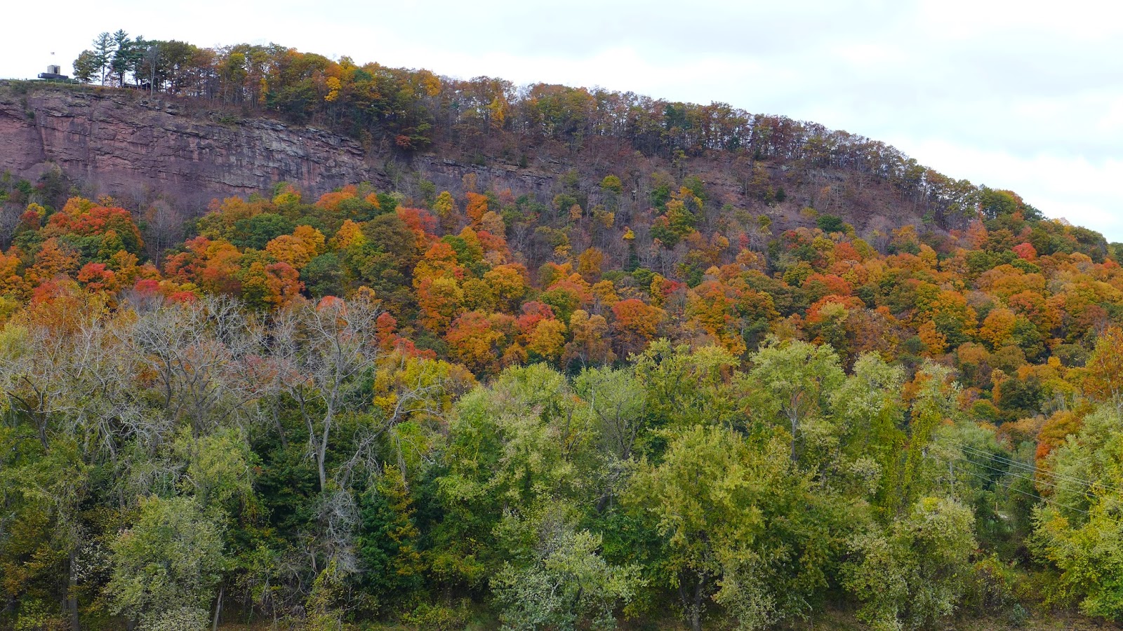
I've heard it said before you know when you are approaching the summit of a climb when you see blue on black. That means blue sky is meeting black asphalt. Well, Vermont has more miles of unpaved roads than paved roads. So one is more apt to see blue meeting brown when cyclo-touring Vermont. Today's bluebird skies doled out some nice blue on brown crests.

After climbing Foundry Rd, I stopped to take in the view of what I believed to be the Adirondacks in New York. While stopped, a group of four mountain bikers came up what looked like a driveway. I suspect their average age was much older than me. We talked a bit. They were quite far out and heading even further out. I asked about what trails could possibly be around there. They kind of looked at each other and snickered. They claimed they've been riding some of the best trails in Vermont for over 30 years. I looked around on their bikes and saw no GPSs. Then I asked if they load any of their rides on Strava. I got funny looks, like "what's Strava?" Then one commented that they need to keep the secret stash protected. Bummer. I looked in Strava around that area and there was nothing lit up. Either the locals keep a very tight lid on it or there's really nothing there. Has me wondering...

So what is it about Vermonters and their Subaru's? I'm pretty sure 78.9% of Vermont drivers own Subaru's. Does the state give tax breaks? Is there a penalty for owning a non-Subaru? Maybe to fit in with rural culture, you feel compelled to own a Subaru, one of those meme things. Obama, Coexist and NPR stickers must be one of the factory trim package options too. And I suppose because summer is just a transition between mud season and winter, that there is no reason to take the studded tires off. Just having fun here. Nothing against Vermonters or Subaru's. In mountainous terrain that is ice and snow covered half the year, AWD cars no doubt make sense. I may buy one some day after I move to Colorado.

Turnpike Rd starts out nice gravel and drops to about 1.5 lanes wide after a mile. As the houses become less frequent and elevation is gained, the road becomes barely one lane wide. You know you are in for a treat when you start seeing grass growing in the middle. Eventually the gravel surface peters out altogether, becomes leaf covered, and gnarly under the leaves. Very wet too. On the sofa bike, this is no problem. But on my cross rig where your center of gravity is already perched half-way into an endo, riding down steep ledgy rocks is terrifying. I think I lost a mile per hour off my pace riding a half mile of rough jeep road. Eventually you are "back on the map" on the other side and can resume WFO descending. The trailhead for Gile Mtn was packed with cars, 78.9% Subaru's, of course. It was a six mile, nearly monotonic descent back to Norwich.

I finished with 62 miles, 7000 feet of climbing in 4.2 hours moving time. Temp rose to around 60F, and there was very little wind. One of my more satisfying gravel rides. Here are a few iPhone 5S photos from the ride.

Top of Bragg Hill Rd. Seemed like dreary day in valley until you climb up above morning fog.

Joe Ranger Rd. Only oak trees clinging on to leaves.

Blue meets Brown. Potash Hill Rd. Skinny tires would have been fine.

Top of Foundry Rd climb, from Strafford Rd.

Turnpike Rd. I thought there was a reason I brought the CX bike. About a half-mile
of this, some of it up higher was wet, chunky and leaf covered.

Sunday, October 19, 2014

Tour of the Pocumtuck Ridge

Last fall I did a big loop from Amherst, MA that entailed a considerable amount of climbing in rugged terrain. The area struck me as a place that possessed Hill Junkie character - killer fireroad climbs, challenging singletrack and great views from high places. Perusing the Strava Global Heatmap, as I often due when dreaming about new places to ride, brightly glowing tracks in the Deerfield and Greenfield area caught my attention.

I've done the D2R2 ride many times from Deerfield. We start from a large hay field. Across the field to the east is a towering ridge that spans from south to north as far as you can see. I've heard you can ride that ridge. The heatmap showed many have. That clinched it for me. With any luck, there might still be some fall foliage in the area.

To plan this route, I decided to give the Strava Route Builder a try.  I found it has some minor quirks, but it has something nobody else has: heatmap overlay! You can use street, terrain or satellite views, with or without the heatmap overlaid. Street and path following can be turned on or off. I found this to be the most versatile off-road route planning tool yet. Previously, I'd have to go into Strava Explore and grab tracks from specific rides. I had no idea if they were a one-off or followed a popular route. With the heatmap, you know exactly where the popular routes area. Readers will be sad hear this may spell the end of Hill Junkie boondoggles. The heatmap takes speculation out of route building.

The plan was to park in Greenfield, take 10 miles of paved road south to Mt Toby, which I hit on my ride from Amhest last fall. There is nothing super special about Mt Toby, other than it is a superb 1000ft fireroad climb from the north. Descending the south is a different beast. It is four miles of ATV chunder buried under fresh leaf drop. Momentum is your friend on the sofa bike!

There was 0% chance of rain and nothing on the radar when I headed out, despite some pretty ominous looking clouds. I no more than pushed off when it started raining. WTF! It sprinkled the whole way to Mt Toby, enough to make the road and my feet wet. It was less than 50F. Fortunately that didn't last long and wasn't enough to make off-road terrain wet. I never saw another person on Mt Toby until I reached the bottom on the south side.

Crossing back over the Connecticut River, with most of the paved riding behind me, it was time to traverse the Pocumtuck Ridge. The Mt Sugarloaf State Reservation is at the southern terminus. It is a popular state park with a grand view from the summit. I have always wanted to ride up this paved climb, but not necessarily on a sofa bike with sub-20psi in the tires. The leaf peepers were certainly out. The view was worth one more paved diversion.

I would be great to follow the Pocumtuck Ridge Trail all the way back, but there are pesky interferences, like big cliffs along the way, that would not be fun to carry a bike up. So a bit more road brought me around to the north Mt Sugarloaf peak, which goes higher than the south prominence and is undeveloped. I discovered the route that loops up and around the rim is superbly designed singletrack. Some more great views of the valley below along the way.

Dropping back down Sugarloaf, in no time I was climbing up to the Deerfield ridge. This turned out to be doubletrack. With leaf drop nearing completion up top, you could see through the trees in many places to gauge climbing progress. A few openings afforded great vistas too, such as the field the D2R2 ride is run out of.

Dropping off the Deerfield ridge, there was some great singletrack. Crossing over a dirt road brought me past a pack of mountain bikers and onto freshly leaf-blown singletrack. Sweet! No more apprehension of sliding out on hidden roots and slickrock. I expected New England ridgeline gnar on this ride, but thus far, there was none.

It wasn't until I got into Rocky Mountain Park in Greenfield that I finally encountered gnarly ridge riding. More great vistas of Greenfield along the way, but the ridge was getting pretty short, only a few hundred feet above town.

I got back to the car with 41mi, nearly 5000ft of climbing in 4.1hrs. Even though there was a lot of paved riding in this loop, it didn't seem like it. Paved miles go by quickly, and way more than half of the time was spent off-road. I'll do this loop again, maybe with a few tweaks, but it was almost perfect right off the heatmap.

Sunderland Fire Tower at Mt Toby summit

Heading down the Mt Toby AVT track on south side of mountain

The south and north Sugarloaf outcroppings


South Sugarloaf from the bridge over the Connecticut River.
Observation deck in upper left.

Mt Toby on left from Mt Sugarloaf with the Connecticut River in between

South Deerfield from Sugarloaf observation deck

Overlook from the north Sugarloaf peak

Slightly different angle from above photo

Pocumtuck Ridge view of the fields the D2R2 ride start in

Greenfield from Poet's Seat

Wednesday, October 15, 2014

Published, sort of

Shortly after I got back from my vacation, I received an email from the director of the Colorado Trail Foundation, Bill Manning. He liked my photos from the Lake City section I rode up around 12,000 to 13,000ft and was wondering if he could have permission to use them. As I am a complete amateur when it comes to photography and have no aspirations to ever make a cent off photos I take, I was more than happy to help Bill out. I sent him full resolution images.

A short while later, Bill contacts me again and said a British magazine was interested in photos from the Colorado Trail and my photos may be of interest to them.  The magazine is called The Great Outdoors. I checked TGO out first before responding to Bill. At first I was cautious, as they appeared to be a hiking oriented mag, and could they possibly be anti-mountain biking? Deeper probing showed not. They ran stories of off-road riding too.

Again, I didn't want compensation for anything they might want to use. I told Bill they were free to use my Colorado Trail photos, just give me credit. Bill also said he'd try to get the TGO to send me a print copy if they used any of my photos.  I wasn't sure they would even use them, as the CT piece was supposed to be more about bike-packing and the Colorado Trail Race.

I don't think even two weeks went by when I got a brown paper wrapped package post marked from the UK. At first, I was like what's this? Then it dawned on me. It was a very thick magazine, a special edition sometimes referred to a "bookazine." It was full of glossy pictures from around the world featuring 100 bucket list epic adventures. Cool! But how could any of my photos have made it into the mag? It probably took two weeks just to come over the pond.

But sure enough. One of my photos was in there on a one-page CT piece. The only problem, they gave Scott Morris the credit! I've never met Scott, but I have followed his blog for many years, and Scott has been involved with bike-packing and the Colorado Trail Race for years. TGO magazine probably had photos to consider from Scott too, as he's posted many photos from the CT on his blog. Here's a rather poorly scanned image of the page with my photo.


That photo certainly captured the essence of my ride that day, and the Colorado Trail over all.  I'm certainly not going to lose sleep over the botched photo credit. I won't even let them know. I'm just happy to get this expensive magazine (10 GBP + 7 GBP shipping) to peruse and dream over what adventures to put on my bucket list. The special edition magazine covers many human powered activities, such as hiking, biking, repelling, kayaking, skiing and more. Many of the adventures are competitive events.

Sunday, October 12, 2014

Fall in the Whites

Can't seem to get enough of riding mountainous, off-road terrain lately. No hostile or inattentive drivers to deal with, solitude, and plenty of vertical to work up a good endorphin buzz.  What is really cool is new places to ride are popping up faster than I can get out to ride them. Two destination riding areas come to mind: the greater Stowe, VT area and the Carrabassett Valley in Maine. Have to put those on the top of my list for next year.

A while back Louis asked me what is up with all the tracks in the Strava Global Heatmap around Campton, NH. I didn't know. I ride from there a lot, usually on a cross bike to hit the gravel roads. But clearly, local riders appeared to be riding much more than forest service and logging roads. I was planning a long ride for Sunday. Plans for the Great River century ride fell through. I didn't feel like driving too far. Campton is less than 90 minutes away. Time to explore.

I pulled a few promising tracks from Strava into my Garmin 510. Rider's speeds on these tracks were very slow at times, often in walking speed range. Would I encounter super chunky terrain and embark on a classic Hill Junkie boondoggle? I didn't know.

After a warm-up on the 1300ft Campton Mtn climb, which is almost all paved now, I bombed down and crossed over Rt 49 to the area of the Welch Ledges. Riders have been riding up to the ledges, but not on the popular Welch-Dickey hiking loop. Looked steep on paper. Turns out it is a very well constructed trail, the gradient never overbearing. Route following was very difficult with leaf drop. New trails hide quickly with leaf cover, as not enough of a depression in the ground has been made yet.

The view from the ledge did not disappoint. There were many, many people up there, most making their way around the Welch-Dickey loop which climbs much higher than I was going. Spent a good while there, talking with a slightly older couple who also cycle.

Oak leaves made the descent a bit sketchy. Oak leaves over bare granite were deadly. I can get better traction on ice. Part way down I forked onto another trail. There was singletrack all over in there. This noodle of a trail meandered in a tight area and again was fun stuff. Never fast, and it undulated mightily with the forest floor. My racy geometry hardtail always kept me on the cusp of disaster.

Crossing back over Rt 49, I hit more trails in the Smarts Brook area. This is signed for XC ski use and there were many bridges at the mostly dry stream crossings. I was lucky it hadn't rained up there in some time, with how rooty and rocky some of the terrain was. I clearly rode one of the long singletrack segments the wrong, uphill direction. Some nasty steep pitches up granite or root mazes that were too much with leave drop to punch up. You can tell by ruts and braking stutter bumps that the trail was primarily a downhill run. Took me forever to reach the top. There is a large network of trails being ridden in this area, and I barely touched it before popping out on Sandwich Notch Rd.

A colleague who fishes stocked ponds in the Sandwich Range mentioned Sandwich Notch Rd was all rutted out from heavy rain. Hmmm, maybe if you're taking a Corvette over the seasonal road. I didn't find it in any worse shape than usual, just fine for a cross bike but probably not a road bike. The descent would suck on a road bike.

Down the other side I picked up one of my favorite doubletracks in the Whites, gated Algonquin Rd. It follows the Beebe River, downstream, for many miles. You feel like a superhero riding the 1% grade downstream. Little work produces big speed on moderately rough surface.

I had planned to pop out on pavement and take Rt 175 the last couple miles back to the car, but Page Hill Rd caught my attention. I tried to ride this once before and it turned into a bushwhack on the other side near the bottom. A few people live on the gravel road on this side, then it becomes an un-maintained road. It went up, the sun was to my back, and the fall colors were brilliant. I gave it a go.

With no GPS track, I had to wing it at a couple junctions. Turns out I chose wisely. No bushwhack this time and got in another 400+ feet of climbing off-road. I got back to the car with 34 miles, 4800 feet in 3.6 hours on the Garmin. Another great fall day of riding. I'll leave you with a photo dump from the ride. Thanks for reading.

Welch Ledge looking across the valley into the Sandwich Wilderness Area

Look up towards the Dickey ledges. A rare moment this view wasn't full of hikers.
The logs keep walkers off sensitive vegetation islands.

Trying not to go over the ledge and win a Darwin Award. It actually wasn't that steep here.

One more from the Welch Ledge.

Beginning the descent back down with Dickey Mtn in background. 
Lots of slickrock which was fortunately all dry today.

Further down, looking down.

Singletrack below the ledge. Where's the trail?

Near the top of the climb in Smarts Brook area.

Atwood Pond

Atwood pond looking more easterly

Sandwich Notch Road, north side looking down

South side of Sandwich Notch Rd looking back up

Algonquin Rd

Color along Algonquin Rd