Monday, September 25, 2017

2017 Vermont 50

Don't know why I keep coming back to this sufferfest. The VT50 is essentially a 4-5hr individual time-trial. I have never gotten through it without cramping. This was may 8th time in an 18 year span. My first expert class MTB race was the VT50 back in 2000.

I almost bailed on the race this year for multiple reasons. First, my main steed wasn't expected to make it back from Colorado until after the race. For some reason, FedEx thought it was economical to send my bike through Arizona, New Mexico, Texas and North Carolina before heading up to New England. They did get the Tallboy back to me before the weekend. One excuse removed. I wasn't cherishing the thought of racing my 15yr old hardtail with barely any travel left in the fork...

Then the forecast was calling for record heat. High near 90F at the end of September? I have enough trouble with hydration and cramping when we start with frost on the ground, as in many times past. But how could I turn down a dry week and mint course conditions? To my amazement, I found White River Inn still had decent rooms available for a good price. I booked the day before checking in.

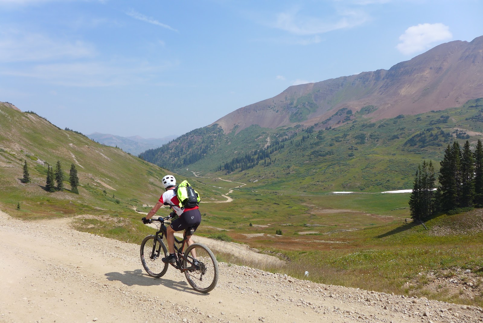
I posted an abysmal time on Mt Washington this summer. I've avoided structured intensity training pretty much all summer and it showed. I was at least five pounds above my "racing weight" too. Two weeks in Colorado took care of the weight problem. I ate a little more healthy than in trips past and had more volume of aerobic activity too. There is no training at 14,000ft though! A large majority of my activity was between 10,000-14,000ft. You go at best maybe half pace that high up. No air to do anything more. Like Washington, the VT50 was going to be what it was going to be. No goals or expectations.

It was very mild lining up at the start. No need for long layers for sure. I saw nobody with them on. It was around 60F. I had about 70oz of Gatorade with extra electrolytes mixed in on me. I would swap that out at the 31mi mark for a smaller 50oz pack. No fog on this warm morning. There was barely a hint of light in the east as we rolled out with LED lights on.

I quickly slid to the back of ~100 riders in my wave on the first super-steep punchy climbs on the road. I know how deep digs on these early rises do nothing but bring cramps on sooner. It meant I would be at the back of the pack on conga line hill where many walk. But today it was so dry and firm that most people were riding it. I was not forced to dismount. I rode the whole thing. Probably a first in eight times for me. For many others too, I suspect.

I was feeling pretty good but tried to keep a governor on deep digs. It sucks riding at 50% of your capacity, just knowing the cramping demon will surface at some point anyway. I had a pretty good average speed going half way in, 11+mph through the climbing loaded first half of the course.

Then it started. At 26mi, the first cramping twitches started. By mile 28, I was forced off the bike for the first time. I think it was the same hill I almost always first cramp on. This BS is so predictable. I was not happy, mostly like why did I sign up for this stupid race when exactly the same thing happens every time?! The next 22 miles were totally going to suck. Again.

There was a whole lot of deliberate walking up hills over the next few miles. I know from experience walking on off-road grades greater than 10% doesn't lose too much against the clock and it forces me to relax and recharge the imbalance in my revolting hamstrings. I can sometimes buy back an hour of moderate intensity on the bike with 10-15 minutes of walking. A lot of people passed me though, even though I was going just 1mph slower than they were up these steep grades.

I swapped packs at the 31 mile stop and was kind of going again. There were a couple more sustained steep climbs after that I walked. I always seem to walk some of the beautiful singletrack climbing up to below the deck on the house with music. Hate that part because I'm cramping. But the back 20 miles of the course has less climbing and a lot more singletrack in it. It means you are not on the gas all the time and can get bits of recovery. It is really fun stuff too. Lots of rock features toward the end.

A lengthy bit of descending pops you out in Brownsville just before the last climb of the race up the flanks of Mt Ascutney. I had passed a few people back just before this point and hoped to not hemorrhage any more spots. The cramping was barely holding off.

There's that saying the horse smells the barn. You definitely get that sense the last few miles on this course. It's partly you want it to be over, partly looking forward to the final ruckus descent to the finish. I could hear somebody breathing down my neck for the last two miles and gained on me as the descent began. No way dude, I'm on a Tallboy long-travel, you ain't passing me!. The off-camber side slope was nice and dry and I let it rip. Scared myself shitless on a few turns. Racing Ralph's are not the best tires for this! I held my spot to the line by just two seconds!

I finished with 4:48:29, about 7 minutes slower than two years earlier when I last did the race. Can't really complain about that. It was good enough to net second podium spot for the 55+ age group. My nemesis Stephen Wright showed up this year and claimed the top step, about 4 minutes faster. Could I have not back off quite as much when the cramping started and not given up those 4 minutes? I don't know. I have had experiences where that approach went spectacularly badly. Either way, a good clean race, and I didn't feel the heat was overly oppressive.

2nd place finisher's size Vermont maple syrup
I was curious to see Strava had me tied for eight place in the finishing descent out of over 700 over the years. How can this be, for a timid descender? Tied with Mike Barton, multi-time overall winner here?! I knew I finished strong, but dang. Must've taken some risk there. Have to chalk it up to riding the sofa bike. So many ride hardtails and short-travel dualies on this course. Others are probably tired too, and I don't think I'm ever fatigued finishing this race.  Cramping prevents me from getting tired. Ironic. The Santa Cruz Tallboy LTc is surely overkill, but it lays waste to anything going down, even for cautious me.

Post race, I got my first massage ever! Yeah, short massages are offered to racers free. I signed up, nobody was waiting, and I had two ladies working on me, uh-huh. My hamstrings were pretty sensitive so they kind of backed off there when I think I could have used the most work there. The shoulder/upper body massage sure felt great though!

Mighty fine but roasting hot day in late September
I thought it would be interesting to plot out my eight finishing times since 2000. In eight races, I have not flatted or had a mechanical here. Pretty amazing really, 400 miles and about 65,000ft of descending and no flats. I've had no serious crashes either. My slowest times were when I was younger and racing a 26" steep geometry hardtail. 2009 was the year with Biblical proportion rain fall, so can't pay too much attention to that outlier. I was probably the most fit that year, winning the BUMPS hillclimb challenge. The 29" hardtail brought a new PR in 2013, my first sub-5hr finish. But my fastests times came when I switched over to my behemoth Tallboy, weighing 4 pounds more than my hardtail. It's more relaxed geometry made the descents so much more fast and fun that it made up for the excess weight to haul up 8000+ feet of climbing. Regardless, it's still nice to see I can post times faster than almost 20 years ago and two age groups younger on this course. When May 25 rolls around next year, I'll probably forgot how much the cramping hurts and register again.


Expert 55+ Podium, David Boyce 3rd, Stephen Wright 1st and myself 2nd. Photo by Lara Gibson.

Monday, September 11, 2017

CO Day 9: Phil's World in the desert, avoiding high country lightning

Had planned to ride Indian Ridge up around 12,000ft today. I attempted this a few years ago when I got caught up there in an intense lightning storm. Most scared I've ever been in my life. I never made it to the part called Indian Ridge, a highly scenic, exposed section of the Colorado Trail.

The forecast turned more sour when I got up this morning. 60% chance of lightning by noon even per optimistic sources. No way was I going to chance that. It takes 3hrs of climbing just to get up there, and reports say to expect a lot of hike-a-bike up top. That would put me into early afternoon before coming off the ridge. I bailed.

Instead, I went to Phil's World, a purpose built trail system near Cortez, about 40 minutes west of Durango. It sits between 6000-7000ft and is essentially desert terrain a lot like Moab or Hartman Rock near Gunnison. Moab is only a couple hours from there, one of the potential benefits of living in Durango - day trips to Moab!

Hated "wasting" a possible good legs day after hiking yesterday on low country riding, but riding in rain, or worse, lighting, is no fun.

Starting out it seemed ridiculous that I drove out into the desert to ride without a cloud in sight. The western wildfires smoke was finally gone and true bluebird skies have returned. It didn't take long for clouds to build, though. From Phil's World, the high peaks Indian Ridge traverses were plainly visible about 25 miles away as the crow flies. By 11am, it was almost certainly raining there. Felt vindicated in making the right call this time.

There was a surprisingly large number of cars in the parking lot for a Monday. Many had Utah plates. Seemed there was an organized group of old fogies (like me) doing a ride. Many others too, including kids with parents who you'd think would be in school. But on the trail, I rarely encountered others. Traffic is one-way, which greatly reduces interference.

It got toasty, my Garmin logging 95F before the end of the ride. Could have been some solar heating there, but car read about 90F driving back. Went through three liters in three hours. At least it's a "dry" heat.

Full loop went 30mi with 2000+ feet of climbing in 3.2hrs moving time. I took it pretty easy, but there are a lot of steep, punchy climbs here. Will have to try again on Tuesday for Indian Ridge, maybe try to drag my old ass out of bed earlier to have better chance of not dying. Forecast looks only slightly better Tuesday than it did today.

Much of the loop follows rocky rims like many trails in the Moab area do.

Moab be out that-away. Irrigated farm land around Cortez.

Looking southwest

Can be techy but never chundery

A large area that burned many years ago now filled in with flowers


Just after 11am and Indian Ridge looks like it is getting hammered already

No weather to worry about on Phil's Trails

More ledge with cumulus clouds over Indian Ridge high peaks

Lens doesn't really capture it, but this was seriously fun roller coaster stuff. Hard as pavement, tires would buzzzz, quiet, buzzzzzz, quiet, etc. The quiet intervals where you'd find yourself in the air.

There were cairns like this in random places

Some hard as pavement sage brush cruising. When I watched the Breaking Bad series, they always showed sky shots and it looked a lot like this. New Mexico is just a few minutes south of here.

Around 1pm, the high peaks are surely getting hammered. I would not have been off the ridge yet.

Parking lot when I finished early afternoon. More cars out of view.

Saturday, September 9, 2017

CO Day 7: Junction Creek, the full monty

I think I've ridden Junction Creek three times now. I wasn't planning to ride it this trip. This trail can be shuttled via a couple dirt national forest roads. Since I self shuttle almost everything I do, riding Junction Creek is a big commitment. It is nearly 4000ft net gain from town via Junction Creek Rd, 5000+ feet if going all the way up to Kennebec Pass. I've been up to the pass from town only once before. Lot of hike-a-bike across the scree field...

Forecast was less than ideal again, so getting in the car to ride somewhere with later start just didn't excite me. Start of the Junction Creek climb is just a couple blocks from the hotel. Hitting Kennebec Pass is a out-and-back poke above tree line, so not much risk.

Temp was perfect at 8:30am. Legs felt better than they should've. Saddle sores were a whole different issue. I made decent time up dirt Junction Creek road. Saw no other bikers, but two large support/shuttle vans came down as I approached the top. The sky was filling in with clouds but didn't look too threatening, so I continued upward on the Colorado Trail (CT) to Kennebec Pass.

The grade goes from constant 6% climbing on Junction Creek Rd to persistent 20% on the CT. There were sections I could not aerobically sustain at that pitch at 11,000ft.

I forgot to put the memory card in my good camera, and my stupid iPhone memory filled up at that same time. I couldn't take any pictures! This drove me batty. Deleting old photos made no difference. Deleting an app I didn't use anymore did free up 10 photos worth of memory. The IT guys at work will have to sort this out. Anyway, I spent an obscene amount of time screwing around with this, which was good in that it gave me some recovery after climbing well over 4000ft already and bad in that I was flirting with getting soaked later.

I saw only two riders on my climb, on the steep part of the CT above Junction Creek Rd. They were bombing down. Maybe they rode the dirt road up the other side. Probably the smarter way. There was considerable hike-a-bike up the scree field. From town though, going up the west side would make for 10's of highway miles for me. I'll take the HAB.

Last time I rode up to Kennebec Pass, I did not check out the Muldoon Mine up there. Supposedly the worlds best outhouse view is there. After seeing it, I have no doubt this is true. From the mine, it is a 5000ft drop back to town on singletrack, but far from all downhill! There is a spanker of a climb halfway down that entails more HAB for an old, tired, sea-level dweller like me!

It was quite warm dropping back down. At the bridge where the spanker climb begins, I stopped to filter some water from Junction Creek. Tastes like... water! Nice and cold. I drank 16oz and filled the bag again for later. I still had some of my 100oz Gatorade left too.

When I finally reached the top of the spanker climb, back up to around 9600ft, there was a young, local couple sitting there. They rode up a different way. We talked a good while, gleaning all kinds of useful info on trails and living in Durango. Of course, as soon as we pushed off, it started pouring out! I had 3000ft of vertical drop on clay and rock to go. The brief downpour did little more than make the vegetation wet and me soaked. Maybe I'll luck out.

I didn't dilly dally ripping down. It is very chunky rocky terrain that considerable speed can be carried on. I felt my wheels bottom out hard several times, like taking a hammer to a steel drum bottom out. No sidewall tears! Racing Ralph's at <20psi are="" cut="" for="" not="" of="" out="" p="" riding="" this="">
Before I reached Gudy's Rest (where the final CT switchbacks begin), it started pouring again, more earnestly. Now the trail was getting juicy. I could see tracks from somebody that must have been just ahead of me. I caught him. He had crashed already and was going very slow. It is scary how quickly you get cold at higher elevations when it starts raining. Like you go from sweating to shivering in two minutes. The rain stopped again as I finally reached the road, where a gang of MTBers were re-grouping, maybe part of the supported group whose vans I say earlier.

Bike got a little yucky, but I escape with only nuisance wetness and never had to put my rain gear on.  Finished with about 52mi, 8300ft of climbing, in 6.5hrs moving time. Tons of tech on this ride. My hands, wrists and ass are hurting. If I lived here, I'd probably ride Junction Creek periodically, maybe explore some of the other ways to get up top.

Buttes that are towering when starting out. About 1400ft up from town on Junction Creek Rd.

Note bad climbing on Junction Creek Rd

First view of the high peaks on Junction Creek Rd

Will be up there before too long


View to north from Junction Creek Rd, prob around 10,000ft

Colorado Trail from road junction at 10,400ft
 
Beginning switchbacks on the CT above road junction

The infamous scree section. At ~20% grade and 11,000ft and loose as can be, it became a protracted HAB

Looking back down the scree section

After cresting Kennebec Pass and dropping part way down the west side to the trailhead there, this is the view. I hope to ride that 12,000ft ridge this coming week if a good enough weather day materializes. That is the same ridge further north I got caught on in lightning storm a few years ago. Never, ever again.


View south from Kennebec Pass trail head parking area

This is where sane people shuttle to when riding the scree field. It is all rideable going down.

Looking east up at Kennebec Pass from upper trail head
View from Muldoon Mine


Looking down on Kennebec Pass from Muldoon Mine site

The famous Muldoon Mine shitter. It is on verge of falling off the cliff.

Looking down at scree field and CT trail from Muldoon Mine

Muldoon Mine ruins at around 11,800ft on Cumberland Mtn

The falls on Junction Creek Trail. Was flowing today, been dry on prior occasions.
 
Junction Creek Trail. Don't look down!

Junction Creek Trail

Of course, after epic effort, and epic feast is required. Serious Texas BBQ. Big Six platter, feeds 2-3 people, six kinds of meet, upwards of two pounds of food. That's a cafeteria tray for scale.  Very nearly finished it in one sitting. Have to visit this place once each time I come to Durango. Probably not the best recovery food, but it sure is satiating. 

Wednesday, September 6, 2017

CO Day 4: Lupine, Paradise Basin, Trail 401, Tony's MTB Loop

Crested Butte is my favorite Colorado town for trail riding. It is far from any population centers. The many hundreds of miles of trails accessible right from town are never crowded. The trails and terrain perfectly match my riding style too.

The air was super smoky getting up this morning. The wind is carrying smoke from numerous, large northwest forest fires over the whole state of Colorado. Visibility was only a couple miles in places. No bluebird sky photos today! Should probably be worried more about what that is doing to my lungs. Can't say I really notice it, but there are health advisories posted across the state.

The hotel in Gunnison doesn't serve breakfast until 6:30am. That gave me an excuse to sleep in. I desperately needed extra sleep. I sensed adrenal fatigue coming on after three physically stressful days in a row.

My legs were utter garbage starting out up the bike path in CB. I thought adding more air to the tires would help. Nope. It was all me. After just a few minutes on paved bike path, Lupine Trail is picked up. This was built a few years ago and is a fabulous route out of town high up on open meadows.  It's crazy how good the views are after just a few minutes of pedaling.

I've never ridden the Gunsight Connector extension to Lupine before. It's always been close/roped off when I've been here. Not today. The descent through the large aspen grove was dreamy.

Slate River Rd is then taken up to Paradise Divide. I've been up to the divide only once before in 2010. Other times I cut off on Trail 403 before reaching the divide. 403 kinda sucks. So rutted and such a waste of vertical. Death grip on brakes the whole way, only to have to climb it back on gravel in the next gulch anyway. Paradise divide goes higher and offers spectacular scenery even though you are on a jeep track. On this weekday, I think only 2 or 3 motor vehicles passed me in over an hour of climbing. The view down Paradise Basin into the Maroon Bells Wilderness makes all that 12-18% climbing worth it.

The descent pops you out right at Shofield Pass around 10,700ft. For many folks, this is the shuttle drop-off point for Trail 401. I don't know why anybody would shuttle this with such a fine jeep road climb to the pass. There were a couple other dudes hanging out there before jumping on Trail 401. Talking about the smoky haze, one of the guys was like what smoke, as he lights up a bowl. What a riot!

You first climb on 401 to back above 11,000ft before the fun begins. I pondered if my old, tired legs were going to clean all those switchbacks. So steep, so little air to breath. But I know the steep parts so well now to recover where I could. It helped that the trail was as hard and smooth as concrete too.

You have to ride Trail 401 to get a sense of the experience. Pretty much zero work, smooth as butter, just like your soul is drifting through paradise. And no, I didn't imbibe at Shofield pass either. Mid-401 there is another spanker of a 500ft climb before resuming the descent. Sometimes I wonder if that last part is worth it. Eventually you must pop out on Gothic Rd, as the wilderness area encroaches right down to the road.

It's not all downhill back to town. Dirt Gothic Rd has some climbing, then some more again picking up the last bits of trail, Upper Loop and Tony's. Love finishing on Tony's, a lot like finishing on Kitchel at Kingdom Trails.

Clouds did move in like forecasted, but the rain stayed just to the south. Another perfect day in short sleeves start to finish. Ride went 39mi with 5300ft of climbing in 4.8hrs moving time. That's about 25,000ft in four days. How come I'm not dead yet?

Wild fires and smoke map. Whole state of CO is in path.

Crested Butte from Lupine Trail. So much smoke.

Heading north on Lupine Trail, looking up the Slate River drainage


First time on Gunsight Connector. Many hundreds of feet vertical lost through this grove at high speed through switchbacks.

Slate River Rd

Slate River Rd

The switchback to head up FS734. Where the climbing starts.

Looking back down to Slate River and the switchback

Looking into the Raggeds Wilderness. Probably Cinnamon Mtn on right and Treasury Mtn further back in distance.

Looking back down 734 and my hypoxic weaving track 
Paradise Divide just visible right of center


About 2500ft net gain from town, unfortunately most of it gain in last four miles.

Paradise Divide

Looking down into Paradise Basin

Heading down Paradise Basin

Still some flowers left in Paradise Basin

Paradise Basin with Maroon Bells wilderness beyond. Hiked in there last trip.

Shofield Pass 10,707ft

Top of Trail 401 looking north

Trail 401

Trail 401

Trail 401. Mt Crested Butte barely visible through smoke. Normally it is very prominent.

Trail 401

Trail 401

Gothic Mtn from Trail 401

East River from Gothic Rd