Sunday, March 26, 2017

Is New England a Gateway Drug to Colorado?

This bipolar winter has been dishing out diversity in spades. It seems every weekend there were sweet conditions for one activity or another. Some weekends it is hard to chose what to do outside, because it is all good! This past weekend was a prime example.

Waterville Valley Skate Ski, Friday, March 24

Skogs and I had planned to ski on our off-Friday (we work for the same company) before potential rain and warmer temps screwed things up. Checking Waterville's grooming report first thing in the morning, they didn't groom, saying "expect glazed (FAST!) conditions". Well, that sucked. We contemplated hitting Jackson, which did groom, but snow/rain was moving in midday and I didn't really want to drive back in that.

Conditions were glazed alright. More like rock hard frozen corduroy with liberal garnish of hemlock debris to gum your skate skis up right away. In between near face plants from hitting sticks and pine cones, I was trying to keep my skis under me.

Rock hard corduroy and stop your skis dead tree debris were not what I had in mind.
But then the snow started. Light at first, quickly becoming heavy. This vastly improved conditions. The hockey ice glide went away, which ironically Skogs was enjoying while skiing without poles due to shoulder injury, but control went up an order of magnitude. I could actually put power to the snow and control it at the same time. Sweet!

Ninety minutes later, that's more like it! Top of Tripoli Rd.
Totally froze my face off on the 10 minute Tripoli Rd descent!

Snow started piling up at the rate of 1-2" per hour. I managed to get a 40km skate in before the trails became a slog. What started as a dubious at best ski finished quite satisfying.

Arvid took this photo as I finished skiing 40km. My mom said now I know what I'll look like when (if!) my hair turns gray. Thanks mom!
White Mountains Hike, Saturday, March 25

I started my next day as I do many unstructured weekend days. I sit down in front of the computer with my morning cup of joe surveying weather and trail conditions. Often weekend activities are literally decided minutes before heading out the door. So what did the weather show? Rain. A long stream of it flowing through central New England. I wanted to ride, but there are better things to do than freeze your ass off riding in 35F rain. The north country looked to be escaping this soggy ribbon. A hike it would be!

First view upon reaching the ridge at Little Haystack Mtn, 4760ft elevation. Mt Flume and Mt Liberty on right.

On the flank of Mt Lincoln.
I hadn't hiked big peaks in a while. A trip, snowstorms and limited weekend time kind of got in the way. I settled on the classic Franconia Ridge loop. It was no longer calendar winter, so the winter 48 list chasers won't be out. Should be a quiet day in the Whites. Franconia Notch provides the most easily accessed hiking too.

I was a bit surprised to see the Lafayette campground parking lot overflowing. I was barely able to park off the highway. Friday's snowstorm left about 4-6" of sugar powder in the Notch. Temp was right around freezing. Several people headed up the Falling Waters trail before me, none wearing snowshoes. I started in microspikes.

Mt Lafayette. People barely visible on summit

Mt Washington beyond the Pemigewasset Wilderness.

I passed 15 people heading up to Little Haystack, a nearly monotonic 3000ft climb. The snow got progressively deeper as I climbed, and the more people I passed, the last packed the trail became. It was still much easier and faster to stay in microspikes though, to the exasperation of snowshoe purists I'm sure. No risk in getting called out today though, as snowshoes stayed on people's packs.

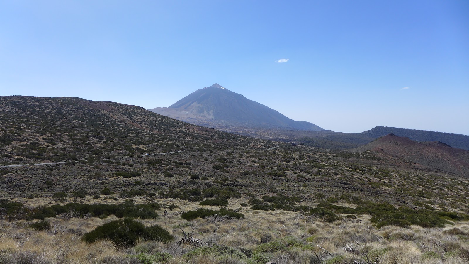
No bluebird skies up top, but the views were arguably more stimulating. There was high overcast and much patchy undercast. Many 4000 footers can be seen from the Franconia Ridge. Some were obscured, others poking through. Just across the Notch, most of the Kinsman Ridge was socked in. Glad I didn't opt to head up that side, as I'm sure many who parked there before me did.

Looking south along the Franconia Ridge from Mt Lafayette

Looking back up at the ridge from Greenleaf trail just before clouds socked it all in.

Only a handful of people had traversed the Franconia Ridge. The ridge was almost completely snow covered, some drifting here and there, bare rock at outcroppings. Was no problem leaving the spikes on the whole time. I think I interacted with only five people on the ridge, a couple I passed up there, a couple gals that I had earlier passed on Falling Waters (I stop too much for pictures!), and a solo guy doing big 30 mile loop. Had some solo time on Mt Lincoln and Lafayette. The wind was really howling on Lafayette. I suspect the windchill was down near 0F. Pretty raw, hurt to expose face to that.

Deep new powder on 3-5ft base on Greenleaf Trail nearing the hut

Much further down on Old Bridle Path and out of the wind.
The snow was very deep heading down Greenleaf Trail to the hut. Descending consisted of glissading bounds. So much easier than summer when the scree field is an ankle fracture waiting to happen. I just hoped I wouldn't bound into a spruce trap as I got into tree line! The snowpack was several feet deep at the Greenleaf Hut. As I approached the hut, clouds socked everything in. The open ridge views were gone just like that. Boy, did I get lucky today. The 8.7mi/4475ft hike was one of my better winter hikes even though it wasn't technically winter anymore. The experience certainly felt like mid winter.

Duxbury MTB, Sunday, March 26

So how do you top off two fantastic days of winter wonderland? You head a bit south to avoid snow entirely! Duxbury pokes out a bit into the ocean, kind of like Cape Cod does. It enjoys some of the same weather moderating benefits the Cape does. Duxbury shed the last of its snow several days ago, and the sandy soil drains really well. There is no shortage of singletrack and dirt road riding there to make the 75 minute drive more than worth while.

A stiff wind was coming off the Atlantic. It meant the temp was not going to change much during the ride. No shedding layers! It also meant the out-and-back to Saquish would be brutal, as it usually is. Dead flat, but you might as well be climbing a mountain with how hard you have to work into that wind. No beach ride this time. It was high tide. Riding this dirt track seven miles out onto a sandbar isn't for everybody, but I like it for the change of scenery and steady-state effort you can put into it. I think of our lost cycling comrade Alec Petro every time I go out here too. He must've ridden Saquish hundreds of times.

End of the line at Saquish. High tide meant no return on the beach.

The "road" out to Saquish
The terrain in Duxbury Conservation Land is a little mellower than Otis or Trail of Tears on the Cape. There are virtually no rocks here. It can be extremely rooty in spots though. There are many punchy climbs, but not as long as Otis or ToT climbs. A great workout can be had though. I throw in some cranberry bog loops with snippets of tasty singletrack to bring the mileage up to 40 miles in 3.3-3.5hrs moving time. Mud is rarely found in Duxbury. Bike goes back home as clean as it left.

Returning from Saquish. Pretty sandy in spots. Such contrast from last two days in the whites. Hard to believe same weekend, difference between 90 minutes north and 75 minutes south.
Should I be surprised to find mountains of cranberries adjacent to cranberry bogs???

My Duxbury loop entails a couple hours riding trails like this.
Driving home from Duxbury, the radar showed next band of precip moving into the area. I drove into the Big Dig tunnel dry, popped out on the other side in rain. Another perfectly (luckily) timed activity this weekend, three-for-three.

I hope to ski one more time this season. If I get a skate in next weekend, first weekend in April, I will have skied in six months this season, Nov-Apr. In 20 years, I think there was only one or maybe two other times I've been able to do that. The season started with copious cover on Thanksgiving weekend at Prospect Mountain in Vermont. It could finish there or hopefully much closer in the White Mountains.

I've posted many times now on Hill Junkie about how great it is to be able to bike dirt and ski snow on the same weekend living in central New England. Cathy and I plan to move to Colorado some day, maybe in the not too distant future. I was asking myself this weekend, will I be giving anything up by moving? Or is New England just a gateway drug to Colorado?

Thursday, March 16, 2017

Fat Bike Conditions Flowchart

This bipolar winter has made for exceptionally hit or miss fat biking conditions. Mostly miss. When we get snow, we get too much. Then few step up to perform the sacrificial work of breaking out trails for riding later. Then poof, the snow is gone again, and there is no need to muddle around on a fat bike. Even when snow gets packed by the user community, the end product is often less than desirable riding material. Glad I have other winter activities to fall back on.

While attempting to ride groomed trail at Horse Hill today, it occurred to me that I have gotten robbed of riding fat bike on snow this winter for about every reason that exists. A flowchart something like this popped into my head.


Sunday, March 12, 2017

Gran Canaria Day 6: Tejeda Lollipop Loop in Blazing Heat

After our "rest" day on Wednesday, the rides get progressively harder. The weather wasn't getting cooler either.  Highs near 30C (86F) were forecast each day. Friday's ride was possibly the best ride yet on Gran Canaria. Very quiet roads, great scenery, feeling like you're "way out there." It's amazing how much difference getting more than an hour or two's worth of sleep makes too. The night before I got less than 2hrs ours sleep. Caffeine, amped metabolism, thinking about how hard the next day's ride is going to be likely all contributed to a sleepless night.
Day 6 headed out like Day 3 to the Valley of the Tears. Instead of heading up the 20% switchbacks, we continued on GC-210, climbing another couple thousand feet at a more reasonable pace. Vistas provided dramatic views of the switchbacks that we rode two days earlier across the canyon.
Several riders in this week's camp did the same camp last week. Doubling up a really hard week, back to back. The weather is 180-degree difference. Abnormally hot this week, abnormally wet and cold last week. Not sure which I would have preferred. Some riders were borderline hypothermia last week, had one rider that may have had too much heat yesterday and had to get checked out. 
Today's ride finished by descending from Ayacata again, a descent we became very familiar with. 4300ft and countless switchbacks. Each time I go down this beast I get faster. Hard to know if that is a good or bad thing. I finished with 72mi, 8700ft of climbing on my Garmin. Others logged more climbing.
One more day to go. Peter always has a special route planned for the last day, north of 10,000ft of climbing. There is a more sane ride offered though, and many riders were planning to take up that offer. Today's photo dump is from my cheap waterproof camera. Got sick of messing with the lens cap on my LX7.

Heading out through Mogan on GC-200

GC-200 on second hump to first summit of day. Most of pack went way harder up this first climb than I wanted. Scott, Adam from Thomson tours and Keith here.


The geoligists couple particpating in this week's camp from first summit on GC-200.

Dave coming down one of many rough switchbacks on GC-200

Dave and I leading the way, back on the GC-210, heading into the Valley of the Tears

Dave and Keith in the Valley of the Tears

Stacked right on top of one another

Group was pretty fragmented through Valley of the Tears

This time we stayed on GC-210 and continued climbing for another couple thousand feet

Those are the 20% switchbacks we climbed two days ago

Modern cliff dwelling

More homes cut into the cliffs along GC-210


Artenara

Dave passing through Artenara

Looking back up at Artenara from GC-210

Tejeda from GC-60

Nice scenery and moderate temps at 1000-1400m today. Nasty hot at sea level.

Three young studs came flying by on the 8km climb on GC-60. Dave latched on. I'm like WTF, the pace was just fine. It went to borderline insane for the next 15min and nearly balastic as we crested the pass into Ayacata.

Artenara on pass in distance we passed through about 30 minutes earlier. Haze in air is dust from Saharan Desert, which is why this week so hot.

Dave beginning plummet back to Puerto de Mogan at 4300ft on GC-605. The top third is total crap pavement and we had close call with dickhead driver that passed us on the right with no warning. It is rare though to encounter hostile drivers here, even in trafficy areas. So different from the states.
Peter Thomson at evening briefing. The next day's ride is discussed each evening, any hazards pointed out, turns not to mess, tough climbs to tackle. Then we head over to dinner.

Gran Canaria Training Camp Day 1

A couple months ago, Brett was throwing out ideas for a spring trip, “training camp” as guys often explain it to their wives. Roger’s Italy training camp? Destination’s Mallorca? Thomson’s Italy tour? Or maybe Thomson’s value priced Canary Islands training camp...

I had gone on a Thomson tour before, the Trans Dolomites in June of 2011. I was impressed with the overall quality of the trip. Looking into the Canaries camp, it resonated with me. Very climbing intensive and a part of the world I hadn’t been to yet. I reached out to Dave, and he too was interested. We sealed the deal.

I don’t do red-eye flights well. We left Boston in the evening, arriving in Dublin at 5am for connection to the Gran Canaria. I took Benadryl in the hopes it would make me drowsy enought to sleep. Nope. Did not sleep a wink on the 4.5hr flight to Gran Canaria either. Getting on the island around noon, we shuttle to our resort, the Hotel Cordial in Puerto de Mogan, have lunch, build bikes, and go for a “shakedown” ride, a mere 3000ft of climbing out-and-back. All of this going on 36hrs with zero sleep. Surprised I remember any of it.

The weather forecast was decidedly hotter than normal. Normal temps hoover around 75F this time of year, but our week would see temps near 90F most of our week here. Thompson was set up for two weeks here, camps offered first and second weeks of March. The first week saw some cold and wet days. Not sure which I would have preferred. Several people in our week’s camp booked both weeks, two weeks of about 60,000ft climbing per week! They would get both ends of weather extremes here. Peter Thomson said only once or twice a year does it get as hot as this. Lucky us.

The reason it was going to be so hot was the winds reversed from usual and were coming off the Saharan Desert in Africa, the hottest desert in the world. The Canaries are only ~100 miles or so from the coast. Not enough the cool the air.

Our group of 22 riders road out of town late in the afternoon at a pretty brisk pace, on GC-200, a road we will become very familiar with. It tops out at about 2000ft above sea level, but round-trip entails about 3000ft of climbing. If this was any indication of what the week would hold, I was toast!

There were some pretty strong riders in the group. We had mountain bikers, triathletes and roadies. Most of the group was from the US, Canada and the UK.

The food at the hotel was amazing. It was buffet style, with hundreds of items to chose from. Every evening there must have been over a dozen different meat – rabbit, lamb, beef, pork, several types of seafood. Was both perfect and not-so perfect for a gorger like myself.


The following days would get progressively harder, the mileage and vertical increasing each day. The temps would get hotter and hotter too. It was going to be a tough week.

Single group rolling out for shakedown

Single paceline heading out of Puerto de Mogan on GC-200


Looking down the others side, a ruckus descent we'll hit a couple times later in week


What we came up and will head back down on this ride

Friday, March 10, 2017

Tenerife Day 5: Up and Over el Teide

Day six of the Canaries training camp was a logistical marvel that Peter and team have put together. The day starts the evening before for the Thomson team. The bikes are loaded atop the support vans and driven to the ferry for the transfer to the next island over, Tenerife.  Our morning starts at a harsh 4:30am. We have light breakfast at hotel and pile into hotel shuttle for 45min drive to Gran Canaria airport. The flight is a quick 30 minute puddle jump. Then we pile into the vans for another 45 minute dive to the southwest side of the island where are ride starts just above sea level. From there, we climb monotonically about 7000ft at 6% average grade over 21 miles, topping out at about 7800ft at highest point of ride. We drop to only around 3000ft on other side, where a short 15min shuttle gets us back to the Tenerife airport. 30 minute flight, 45min shuttle back to hotel, just in time for second seating of the fantastic food spread our resort puts on each evening. Our day finished around 10pm, but the Thomson team still had to get the bikes and vans back via ferry to Gran Canaria for the next morning's ride. A lot of work for one ride, but it is a very special ride, a climb that many top pros also train on.

To start the day off, I got maybe 90 minutes sleep. Not sure why. Too much caffeine earlier in the day? Metabolism jacked by so much activity? Sucked man. I was in complete mental haze getting ready to roll out at 10am on Tenerife.

My GPS showed 90F shortly after staring in Los Cristianos. I was pretty sure I lost all my sunscreen in 30 minutes. Was going to be a soggy chamois riding day. The air was much more clear than the previous days, maybe because the Saharan desert dust wasn't quite coming over this way in the morning. This would make for some clear pictures later on. I hadn't explored what to expect up top, so it was mostly going to be a surprise.

The A-group got pretty spread out. It is training camp, and the ground rules were each person climb at their desired pace. I took lots of pictures with the good LX7 camera, so I was stopping a lot and leap-frogging with Brett on the climb. About an hour into it, Brett's rear tire pretty much just exploded. We were maybe 3rd and 4th riders heading up and had a nice pace going. Kinda sucked. Don't know what happened. It was not a puncture. The tube blew out internally on rim-side, but not at a spoke hole either. Never seen anything like it. Jordi from Thomson was not far behind us and helped get Brett going in no time. But now were were DFL out of the A-group.

The scenery wasn't changing much. You're on this side-skirt of a giant volcano, which some place on the top ten most dangerous volcanoes in the world. You can't really gain perspective of how steeply you're climbing because your whole reference plane is tilted. Your legs know it though. I stopped taking so many pictures and picked up the pace a bit. The higher you get, the more obvious it becomes your riding through pumice and lava flows, even though sparse canary islands pines now add some green  to an otherwise Martian looking landscape.

I reached the initial peak around 7000ft and nobody was there except Adam with the van from TBT. An initial fast descent took me into a barren lava flow waste land, Teide National Park. The terrain looked very much like Haleakala on Maui, also a volcano island. Signs indicated when various flows occurred. The ski was pristine blue, the first time on this trip. Maybe we rose above the Saharan dust? The wind has been from the east all week, off the mighty Saharan desert, driving the temps up and putting a dry haze in the air. The air felt more Arizonan desert than tropical island, that's for sure.

The climb side-skirting the summit cone was a brute. Another 1000+ft of vertical with some insane cross winds. A bit trafficy too, as there is a lift that carries tourist to the 12,000ft summit crater. Hard to believe that the cone stood another 4000+ft above me. Another spirited descent with sketchy cross winds brought me to the lunch stop at the Papillon restaurant, which our van just arrived at.

From here, it wasn't all downhill back yet. Another 800ft grind in noticeably thin air had to be scaled before the real descent began in earnest. The descent was a white knuckle speed fest. The road was mostly good, but random bits would really throw you for a loop. I hit a heave hidden in a shadow of eucalyptus trees going over 40mph. It actually launched me, and when my front wheel regained contact with the ground, it was not quite pointed in direction I was traveling. I shudder thinking about how closely I came to completely losing it. That rattled my nerves pretty good.

The temperature was mostly in the 70's up top, but as we dropped, it climbed back up to around 90F. The ride ended just below 3000ft at tiny local bar/pastry shop. Several locals were hanging out while 18 spandex clad foreigners nearly took over the place and started devouring treats and beers. Our hard work was over, but the day was hardly over. We had a flight to catch, shuttles to endure, and hopefully catch the second seating of dinner at our resort base camp before the closed.

Our flight left an hour behind schedule. There was a bit of anxiety in the ranks about supper. Back to back big effort days require big calorie replenishments.  We did make it back in time with little margin to spare. The ride went about 60mi in 4.6hrs. I logged 9200ft of climbing, but most others in our group logged more.

Unloading the vans, heading toward the faraway dome (beyond bumps in foreground)

Looking back towards Los Cristianos, the prominent double bump in previous photo now barely noticeable in center of image here

Canary islands pine appear while getting up into pumice land

First glimpse of summit cone just peaking out after first high point at about 7000ft

el Teide with recent lava flows plainly visible

I take photos with no cars, but there was fair amount of traffic on this road up and over. Similar to Saddle Road on big island of Hawaii, I'd say

Another angle of el Teide

Probably due south of el Teide 


Looking back down descent from around 7700ft, near the high point of the ride (and probably highest road on the island)

Some rather unearthly looking landscape here. 

Red cinder cones, just like in the Hawaiian islands.


Dave, myself and Brett at our lunch stop at the Papillon restaurant 

Kristen, Brett, Clint, Todd, Matt, Andy and Dave ready to roll out after lunch

Now east of el Teide, some lingering snow is visible 11,000-12,000ft

Of course, any volcanic island needs an observatory up top, right?

Coastline about 7500ft below.

Final regroup before nearly vertical mile plummet to finish

Photo doesn't really depict how large these structures were. Sure was nice to have a clear day for this one. Peter mentioned this was the clearest he's seen it. Usually you run into clouds and/or rain as you descend the rainy side.