Saturday, August 29, 2015

Kearsarge Hillclimb

In its third year, I finally had no schedule conflict to participate in the Kearsarge Hillclimb Race. I've climbed Mt Kearsarge many times by bike over the years, so I was intimately familiar with its undulating profile. That profile would make for some interesting race dynamics.

The night before I looked at the previous two years' results. I figured on a good day I might finish in around 36 minutes. I haven't been putting in focused intensity work this year. Just riding lots. And hiking lots. I perceive the hiking is diluting my bike time and possibly impacting bike fitness. Really hard to tell without regularly tracking things like a 20 minute FTP test with a power meter. But I'm so not into that right now.

Lining up, I didn't see my nemesis Erik Vandendries. Maybe I had a shot at a 50+ win. A friend noted that the men's 50+ age group was over 25% of the pre-registered riders! Crazy. We go off, and just up the road, in sight, is a couple-minute 12% wall to climb. I knew some people's races could be broken right there. There's a huge benefit to cresting that beast with the lead group. Riders in that group will continue to keep the power up while the grade tapers off to easy or even downhill. The young guns will kill themselves during this first half of the race going for a $150 prime at the toll gate while I sit on. The serious climbing doesn't start until after the toll gate. Then it is each man and woman for themselves.

Sure enough, I was one of the last riders to crest that initial 12% wall with the lead group. A gap opened behind me. It was bye-bye to anybody that didn't make that selection. I was on the train, and it was hauling ass.

Coming into the park entrance for the $150 prime, we had a pack of maybe a dozen riders. I thought maybe I should contest it, as my untrained VOmax still appeared to be intact staying with these guys this far. I entertained that thought for all of a millisecond. I had no chance against many of the young studs in that group.

On the summit road, a few riders gassed from going for the prime slipped backwards. The climbing got serious. We had a mile of about 12% staring us down. No more getting a free ride on that train. The train disintegrated. Most of the fragments disappeared ahead of me. A couple drifted back, but two stayed with me the whole way up. Jack Drizhal, Ben Koyle and I traded places many times on the 3.5 mile summit road. There were times I thought they were done and finally I can grow a safety gap, but no. Next thing you know, Jack puts in a surge and I'm struggling to stay with both of them. I was surely pushed to my limit during this 20 minute period.

Approaching the finish, neither Jack nor I were content in letting the other go. We drove each other into cross-eyed hurl territory.  I had no idea what place we were sprinting for. Really beside the point. It's the finish, dammit! Jack got me by 2 seconds and Ben was about 10 seconds back. So Jack falls over into the grass gasping and I hung over my bars drooling, trying not to hurl. Man, I miss those hard finishes from road racing.  I thought the lead up to the prime was fast and hard. But Ben burst my bubble, said that was quite a bit slower than the last two years. What would my time have been those years? Could have gone either way. Faster if I stayed with a faster group to the sustained climb, slower if I got popped right away and lost the draft advantage leading up to the steep part.

I finished in 35:11, a little better than my estimated time. That netted a win for the 50+ and 8th overall out of around a hundred. Pretty happy with that.  As I suggest for this climb on my website, I sent a pair of sneakers to the finish so I could hike the 0.5mi/400ft to the actual summit. It was a fabulous day, perfect temp, sunny and good visibility. Victoria Di Savino (2015 BUMPS leader) did the same and joined me. The views did not disappoint.

Post race food and awards were excellent. I scored a generous gift certificate to S&W Sports in Concord.  The Hopkington Rotary Club and volunteer crew did a superb job organizing the event. Hope I have no more schedule conflicts so I can participate in this event in coming years.

On a different topic, I head out west next weekend for a couple weeks. Ever since I built up enough hiking fitness to tackle the Presidential Traverse, I have been reluctant to let that fitness slide. I've been doing a big hike every weekend since. There's two parts to my desire to keep it going. One is I think hiking, especially with poles, will help me come ski season. I have gained considerable agility and balance on my feet, and skate ski technique is so vitally dependent on balance. The other is there may be some big fall hikes in the planning. I don't want to miss out. I can't do 20-30 mile hikes with guys that are hiking all the time if I don't maintain at least a little hiking base. I needed a hike this weekend, and after the Keararge race was the only window that worked.

Seeing I was already at a worthy hiking mountain, I saw no point in driving north. Instead, I drove around to a side of Kearsarge I had not been on to hike the Lincoln trail to the summit. If that went well, I would also drop down the north side and do a loop on the Barlow and Winslow trails. I have not been on any of these trails and didn't know what to expect.

The Lincoln trail was pretty gradual. In fact, part of it followed a logging road. But near the summit, there was a serious hands and feet section with a bit of exposure. Never saw a soul all the way up.  That 4.4 miles went by pretty quickly, so I cruised right over the summit and dropped down the Barlow trail. Where did all these people come from?! Never knew hiking up this side of Kearsarge was so popular. Almost as nuts as Monadnock. Bottoming out at the parking lot, I started heading back up the mountain on Winslow. Now this was steep, regaining what I lost in 1.8 miles in only 1.1 miles. I found I could really put some force into the poles, just like the "hang" pole when skate skiing up a steep grade. Great workout, but I was going to be so trashed for a planned long ride in Vermont on Sunday!

Back over the top, I began the long 4.4mi descent back to the car. Just like the ascent on this trail, I never saw another person. 6750ft of climbing for the day left me in shambles. At least now I reserve the option to do a big hike out west. Have my eye on an Idaho 12,000 footer.

The finishing area parking lot below from a knob en route to the summit.

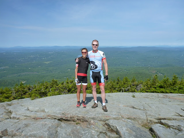
Summit photo with Victoria. Saw one other hill climber make it up here.

The 50+ podium

The rock scramble on Lincoln Trail. Some of these giant rocks were loose.
Creepy, as it seemed if you moved the wrong one, 1000 tons of rocks would
crash down on you.

Heading northeast on the Barlow Trail.

Part way down the Barlow Trail looking northeast.

Monday, August 24, 2015

Osceola - hiking weekend #8

Not willing to give up on the streak of doing a big hike every weekend, on a whim I headed to the Whites on Sunday. I wasn't fully sure what I was going to do. Had an hour on the highway to think about it before the first potential exit.

While it was misty and wet at home, there was lots of blue sky showing up north. Not quite clear enough for a Franconia Ridge hike, so I decided to give Mt Osceola a whirl. Didn't know anything about it, other than I vaguely remember a friend recently taunting me to try the east side. I like loops, so I thought an up and over, coming back on Tripoli Rd would make a great ~13 mile loop.

Heading out from the Livermore trail head, I found Greeley Ponds path to have been fully reconstructed since storms destroyed it several years ago. Would be awesome if Waterville groomed that for skate skiing. In no time I reached the ponds. That meant the real climbing would begin.

The east approach was wicked steep. I like it when you go up almost as much as you go laterally. Puts a lot of vertical under you in a hurry. Was fair amount of hands and feet, and being cool but quite humid out, I sweat profusely. So profusely in fact, that sweat plugged the barometric sensor port on my wrist-worn GPS and I stopped getting credit for my vertical.

Elevation can actually be an important navigational aid. Say a storm is moving in. If you are near the peak, you may have time to bag it and get back down. But if you have 1000ft of vertical to go, best bet is to cut your losses and head back. With tree or cloud cover, you can't always tell visually how much further to the summit. The GPS fills in that gap. Since I had never done Osceola before, I had no idea what lie ahead, just that the summit was around 4200ft. But I didn't know right away my GPS was stuck on 3100ft and I though dang, I still have 1000+ feet to go? Then I started going down. I had already crested the east peak. Silly to rely on electronics that much...

Then I came up to this crevice that a young couple was coming down. You gotta be shitting me! They're doing that without ropes? I later learned that feature is call "The Chimney." Almost felt like climbing up a chimney. Just don't look down! It actually wasn't that scary once on it. The hand and foot holds where quite good.

There was some very nice hiking along the ridgeline to the main peak. Views were limited through the scrubby fir trees. Before I knew it, I heard voices and the trail opened up to a bare ledge with a grand view.  The cloud deck was getting lower, many peaks in all directions were now socked in. I made it up just in time. A few photos and I was on my way down the west side.

The gradient on the west side was much less severe. Rocks all the way down though. I brought poles which help prevent ankle rolls, so I did not put on my ankle braces. Total elapsed hike time was about 4.8hrs. I finished the hike with an ice soak in Osceola Brook. Doesn't matter what time of year or how warm it's been, mountain streams are always frigid. Wonder if I should hit Hyndman Peak in Idaho in a couple weeks...

New and improved Greeley Ponds Trail. Have to hit this with a bike!

Lower Greeley Pond.

A rock slide scramble on Mt Osceola Trail.

Looking north(ish) from near the east peak. Probably some of the Pemi Wilderness in there.

Top of The Chimney. Pretty near vertical.

From Mt Osceola summit, looking at Waterville Valley village.

Mt Osceola summit ledge, looking at ridgeline I just traversed. The Chimney is
the steep rocky bump-up in middle of ridge.

Asked a woman to take photo. She was scared for me and didn't want to get any closer
to edge to capture some of it. Just barely below cloud deck.

Ice bath. I reluctantly include this one as I know it will give Rich at work
Photoshop fodder.

Tuesday, August 18, 2015

A different kind of gap ride

I would be remiss if I didn't post on a ride Paul and I did last weekend. Paul architected the route, borrowing portions from Adam's Irreverent Road Ride and distilling the loop into a pure climbing fest with other big gaps like Lincoln Gap and Roxbury Gap. The result was 9000ft of climbing in just over 100km.

A few sections of the route, neither of us had been on. We trusted the IRR folks wouldn't do something too irreverent with road bikes, right? Should have read the description a little more closely of how the IRR came to be.

Starting in Roxbury, we immediately began climbing on W Hill Rd. I was telling Paul how it felt like another road I ride VT, saying beware when the power lines end. The power lines on these Class IV roads end at the last house, and road maintenance also ends. Sure enough, the power line stopped and the route immediately became more interesting. The climbing plateaued and the "road" turning into saturated black loam with 1-2ft deep water filled jeep ruts. IRR is sending road bikes down this a day after our ride? We had 38mm and 40mm tires on our cross bikes and couldn't ride parts of it. In one cesspool, nearly my entire front wheel submerged into the goo. Four miles into the ride, our bikes were trashed.

The next mile and a half were on and off the bike. Mostly on, but we could never trust the water holes. Did not want to endo into that stinky quagmire. I'm pretty sure I took two years off my rims as we began descending and the surface became gravel again. Fortunately, part way down there was a stream crossing in which to salvage the bikes. What would the next road on the other side of Rt 12A bring?

The next dirt climb, Cram Hill Rd, was much better. Gained a bit more than the first, about 800ft vertical. The descent on Connecticut Corners and Threshee roads was quite nice.

These first two climbs where just a warm up for one of the main attractions: Braintree Gap. This is another Class IV town road. I've ridden it once before from west to east, now we were hitting it east to west. I thought it was tough on a mountain bike last time, now we had skinny higher pressure tires, no disk brakes, and not nearly as low of gearing. Was it even rideable?

Turns out it was, but it was 30+ minutes of pure suffering. The doubletrack became increasingly rough and loose as the gap was reached. Much of the climbing was at a 15% grade and portions were steeper. The descent is what I feared though. I didn't clean it on a MTB last time, and it was strewn with tree debris and mud. Now we were going down that on cross bikes?

It wasn't that bad either. I think a couple sections might have been worked on, as I didn't notice the exposed ledgy sections that gave me grief when climbing that side last time. Sure was a waste of vertical though, death grip on the brakes the whole way. Continuing the descent to Rt 100 on open and closed gravels roads was much more like it, WFO at times.

We had hoped to re-supply in Hancock, but the general store there closed shop! It was fairly warm and a bit humid. My two bottles were already depleted. Fortunately we were able to fill bottles with water at the inn across the street, but I gathered maybe many before us had done the same. We left a tip.

Next up was Middlebury Gap, a paved up and over that I've done many times from both directions. Just grind it out and get it done. We re-supplied at the Ripton store on the other side, halfway down where we turned off to begin the next, new to us, dirt climb. Interestingly, everyone we met asked how far we were going and told us rain was on the way. I was sweating so much I would have welcomed rain.

I liked the next road, the Natural Turnpike. It turns into a well maintain seasonal forest service road. Because it passes through undeveloped land, it stays in the forest with no views. Paul didn't like it that much because of this. But it was a 1000ft climb on dirt road with no cars. The descent was unlike the others too, where a little work was needed to top out the speed. Because of tree cover, we couldn't see in Google maps if this road was going to be like the first one we hit. But after we crested the high point, all concerns were put to rest.
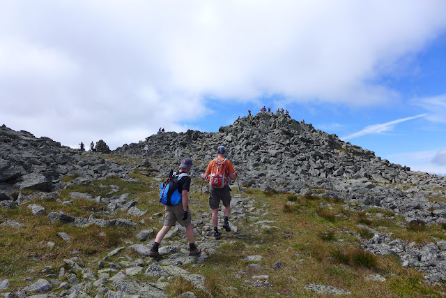
Even though many humps had been crested already, we still had two more really big ones to go. Next up was Lincoln Gap. I've never done this one from the west. I worried about brakes overheating on the east side 20-25% descent. The west side climb is no picnic to climb either. The grade tops out around 18-20% near the top. That did some damage. The plan was to drop down into Warren, resupply a last time, then hit Rox.

Paul seized up getting off the bike at the Warren general store. Hmm, that is usually me on rides like this. Maybe the potassium I started adding to my drink mix is working. Maybe all the weight bearing hiking I've been doing lately his helping. Who knows. We just had to get over one more hump, then it was literally all downhill back to the car.

I was dismayed to pass the "Pavement Ends" sign on Roxbury Gap only to find brand new asphalt where there used to be gravel. I asked a walker right there if it was paved all the way to the summit now. Yep. Bummer. From the summit most of the way down the east side is still gravel though. I suspect it won't be long.

I finished with exactly 5hrs moving time on my Garmin. Paul expected a faster average than that, but the long quagmire section really pulled that down. Still a great loop though, one I'd do again in a heartbeat with one tweak: cut out the muddy W Hill Rd section by dropping down Oxbow Rd to Rt 12A. That pops out very close to the next dirt road climb across Rt 12A. There's certainly no shortage of route possibilities here. This was probably the highest climbing density ride I've done on a road or cross bike.

Starting out on W Hill Rd. Still have power lines, so all is good.

Lost the power lines, now not all looks so good.

Ruh-Roh!

Sometimes your front wheel would just disappear into the abyss.

You just don't chance that with almost 5hrs to go!

Lucky to have conveniently placed stream for bike wash.

My bike all clean again.

North on Rt 12A to pick up Cram Hill Rd.

Connecticut Corners Rd descent.

Paul cresting Braintree Gap.

Myself coming down Braintree Gap.

Natural Turnpike near bottom on north end. I think that is Lincoln Peak in the distance,
which I mountain biked to the summit of a few weeks earlier.

Looking down the east side of Roxbury Gap, which is still gravel.

Paul at summit of Roxbury Gap, Recycle those streaming electrolytes!

Sunday, August 9, 2015

Presidential Traverse: A different kind of wrecked

Earlier this summer, Mark Suprenant (Soups) extended an invite to hike the Presidential mountain range in the White mountains in a day. I dearly love wide open ridge line rides out west. We have only a few extended ridge lines above tree line in the northeast, and this was the grand daddy of them all. Even if bikes were allowed up there, it would be utterly unrideable. The only way to experience it is on foot. So for lack of better judgement, I told Soups I was interested.

In June, a weekend was picked for the traverse. Soups, having nearly completed all 48 4000 footers in NH in the past year at that point, was already a seasoned hiker. Other seasoned hikers were on the invite list too. I hadn't hiked in a year. I know how DOMS (delayed onset muscle soreness) can be for a cyclist after even a modest hike. Now I was looking at an all-day hike with pros. This freaked me out more than a little bit.

So I made a point over each of the five weekends remaining to get a hike in. I hit the Tripyramids first. That nearly killed me, both literally and figuratively. Only 3000ft of climbing, and more importantly, descending, left me crippled for days. Four weekends left to build conditioning to do a hike several times more punishing. Panic set in.

I upped the ante over the following weeks, inducing DOMS that left me hobbling at the office on Monday mornings like I was 40 years older than I am. But the last weekend before the presi-traverse, I did 4500ft of vertical on steep Mt Monadnock with zero DOMS afterwards. That was encouraging. Now I just had to double the elevation and double the distance!

Getting up at 3am for a 6am rendezvous in the Whites sucked. I did sleep though. At least the forecast was not adding to pre-hike jitters. It was expected to be an ideal day. Mostly clear, temp into the 50's at elevation, very little chance for rain. You still have to pack for the worst though. People have died from exposure in the Whites in August.  I bought a large hydration pack with enough room to hold winter layers, emergency bivy, first aid kit, more than enough food for the traverse, and of course three liters of water. I have never hiked or biked with so much weight slung over my back.

Soups, Tim Lucia and I began our hike at 7am in Appalachia on the Valley Way trail. The 3500ft gain to Madison Hut went by in no time. I felt good. At least I had the sense to not bury myself on the bike during the week. From the hut, a spur is taken to summit of Mt Madison. We go up that?! Where's the trail, I thought to myself. There was a lot of traffic from folks that started their day much earlier. The view from the summit provided a different perspective on Mt Washington, which I've climbed so many times by bike.  Interestingly, almost half the day's climbing was complete after bagging that first peak. That didn't matter to me. Almost none of the day's descending was complete. It was the 8000+ feet of descending continuous rock garden that was going to destroy me, rock by rock.

Mt Adams was next and it looked even more formidable. Not having been to any of these peaks except Washington, I saw a trend emerging. Hike a thousand feet up a massive rock pile, descend, repeat. Above tree line, the continuous post card views kept the mind off how badly my body was going to deteriorate before the end.

Looking at the profile for this hike, each summit appeared as a little bump. That is so deceptive though, because those little bumps are scaled by the 3000ft just to get up here. Each little bump took more than an hour to go up and over, often requiring at least some hands to scramble the steepest parts.

Mt Jefferson was the next peak, going even higher than the first two. So far I was feeling pretty good, but after the descent from Jefferson, my knees were starting to feel a little wobbly already. Even though more than half of the climbing was behind his, we barely made a dent in the descending.

Mt Clay was next, another tough climb, with fortunately little descent on the back side. The whole time, the Mt Washington summit loomed before us. Finally, we began to tackle this one as we hugged the rim of the Great Gulf Wilderness.

The summit of Mt Washington was a circus. I thought on the bicycle race day things were busy up there. Nope. With two cog railroad trains running and steady stream of cars and motorcycles heading up, Soups likened it to "the mall at Christmas." Just nuts. Fill our water and get out of there.

Unfortunately, it was a bit of a conga line dropping down to the Lakes of the Clouds hut. Mostly tourists who didn't have the "trail awareness" that more experienced hikers have. Still good to see people getting outside and off their butts. The entire south Presidentials were visible from the south face of Mt Washington. It looked so tame, like almost no elevation change and smooth. The scale of how far down the ridge you see dupes one into believing it's going to be easy.

Serious knee and ankle fatigue was setting in. I brought my ankle braces along and had planned to put them on at the Washington summit, as that's when the descending elevation change begins in earnest. But I wasn't having trouble with my ankles turning, and those things cause hot spots all around my feet, so I left them off for the time being. I did hike with two poles, the first time this summer. Even though they got in the way on the steepest parts, the poles were proving to be a huge help in stability and in taking some of the pressure off my knees dropping down big steps.

Only three peaks remained, Monroe, Eisenhower and Pierce. Once away from the Lakes hut, the crowds thinned out considerable. There were times we could see no other people on the stretched-out ridge line before us.  I didn't like the fact that each time we climbed, we had to descend that same vertical over again. The climbing was fine, the descending was getting more and more tedious for me. I took two Aleve in hopes of easing knee and ankle pain. Soups and Tim were gapping me on the descents.

We finally reached Mt Pierce. The view back towards Mt Washington was pretty sweet, with how the sun was hitting it. From here, it was all downhill back to the car. Tim was saying this like it was a good thing. I would have much rather climbed 2500ft from that point back to the car than descend 2500ft back to the car! Soups was saying, "don't worry, it's a really easy grade." Yeah, right. It was not steep, but the entire 2500ft was wet baby head rocks! Soups was like "but it wasn't like that this past winter." Yeah, with six feet of snow on the ground. How I survived that without face planting, rolling an ankle or just stopping to cry for while is beyond me.

I would never have thought the sound of motor vehicles would be music to my ears as we approached Crawford Notch on Rt 302. We finished with sunlight to spare. The hike covered about 19 miles in 11.4hrs total elapsed time with 8600ft of climbing. I'd say that that was the hardest one-day activity I've done, as far as pushing through physical discomfort. It is a different kind of wrecked than what a hard bike ride leaves you in. The hike was never taxing in a cardiovascular sense. It taxed my all my joints, even my shoulders, as I became increasingly reliant on the poles toward the end. Still though, it was my most rewarding day in the White Mountains to date.

Soups climbing Mt Madison with Madison Hut below

Myself on Madison with Washington in background

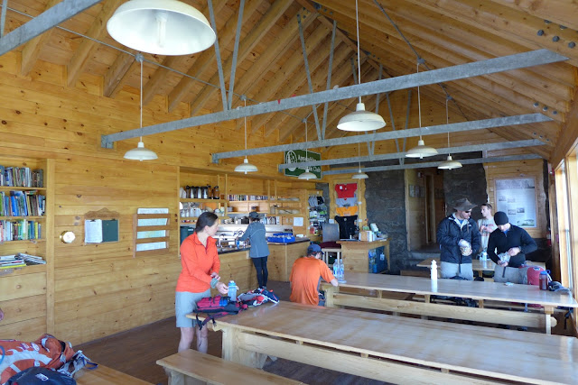
Inside the Madison hut

Soups and Tim heading up Mt Adams

Mt Madison from Mt Adams

Mt Adams summit with Washington obscured by cloud

Thunderstorm Junction

Tim heading up Mt Jefferson

Approaching Mt Jefferson Summit

Mt Jefferson with Mt Clay and Mt Washington in background

Heading to Mt Clay

Looking back at what we covered so far

Soups on or near Mt Clay

The Great Gulf Wilderness

Tim and Soups approaching summit of Mt Washington

Tim overlooking Great Gulf Wilderness

Soups gazing into Great Gulf Wilderness

Line of tourists waiting just to have picture taken a the Mt Washington summit sign. Photo only counts if you hiked or biked up here!

Conga line from Mt Washington summit to Lakes of the Clouds hut. Whole southern Presi's
in this shot.

Approaching Lakes hut.

From Lakes back at Mt Washington

Tim and Soups at Mt Monroe with Dry River Wilderness below. I thought this was
 the best view on the traverse.


Two more to go, Eisenhower and Pierce.

Grades were tempered along the southern Presi's, but footing was never easy. Looking
back over Monroe with Mt Washington in distance.

Eisenhower and Pierce in distance. Finally away from the masses.

Looking back at Washington.

Tim and Soups on way to Eisenhower.

Last summit, Mt Pierce, looking back at the southern Presidential range.