I did the Mt Greylock Hillclimb TT on Saturday. A record number of folks turned out for this well run event on a pristine day. For once, it was not too hot, too cold, too wet or too windy. It was just right. Should be PR conditions, right? That's not exactly how it went down.
Late in the week I was fighting a scratchy throat, not getting enough sleep and dealing with a lot of frustration at work. I had to get up extra early on Saturday due to road closures on the way to Mt Greylock. Needless to say, I felt less than stellar. It didn't matter. It was going to be nice, and I hoped to ride more after the TT.
I got in a decent warmup before lining up for my 10:28:30am start. A rider goes up every 30 seconds. Wouldn't you know it, I was DaveP's 30 second guy. He's been PRing most of his climbs this season, and the way I felt, I thought surely I'd go out too hard and he'd pass me in the last mile.
The climb starts very steeply. In fact, there is some 17% grade in the first mile. Then you get some downhills where the big ring is needed, before the climbing resumes. There is a lot of 10-12% grade in this climb. The summit is reached 9.1 miles from the start.
Once I got into my rhythm, I felt ok. I think I handled the start well and did not go out too hard. John and Pamela on the tandem were staged a couple minutes ahead of me. I gained on them during the initial steep section, but dang if they weren't hard to catch through the rollers. I bet they went well over 40mph on the two downhills, while I max'd out at 35mph. But when it got steep again, I finally passed them. Once was not enough for John. He first solo'd up as one of the first time-trialists, descended, then teamed up with Pamela on the tandem. Impressive. That would be a surefire way to end my marriage if I tried that with Cathy.
I passed oodles of people on the way up. I recalled from last year, just weeks out of a cast, reaching the hard left hand turn in 40min, 30sec. I figured I should be able to do that in 40 minutes flat this year on such a perfect day. But as I approached the turn, 40 minutes came and went. I rounded the corner in EXACTLY the same time as last year. Last year, I buried myself from that point on to PR this climb in a fraction of a second under 44 minutes. Could I do that again this year?
I tried. I just didn't have that VOmax snap I had in my legs like last year. It took me 3:30 to finish that last half mile or so last year, and I think I did a good chunk of it out of the saddle. This year, it took me 3:54 to cover that last part to finish in 44:24. A solid 2nd best effort, but I was somewhat bummed to climb the first 95% of the climb in the same time as last year, but then go 11% over in the last 5%.
Not surprising, really. My training has been dysfunctional at best this year. I think running is mostly to blame, but travel and work schedules have thwarted many intensity workouts. In fact, I can count on one had the days I've gotten in quality interval workouts this year. Most of my riding has been the "junky middle" kind of riding. The junky middle is often the most enjoyable riding though. Trips to Arizona, North Carolina, Italy and Colorado this year have all gone well. I will remember these trips far longer than some race result. Not all is lost by failing to maintain a certain structure in training.
Running has been a big experiment. I hope to find out in the next month or two if my bone density has improved. The doc said go run and check back in a year. It will be a year in December, but I will probably jump the gun a bit on that. Running has impacted my cycling training by eliminating honest recovery days. I run on what traditionally were my complete rest days or active recovery days. The deal is, even an easy five mile run beats you down. At least it does for me, as I'm not running 30 miles a week. I'll ride hard or race all weekend. A rest day is really needed on Monday. But no, I run. Then come Tuesday, my intervals day, my legs feel like poo. Sometimes I attempt intervals, only to shut them down early or half-ass get through them. I used to cherish these sessions, as huge gains come from modest time commitment.
I need to re-assess what I want to do next year. I'll be able to race in Masters 50+. Be nice to win a race or two. That won't happen if I continue with my current workout regimen. If my bone density scan shows little or no improvement, running will clearly be out of the picture and I'll have to find some other means of corrective action. But I suspect there will be a marked improvement. Then what? I could shift my focus to duathlons. I believe I could easily become a competent runner if I ran more than one hour per week that I have been. My triathlete friends insist I've been going about it wrong this season. I should be doing my bike intervals and running on the same day. That would leave a day or two per week open for true recovery. I can only imagine what a five mile run would feel like after one of my VOmax sessions on the bike. If I want to be a bike first, run second kind of guy next year, that may be what I have to do. But...
I hung around up top Mt Greylock for a while chatting with hillclimb enthusiasts. Time went by quickly, and my sense of well being went downhill. I was definitely coming down with something. I decided to bag riding a loop over Petersburg Pass, get some free lunch at the bottom and call it a day.
Later that evening, I felt the day wasn't yet complete. I ran only once this week, a relatively short 4.2 mile run. I decided I would go out for a run, a trail run. I hadn't yet run on a rough off-road surface. The Mines Falls run I did earlier this summer was on a well groomed dirt path. A loop I had in mind from my house went four miles on gnarly ATV trails. I put both ankle braces on and had no idea if I could even run in those things.
I got into the woods and I first thought, wow, this isn't that hard. I was pretty confident I would not be able to roll an ankle to point of injury with the braces on, but I could easily trip on a root or Irene dead fall and bash a kneecap. My loop was very hilly. I went uphill faster than downhill. I was amazed at how easy it was to run up the steep gnarly bits compared to riding up them on a mountain bike. It was like running uphill took no additional effort over running on level trail. On a bike, you really feel the ups.
I crested the top of Seavey Hill and dropped back down to my house. Even though I was sick and my legs hurt from Greylock, that was actually quite enjoyable. I could easily get into more of that. There are many areas not reachable by bike (like wilderness) that could easily be reached by running. I watched a movie with my wife after the run. I could barely walked after the movie. It appears running on rocks and roots uses a lot of muscles that don't come into play running on flat pavement. The ankle braces didn't seem to have much negative impact on my mobility. No chaffing. I have trails close to the office that may need to be sampled on foot this week.
Sunday, September 11, 2011

Monday, September 5, 2011
Junction Creek Loop
Friday's forecast was somewhat improved with only 30% chance of afternoon thunderstorms. I really wanted to do a Telluride/Ophir loop on this trip, but legs and weather were too iffy to risk it. Instead, I opted for a slight variant of a ride I did a couple years go: Junction Creek.
This ride is a quintessential Hill Junkie ride. A 4000ft climb on dirt FS-171 right from town takes you to the upper trail head of the section of the Colorado Trail called Junction Creek. 20+ miles up, then 20 miles all singletrack down. Except it is not all down. Somehow I always seem to forget the climby bits on these epic descents. On the way down, one climbing section involved nearly 1000ft gain with a bunch of hike-a-bike. The descent can be quite bony and steep in spots too.

I started riding quite early, since I didn't have to drive to this trail head. I soon realized that some of the previous night's spicy Mexican food was not going to wait until I got back from the ride. Thank goodness there was a pit stop at about 9000ft by the Animas Lookout on FS-171. Pine needles would have made for nasty toilet paper.
I plodded along on the dirt road climb at light to moderately aerobic pace. Progress seemed slow, but later when I checked my climbing time from 2009, I was within a minute and started several blocks further away, so not any slower than 2009.
Approaching the upper trail head, there was a horse camp. A large tent, trailers, even a small electric fenced in corral. There were also a few border collies there. The horses were tethered to the trailers right along side the jeep road. All the animals went berserk as I went by. The collies would have none of it, as clearly I was loose and should not be escaping. Despite screaming from the owners, one dog was intent on not letting me ride away. He grabbed a hold of my heel while I was pedalling. Glad cycling shoes have stout heel cups. My mother later asked me "weren't you terrified?" Nope. I've lived near border collies for many years in Michigan. They are not mean but can appear menacing when giving chase. I shrugged the incident off. Dogs should be allowed to run free at 10,000ft and 20 miles from the nearest house.

I realized I had eaten nothing during the 2.5hr climb and drank only one water bottle. Yeah, that's right. Water bottles. When preparing my Camelbak in the morning, the tube attachment area burst just as I was heading out the door. Stickiness all over my chamois and hotel room floor was the result. I scrounged up four bottles in the room, two of them small airport bottles with screw caps. That was less water than I anticipated needing but the best I could do. Four bottles stuffed in a Camelbak makes for a lumpy, uncomfortable backpack. I had no cage to put on the frame.
I began the singletrack descent. It starts out with a lot of up and down. It felt more up than down, actually. Eventually it starts dropping earnestly into the Junction Creek gorge with a vengeance. I hoped the new pads I put on held up.

Besides the climbing on the descent, the other thing I forgot about this descent was how exposed it was. I'd say 50% of the upper half is highly exposed. A fall in these areas could easily result in sudden death. Drops of 100ft or more were everywhere, and the trail was very narrow. Great care had to be taken to not clip a rock with the uphill side pedal, resulting in a immediate launch over the edge. The exposure was so persistent, I got used to it after a while. Probably not a good thing. Considerable focus was needed riding this trail.

After crossing the bridge over Junction Creek, the big climb brought me back up to about 9600ft elevation. There were sections greater than 20% grade that my sea level hematocrit could not ride. So far, the weather was holding up. Rain would be a disaster, as there is only one way back down to town. The soil here had a red clay base. A few areas were still a bit greasy from rain presumably the evening before.
While climbing at about 3.5mph, something suddenly started crashing through the brush just to my right. It was a black bear! Crap, was he close. Fortunately he heard me first and started bolting uphill. It was a near shear drop to my left. My only escape route would have been on skinny trail steeply up in the direction I was going or to stop, dismount, and point my bike back down. If I had to do either, I would have been bear bait.
On Wednesday's rainy ride, I passed two female hikers early in the ride. They commented how quiet I was and that they didn't even hear me coming. I said "that's scary, bears won't hear me coming either." That's one of the risks riding alone and not wearing a bell. Does anybody even wear bells in Colorado, or is that just an Alaska thing?
From the intermediate high point of Junction Creek, there are miles and miles of high speed bombing. It looked like an old logging road with narrow ribbon of singletrack down it. I feared it wouldn't lead back to town and I had to climb back up it. People drop down the wrong side of ridge lines all the time out here and need rescue. The trail went more south than east and had me worried for a bit. Eventually I reached the junction with Dry Creek trail. In 2009, I took Dry Creek, then Hoffheins trail back up to the Colorado Trail. This time I wanted to stay on the CT to minimize climbing, but I really didn't know what this few miles section would entail.
It turned out this section nicely contoured for a while before beginning more high-speed descending. Lots of waterbars and rocky chicanes required attention. My water was nearly gone when I finally reached Gudy's Rest, a nice viewpoint before beginning a serious set of switchbacks down the gorge wall. I encountered other riders and hikers in this area. During the rest of my descent, I encountered only a solitary backpacker.
I was happy to reach FS-171 again without rain or any serious mishaps. The cumulus clouds were getting darker on the bottoms. It was a 4-5mi gradual downhill back into town on dirt and paved road. Not more than two minutes after getting back to the hotel, thunder broke out with rain. I had to pack my bike up under the hotel lobby car port. I just nicely had enough time to box it up and drop it off at FedEx on the other side of town.
This loop went 48 miles with upwards of 6000ft of climbing in 5.3hrs moving time. It max's out around 10,600ft and does not go above treeline, but there are nice views on the upper portions of the road climb.
That's it for Colorado this year. Over 30 hours of moving time in 6 days destoyed me. That is probably a record amount of riding for me. I hit many new trails in Cortez, Salida and Horse Gulch in Durango. DaveP has been to Colorado with me. Need to get him and Alex out here next year, maybe go a week or two later in hopes of slightly cooler weather and less risk of afternoon thunderstorms. Need some of those afternoon hours to get 5-6hr rides in, you know...
This ride is a quintessential Hill Junkie ride. A 4000ft climb on dirt FS-171 right from town takes you to the upper trail head of the section of the Colorado Trail called Junction Creek. 20+ miles up, then 20 miles all singletrack down. Except it is not all down. Somehow I always seem to forget the climby bits on these epic descents. On the way down, one climbing section involved nearly 1000ft gain with a bunch of hike-a-bike. The descent can be quite bony and steep in spots too.

The day and climbing started off nicely.
I started riding quite early, since I didn't have to drive to this trail head. I soon realized that some of the previous night's spicy Mexican food was not going to wait until I got back from the ride. Thank goodness there was a pit stop at about 9000ft by the Animas Lookout on FS-171. Pine needles would have made for nasty toilet paper.
I plodded along on the dirt road climb at light to moderately aerobic pace. Progress seemed slow, but later when I checked my climbing time from 2009, I was within a minute and started several blocks further away, so not any slower than 2009.
Approaching the upper trail head, there was a horse camp. A large tent, trailers, even a small electric fenced in corral. There were also a few border collies there. The horses were tethered to the trailers right along side the jeep road. All the animals went berserk as I went by. The collies would have none of it, as clearly I was loose and should not be escaping. Despite screaming from the owners, one dog was intent on not letting me ride away. He grabbed a hold of my heel while I was pedalling. Glad cycling shoes have stout heel cups. My mother later asked me "weren't you terrified?" Nope. I've lived near border collies for many years in Michigan. They are not mean but can appear menacing when giving chase. I shrugged the incident off. Dogs should be allowed to run free at 10,000ft and 20 miles from the nearest house.

One of many views heading up FS-171. Probably above 10,000ft here.
I realized I had eaten nothing during the 2.5hr climb and drank only one water bottle. Yeah, that's right. Water bottles. When preparing my Camelbak in the morning, the tube attachment area burst just as I was heading out the door. Stickiness all over my chamois and hotel room floor was the result. I scrounged up four bottles in the room, two of them small airport bottles with screw caps. That was less water than I anticipated needing but the best I could do. Four bottles stuffed in a Camelbak makes for a lumpy, uncomfortable backpack. I had no cage to put on the frame.
I began the singletrack descent. It starts out with a lot of up and down. It felt more up than down, actually. Eventually it starts dropping earnestly into the Junction Creek gorge with a vengeance. I hoped the new pads I put on held up.

Exposure. Note trail at bottom of gully in lower left of image
amost 100ft straight down. A slip over the edge here would ruin
your ride.
Besides the climbing on the descent, the other thing I forgot about this descent was how exposed it was. I'd say 50% of the upper half is highly exposed. A fall in these areas could easily result in sudden death. Drops of 100ft or more were everywhere, and the trail was very narrow. Great care had to be taken to not clip a rock with the uphill side pedal, resulting in a immediate launch over the edge. The exposure was so persistent, I got used to it after a while. Probably not a good thing. Considerable focus was needed riding this trail.

The falls on Junction Creek trail. Just a trickle today.
After crossing the bridge over Junction Creek, the big climb brought me back up to about 9600ft elevation. There were sections greater than 20% grade that my sea level hematocrit could not ride. So far, the weather was holding up. Rain would be a disaster, as there is only one way back down to town. The soil here had a red clay base. A few areas were still a bit greasy from rain presumably the evening before.
While climbing at about 3.5mph, something suddenly started crashing through the brush just to my right. It was a black bear! Crap, was he close. Fortunately he heard me first and started bolting uphill. It was a near shear drop to my left. My only escape route would have been on skinny trail steeply up in the direction I was going or to stop, dismount, and point my bike back down. If I had to do either, I would have been bear bait.
On Wednesday's rainy ride, I passed two female hikers early in the ride. They commented how quiet I was and that they didn't even hear me coming. I said "that's scary, bears won't hear me coming either." That's one of the risks riding alone and not wearing a bell. Does anybody even wear bells in Colorado, or is that just an Alaska thing?
From the intermediate high point of Junction Creek, there are miles and miles of high speed bombing. It looked like an old logging road with narrow ribbon of singletrack down it. I feared it wouldn't lead back to town and I had to climb back up it. People drop down the wrong side of ridge lines all the time out here and need rescue. The trail went more south than east and had me worried for a bit. Eventually I reached the junction with Dry Creek trail. In 2009, I took Dry Creek, then Hoffheins trail back up to the Colorado Trail. This time I wanted to stay on the CT to minimize climbing, but I really didn't know what this few miles section would entail.
It turned out this section nicely contoured for a while before beginning more high-speed descending. Lots of waterbars and rocky chicanes required attention. My water was nearly gone when I finally reached Gudy's Rest, a nice viewpoint before beginning a serious set of switchbacks down the gorge wall. I encountered other riders and hikers in this area. During the rest of my descent, I encountered only a solitary backpacker.
I was happy to reach FS-171 again without rain or any serious mishaps. The cumulus clouds were getting darker on the bottoms. It was a 4-5mi gradual downhill back into town on dirt and paved road. Not more than two minutes after getting back to the hotel, thunder broke out with rain. I had to pack my bike up under the hotel lobby car port. I just nicely had enough time to box it up and drop it off at FedEx on the other side of town.
This loop went 48 miles with upwards of 6000ft of climbing in 5.3hrs moving time. It max's out around 10,600ft and does not go above treeline, but there are nice views on the upper portions of the road climb.
That's it for Colorado this year. Over 30 hours of moving time in 6 days destoyed me. That is probably a record amount of riding for me. I hit many new trails in Cortez, Salida and Horse Gulch in Durango. DaveP has been to Colorado with me. Need to get him and Alex out here next year, maybe go a week or two later in hopes of slightly cooler weather and less risk of afternoon thunderstorms. Need some of those afternoon hours to get 5-6hr rides in, you know...
Friday, September 2, 2011
Thursday's Double Treat
Colorado Trail
The probability of T-storms was high on Thursday. I didn't want to suffer another debacle like Wednesday's ride. I broke with Hill Junkie protocol (again) and shuttled a ride. This time the net advantage was only a thousand feet or so. My favorite section of the Colorado Trail to date is the section from Molas Pass to Coal Bank Pass. It is almost all above tree line and hovers around 11,000-12,000 feet. Normally I park at the bottom of Engineer Mountain Trail and work my way over to Molas Pass via Old Lime Creek Rd, a rough jeep road east of of Hwy 550. But with Thursday's forecast, there was an exponential increase in the risk of getting caught in the great wide open in another deluge. So I went for the low hanging fruit and skipped the human propelled shuttle.
The women wanted to hike up to Engineer Mountain. It is a very popular hike just off Hwy 550 from Coal Bank Pass. In just 2.5mi, you gain incredible views. The plan was the women would drop me off at Molas Pass, drive back to Coal Bank Pass to hike, then drive back down to the bottom of Engineer Mountain Trail to pick me up. With any luck, we'd get there at about the same time.


Unfortunately, I learned later that Cathy just doesn't tolerate altitude well. They did not get far into the hike at all before having to turn around. Earlier in the trip, my mom noticed that Cathy's lips were a tad blue on the summit of Pikes Peak and Cathy was not altogether with it at 14,000ft. But even at 11,000ft, she has trouble. That was too bad, as the view from Engineer Mtn is one of the best.

I felt I was making pretty good progress on the Colorado Trail. I had ridden this section once before and knew what to expect and where the good photo ops were. I wanted to keep moving to beat the rain. It didn't take long for cumulus clouds to begin forming. I hate being rushed in a ride, but I had to at least reach Engineer Mtn Tr before any threatening weather formed. There was no other way down.

I always seem to "forget" the challenging parts of these rides. The descent from Jura Knob involved a lot of hike-a-bike. Then again beginning the initial climb towards Engineer Mtn. With a hard week of riding in my legs, it took considerable mental fortitude to keep pushing.
I hadn't seen another person in over an hour. Suddenly, I hear a thump, thump, thump right behind me. I turned to look in terror, expecting some massive beast ready pounce on me. It was a runner right on my wheel. I thought I was doing well, but no. I thought about asking him if he had a few hematocrit points he could sell me. This was well above 11,000ft.
I reached the saddle at Engineer Mountain. Amazingly, there was cell phone coverage there. I called Cathy to give her an ETA. That is when I learned they did not make it too where I was now standing. There was a strong wind blowing through the saddle, the sun was still out, the temp mild, and the skies were still not very threatening. I could have relaxed up there all afternoon. I had the saddle to myself. Interestingly, there were people at the very summit of Engineer Mtn. It probably takes hours of rock scrambling to get up there from where I was. I would never have gone up there with the forecast. From town later, it did look like bad weather moved in.

The non-stop drop-dead views are not the only great part of this ride. The nearly monotonic 2600ft singletrack descent is another great part. It is my favorite trail descent. You pedal all of maybe 60 seconds in five miles of downhill bliss. It is steep in spots, bit rooty in others, but mostly just FAST.

I finished with 21mi, 3200ft of climbing, in about 3.4hrs of riding time. It was a perfect ride. The trails around here are very well maintained, thanks to groups like Trails 2000. No wonder Durango is such a riding meca. Heading back into town, we all felt a tad unfulfilled. The women rented bikes to ride the bike path end to end (where there's just enough air for Cathy), while I did a second ride from town.
Horse Gulch
I headed out via the switchbacks prominently displayed from the north side of town up to the college campus. Fort Lewis College sits on a mesa about 500ft above town with some great singletrack hugging the rim. It is nice little touches like this that makes me want to move here.

Heading east of the campus into the Horse Gulch trail system, I decided I felt good enough to venture further in than the last time I rode a token amount in this area two years ago. I rode out Telegraph Trail, not having any idea what to expect. It went up. A lot. The area is deserty and the soil is like baseball diamond grit. Really hard, really fast. I climbed up to the saddle where old telegraph poles still stand. I decided to take Crites Connect down, which merged into Carbon Jct Tr. This consisted of a four mile, beautifully contoured singletrack descent. Major score! I will have to do more riding in Horse Gulch the next time I visit Durango.

The trail deposited me out on Hwy 550 well south of town. It took some crazy risk taking during rush hour traffic to get across many lanes of Hwy 550 to pick up the paved Animas bike path. This follows the river nearly all the way back to my hotel.
Ride two for the day netted another 22.9mi with 1800ft of climbing in 2.3hrs. There were sprinkles in town during the afternoon, but I never heard thunder. The day with minimal chance it stormed almost all day, and the day with much higher probability of storms, it stayed mostly clear. Nearly 12 hours of high altitude riding in two days put me into a stupor. Kids pay good money to feel that way. We ate at Gazpachos for dinner. We were warned it was spicy, and it was. The spiciness nearly had me sweating into my food. I would experience discomfort on the saddle the next day. Superb Mexican cuisine. I highly recommend it. Have to wait until after I get back home to put something up on my last ride of the trip on Friday. Attacked by border collies, close encounter with a bear, and fear of death riding. Good stuff.
The probability of T-storms was high on Thursday. I didn't want to suffer another debacle like Wednesday's ride. I broke with Hill Junkie protocol (again) and shuttled a ride. This time the net advantage was only a thousand feet or so. My favorite section of the Colorado Trail to date is the section from Molas Pass to Coal Bank Pass. It is almost all above tree line and hovers around 11,000-12,000 feet. Normally I park at the bottom of Engineer Mountain Trail and work my way over to Molas Pass via Old Lime Creek Rd, a rough jeep road east of of Hwy 550. But with Thursday's forecast, there was an exponential increase in the risk of getting caught in the great wide open in another deluge. So I went for the low hanging fruit and skipped the human propelled shuttle.
The women wanted to hike up to Engineer Mountain. It is a very popular hike just off Hwy 550 from Coal Bank Pass. In just 2.5mi, you gain incredible views. The plan was the women would drop me off at Molas Pass, drive back to Coal Bank Pass to hike, then drive back down to the bottom of Engineer Mountain Trail to pick me up. With any luck, we'd get there at about the same time.
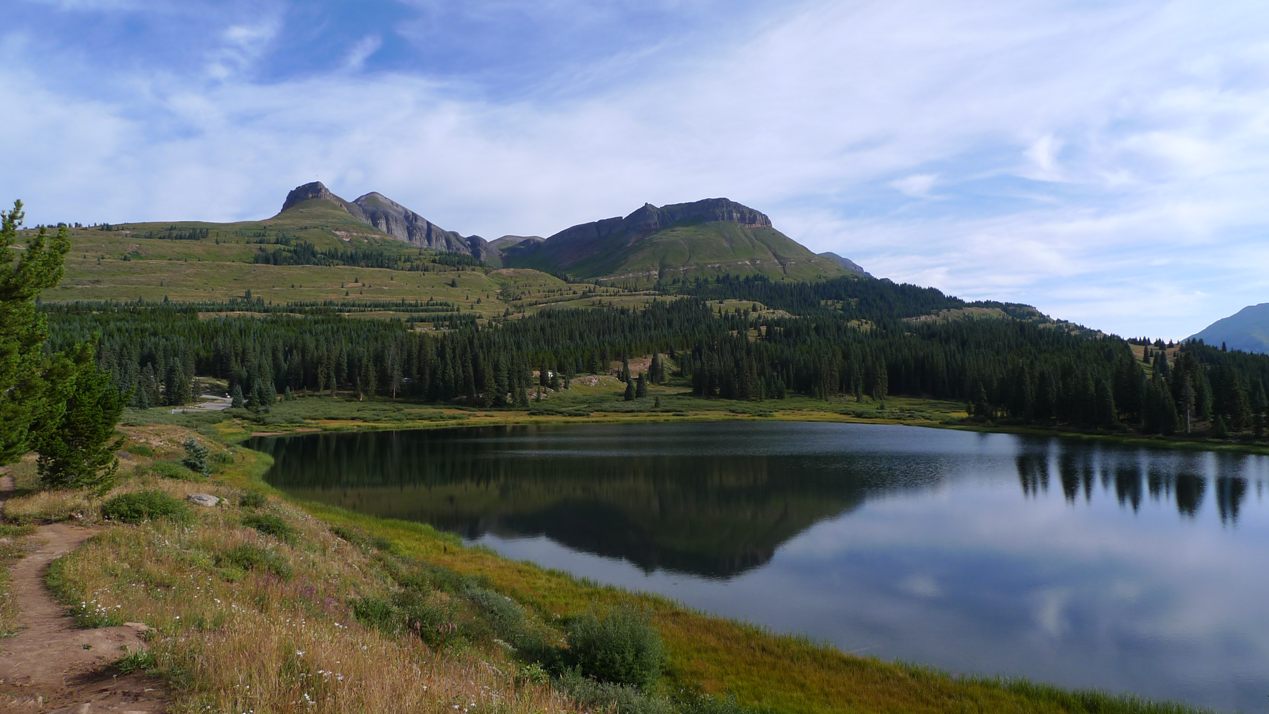
Starting out at Molas Pass

Wide open contour singletrack here. This is why I come to Durango.
Unfortunately, I learned later that Cathy just doesn't tolerate altitude well. They did not get far into the hike at all before having to turn around. Earlier in the trip, my mom noticed that Cathy's lips were a tad blue on the summit of Pikes Peak and Cathy was not altogether with it at 14,000ft. But even at 11,000ft, she has trouble. That was too bad, as the view from Engineer Mtn is one of the best.

Approaching Jura Knob at 12,000ft
I felt I was making pretty good progress on the Colorado Trail. I had ridden this section once before and knew what to expect and where the good photo ops were. I wanted to keep moving to beat the rain. It didn't take long for cumulus clouds to begin forming. I hate being rushed in a ride, but I had to at least reach Engineer Mtn Tr before any threatening weather formed. There was no other way down.

Looking south from Jura Knob. I believe that is Enginner Mtn
just poking into view on the left side of image. Hard to stay on
skinny ribbon with views like this.
I always seem to "forget" the challenging parts of these rides. The descent from Jura Knob involved a lot of hike-a-bike. Then again beginning the initial climb towards Engineer Mtn. With a hard week of riding in my legs, it took considerable mental fortitude to keep pushing.
I hadn't seen another person in over an hour. Suddenly, I hear a thump, thump, thump right behind me. I turned to look in terror, expecting some massive beast ready pounce on me. It was a runner right on my wheel. I thought I was doing well, but no. I thought about asking him if he had a few hematocrit points he could sell me. This was well above 11,000ft.
I reached the saddle at Engineer Mountain. Amazingly, there was cell phone coverage there. I called Cathy to give her an ETA. That is when I learned they did not make it too where I was now standing. There was a strong wind blowing through the saddle, the sun was still out, the temp mild, and the skies were still not very threatening. I could have relaxed up there all afternoon. I had the saddle to myself. Interestingly, there were people at the very summit of Engineer Mtn. It probably takes hours of rock scrambling to get up there from where I was. I would never have gone up there with the forecast. From town later, it did look like bad weather moved in.

From Engineer Mtn looking north. One of the grandest views
in Durango area.
The non-stop drop-dead views are not the only great part of this ride. The nearly monotonic 2600ft singletrack descent is another great part. It is my favorite trail descent. You pedal all of maybe 60 seconds in five miles of downhill bliss. It is steep in spots, bit rooty in others, but mostly just FAST.

The Engineer Mtn Tr cuts through many meadows on the way down.
You go so fast the colors of the flowers fuse into each other.
I finished with 21mi, 3200ft of climbing, in about 3.4hrs of riding time. It was a perfect ride. The trails around here are very well maintained, thanks to groups like Trails 2000. No wonder Durango is such a riding meca. Heading back into town, we all felt a tad unfulfilled. The women rented bikes to ride the bike path end to end (where there's just enough air for Cathy), while I did a second ride from town.
Horse Gulch
I headed out via the switchbacks prominently displayed from the north side of town up to the college campus. Fort Lewis College sits on a mesa about 500ft above town with some great singletrack hugging the rim. It is nice little touches like this that makes me want to move here.

From Rim Trail above town. Perhaps a little precip in distance
late in afternoon.
Heading east of the campus into the Horse Gulch trail system, I decided I felt good enough to venture further in than the last time I rode a token amount in this area two years ago. I rode out Telegraph Trail, not having any idea what to expect. It went up. A lot. The area is deserty and the soil is like baseball diamond grit. Really hard, really fast. I climbed up to the saddle where old telegraph poles still stand. I decided to take Crites Connect down, which merged into Carbon Jct Tr. This consisted of a four mile, beautifully contoured singletrack descent. Major score! I will have to do more riding in Horse Gulch the next time I visit Durango.

High up on Telegraph Tr in Horse Gulch.
The trail deposited me out on Hwy 550 well south of town. It took some crazy risk taking during rush hour traffic to get across many lanes of Hwy 550 to pick up the paved Animas bike path. This follows the river nearly all the way back to my hotel.
Ride two for the day netted another 22.9mi with 1800ft of climbing in 2.3hrs. There were sprinkles in town during the afternoon, but I never heard thunder. The day with minimal chance it stormed almost all day, and the day with much higher probability of storms, it stayed mostly clear. Nearly 12 hours of high altitude riding in two days put me into a stupor. Kids pay good money to feel that way. We ate at Gazpachos for dinner. We were warned it was spicy, and it was. The spiciness nearly had me sweating into my food. I would experience discomfort on the saddle the next day. Superb Mexican cuisine. I highly recommend it. Have to wait until after I get back home to put something up on my last ride of the trip on Friday. Attacked by border collies, close encounter with a bear, and fear of death riding. Good stuff.
The Mother of All Rides from Hell
Every now and then, a ride goes awry. Wednesday's ride went awry in a big way. Almost nothing when right. Here's a tale of lightning, greasy red clay and fatigue.
I had scoped out online a section of the Colorado Trail (CT) that I hadn't ridden yet. It hoovers around 11,000ft. My plan was to park at the Bear Creek trailhead on CO-145, ride up 145 to Scotch Creek/FS-550, climb up to the ridge, surf the ridge at 11,000ft for 15 miles, then bomb down Bear Creek trail back to the car.
This ride is close by as the crow flies, but an 80 minute drive by car, as it starts in the valley on the other side of the mountains. It is a bad omen when there is overcast in the morning and I had to use the wipers a few times. The skies looked like late afternoon monsoons at 8am. I figured it will burn off for a few hours and I should be able to clear the ridge line in that time. Bad judgement call number one.
It sucks starting out on wet roads when it is in the 50's out. Plus I had to go slightly uphill on CO-145 along the Delores River into a stiff northeast wind. I drilled it pretty hard for these 10 paved miles, as I wanted to beat the certain afternoon storms.
I reached Scotch Creek in pretty poor time. Tired legs, altitude, uphill and headwind all conspired against me. Now the real climbing would begin. Scotch Creek Rd is a rough jeep road that gets progressively steeper as it gains altitude. It started out as a wet, muddy scree surface. Abusive on the body and tough to hold a line. Further up, I noticed the water bars were recently reformed by a bulldozer. Long sections were loose, sink to your rims, red clay. Eventually I reached the dozer in action. The operator was nice to move aside to let me pass.

It was about this time I heard the first thunder boom. I hadn't even reached 9000ft yet! I looked over my shoulder to the west and saw the sky was turning black. This was really going to suck, as I was not turning around. Bad judgement call number two.
I buried myself on this climb. The further up I went, the more torn up the surface became from dozer work. I had all I could do to go 2.5mph on sections. Thin air, mushy surface, and big double-digit grades. The thunder became more frequent and closer as I climbed. I began looking for areas of shelter to duck into. There was nothing except big trees, nice lightning rods.
I reached the ridgeline. It was starting to rain, but the lightning was passing by just a couple miles to the south. I put on thermal tights, a thermal top and Gortex rain shell. Then I stood under a spruce tree, which make for great umbrellas. The rain promptly petered out. The sky got a little brighter. I took the layers back off and decided to head down the CT a ways. I could always turn around if the weather turned for the worse right away. Bad judgement call number three.

The riding on the ridge was superb. It was the only part of the ride that didn't suck. The trail was well maintained, buff, reasonably dry and changed elevation gently and moderately. My sea level hematocrit could handle this. I talked briefly with a guy at some kind of a camp on the ridge. He said the weather was funky all week and rain, when it came, didn't last long. He said it didn't get much colder than 50F. The clothing I brought along could handle that, I thought.

I cruised several more miles on the rolling CT. Nice views to the east opened up here and there. This wasn't treeless like some other ridges I ride. There is a forest service road that crosses the CT a couple times in this area. A forest ranger was parked there in a truck. I thought it would be good to gauge his sense of the weather. He didn't seem concerned that I was out there alone in temperamental weather heading down a trail that had no more bail-out options for many miles. The sky was overcast, and any thunder was from a cell that was moving away.
I committed to finishing the whole loop. This was my final bad judgement call. The riding up here was too intoxicating to say no. I reached the point where a massive 1000ft climb begins to reach the section called Indian Trail Ridge. Sign up top called it the Highline Trail. Whatever. It goes above tree line and becomes exposed. It was here were I began hearing new rumbles of thunder. Uh, oh. Pedal harder. Can't turn around now, way too far away from any trails or roads off the ridge.
My fear wasn't so much the lightning, but hypothermia. With lightning, you'll never know what hits ya. Dying from hypothermia would suck a lot more. I hadn't used my new Gortex rain shell yet, and I wasn't sure how could it would get and if I'd stay dry enough underneath.
The climb went on and on and on. It would never end. I don't think Topo correctly displayed how big this climb really was. At 11,000+ feet, the best I can do is hold 3-4mph on 10% grade. I could see the dark area of sky was heading right for me. I didn't think I'd reach the top before it would hit.
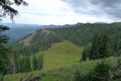
I finally reached the junction of Grindstone Trail at 11,700ft. The view was spectacular, but risk of either getting struck by lightning or blown off the mountain was too great to take a picture.Grindstone begins the descent and connects with Bear Creek Trail. Grindstone is very steep, benchcut into the side of extremely steep terrain, and can be quite gnarly in spots. I no more than began the plummet when the skies opened up. I quickly put the layers back on again.
It didn't take more than two minutes for the trail to fill with water. The soil here has a red clay base. It turns into the slipperiest, stickiest quagmire you can imagine. Descending 20-30% grades in an 12" wide trough of this goo with precipitous drop-offs to the outside was a recipe for disaster. I could not keep the bike under me. It was like riding a deep, icy car track without studded tires. I bailed off the bike or went sliding on my back many times when the bike went out from under me. Fortunately I never went over the edge. It rained mightily for at least 30 minutes.

I reached an open meadow area where the trail traversed an extremely steep slope. The grass and weeds were so tall and dense, you could barely make out where the trail was. It was up to my handlebars. Underneath lie all kinds of perils - rocks, divots, off-camber greasiness. It was raining so hard, that when I got a ways out into the middle of this meadow, I could see absolutely nothing in all directions. Just meadow at about 45 degree incline in my immediate vicinity. And lightning was crashing all around me. Alex would have died of fright right on the spot. I was clearly the highest object around with nothing else in site.
I finished sliding my way down to Bear Creek Trail, 2300ft in just a few miles. Bear descends at a much more gentle grade, which meant I occasionally had to pedal. I soon learned that red clay offers ZERO traction when going uphill. I was forced to walk up almost all inclines. The trail rolled a lot too. Then my drivetrain stopped working. Thanks to Shimano's penchant for high gear counts and narrow chains, chain suck woes become common in anything but fair weather conditions. My bike by now probably weighed 40 pounds. It looked like it was made out of red clay. Nothing on it was recognizable. In one fit of rage, I nearly hurled it over the edge. It would have been far quicker to walk the 8 miles back to the car than lug this thing along.

On the steeper descents, my front brake started making grotesque sounds. The pads were gone and it was metal on metal. They still stopped me though.
The rain was letting up. I realized the layers I brought worked well. I would live to ride another day. What was supposed to be the funnest part of the ride turned out to be the suckiest. I bet I walked 30% of the descent. Bike wouldn't pedal and parts were to too slippery to stay upright. It took me hours to get down from the ridge. Finally I heard cars. I popped out by the Delores River. I was no more than 100ft from my car when I took one more nasty tumble at high speed. Front wheel caught 2" trail lip in red clay and I went sliding on my back again. F-bombs!
My moving time (that was registered when I was actually going fast enough for GPS to detect it) was 6.1hrs. Total time out was over 7hrs. Seems I was just saying I did my longest unsupported ride ever, but now this one tops it by a bit.
Cleaning my bike up in the river, I found the red clay to set up like concrete even though it wasn't dry. It was so hard to get off. I probably spent 45 minutes working on my bike. Additionally, I found my GPS got rain in it and went haywire on me. Great. I destroyed my brakes, drivetrain, suspension bushing and now my GPS in one ride. That was an expensive ride. Needless to say, I was not in the best of moods coming back to the hotel where the women were. I was in panic mode to get brake pads (I always take one pair with me) and to find a tiny T6 torx driver to open my GPS to dry it out. The hotel helped me find a closed bike shop that would sell me pads after hours, then I tried Sears and then Home Depot before I found a T6 driver.
The GPS did have water in it. That was easy to dry out. Somehow, water got inside the LCD display too. That will not come out easily. At least I was able to restore GPS operation.
I'd definitely do this ride again if there was zero percent chance of rain with money back guarantees if it does rain. It is a great loop and should be nearly all rideable on dry trails. The ridge was dry and sweet stuff to cruise on. Thursday's forecast called for much higher probability of rain, but it didn't. I got in two great rides. That will have to wait for another post.
I had scoped out online a section of the Colorado Trail (CT) that I hadn't ridden yet. It hoovers around 11,000ft. My plan was to park at the Bear Creek trailhead on CO-145, ride up 145 to Scotch Creek/FS-550, climb up to the ridge, surf the ridge at 11,000ft for 15 miles, then bomb down Bear Creek trail back to the car.
This ride is close by as the crow flies, but an 80 minute drive by car, as it starts in the valley on the other side of the mountains. It is a bad omen when there is overcast in the morning and I had to use the wipers a few times. The skies looked like late afternoon monsoons at 8am. I figured it will burn off for a few hours and I should be able to clear the ridge line in that time. Bad judgement call number one.
It sucks starting out on wet roads when it is in the 50's out. Plus I had to go slightly uphill on CO-145 along the Delores River into a stiff northeast wind. I drilled it pretty hard for these 10 paved miles, as I wanted to beat the certain afternoon storms.
I reached Scotch Creek in pretty poor time. Tired legs, altitude, uphill and headwind all conspired against me. Now the real climbing would begin. Scotch Creek Rd is a rough jeep road that gets progressively steeper as it gains altitude. It started out as a wet, muddy scree surface. Abusive on the body and tough to hold a line. Further up, I noticed the water bars were recently reformed by a bulldozer. Long sections were loose, sink to your rims, red clay. Eventually I reached the dozer in action. The operator was nice to move aside to let me pass.

Riding up grades at 10-20% of this was nearly impossible.
The climb on Scotch Creek Rd was 6 miles.
It was about this time I heard the first thunder boom. I hadn't even reached 9000ft yet! I looked over my shoulder to the west and saw the sky was turning black. This was really going to suck, as I was not turning around. Bad judgement call number two.
I buried myself on this climb. The further up I went, the more torn up the surface became from dozer work. I had all I could do to go 2.5mph on sections. Thin air, mushy surface, and big double-digit grades. The thunder became more frequent and closer as I climbed. I began looking for areas of shelter to duck into. There was nothing except big trees, nice lightning rods.
I reached the ridgeline. It was starting to rain, but the lightning was passing by just a couple miles to the south. I put on thermal tights, a thermal top and Gortex rain shell. Then I stood under a spruce tree, which make for great umbrellas. The rain promptly petered out. The sky got a little brighter. I took the layers back off and decided to head down the CT a ways. I could always turn around if the weather turned for the worse right away. Bad judgement call number three.

From the CT ridgeline, the storm that just missed me during
the climb. Tried to get picture of lightning, but cameras are too slow.
The riding on the ridge was superb. It was the only part of the ride that didn't suck. The trail was well maintained, buff, reasonably dry and changed elevation gently and moderately. My sea level hematocrit could handle this. I talked briefly with a guy at some kind of a camp on the ridge. He said the weather was funky all week and rain, when it came, didn't last long. He said it didn't get much colder than 50F. The clothing I brought along could handle that, I thought.

CT goodness. Sky looks less threatening here, but only temporarily.
I cruised several more miles on the rolling CT. Nice views to the east opened up here and there. This wasn't treeless like some other ridges I ride. There is a forest service road that crosses the CT a couple times in this area. A forest ranger was parked there in a truck. I thought it would be good to gauge his sense of the weather. He didn't seem concerned that I was out there alone in temperamental weather heading down a trail that had no more bail-out options for many miles. The sky was overcast, and any thunder was from a cell that was moving away.
I committed to finishing the whole loop. This was my final bad judgement call. The riding up here was too intoxicating to say no. I reached the point where a massive 1000ft climb begins to reach the section called Indian Trail Ridge. Sign up top called it the Highline Trail. Whatever. It goes above tree line and becomes exposed. It was here were I began hearing new rumbles of thunder. Uh, oh. Pedal harder. Can't turn around now, way too far away from any trails or roads off the ridge.
My fear wasn't so much the lightning, but hypothermia. With lightning, you'll never know what hits ya. Dying from hypothermia would suck a lot more. I hadn't used my new Gortex rain shell yet, and I wasn't sure how could it would get and if I'd stay dry enough underneath.
The climb went on and on and on. It would never end. I don't think Topo correctly displayed how big this climb really was. At 11,000+ feet, the best I can do is hold 3-4mph on 10% grade. I could see the dark area of sky was heading right for me. I didn't think I'd reach the top before it would hit.

Approaching high point of ride, dark clouds and thunder getting
very close.
I finally reached the junction of Grindstone Trail at 11,700ft. The view was spectacular, but risk of either getting struck by lightning or blown off the mountain was too great to take a picture.Grindstone begins the descent and connects with Bear Creek Trail. Grindstone is very steep, benchcut into the side of extremely steep terrain, and can be quite gnarly in spots. I no more than began the plummet when the skies opened up. I quickly put the layers back on again.
It didn't take more than two minutes for the trail to fill with water. The soil here has a red clay base. It turns into the slipperiest, stickiest quagmire you can imagine. Descending 20-30% grades in an 12" wide trough of this goo with precipitous drop-offs to the outside was a recipe for disaster. I could not keep the bike under me. It was like riding a deep, icy car track without studded tires. I bailed off the bike or went sliding on my back many times when the bike went out from under me. Fortunately I never went over the edge. It rained mightily for at least 30 minutes.

Grindstone Trail. Loose rocks, mud, and exposure.
I reached an open meadow area where the trail traversed an extremely steep slope. The grass and weeds were so tall and dense, you could barely make out where the trail was. It was up to my handlebars. Underneath lie all kinds of perils - rocks, divots, off-camber greasiness. It was raining so hard, that when I got a ways out into the middle of this meadow, I could see absolutely nothing in all directions. Just meadow at about 45 degree incline in my immediate vicinity. And lightning was crashing all around me. Alex would have died of fright right on the spot. I was clearly the highest object around with nothing else in site.
I finished sliding my way down to Bear Creek Trail, 2300ft in just a few miles. Bear descends at a much more gentle grade, which meant I occasionally had to pedal. I soon learned that red clay offers ZERO traction when going uphill. I was forced to walk up almost all inclines. The trail rolled a lot too. Then my drivetrain stopped working. Thanks to Shimano's penchant for high gear counts and narrow chains, chain suck woes become common in anything but fair weather conditions. My bike by now probably weighed 40 pounds. It looked like it was made out of red clay. Nothing on it was recognizable. In one fit of rage, I nearly hurled it over the edge. It would have been far quicker to walk the 8 miles back to the car than lug this thing along.

Bear Creek Trail. Ridge I descended from in background.
Trail was so slippery it was even hard to stand on.
On the steeper descents, my front brake started making grotesque sounds. The pads were gone and it was metal on metal. They still stopped me though.
The rain was letting up. I realized the layers I brought worked well. I would live to ride another day. What was supposed to be the funnest part of the ride turned out to be the suckiest. I bet I walked 30% of the descent. Bike wouldn't pedal and parts were to too slippery to stay upright. It took me hours to get down from the ridge. Finally I heard cars. I popped out by the Delores River. I was no more than 100ft from my car when I took one more nasty tumble at high speed. Front wheel caught 2" trail lip in red clay and I went sliding on my back again. F-bombs!
My moving time (that was registered when I was actually going fast enough for GPS to detect it) was 6.1hrs. Total time out was over 7hrs. Seems I was just saying I did my longest unsupported ride ever, but now this one tops it by a bit.
Cleaning my bike up in the river, I found the red clay to set up like concrete even though it wasn't dry. It was so hard to get off. I probably spent 45 minutes working on my bike. Additionally, I found my GPS got rain in it and went haywire on me. Great. I destroyed my brakes, drivetrain, suspension bushing and now my GPS in one ride. That was an expensive ride. Needless to say, I was not in the best of moods coming back to the hotel where the women were. I was in panic mode to get brake pads (I always take one pair with me) and to find a tiny T6 torx driver to open my GPS to dry it out. The hotel helped me find a closed bike shop that would sell me pads after hours, then I tried Sears and then Home Depot before I found a T6 driver.
The GPS did have water in it. That was easy to dry out. Somehow, water got inside the LCD display too. That will not come out easily. At least I was able to restore GPS operation.
I'd definitely do this ride again if there was zero percent chance of rain with money back guarantees if it does rain. It is a great loop and should be nearly all rideable on dry trails. The ridge was dry and sweet stuff to cruise on. Thursday's forecast called for much higher probability of rain, but it didn't. I got in two great rides. That will have to wait for another post.
Tuesday, August 30, 2011
Tuesday Double Header
Needed a bit of a break Tuesday, so I headed over to Phil's World near Cortez, CO. This riding destination has been growing in size steadily over the years. I figured it was time to check it out. There is not a lot of elevation change here, maybe a few hundred feet min to max. It also stays below 7000ft, so there was air to breath.
It was a shame to waste a pristine day on a low country ride. There was nary a cloud in sight. My stupid alarm didn't go off (again), and my legs were a tad wrecked from Monday's ride. A late start with wrecked legs on a high country ride would be risky deal with monsoons still in gear. The women planned to hike the Animas City Mountain trail in the morning, then we'd all tube the Animas River in the afternoon.
I would never have found the Phil's World trail head if I hadn't seen the sun reflecting off windshields out in the desert. Quite a few riders were out. I had a partial GPS track to follow and a new printed map from Big Loop Maps that showed recent additions. The cool thing about Phil's World is it can be ridden as one, big continuous loop without repeating anything.

I quickly realized I was in for a treat. The trail alternated between techy mesa rim riding and super buff roller coaster. It seemed around every corner there was an opportunity to get air. Huge air, sometimes. I wore a perma-grin riding here. Take what you like best from Tucson's Fantasy Island, Fruita's Bookcliffs and Gunnison's Hartman Rocks, roll them into one giant doobie, that is Phil's World. I think I had the most fun riding here than any place else. I rode the entire trail system, a continuous loop of nearly 30 miles in 3.2 hours.


I finished riding by 1pm and headed back to Durango to meet the women. The Animas River was up a bit due to recent rain. This was good and bad. It was good, as the flow was just sufficient for tubing without dragging butt too much on rocks. It was bad in that it clouded the water up. The air temperature was in the upper 80's, a hot day. We picked up rental tubes from Southwest Whitewater Rafting and put in at 32nd street. We thought about going down just to the high school around 25th street and walking back to the car.

The tubing was pretty good actually. Others were out. The water temp was a bit of a shock at first, but the tubes keep you mostly above the water. I brought my older camera along in double Ziploc bags. It was quite entertaining watching Cathy navigate rapids through some of the boulder fields. The cold water served as a nice ice bath for battered legs. I had trouble kicking though. My hamstrings wanted to cramp up.

We floated all the way down to 15th street, supposedly 3 miles of river. Southwest Whitewater is right there, so we returned the tubes. Durango runs a free trolley service. We hopped on the trolley to catch a ride back to the car.

On a previous trip to Durango, I discovered a serious meat lovers joint called Serious Texas BBQ. My mom is big on meat, so I took her and Cathy there for dinner. Think Gauchos in Manchester quality, but order your meal where you walk in and then sit at open air tables to eat it. We'll have to see how I fare on Wednesday's ride after protein loadin. Time to get high in Durango. Hope to ride a long section of the Colorado Trail at around 11,000ft that I haven't ridden yet.
It was a shame to waste a pristine day on a low country ride. There was nary a cloud in sight. My stupid alarm didn't go off (again), and my legs were a tad wrecked from Monday's ride. A late start with wrecked legs on a high country ride would be risky deal with monsoons still in gear. The women planned to hike the Animas City Mountain trail in the morning, then we'd all tube the Animas River in the afternoon.
I would never have found the Phil's World trail head if I hadn't seen the sun reflecting off windshields out in the desert. Quite a few riders were out. I had a partial GPS track to follow and a new printed map from Big Loop Maps that showed recent additions. The cool thing about Phil's World is it can be ridden as one, big continuous loop without repeating anything.

GPS track of Phil's World
I quickly realized I was in for a treat. The trail alternated between techy mesa rim riding and super buff roller coaster. It seemed around every corner there was an opportunity to get air. Huge air, sometimes. I wore a perma-grin riding here. Take what you like best from Tucson's Fantasy Island, Fruita's Bookcliffs and Gunnison's Hartman Rocks, roll them into one giant doobie, that is Phil's World. I think I had the most fun riding here than any place else. I rode the entire trail system, a continuous loop of nearly 30 miles in 3.2 hours.

Near highpoint, Cortez in distance.

Rim riding.

Slickrock

There were several bits of exposure here. A fall over this
edge could be fatal.

There were many miles of roller coaster material like this at
Phil's World. A photo does not convey how steep the drops
and rises are, or the downhill bias to this trail that imparts
considerable speed while shredding here.
I finished riding by 1pm and headed back to Durango to meet the women. The Animas River was up a bit due to recent rain. This was good and bad. It was good, as the flow was just sufficient for tubing without dragging butt too much on rocks. It was bad in that it clouded the water up. The air temperature was in the upper 80's, a hot day. We picked up rental tubes from Southwest Whitewater Rafting and put in at 32nd street. We thought about going down just to the high school around 25th street and walking back to the car.

Mom and Cathy on the Animas River.
The tubing was pretty good actually. Others were out. The water temp was a bit of a shock at first, but the tubes keep you mostly above the water. I brought my older camera along in double Ziploc bags. It was quite entertaining watching Cathy navigate rapids through some of the boulder fields. The cold water served as a nice ice bath for battered legs. I had trouble kicking though. My hamstrings wanted to cramp up.

Cathy on the Animas.
We floated all the way down to 15th street, supposedly 3 miles of river. Southwest Whitewater is right there, so we returned the tubes. Durango runs a free trolley service. We hopped on the trolley to catch a ride back to the car.

Mom doing a fine job dodging boulders.
On a previous trip to Durango, I discovered a serious meat lovers joint called Serious Texas BBQ. My mom is big on meat, so I took her and Cathy there for dinner. Think Gauchos in Manchester quality, but order your meal where you walk in and then sit at open air tables to eat it. We'll have to see how I fare on Wednesday's ride after protein loadin. Time to get high in Durango. Hope to ride a long section of the Colorado Trail at around 11,000ft that I haven't ridden yet.
Monarch Crest to Little Rainbow
Not much bloggy time tonight. Pictures will have to tell the story. In short, today's ride was the longest I went without picking up water along the ride. I carried 100oz Camelbak and 28oz bottle with me, and that was enough for over 6.5hrs total time out on the trail. Cooler temps helped. There was constant threat of rain with intermitent sprinkles all day. No thunder, fortunately. I cleared the entire crest trail without encountering another trail user. Just some campers at Marshall Pass. Supreme solitude! Rode nearly 48mi, almost all singletrack with almost 5000ft climbing and >9000ft descending in 6hrs moving time. Not a typical Hill Junkie ride. Not sure what's on deck for Tuesday. Body is pretty cooked.

On the Divide at 12,000ft with sprinkles. Carried full winter gear
in my backpack. Temp was about 50F. Pack probably weighed
over 15 lbs.

Looking back north along the divide

The new Little Rainbow Trail just above Salida.
Non-stop flow with bermed turns and gravity cavities. This
with Race Track trail that drops back to town was an awesome
way to finish a 6hr ride.

Rainbow Trail west of 285. All benchcut, all buff. It sure was nice
to ride this with fresher legs after not having to ride all the way
up US-50. Clean almost all of it.

More Rainbow west of 285.

Rainbow east of 285. Super chunk major hike-a-bike.
Many hundreds of feet of unrideable vertical at 20-30% grade
like this. At first I couldn't figure out why I didn't see
any bicycle tracks. Only moto tracks. Now I know why. Don't
need to do this trail again.

Top of Rainbow Trail east of 285. A miniscule bit was actually
nice to ride.

Silver Creek trail, which is initial descent from the divide. Not
all of it is this nice. Several talus fields are traversed.
Sunday, August 28, 2011
Assaulted by Pikes Peak
I might have missed out on the pummelling Irene doled out, but not on the beating Pikes Peak gave me today. This was the second annul Assault on the Peak timed "fun ride." I did it last year too. I borrowed Tom Ramsey's super light cross bike last year. This year was a bit more logistically complicated travelling with family, so I used my full suspension MTB. I at least put some roadie tires on it, and the suspension locks out. It still weighed 7 lbs more than Tom's bike did. I also used a Camelback since my dualie has only one bottle cage mount. Fearing cramping like last year, I carried a good deal of my own mix with a strong electrolyte solution (Gu brand, which has about 8x more sodium than Endurolytes). This tallied up to carrying 12-15 lbs more weight up the mountain this year. Oh, the area is experiencing near record high temps for this time of year too. This was supposed to be a fun ride, right?


Cathy and Mom dropped me off in Manitou Springs at 7am. It was already over 70F. They headed off to the Garden of the Gods. I found Tom Ramsey, who was surprised to see me (new email, so he didn't get my message). There were only 300 or so bicycle riders lining up. I expected many more. First wave went to E-bikes. Think motorcycles with quiet motors. Why they continue to have an electric bike division is beyond me. They should not be associated with a human powered event. I lined up about 200 back to avoid going out too hard on my MTB with roadies.

We had a strong headwind heading up our closed lane of US-24. I comfortably sat in behind others even though we were probably going less than 10mph. I forgot to put a wheel magnet on and had no feedback. Funny how when you are on a MTB, roadies won't even look at you. And when you catch a guy on $6000 road bike, the pace automatically goes up. Kind of like getting girled I suppose.

I stopped for first water refill at the reservoir. No sport drink. Just water there. There was a foot race going on too, with different start and finish lines. They had sport drink at their stops. WTF. I believe the same organizer was running these races.

I plugged along. About 2.2hrs into it, I started feeling twinges in my calves. This was not good. It was warm out, and despite climbing thousands of feet, the temperature was not dropping. It was supposedly 45 at the summit. I passed the runners finish line, asked where the water stop was, and was told just past the gate. It was not there! I was out. In fact, I would climb nearly to the summit before reaching another stop, and it was just water. There was nothing with electrolytes in it on the course. Many riders take over 4hrs to climb this beast, and it was hot out. How I was not into full-blown cramping at this point was beyond me. Perhaps it was the strong Gu electrolytes I added to my Camelbak to start things off.


Shortly after leaving he last water stop, I round this corner, thinking the summit was near. Horrors! It still looked like I had a Mt Washington to climb. I had no idea what my pace dropped too. I was finishing without cramping. That was my goal.

I crossed the timing map with about 3:33 hrs elapsed time (my computer at least gave me time of day). That was about 24 minutes slower than last year. How much of that can be attributed to doing it on a heavy MTB? The good thing is I never seized up. I did have easier gearing with the MTB than with Tom's CX bike last year. Maybe that helped. Who knows.
I managed to beat Cathy and mom up there. They took an 10:40 cog rail train to the summit. We could only talk briefly and get the obligatory summit sign photo. Black clouds were quickly building and sprinkles were felt.
I put on near winter clothes for the descent and high tailed it off the summit. Disk brakes sure are sweet on a summit like that. You can come so much faster into the switchbacks and have complete confidence in stopping power. I no more than started down than a big thunderboom echoed from not far away. I managed to stay dry. At about 10,000ft, the temperature was toasty, maybe 80's. It was 90F back in Manitou Springs.
Catching up with Tom at the bottom, I learned he was 10th overall! He's 59 and finished 40 minutes ahead of me. I'm waiting for Tom to come back to NH next year to crush the Mt Washington 60yr old age group record. Living at altitude has given him a barely legal hematocrit. I'm jealous. I had a pretty nasty altitude headache going on, even after I got back to the bottom. To make my headache worse, I was not listed in the results when they were posted. How can this even happen with chip timing? I went over the timing mat, even heard my number verbally called out. They did give me much assurance it would be worked out. When I caught up with Cathy and mom, I learned Cathy did poorly at 14,100ft. My mom said her lips got a little blue and she wasn't making complete sense at times. Scary.
I won't bring a mountain bike to Pikes Peak again. It is hard enough. I certainly will share thoughts on hydration strategy on the climb for cyclists when the survey hits my inbox. For $200 registration fee, I expect better. Regardless of equipment and hydration challenges, Pikes peak is still a must do climb. Nothing else in the continental 48 really compares. I love that riding to the top of the world feeling you get as you round switchback after switchback above tree line.


Pikes Peak at sunrise from our hotel.

The abomination I rode.
Cathy and Mom dropped me off in Manitou Springs at 7am. It was already over 70F. They headed off to the Garden of the Gods. I found Tom Ramsey, who was surprised to see me (new email, so he didn't get my message). There were only 300 or so bicycle riders lining up. I expected many more. First wave went to E-bikes. Think motorcycles with quiet motors. Why they continue to have an electric bike division is beyond me. They should not be associated with a human powered event. I lined up about 200 back to avoid going out too hard on my MTB with roadies.

Staging with our destination ahead.
We had a strong headwind heading up our closed lane of US-24. I comfortably sat in behind others even though we were probably going less than 10mph. I forgot to put a wheel magnet on and had no feedback. Funny how when you are on a MTB, roadies won't even look at you. And when you catch a guy on $6000 road bike, the pace automatically goes up. Kind of like getting girled I suppose.

All manner of human powered contraptions partake. The parapalegic
was back with his handcycle too.
I stopped for first water refill at the reservoir. No sport drink. Just water there. There was a foot race going on too, with different start and finish lines. They had sport drink at their stops. WTF. I believe the same organizer was running these races.

Only 1mi of dirt left on this 24.5mi climb.
I plugged along. About 2.2hrs into it, I started feeling twinges in my calves. This was not good. It was warm out, and despite climbing thousands of feet, the temperature was not dropping. It was supposedly 45 at the summit. I passed the runners finish line, asked where the water stop was, and was told just past the gate. It was not there! I was out. In fact, I would climb nearly to the summit before reaching another stop, and it was just water. There was nothing with electrolytes in it on the course. Many riders take over 4hrs to climb this beast, and it was hot out. How I was not into full-blown cramping at this point was beyond me. Perhaps it was the strong Gu electrolytes I added to my Camelbak to start things off.

Day started nice. Monoons are still in full swing though. We
drove through intense thunder and lightning to Salida later.

I thought I was near summit, round corner, then see this.
The dark clouds rapidly developed into thunder.
Shortly after leaving he last water stop, I round this corner, thinking the summit was near. Horrors! It still looked like I had a Mt Washington to climb. I had no idea what my pace dropped too. I was finishing without cramping. That was my goal.

The "W" section. At least it wasn't as windy up here as last year.
I crossed the timing map with about 3:33 hrs elapsed time (my computer at least gave me time of day). That was about 24 minutes slower than last year. How much of that can be attributed to doing it on a heavy MTB? The good thing is I never seized up. I did have easier gearing with the MTB than with Tom's CX bike last year. Maybe that helped. Who knows.
I managed to beat Cathy and mom up there. They took an 10:40 cog rail train to the summit. We could only talk briefly and get the obligatory summit sign photo. Black clouds were quickly building and sprinkles were felt.
I put on near winter clothes for the descent and high tailed it off the summit. Disk brakes sure are sweet on a summit like that. You can come so much faster into the switchbacks and have complete confidence in stopping power. I no more than started down than a big thunderboom echoed from not far away. I managed to stay dry. At about 10,000ft, the temperature was toasty, maybe 80's. It was 90F back in Manitou Springs.
Catching up with Tom at the bottom, I learned he was 10th overall! He's 59 and finished 40 minutes ahead of me. I'm waiting for Tom to come back to NH next year to crush the Mt Washington 60yr old age group record. Living at altitude has given him a barely legal hematocrit. I'm jealous. I had a pretty nasty altitude headache going on, even after I got back to the bottom. To make my headache worse, I was not listed in the results when they were posted. How can this even happen with chip timing? I went over the timing mat, even heard my number verbally called out. They did give me much assurance it would be worked out. When I caught up with Cathy and mom, I learned Cathy did poorly at 14,100ft. My mom said her lips got a little blue and she wasn't making complete sense at times. Scary.
I won't bring a mountain bike to Pikes Peak again. It is hard enough. I certainly will share thoughts on hydration strategy on the climb for cyclists when the survey hits my inbox. For $200 registration fee, I expect better. Regardless of equipment and hydration challenges, Pikes peak is still a must do climb. Nothing else in the continental 48 really compares. I love that riding to the top of the world feeling you get as you round switchback after switchback above tree line.

Myself, Mom and Cathy at the summit.
Next up: Monarch Crest Trail. Hope I have it in me to add a lengthy extension. Hydration is the primary concern. I'll take Iodine with me. Never used it, but it reported makes nasty tasting, but safe to drink water.
Subscribe to:
Posts (Atom)