Wednesday, March 8, 2017

Gran Canaria Day 4: Puerto de Mogan - Barranquillo Andres - Cruz San Antonio - Puerto de Mogan

A semi-recovery day today, as the next three will be big days. Peter's route heads out of Puerto de Mogan via GC-500, the coastal two-lane scenic route that is reminiscent of Rt 30 in the touristy area of West Maui. A nice warm-up, although 1000ft of climbin is accumulated in about 12 miles.

The route then turns inland and begins gradual climb up GC-505. Traffic went to almost nil and the canyon was pleasant to look at. Our pace was civil and I hung out at the back to take pictures.

I knew as soon as we crossed a Strava KOM marker painted on the road, the pitch was going to get decidedly steeper. A sign then warned us of 14.7% grades over the next 7km. That's hardly recovery material!

Up in La Fillipina, we bear left off GC-505 and the gradient kicks up another notch. This was south facing and it felt darn near 90F here. The pavement was pretty rough too, but not that it matters much when you are going barely fast enough to not fall over.

Me, Dave and Todd from Calgary were the first to reach the Thomson van awaiting us, not that anybody was pushing hard today. The view was quite good, the sky closest to bluebird yet. It is surprising how arid it is here, being on what essentially a tropical island. Peter Thomson mentioned the wind would be coming off the Sahara Desert nearby, and that brings heat and dusty haze in the air. Hmmmm, breathing in Saharan dust. Is that good for you?

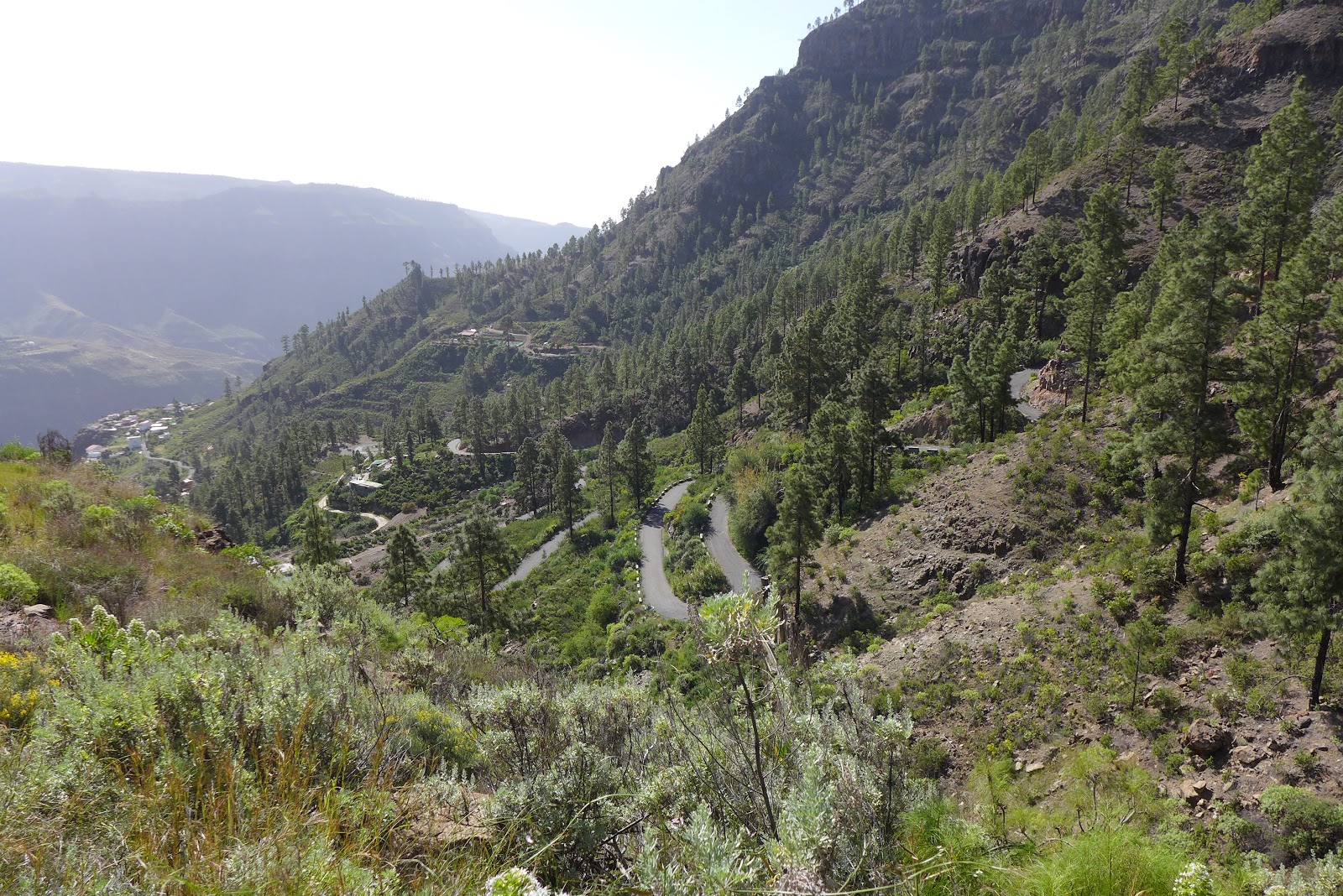
Anyway, we finished with the best part of yesterday's descent, a nearly 3000ft rip on good pavement with insane number of switchbacks. I brought my 510 and 1000 GPS units with me today. The 1000 is definitely wonky. The both logged about 1000ft of climbing along the coast, then in nearly 3000ft net gain, the 1000 logged only 2500ft. How do you get this wrong. I've had the unit too long to return it. I uploaded from the 510 today, which I carried in back pocket. The 1000 is awesome for mapping. I download free Gran Canaria map that has every imaginable detail in it. Too bad we aren't going to have chance to ride trails this trip.

Tomorrow is puddle up over to Tenerife. We start at sea level and climb to about 7800ft before dropping down the other side to just under 3000ft. Nearly 8k climb, 5k descent. Some ups and downs along the way should bring the total climbing to around 10,000ft in about 60 miles. It will be hot and windy.

Rolling out on the GC-500 at 8:30am. Traffic was light. This was crazy busy finishing ride #2 later in day.

GC-500 hugs coast and tunnels through the steepest fingers of rock.

Keith from the UK. He mentioned he was riding Thomson tours today because of a blog post from my 2011 Italian trip. He's done six Thomson tours now. Always cool to get feedback, knowing there are still one or two people out there that read these things.

The A-group heading inland on GC-505, what Peter described as a false flat. It gains less than 100ft/mi for 8mi.

Very little traffic on GC-505 as we headed up the canyon. We soon pass a Strava KOM marker painted on the road and know the gradient is going to kick up. Shortly after, a signed warned of max grades of 14.7% over next 7km.

Todd and Dave on one of many switchbacks on GC-505. 

Dave and Todd heading up GC-505

Looking down some of the lower switchbacks of GC-505 and the canyon we came up from the coast.

Starting to see a pattern in rides here. Middle of island is steeply corrugated and chocked full of switchbacks.

Todd heading up GC-505. Dave was a bit up now because I kept dilly dallying taking photos.

Orange groves dotted the hillside.

Now off GC-505 onto barely a lane wide "road" that got ridiculously steep for a "recovery" day.

Todd nearly the height of land

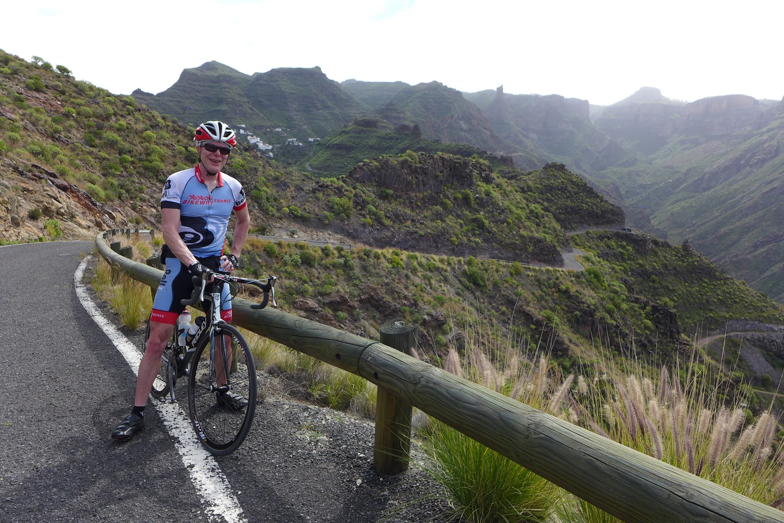
Myself, Todd and Dave at top of today's ride. Nearly monotonic, nearly 3000ft descent from here back to hotel.

Initial rip from top

Are we in Arizona? Looked and FELT like it today. Very hot and going to be even hotter for Thursday epic climb on adjacent island Tenerife.

Tuesday, March 7, 2017

Gran Canaria Day 3: Valley of the Tears

Our third day on the islands got into some real climbing. The route is affectionately known as Valley of the Tears. Now I understand why.

We rolled out the same way we did on the first day. No surprises, a never too steep double bump-up with 2500ft of climbing to the high point. Instead of turning around like we did on Day 1, we bombed down the opposite side on heinously steep, rough pavement. Gonna have to check all the bolts on my bike before the next ride!  We dropped all the way down into La Aldea de San Nicolas, where there appeared to be many plantations under netting.

Heading out of town on GC-210, we soon found ourselves in a deep, winding canyon. Scenery was gorgeous, again reminiscent of terrain you can find in the desert southwest of the US. There were a series of reservoir dams in the canyon, and each one invariable involved steep switchbacks up the canyon wall to get above the dam. Even though the climbing was a bitch at times, Peter Thomson warned us in the ride briefing that all of this was just the “climb before the climb.” Great.

We reached the junction of GC-606 where our van was awaiting us. This is where the climbing begins, we’re told. It was hot. Switchbacks scaled the nearly vertical canyon wall and at 20+% sustained grade. Felt just like that top mile of Lincoln Gap in Vermont. And it was just the beginning of 3000+ feet of steep AF climbing in the next 7 miles. There was one respite in the middle, which just meant the grade while climbing was a lot steeper than the average over 7 miles. Dave was gone, I shadowed Brett mid-group. Some F-bombs were heard.

The top was a modest double-hump. Once over the second hump, we dropped back to the same cafe we had coffee at yesterday. Then it was a 4300ft rip back down to our hotel. It wasn't all down, but nothing onerous on the way back. The top third was wicked nasty asphalt to descend. Imagine chip-seal with large stones. It was something like that. Think I have blisters on my palms from that one. Then we got into the canyon where I took many photos yesterday. I had already taken enough photos there. I didn't want to lose the Canadian train of Matt, Andy and Todd by stopping again. Brett exercised reasonable caution on the rough stuff where Dave and I went for a little more white knuckle adrenaline. Many sections of these roads are only one lane wide and it is non-stop blind turns. Not a lot of traffic, but enough that you had to treat every turn as if you were going to suddenly meet a car. And bikes. Must have passed over a hundred cyclist heading up in midday sun. The sketchy scenarios were where cars were passing bikes and leaving no pavement left for descenders. Such a riding destination, the Canaries are.

The five of us pacelined it back to town on the less steep parts on GC-200. What a riot, 4300ft with a zillion switchbacks in no time at all. Our ride went about 59 miles with 7300-8500ft of climbing, depending on whose barometric altimeter you believe. Why do I always get the GPS units that measure less than everybody else's?! Strava elevation correction put me at over 14,000ft, which is obviously wrong. A good day on the bike, avoided cramping, "active recovery" ride planned for Wednesday. Dave and I had planned to MTB Wednesday, but a large area of trails near the hotel was recently bought by a wealthy person and he fenced off all access. Rental outfits say you do not want to test this persons resolve. Bummer.

Dave heading up first climb of the day on GC-200

Smiles now, tears later in Valley of the Tears? Not for Davie.

Back side of GC-200, our first rough descent into La Aldea de San Nicolas. What look like buildings are large fields covered with netting.

Heading up canyon out of La Aldea de San Nicolas on GC-210.

First set of switchbacks on 210

Part way up first set of switchbacks

Myself working up first set of switchbacks (photo by Todd)

Kinda like the switchbacks in Teluride

Add caption


Junction of GC-606, where the "real" climb begins. Seemed like all we did was climb just to get here.

Rugged country in the center of Gran Canaria


Brett rounding one of many switchbacks heading out of canyon. Grade was easily hovering around 20% here.

Looking down some of the GC-606 switchbacks. There might have been tears here.

Brett higher up where there was a brief respite before the next round of 20% hits.

A brief drop before the next wall. Still smiling... (photo by Andy)

See many little enclaves out in the middle of nowhere. Quite a haul on one-lane roads with lots of cliff exposure.
Village in photo above now below us. Brett making his way up, probably close to 20% again.

Lots of plants in bloom above 4000ft.

Brett, still climbing with views to help ease the suffering.

Atlantic Ocean now many miles in distance

Approaching hight-of-land

View from first of double-hump summit for this loop. Second hump is in center of photo. From there, it is better part of 5000ft descent back to hotel.

Many rugged hiking routes in center of island

Beginning descent to Ayacata, where we stopped for Cokes and Espressos. 
Todd got ahead of us on descent back to town and captured photos as we rounded this switchback.

Monday, March 6, 2017

Gran Canaria Day 2:

Day 2 in the Canaries stepped it up a notch. Thomson formally divided us 25 or so riders into A and B groups. Naturally Dave, Brett and I signed up for the A group, 11-12 riders total. The temperature was perfect at 8:30am. The pace was a little less spirited riding out of Playa de Mogan than yesterday’s shakedown ride. Once we turned off GC-200 onto steep GC-605, the governors were turned off and our group began to fragment.

GC-605 was fabulous segment to climb. It switched-backed up all walls of a huge canyon at persistently steep grades. There was very little traffic. Frequent vistas down the canyon were your reward for all the strenuous effort put into the climb. I stopped numerous times to snap photos, falling well back from most of our group. Might never be here again and wanted to capture it.

The A-van awaited us at the first crest. A small descent brought us to the remainder of the climb, which topped out at 4300ft above sea level. We stopped briefly for in Ayacata for Americanos at a cafe before beginning the long plummet down.  The temp had risen enough that even at elevation, it was still perfect and nobody put long layers on for the descent.

There were some sucky pavement sections. You'd be ripping 40+ mph then hit rotten asphalt and be like oh faaaawk! We did quick Regroup in not easy to navigate San Bartolome de Tirajana before continuing downward plummet on much better pavement.

It wasn't all down. We cliff-hugged through the Fataga Valley, sometimes called the Grand Canyon of the Canary Islands. Views did not disappoint. At one point the road pitched up rather violently and was barely one lane wide. There were huge numbers of cyclists going by in opposite direction here and moderate traffic. It was quite sketchy at times. A truck was heading down and met a car and plugged things up for those caught behind it. I would not want to back a car down that!

The view from the top was best of the ride and maybe one of the best on the island. Reminded me a lot of the Gila Canyons of Arizona where the Arizona Trail passes through. So similar, except in AZT case, singletrack is cut into canyon road instead of a road.

From top of the Fataga Valley, it was all downhill to the ocean at Maspalomas. Maspalomas was a bit of a CF, very high traffic, lot of it stop and go on the GC-500 we had to take all the way back to Playa de Mogan. Must have been 30 or more round abouts and several tunnels along the way, and we climbed the same 30-50 meters about a hundred times along the coast it seemed. Would like to have taken pictures here, but the train I was positioned in was too good to lose and have to solo it all the way back. The finish was all trafficy, mainly Maspalomas and a few other coastal communities we rode through.

Jordi, our Thomson ride leader, announced we were up to the last climb. It was then a brief plummet back to hotel. The gloves came off, like it was a Tuesday Night Worlds finishing sprint. An "Oh Faaawk!" was heard as riders bolted up the fairly steep wall.  No, I did not play those shenanigans. Probably would have cramped up. I finished with just over 100km on the Garmin in 4hrs moving time. Oof, that was harder than it looks on paper. I logged about 6500ft of climbing with my new Garmin 1000, although a few others in the group logged over 7000ft.

A and B vans getting ready to roll out. Thomson support is top notch.
Beginning the climbing in earnest on GC-605

Looking down to where GC-605 branches off GC-200. Our hotel is down valley around bend on coast. Dark band in background is not clouds. It is the Atlantic.

Looking down an a few thousand feet of climbing. This was pure bliss, very minimal traffic, good pavement.


Further up GC-605 with small convoy of tour vans coming up. Probably 8% grade average, but sections steeper for sure.

Somewhere between 3000-4000ft, flora became ponderosa pine forest or what ever they call these pines here.

Heading up to Ayacata

Heading up to Ayacata. Dave second wheel, Brett 5 more wheels back.

Bike cafe in Ayacata

Some of the gang in Ayacata

Beginning descent from Ayacata, Jorgi leading the way

Heading down to San Bartolome de Tirajana

Brief regroup in San Bartolome de Tirajana

Heading up cliff hugging road in Fataga Valley

Lot of one-lane road in Fataga Valley. Had some pretty sketchy pinch points here. Could be right out of Arizona.

Fataga Valley, aka the Grand Canyon of the Canaries
Brett, Dave and myself at vista of Fataga valley


Descent to Maspalomas with ocean in distance. Some fast ripping here too.