I was a bit underwhelmed by the Portland shop. It was very small and basically just a bay in a old shipping warehouse building. I drove past it three times, stopped and asked for directions, then realized the BNS taped on a door was the right place. Perhaps the store is still being remodelled or built up. They did have the sizes in the Salomon boot lineup I needed to try on though. I ended up in a newer version of the RS Carbon, but 2/3 size bigger than what I have now. It is possible that my current boot is too small and that is why it hurts my talus protrusion so much. The higher end S-lab model boots have too narrow of a heel cup to work with my titanium reinforced ankle. If the larger size RS Carbon's don't work, I'm not sure what my options will be. All my skate and roller skis have pilot bindings, so I'm kind of stuck with Salomon. I'll try the new boots out this week on rollerskis.
On my way back, I stopped at Mt Agamenticus in the very southern part of Maine to ride. I've ridden here only once or twice maybe eight years ago. NEMBA has broadened the riding options here considerably in the years since. I knew Mt Aggie to be a pretty technical place. Being alone, I wouldn't know where all the good stuff was. It is not on the official park map, as that just covers the immediate summit area. So I went data mining on the Internet. I found GPX track files on Bikemag.com and GarminConnect. With no descriptions, you have to treat this info as suspect at best.
One promising track was a 10+ mile loop on the south side of Mountain Rd, where I have never ridden previously. There are several lakes in this vast, undeveloped area. Google Earth indicated the topography is steeply corrugated. Looked enticing, maybe some views available, but potentially quite brutal. I saved this track and a few others that canvased the more typical Mt Agamenticus side of Mountain Rd.

Folly Pond still very low
I parked at the base of the summit road, quickly changed, then headed off to the south side. I figured I'd bang out that 10 mile loop as a one hour warm-up for the steeper, climbier stuff on the north side. Yeah, right. The first few miles were all ATV track, wicked steep in spots, water crossings, and almost all loose rutted out rock. Throw in nearly complete leaf drop, I had no idea what was passing under my tires.
There was one section of spaghetti track that almost surely would be MTBer built singletrack, as ATVers just don't ride that way. I went past this trail twice before finding it. It must be quite new or infrequently ridden, as it was barely discernible under the leaves. But it was goooood - clearly built by mountain bikers. All rideable save for a few dabs, but very challenging. I was running about 18psi front and 20psi in my rear tire. I surprised myself by some of the stuff I managed to scale. I cringed repeatedly from bottoming out the rear tire. This trail had a lot in common with the one called Evil FOMBA. Due to leaf drop, I did repeatedly go off the trail. I would never have been able to follow it without my GPS.
It was back onto ATV track for a while. It seems most of the ponds are man-made. There is a large network of dams in this place. No water was flowing though. Fall rains still haven't made up for the drought this summer. I had no GPX track for it, just a suggestive rough track I manually entered for a loop around Middle Pond. It took me forever to find the trail. Leaf drop again. But this was sweet. Nice flow, all rideable. It popped out by a large dam. One of the tracks I noted on Dirtrag.com showed the route crossing this dam. It looked sketchy to me. There was nobody out here and nobody knew exactly where I was. I decided to see if I could ride further downstream and cross without walking atop a skinny concrete wall with big drops to either side.
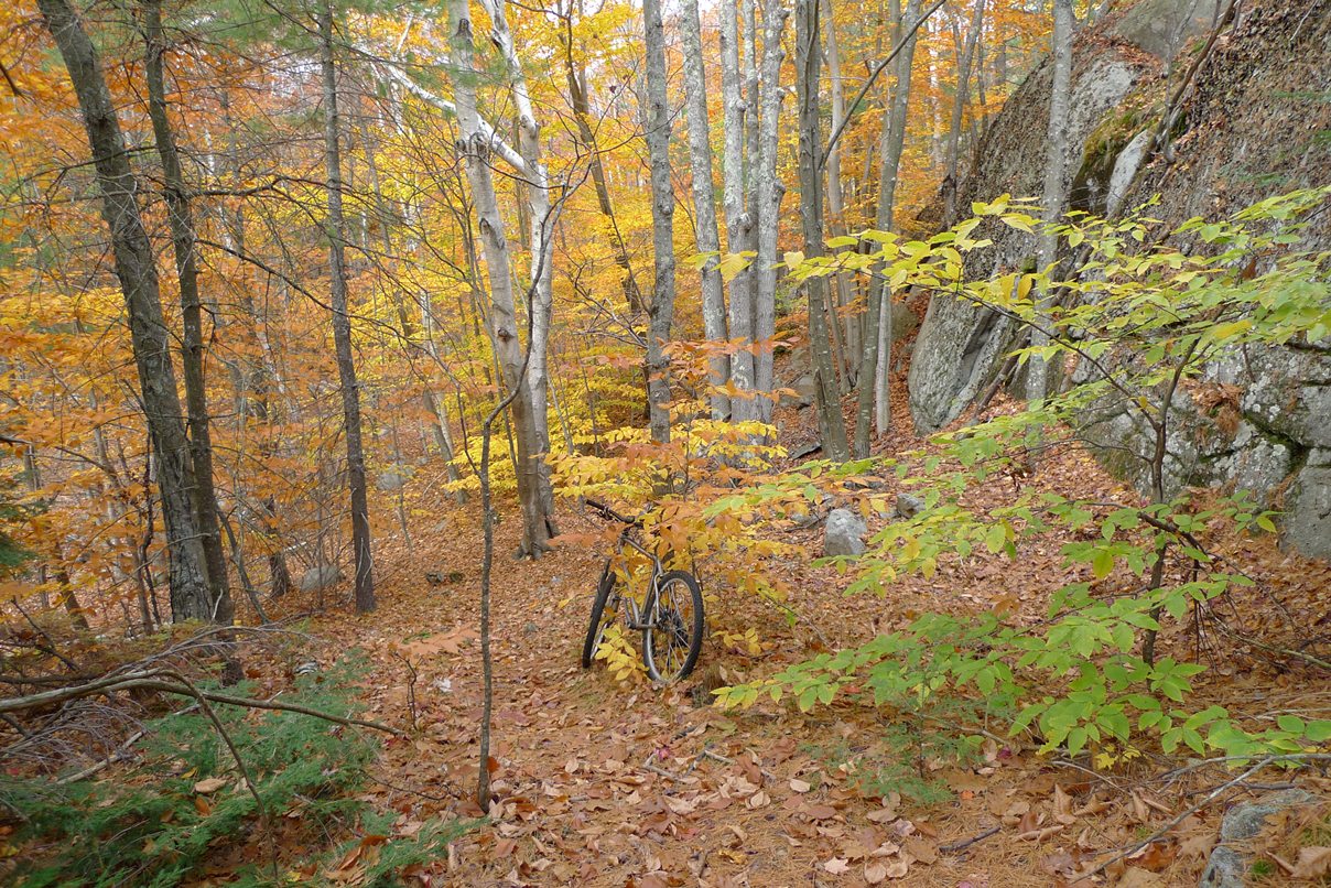
A tidbit that was nice along east side of Middle Pond
I found a route to the other side. The stream crossing was completely dry. It was decent riding. Now I had to find the singletrack back on the east side of Middle Pond. The topography on this side was essentially a cliff that drops straight down to water. The Bikemag map showed a track for it, so guys must be riding it, right? The next 1-2 miles took me an hour! At one point, I had to let my bike slide down a rock face, then slide on my butt after it. The trail disappeared at times and I went into full bush whack mode. The singletrack goodness I rode earlier was quickly being negated by this suckfest. There were some nice views high above the pond from rock outcroppings. But these only meant rock scrambling up and down to reach them. Eventually I found a faint ATV trail and bailed out on it, in the opposite direction I wanted to go. I was done hugging the pond on a barely there trail. The ATV track eventually popped out on the Yellow Trail, which looked like a sanctioned ATV trail that was well maintained. As I climbed back up to Mountain Rd, it started to sprinkle. I had 2.5hrs of riding in and only covered about 16 miles so far.

Summit of Mt Agamenticus looking north
The drizzle stopped before things got too wet, so I at least had to summit Mt Agamenticus before heading home. I rode up the east side of Ring Trail. This was super chunk much of the way up, but at least I could attempt it without fear of death like along Middle Pond. I dabbed only twice before reaching the summit. Every way down from there had "No Bikes" signs posted. I don't remember those from eight years ago. They went down some of the abandoned ski slopes. I opted to call it a ride and ripped back down the paved summit road to my car.

Mt Agamenticus in upper left, Middle Pond in upper right, Folly
Pond in upper center
After last weekend's Wapack granite skills ride, I was hoping for something a little more tame today. I ended up with a more extreme ride. I never got to hit Second and Third hill on the north side. Exeter Cycles does fall rides here, so maybe I'll have to hook up with them to learn where the good stuff is. I managed 18.5 miles in 2:50 riding time. There were a lot of minutes hiking not accounted for on the Garmin. Still a good ride. It perplexes me how I escaped rides the last two weekends unscathed but suffered a catastrophe at Yudicky Farm in May.
2 comments:
Did you see anyone in orange vests out there? Yesterday was the first day of deer hunting season here in Maine. The watershed side of Mt. A is a popular area to hunt.
I probably should have explicitly mentioned I rode Aggie on Friday. Saw no hunters. In fact, in the first 2.5hrs I didn't see another person. Muzzleloader season started here in NH on the 30th too. I don't worry too much about bow season. Regular firearm season, which starts on on Nov 10 here, is where you have to be more careful. I do have a hunters orange mesh vest I wear when appropriate. Most hunters are a conscientious bunch. A few are scary. As a former redneck from Michigan, I know the type well. On a ride here in NH I once was told I shouldn't be out, as "something bad might happen to ya." It sounded like a threat to me. Overall, there are far fewer deer and deer hunters here in New England than in the midwest. I think the risk riding this time of year is pretty low if you avoid riding dawn and dusk and wear some orange.
Post a Comment