Earlier in the week, Dave pointed out a rail trail near his house and wondered how we might loop in some dirt roads for a CX ride. I poked around on the web a bit further and found there is a vast network of abandoned rail lines around the state. Particularly interesting was a near loop in the Keene area. I've done the triangle in Manchester already, but it kind of sucked due to one leg being open to ATV traffic. The trails in the Keene area are closed to motorized wheeled vehicles. The three rail trails on the loop are dirt, but I had no intel on surface quality. Illegal ATV used can muck things up. Lack of maintenance can foster muddy areas or overgrowth. This ride would surely be an adventure.
Saturday turned out to be a much better day to be in the woods than on the open road. It was feeling more like winter and it was wicked windy. We parked at the Shaw's right off Rt 101 in Keene, where the Ashuelot Rail Trail can be picked up from behind the building (some references say it is pronounced Ash-we-lot). 21 miles of flat to slightly downhill did not mean it was easy. The surface varied from fast hard park, sandy, rocky to grassy. There was only one brief muddy spot. It was steady tempo work with no recovery for nearly two hours. It was perfect for cross bikes on a cold autumn day.

The Ashuelot Rail Trail along rushing river by same name
The Ashuelot trail merges into the Fort Hill Rail Trail at the Connecticut River. We took a 180 degree turn to head north right along the east bank of the river. Very scenic. This 9 mile section terminates at a major bridge over the river with rails still in place. Reports say it is unsafe to even walk across. We planned to stay on the NH side of the river and take a short bit of Rt 119 to Wantastiquet Mtn. A dotted line on a map caught my attention here. It was described as a wide hiking path. Were bikes allowed on it? Was it even rideable? It gained 1100ft in less than two miles. That is pretty steep, especially for biggish geared CX bikes. Dave was running 38mm city slick tires. I had knobby 35mm tires.
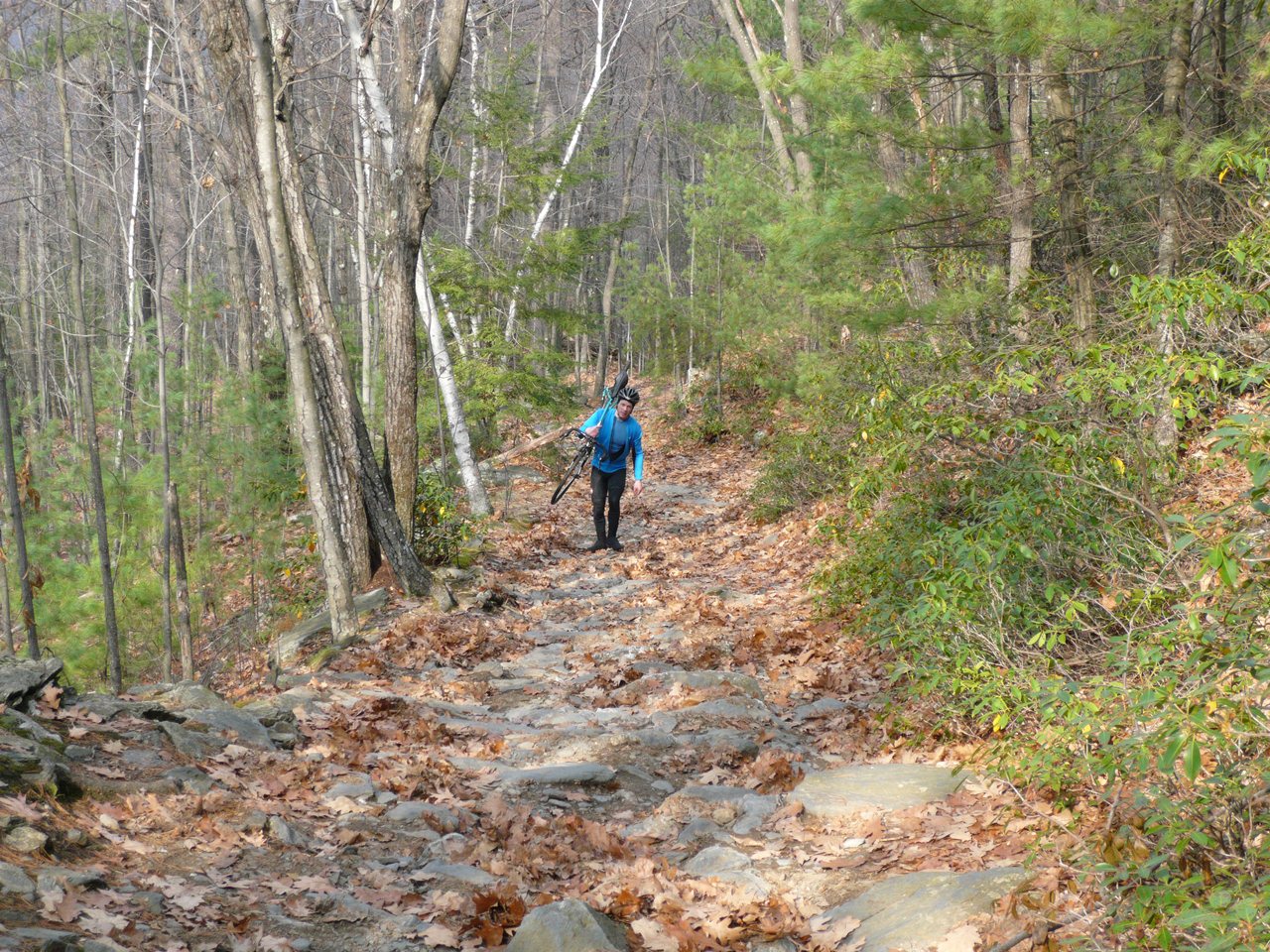
It was a CX ride after all. This is Wantastiquet Mtn.
There were no signs at the bottom, just an iron gate. The path looked like a maintained fire road. We were game. It started harmless enough. After two switchbacks (there are 10), we hit our first hike-a-bike section. Another switchback, the hike-a-bike became more intense. A older hiker presumably with his grandchild commented that I must be incredibly fit or lack common sense. Couldn't it be both? We reached a point where more than half the vertical was gained, so we decided to finish the deed no matter what. In hind sight, probably not a good call. The last half was more hike than bike. The view up top from a rocky knob was quite good though on this hazy overcast day.

Brattleboro, VT from summit of Wantastiquet Mtn
I have been babying an injured leg, and a ride of this duration was questionable in the first place. I conned myself into thinking it was ok, as I would only be riding, not going too hard, and riding doesn't entail much calf muscle effort. Well, this climb completely blew my shaky thinking out the window. The descent scared me. I had no ankle supports on. It was all loose rocks, water and oak leaves with nylon soled booties. I had ZERO traction on anything I stepped on. The descent was a rolled ankle ambush waiting to happen. It seems eccentric muscle contraction really aggravated my calf injury. I was using my bike as a crutch. After reaching the bottom, I fretted over how many days that was going to set me back. I opted out of doing the Velocross CX race on Saturday to give my leg more time to recover. Can't say this was any better than racing for my leg.

Gulf Rd
Continuing north along the river, we followed a few miles of gated fire road before picking up Gulf Rd. Gulf Rd was a real gym. It is essentially a one lane gravel road through a gorge with a rushing stream along side it. It reminded me a lot of Kelly Stand Rd in southern Vermont. We gained about 600ft on this road, climbing into the Pisgah mountains just north of the state park. Dave had no mercy on me, setting a pace to surely punish me for whining about my leg. The next ten miles repeated a pattern of climb a couple hundred feet, descend a hundred feet, on mix of gravel and paved roads. We rarely saw cars. I was pretty spent when we finally reached the high point before beginning the descent towards keen.

Wantastiquet Mtn climb (3x vertical exageration)
Shortly after crossing Rt 9, we hopped on the Cheshire Rail Trail for the last few miles, still downhill, back into Keene. The ride took 4.4 hours and entailed about 3500ft of climbing, nearly all of which was in the last 24 miles. Certainly something I would do again on a cross bike, minus the Wantastiquet climb. It's a great loop to get away from people and see parts of the state you wouldn't normally see.
2 comments:
Yet another great adventure!
Dude I keep these routes to myself!! Epic rides, you have good taste!!!
Post a Comment