It was brilliantly sunny at my house, but pretty gloomy in the mountains. Cool and gloomy was fine as long as it didn't rain. I did not bring knee wamers. It was colder than I thought at less than 50F. Oh well, I'd be climbing double-digit grades shortly anyway.
The climb up Campton Mtn from the west begins paved. About 70% of the way up, it turns to gravel and turns skyward. I saw grades of 22% on the Garmin. My less than fresh legs balked at the biggish gear I asked them to push on the cross bike. That hurt. After reaching the high point on Taylor Dr, it was pretty much all downhill to Rt 49. The few paved bits were treacherous. The road was plastered with wet leaves, which were like riding on ice without studs. There were a few switchbacks I didn't think I would make.

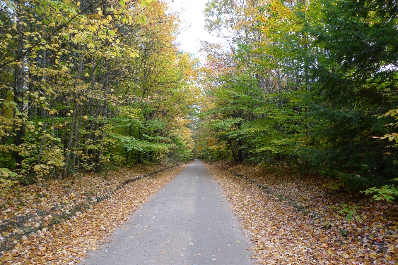
Climbing Sandwitch Notch Rd

Typical Algonquin Rd conditions. Gated. No Vehicles!

More Algonquin Rd
Sandwich Notch Rd was in good shape, escaping hurricane Irene pretty much unscathed. I hit this climb fairly hard too. Is there any other way? At the top I already had 2500ft of climbing logged. The descent was wet and juicy. I forgot how pathetic cantilever brakes are, especially when they get wet. Not a single car passed me while going over the notch.
There were a bunch of cars parked at the junction of gated Algonquin Rd. It is hunting season now. At least with the gates still closed, I would have the road to myself. Algonquin Rd runs along the Beebe River. Hurricane Irene was not nearly so kind to this double track road. The finer aggregate in many places washed away, leaving only larger, chunky rocks. There were washed out areas with water running across them too. This was marginally doable on a cross bike, and extreme risk of pinch flatting was continuously present. On a MTB, I've bombed this 20-25mph most of the way before. Today, I doubt I averaged over 10mph. Somebody else beat me to this road this morning though. There were freshly minted MTB tracks in the mud.

Bump Bridge

Perch Pond. I think those are Loons. Too bad the sun wasn't out
to light up the color.
Bombing back down to I-93 on Pulsifer Rd
Instead of continuing on to pavement and Rt 175, I turned left and headed south for more dirt road goodness. The sequence of roads I mapped out circumnavigates Mt Prospect, a highly scenic area of old farms, covered bridges, lakes and streams with mountains all around. The best part? I barely saw a car the whole time. This section, roughly miles 17-30 of my ride, took a toll on me though. There were many seriously steep but short climbs all the way around. You tend to push into these pretty hard, knowing the burn will stop in a couple minutes. All those deep digs added up, and I paid for it later in the ride.

A couple posts ago I commented about the need for Northern Pass,
a very high power line run from Quebec to southern New England.
This was the only pro-Northern Pass sign I saw out of many
hundreds of anti-signs. Sounds like a heated debate and it would
take some balls to put a sign like this in front of your house. Good
for them.
Crossing over I-93, I hit a dirt road climb I did once before from the other direction. It is Bog Rd. After bombing down the other side, the route passes through Rumney and begins climbing paved Stinson Lake Rd. It seemed no matter where I rode, I was always within earshot of rushing whitewater. Instead of wrapping around the west side of Stinson Lake like Dave and I did last time out here, I went around the east side, which was gravel and climbed a bunch more. I thought surely that would be it for climbing and it would be all downhill back to the car from here...

Brown Brook Falls near Stinson Lake
The descent on Ellsworth Hill Rd was anything but a descent. The two 200ft, 15% grade climbs before the real descent began about killed me. On the plummet back to Campton, a dark cloud moved overhead and it rained briefly. Timed that about right. I didn't get very wet. I could see more cells of rain to the north from the expansive views along Ellsworth Hill Rd.

Views along descent of Ellsworth Hill Rd
I got back to the car fully satiated. With over 6600ft of climbing in 62.4 miles and 4:28hrs, that was probably one of the hardest cross bike rides I've done locally. Spooky how close all three of these numbers are to my Ironcross race last weekend. Today's ride was more fun though. No stress, no flats and no cramping.
On the way back home on I-93, cars were suddenly slamming on their brakes, nearly stopping in the traffic lanes, before pulling over to the breakdown lane. WTF people. People were even getting out of their cars to stand in the highway and take pictures. Turns out there was a pretty spectacular rainbow directly behind us. I refuse to stop on an interstate unless it is an emergency. Where is Darwin when you need him?
1 comment:
I think Darwin got stuck in PA traffic b/c of the time he spent down there w/you.
Post a Comment