Thursday, September 17, 2015

Thunder Mountain/Cassidy Loop

Falling way behind on posts for this trip. Maybe when I get back I can catch up on rides at Snow Basin in Ogden, or the rides around Hurricane and Cedar City I've worked in around rain and other activities. Have to post now on one of the rides I was really looking forward to on this trip, Thunder Mountain near Bryce Canyon National Park.

Thunder Mountain has gotten a lot of MTB press over the years, primarily due to its unique scenery. The trail is not long or epic by any standard, but it does allow one to ride through scenery you'll find in Bryce. The singletrack trail is less than 8 miles long. When looped with the paved bike path in Red Canyon and the Coyote Hollow dirt road, a loop of about 16 miles can be had.

Of course, this is not enough for the Hill Junkie to drive 80 minutes to ride. There are also canyon trails on the other side of UT-12 that offer great riding. By adding a climb up Casto Canyon with return on Cassidy Trail, an HJ worthy loop of 40 miles can be put together.

It has rained every day in SW Utah since I came down this way on Saturday. Wednesday was my only chance to ride Thunder Mountain. The forecast was dubious, and radar show bits of precip in the area. I was going to chance it. Driving over the UT-14 pass at nearly 10,000ft, the visibility was zero, temp was 43F, rain going sideways in extreme wind, and a lot of dead trees toppled onto the road.  I almost turned around.

It rained almost all the way to Bryce. The sun partially came out and I decided to wait a while to let things drain a little. The high winds and sun should expedite the drying process, I thought. Photos I remember seeing of the Thunder Mountain loop suggested a gravelly base to the soil. I thought that would be best to hit first, especially since there was several miles of climbing on paved bike path and gravel road to 8000ft elevation.

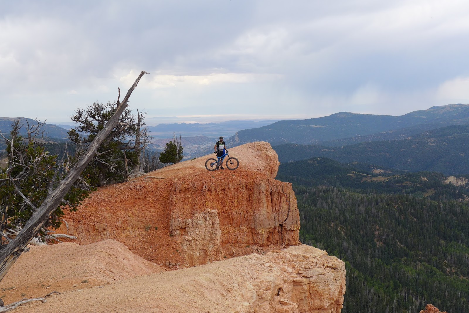
It was freaking cold and windy at 8000ft. Almost put long layers on. The sky looked threatening too, like it could dump rain any minute. But the singletrack was nice and firm already. Tires were not leaving a track and not picking up clay. The trail contoured around 8000ft for a couple miles before nearing the high point where the scenery dramatically opened to a kaleidoscope of color.

Unfortunately, a large group of equestrians were taking a break there. They had come up from the other side, probably earlier in the morning when the trail was still saturated. This completely pulverized the trail tread, making many uphill bits hike-a-bike. The horses also cut many of the switchbacks, causing severe degradation of side slope. Did the riders even understand the impact their animals were having on the trail? I felt like turning around to talk with them, but I suspected it could have just turned into an ugly confrontation. The sun was quickly turning the post-holed surface into concrete.

The views helped take my mind of how much harder this trail was to ride due to equestrian use. I spent too much time composing photos, that's for sure. Not sure when or if I'll get a chance to ride here again, so I wanted to capture the moment.

After popping out at the lower trail head, I crossed over UT-12 into Casto Canyon. A gravel road is followed the first couple miles, then ATV trail continues up the canyon. You may say ew, ATV trail, why ride that? This wasn't New England quagmire filled ATV trail. This was decent riding. In fact, compared to the chewed up Thunder Mountain, it was mighty fine riding.

Casto Canyon Trail crisscrossed the wash many, many times. There was still a trickle of water flowing. It looked like the wash flashed at some point in last 24hrs. The established ATV route across the wash was obliterated in places. Continuous hoodoos and red rock formations lined both sides of the canyon.

I followed the route Luke Stone took a couple weeks ago by adding a climb up and over a scenic vista. This was the Barney Cove and Hancock trails. I didn't expect it to climb so much though.

Cassidy Trail is picked up at the bottom of Hancock. This was where the fun was supposed to start, all singletrack back to UT-12. The only problem was, cattle had done the same thing to this trail that horses did to Thunder Mountain. It was post-holed to hell when it was wet and now it was setting up that way. The climbs where mostly hike-a-bike affairs due to the chewed up surface. This was now late in the ride and it was becoming increasingly difficult to maintain a positive attitude. 10 miles of this will pummel anybody into a sour mood.

A side excursion off Cassidy on Rich Trail was sweet though. No cows or horses had chewed it up, and there was a spectacular vista from rocky outcropping. More wasted time trying to compose that perfect photo, but hey, at least I wasn't cussing 1200 pound animals. One other positive point to this Cassidy loop was nobody was out here. Hadn't seen anybody in hours. I like that in big rides.

Further down Cassidy, the trail was much less abused by stock and several mountain bikes had been on it within the last few hours, smoothing it out a bit. The last two miles were a pretty nice rip back down to UT-12.  I finished with 40mi, 4800ft in 4.6hrs on the Garmin. A frustrating but somewhat satisfying ride, complicated by uncooperative weather and stock destroying the trail tread.

Hoodoos on Thunder Mountain Trail

Horse post holes setting up like concrete

Do you feel weird walking by manikins? I felt that way riding by these.


A windy ridge on Thunder Mountain Trail


Heading into Casto Canyon on ATV trail

Vibrant colors on Casto Canyon Trail


The wash in bottom of Casto Canyon was crossed a zillion times. Still a trickle
of water flowing. I suspect this was raging torrent in past 24hrs.


Fine riding on Casto Canyon Trail

Barney Cove Trail (I think it keeps name all the way to top).
Highest point of ride at about 8200ft.

Bottom of Hancock Trail, lots of cattle grazing in this basin

Cassidy Trail. Should have been buff rip, but torn to shreds by cattle.

Lot of color variation on Cassidy


Tech bit on Cassidy

Buff bit on Cassidy

Took Rich Trail side loop off Cassidy. This view of Losee Canyon opened up.

Panoram of Losee Canyon

Ledge overlooking Losee Canyon on Rich Trail

Probably still Rich Trail before rejoining chewed up Cassidy Trail

Wednesday, September 16, 2015

Virgin River Rim Trail shuttle ride

My wife and mom joined me for part two of my trip out west. We headed to southwest Utah with hopes of seeing Bryce Canyon and Zion national parks. None of us have been to this corner of the country.

Weather was looking much more speculative. Gone were the 0% precip and perfect bluebird days in Sun Valley. You'd expect the desert to be even more arid, but a monsoonal pattern set in.

Luke came down for the weekend to do more riding in this part of his newly adopted state. Saturday he hit the popular spots near Hurricane. Sunday, we planned to do a shuttle ride where mom and wifey would drop us off at the east end of the Virgin River Rim Trail (VRRT) and we'd ride back to Luke's car at the west end. The probability of precip went up toward the end of the day. Needed to get off that rim before weather moved in.

The ride starts out at Strawberry Point at about 9000ft elevation. Fairly nice view from there, looking into Zion National Park. The women left us and continued heading to Bryce Canyon for the day. It was much warmer than we expected at elevation, immediately overheating. Fortunately, there's a campground about half way with water, or so we thought...

The riding starts out extremely chunky and loose. A few sections of the trail are shared use with motos. The steep climbs were quite tedious at times. Every now and then, we'd poke out along the rim with another gorgeous view of pink stone formations below us.

The further we progressed along the VRRT, the better the trail conditions became for mountain biking. Our elevation max'd out around 9700ft near Navajo Peak. From there, several miles of flowy buff singletrack took us down to the Te-ah Campground. We found a water spigot. Dry. Son of a bitch!  Found the bathrooms. Padlocked!  We were screwed. I didn't even bring my filter, being so sure we could get water at the campground. Apparently they already closed for the season.

I pulled my map out to see what other structures might be nearby. There were multiple springs indicated near the campground. We started riding around hunting for them, downhill of course, which meant we would probably end up empty handed and have to pedal back up for nothing, already low on water.

I spotted what looked like water storage tanks much higher up, possibly in area of Boy Scout Spring. We pedal up the two-track. Clearly this was the water supply system for the park, but no sign of a faucet or source of water. There was fenced in area near the tanks that was very green with tall grass. Must be water there. A spring? The fence was knocked down and we started hunting. Luke said he heard water, I said no, that's just the leaves in the wind. He said no, I hear water. He was right. We found a grungy looking pipe barely at grade level buried in the grass with water trickling out of it. It was clear and cold. Could this possibly be safe to drink untreated?

We didn't have much of a choice. We had a long way to go and didn't want to cut the ride short. We pulled the grass and moss back and filled Camelbak bladders with water from what all we knew could have been a sewer pipe. What could go wrong? The water was ice cold, clear and tasted great though.

As we continued along the VRRT, we could see ominous clouds developing to the southwest, the direction weather was coming from. We had a big decision to make. Do we cut off the VRRT just before the end to head up Blowhard Mountain or do we finish VRRT and bomb backdown to Luke's car and call it a day?

Earlier, Luke had commented how close the Blowhard Mtn downhill trail was to the VRRT. Some of his friends said BH was a must ride. But between weary bodies and risk of bad weather moving in, Luke had second thoughts about extending the ride. To hit BH, we had to climb 1500ft, mostly on pavement, to reach the summit. I had reservations about hitting this downhill run because some reviews rated it double-black diamond. I have no business on that kind of terrain. Luke would surely be waiting for me. For all I knew, maybe parts of it weren't even walkable.
The paved miles went by quickly. Soon we were looking at the radomes on the summit. But we were also hearing ka-booms of thunder. Gave me the willies, on the summit of a 10,600ft mountain with a treacherous descent in even good conditions. I wanted to get it over fast.

The initial plummet was steep and furious. I told Luke it was a waste of vertical with such a deathgrip on brakes whole time. He digs that stuff though. I dismounted a few times and hiked down one particularly chundery section that must have been over 30% grade. Once we got past that and saw the view almost as good as Bryce Canyon, the riding got much better for me. The grade and tech moderated for the rest of the 2000+ft remaining descent. I felt sprinkles at one point, but it never really rained and the thunder never got close.

That 3000ft plummet was actually quite good and I would not hesitate to do it again. There was one washout at the bottom though that could annihilate an inattentive descender. Glad Luke saw it first and was there waving me down. The bottom of the descent was very wet and greasy, so clearly it rained there during our ride. The road was still wet too.

Luke's ride was done at about 43 miles. Luke could have brought me back to my hotel, but sitting 1400ft above town, I thought why not rip it on the bike. So what if the canyon road is busy and full of blind curves. It was a bit scary, but the modest grade had me going about 75% of motor vehicle speed, so not too many had to pass. I got back to hotel with 54mi, 6000ft in 5.6hrs moving time on the Garmin. After a rest day Saturday, this ride put me right back into the hole Sun Valley put me in. Ah, aren't cycling trips great?

Antelope heading up to Strawberry Point

Myself and Luke on Strawberry Point

Chundery climbs starting out from east end of VRRT

Many portals to the rim open along the way

Sketchy descent with exposure never far away.

Less than ideal lighting, but still pretty

Luke on the rim

Occasionally the trail would pass through aspen groves or open meadows
 
Never seen somewhat sweat so much.
Sweat streamed, not evaporated, is sweat wasted.

Another view from VRRT

Luke readying to launch into the next life on VRRT

A mossy pipe buried in grass with water trickling out of it for the Camelbak? What could go wrong? The campground mid ride was supposed to have water. We were counting on it. But they closed and shut down the water supply last weekend! My map indicated two springs near the campground. I believe this is Boy Scout Spring, the same spring that feeds the park water supply system. Only deal is park water doesn't come out of what looks like a sewer pipe...

Sardines. HJ's secret mid-ride fueling weapon.

Aspens near end of VRRT

Service road to summit of Blowhard Mountain with storm clouds nearby

At 10,600ft, the aspen are changing color

View of "back bowl" near top of Blowhard Mtn descent

Luke on Blowhard descent along rim

Don't think I would go out there

Rim near bottom of Blowhard descent

Along bikepath coming out of Cedar Canyon. This was dry in the morning.
Must have rained quite a bit somewhere during our ride.

Friday, September 11, 2015

Hyndman Peak Hike

The weekend before heading out west, I got one last hike in at Mt Kearsarge to maintain the hiking base I built up leading to the Presidential Traverse. There are big mountains in Idaho, and I thought maybe I'd reach a point where I needed a day off the bike and I could go hike instead.

Just outside of Sun Valley, there is a 12,000 footer, of which there are only nine in Idaho. There are no mountains that reach 13,000ft in Idaho. This mountain is called Hyndman Peak. From what I read, maybe 10 people will hike it on a weekend. Compare that to Mt Monadnock in New Hampshire where thousands will hike to the summit on a nice weekend.

Hyndman Peak is the only Class 2 hike of the 12,000 footers. So I thought maybe it was ok to do solo away from home. After seeing Hyndman up close from Pioneer Cabin, I began having doubts about hiking it. It looked big and scary.

It wasn't until a late-start breakfast the next morning that I decided to give it a go. The decision was forced more by dreading getting on the bike and climbing another 5000-6000 feet than anything else. I wasn't going to do nothing with such perfect weather and so much outdoors to explore. Scrambling 5000ft up a mountain is a good recovery activity, isn't it?

Arriving at the trailhead around 9am, there was still frost on the ground. Perfect. I brought my filter along just in case, as it was expected to get pretty warm and there is water along most of the route. I read typical round trip times are around 8hrs. That should get me back to the car around 5pm with 3hrs daylight to spare. I did bring full compliment of safety gear with me, multiple warm long layers, emergency bivy, powerful LED headlamp, first aid kit and more. Makes for heavy pack with 100oz of water, but better to have it and not need it than to need it and not have it. Also brought cell phone in outside chance there would be signal up top (there was none at trailhead).

The first three miles gain only 1200ft or so. I read some ride MTB on this part. I didn't see any tracks, but regretted not bringing my bike. It was completely rideable and the descent would have been a rip. Could have saved 1-2hrs off the hike. But time off the bike was not a bad thing.

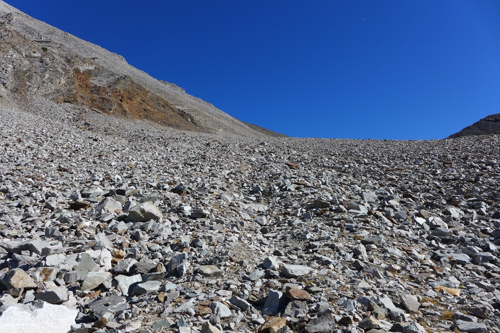
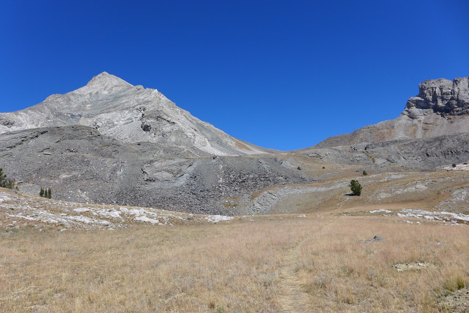
At the three mile mark, the grade kicks up from 6% to about 30%. Time to take poles out and get some upper body work. The next few miles went like this. Gain several hundred feet at really steep grade, then level out for half a mile or so. Eventually a level was reached with no trees and Hyndman appeared in full glory. It was nothing but scree! This was going to be the mother of all scree scrambles for me.

I passed a quaint little pond in the Hyndman basin that looked inviting. Made note to check it out on the way back. I was only half way up the 5000ft net gain climb.

The trail starts to peter out as the surface increasingly became scree. I read that you just aim for the saddle between Hundman and Old Hyndman. No way to go wrong here. The saddle sits at about 10,800ft, or 1200ft below the summit. From the saddle, the route follows closely to the knife edge ridge on loose scree all the way to the summit.

The view from the saddle was almost reward enough for the hike. I could have turned around here and played it safe. But where's the glory in that? I began towards the summit, staying just below the precipice to the right.

The off-camber scree field was quite challenging to navigate. A couple times I ended up in precarious positions and had to reroute. This was not fear of death by any means, but what was disconcerting hiking this slope was how loose and unstable it was. Almost everything moved underfoot, sometimes rocks that had to weigh many times what I weigh. A few times large rocks moved and almost pinched my hand or foot. That would hurt at the very least.

Three hours of continuous uphill hiking will put you in a superb flow state. Reaching the summit without another soul around was a divine experience. I basked in the sun and solitude for a good while.

Before heading down, I pulled the devil's tool out of my pack, my cell phone. Not so surprisingly, I had a 4G signal. I remember seeing a cell tower on big hill over Hailey, and no doubt this summit would be line of site to that, although very far away.  Had to let wifey and the social media universe know where I was.

I made it to the top much quicker than expected, and despite late start, had all the time in the world to get back down. It wasn't the climb that concerned me doing this hike. It was coming back down that scree field. That is when accidents happen. You'd think with my GPS, I could follow the same track down and avoid the couple mistakes I made going up. Nope. It was easier to see from above where others have gone, but I still managed to make new mistakes and ended up in tough to negotiate unstable areas. Don't scree fields ever let go and 10,000 tons of rock go crashing down? Those rocks have to fan out at the bottom somehow. The things I think about while hiking.

Back down to the saddle, I breathed a little easier. Pretty sure I took longer to get off the summit than to go up it. Funny how that is. In some cases, I'm the same way on the bike.

Half way down Hyndman basin, I came back by the heart-shaped pond I noted heading up. The water was clear and frigid. I hadn't seen a soul in five hours. An ice bath to sooth hammered legs seemed irresistible. I hadn't skinny dipped in almost 40 years. I couldn't think of a more magical place to go for a dip. I stripped down and stepped in. The bottom was pretty mushy with sharp rocks. The water was so cold it would take your breath away. I didn't stay in long. The dip was a perfect compliment to the summit experience. How often can you strip down for dip in a pristine high-alpine lake without a worry in the world? I've always wanted to do that since I've been going on trips like this.

The rest of the hike down was mostly uneventful. The sun had now moved to an afternoon position and cast Hyndman Peak in a much different light. You can't take a bad photo in these conditions. I had my LX7, a high-end point-and-shoot with me. Hyndman Creek has some nice cascades in it. The sun was now in a favorable position to capture a few photos there too, unlike first thing in the morning.

With just over three miles to go, I encounter a middle-aged couple heading up. They were traveling lightly and it was later in the day, so I doubt they were heading to the summit. Once I got below the last wall, there were bike tracks. Ah, they road bikes in for the first three miles. Looked like one might have been a fat bike. They must have ditched the bikes in the brush.

I got back to the car in about 6.7hrs total elapsed time. Moving time was probably around 5.5hrs, and distance should be about 14mi even though my Garmin showed only 13mi. This was easily my most unique hiking experience to date. Can't really compare it with the Presidential Traverse, as they are very different kinds of hikes, each special in their own way. I would do this hike again when visiting or even moving to Sun Valley.

First full view of Hyndman Peak about hour into hike.

The saddle between Hyndman (left) and Old Hyndman (right) that had to be gained first.

Small lake that would get used later in the hike.

The closer I got, the bigger and scarier Hyndman looked.

Just to get to the saddle, significant talus had to be climbed.

Looking along ridge to Hyndman summit. Only 1200ft to go!

Back side of ridge is precipitous drop.

View from 12,009ft looking mostly north.

View of basin I hiked up from summit.

Panoram from west to east looking north.

Could have spent all day up here, so quiet, weather so perfect.

You know how I said yesterday Hyndman looked scary from Pioneer Cabin? Well, here is Pioneer Cabin at 9500ft from Hyndman summit at 12,009ft.

My route back down. Had all the time in the world, so I was going take it slow. No marked route. Sometimes I found hints of traveled routes, other times I ended up in precarious situations. All of this was loose.

Looking almost straight up at one tricky sections to get around. No fear of death, but just have to be careful. Several times I almost pinched or trapped a foot or hand when a large boulder moved.

The lake again, with peak almost half a vertical mile up.

Ice bath. Oh yeah, I totally skinny dipped this pond. Hadn't seen nor heard a soul in five hours. 

Looking back up at Hyndman and the saddle with Old Hyndman with better later in the day lighting.

Last full view of Hyndman with fabulous lighting and saturated sky.

Hyndman Creek had some very nice cascades along the way. Had to wait for the return trip so sun would not be into the camera.

Another angle of the falls.

I think this is peak just south of Old Hyndman, just under 12,000ft. Touch of fall color in the aspen.

Unusual art and ranch name on the road to trailhead.

Creepy. When you Google Hyndman images, these will come up.