Weather was looking much more speculative. Gone were the 0% precip and perfect bluebird days in Sun Valley. You'd expect the desert to be even more arid, but a monsoonal pattern set in.
Luke came down for the weekend to do more riding in this part of his newly adopted state. Saturday he hit the popular spots near Hurricane. Sunday, we planned to do a shuttle ride where mom and wifey would drop us off at the east end of the Virgin River Rim Trail (VRRT) and we'd ride back to Luke's car at the west end. The probability of precip went up toward the end of the day. Needed to get off that rim before weather moved in.
The ride starts out at Strawberry Point at about 9000ft elevation. Fairly nice view from there, looking into Zion National Park. The women left us and continued heading to Bryce Canyon for the day. It was much warmer than we expected at elevation, immediately overheating. Fortunately, there's a campground about half way with water, or so we thought...
The riding starts out extremely chunky and loose. A few sections of the trail are shared use with motos. The steep climbs were quite tedious at times. Every now and then, we'd poke out along the rim with another gorgeous view of pink stone formations below us.
The further we progressed along the VRRT, the better the trail conditions became for mountain biking. Our elevation max'd out around 9700ft near Navajo Peak. From there, several miles of flowy buff singletrack took us down to the Te-ah Campground. We found a water spigot. Dry. Son of a bitch! Found the bathrooms. Padlocked! We were screwed. I didn't even bring my filter, being so sure we could get water at the campground. Apparently they already closed for the season.
I pulled my map out to see what other structures might be nearby. There were multiple springs indicated near the campground. We started riding around hunting for them, downhill of course, which meant we would probably end up empty handed and have to pedal back up for nothing, already low on water.
I spotted what looked like water storage tanks much higher up, possibly in area of Boy Scout Spring. We pedal up the two-track. Clearly this was the water supply system for the park, but no sign of a faucet or source of water. There was fenced in area near the tanks that was very green with tall grass. Must be water there. A spring? The fence was knocked down and we started hunting. Luke said he heard water, I said no, that's just the leaves in the wind. He said no, I hear water. He was right. We found a grungy looking pipe barely at grade level buried in the grass with water trickling out of it. It was clear and cold. Could this possibly be safe to drink untreated?
We didn't have much of a choice. We had a long way to go and didn't want to cut the ride short. We pulled the grass and moss back and filled Camelbak bladders with water from what all we knew could have been a sewer pipe. What could go wrong? The water was ice cold, clear and tasted great though.
As we continued along the VRRT, we could see ominous clouds developing to the southwest, the direction weather was coming from. We had a big decision to make. Do we cut off the VRRT just before the end to head up Blowhard Mountain or do we finish VRRT and bomb backdown to Luke's car and call it a day?
Earlier, Luke had commented how close the Blowhard Mtn downhill trail was to the VRRT. Some of his friends said BH was a must ride. But between weary bodies and risk of bad weather moving in, Luke had second thoughts about extending the ride. To hit BH, we had to climb 1500ft, mostly on pavement, to reach the summit. I had reservations about hitting this downhill run because some reviews rated it double-black diamond. I have no business on that kind of terrain. Luke would surely be waiting for me. For all I knew, maybe parts of it weren't even walkable.
The paved miles went by quickly. Soon we were looking at the radomes on the summit. But we were also hearing ka-booms of thunder. Gave me the willies, on the summit of a 10,600ft mountain with a treacherous descent in even good conditions. I wanted to get it over fast.
The initial plummet was steep and furious. I told Luke it was a waste of vertical with such a deathgrip on brakes whole time. He digs that stuff though. I dismounted a few times and hiked down one particularly chundery section that must have been over 30% grade. Once we got past that and saw the view almost as good as Bryce Canyon, the riding got much better for me. The grade and tech moderated for the rest of the 2000+ft remaining descent. I felt sprinkles at one point, but it never really rained and the thunder never got close.
That 3000ft plummet was actually quite good and I would not hesitate to do it again. There was one washout at the bottom though that could annihilate an inattentive descender. Glad Luke saw it first and was there waving me down. The bottom of the descent was very wet and greasy, so clearly it rained there during our ride. The road was still wet too.
Luke's ride was done at about 43 miles. Luke could have brought me back to my hotel, but sitting 1400ft above town, I thought why not rip it on the bike. So what if the canyon road is busy and full of blind curves. It was a bit scary, but the modest grade had me going about 75% of motor vehicle speed, so not too many had to pass. I got back to hotel with 54mi, 6000ft in 5.6hrs moving time on the Garmin. After a rest day Saturday, this ride put me right back into the hole Sun Valley put me in. Ah, aren't cycling trips great?

Antelope heading up to Strawberry Point

Myself and Luke on Strawberry Point

Chundery climbs starting out from east end of VRRT

Many portals to the rim open along the way

Sketchy descent with exposure never far away.

Less than ideal lighting, but still pretty

Luke on the rim

Occasionally the trail would pass through aspen groves or open meadows

Never seen somewhat sweat so much.
Sweat streamed, not evaporated, is sweat wasted.

Another view from VRRT

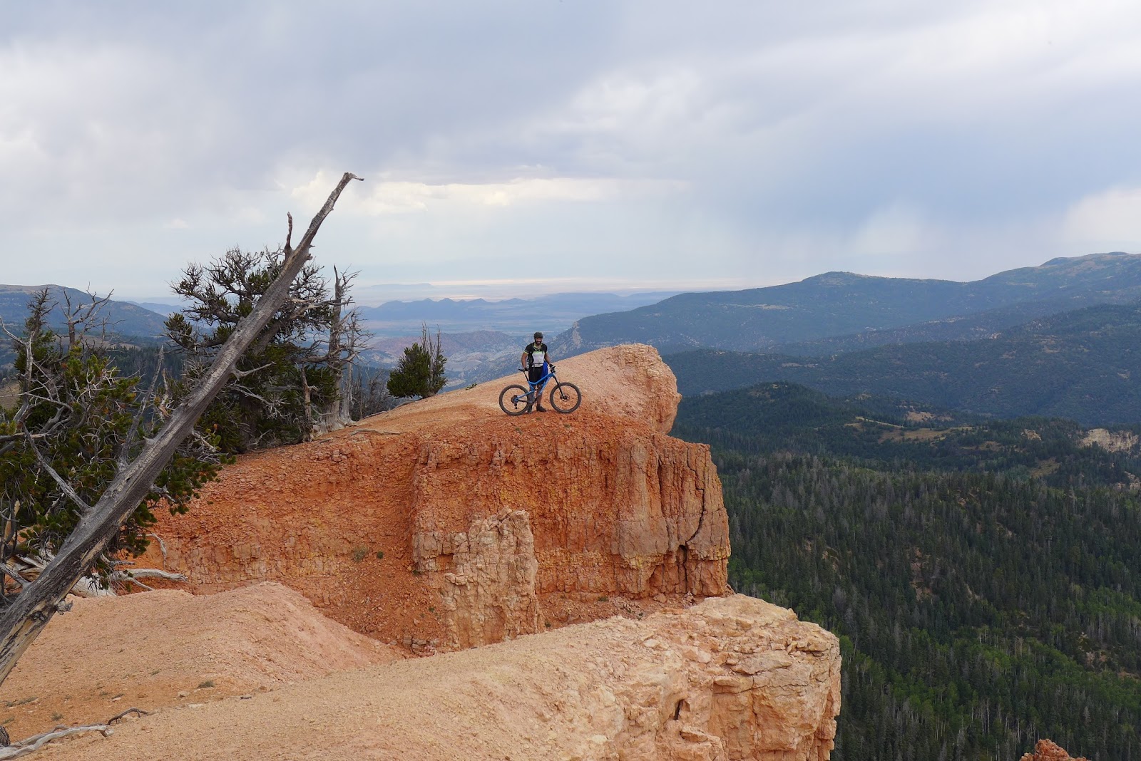
Luke readying to launch into the next life on VRRT
 A mossy pipe buried in grass with water trickling out of it for the Camelbak? What could go wrong? The campground mid ride was supposed to have water. We were counting on it. But they closed and shut down the water supply last weekend! My map indicated two springs near the campground. I believe this is Boy Scout Spring, the same spring that feeds the park water supply system. Only deal is park water doesn't come out of what looks like a sewer pipe...
Sardines. HJ's secret mid-ride fueling weapon.

Aspens near end of VRRT

Service road to summit of Blowhard Mountain with storm clouds nearby

At 10,600ft, the aspen are changing color

View of "back bowl" near top of Blowhard Mtn descent

Luke on Blowhard descent along rim
Don't think I would go out there

Rim near bottom of Blowhard descent

Along bikepath coming out of Cedar Canyon. This was dry in the morning.
Must have rained quite a bit somewhere during our ride.
1 comment:
Loved rreading this thanks
Post a Comment