My September 2013 trip did not go as planned. A lightning strike in August started the Beaver Creek wild fire. It consumed over 100,000 acres and closed an even bigger area to recreation. This area contained a large majority of Sun Valley's MTB trails. I was pretty devastated, as no doubt were the locals and businesses that rely on tourism. I spent only a few days in Sun Valley during that trip and found a few other good places to ride.
Not all has gone well with my 2015 trip to Sun Valley either. While reconstruction of the Osberg Ridgeline Trail was expected to be complete by September, our governing powers to be decided to declare another huge area open to mountain biking as wilderness area. I book trips to Sun Valley with certain expectations, only be disappointed before embarking on the trip. At least Osberg opened about the same time wilderness closed other trails. I debated whether to change my plans and stay in Utah instead, in a state of temper tantrum. But after my head cooled, I decided to visit Sun Valley as planned. There still is a lot of fine riding here, even if the best of it just got killed.
Luke Stone drove up from SLC to join me for a long loop. We hadn't even fully decided which loop to do until literally getting ready to roll. Luke commented that he usually doesn't like to do more than 3000ft of climbing after a big day. 50+ miles and 6000ft seemed over the top. It did for me too. Plus, Luke didn't have a chance to fix the broken wheel spoke. Head out deep into remote area with broken wheel on tired legs? What could go wrong?
I pulled a track from Strava, from Rebecca Rusch, no less, as a guide for the loop. I modified her route slightly to keep us off Rt 75 as much as possible. The ride starts out in town on paved bike path, When we ran out of path, we jumped on Rt 75 for four miles to pick up double track Harriman Trail that roughly parallels the highway. Harriman intercepts Baker Creek Rd, a forest service road that continues climbing gradually for 7-8 miles to the Osberg Ridgeline trailhead.
It was a chilly morning, low in 20's in town overnight. We started with long upper layers but removed them on Baker Creek Rd, as temps rose rapidly.
At the trailhead, Luke commented "you mean we could have shuttled this?!" Yeah, I supposed you could, but then you'd have a guilty conscious descending 2000ft+ more than you climbed. Right? We'll, I guess not everybody shares the same HJ ethic. The 27 miles of riding to the trailhead is pretty decent riding. Only 4mi are on paved road. The rest is bike path, gated doubletrack, and dirt forest service road.
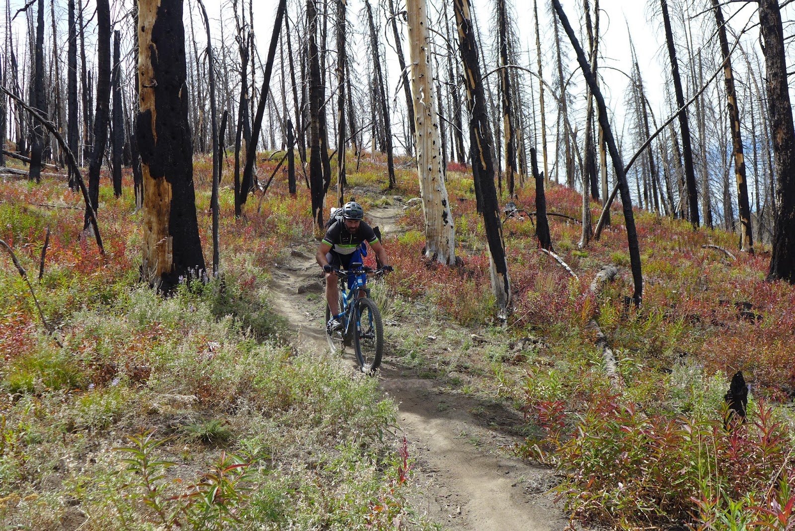
Once on Osberg, you could immediately sense how badly this trail was damaged by the fire. There were mud slides that took out the bench cut, bridges across gullies burned, soil turned into talcum powder and more. But the trail was now riding great. Climbing grades were perfect. It took another 8 miles to reach the high point on Osberg. The views kept getting better and better as we climbed.
We encountered several riders on the way up. A solo guy, a couple and a large group of guys. More riders than we saw on the previous day's traverse adjacent to a large metro area. The solo guy, a local, has ridden the ridge many times. We talked a bit about the new wilderness too. Pretty devastating to lose it to mountain biking while hikers, equestrians, and even trucks to access mineral claims still have access to a once popular mountain biking area.
Osberg's quality of trail, type of riding terrain, and big country views rival the best trail rides I've done anywhere in the country. From the high point, you could not see a trace of human impact in any direction, maybe a hundred thousand acres in 360 degree view. Definitely a way out there feel.
From the high point, it was a nearly 4000ft drop back to town, almost all downhill with a few pesky ups to remind us how trashed our legs were. Luke was tearing it up again, leaving a big dust plume in his wake. He's hard on equipment. His brake pads went out, metal to metal, and we still had 2000ft of steep descent to go. His rear hub started going out again too, the free-hub body slipping under load. That combined with a broken spoke, it's a wonder he and bike finished in one piece.
Made it back, we did. Finished with 55 miles, 5700ft of climbing, in 5.3hrs moving time on the Garmin. That put my 3-day tally to about 16,000ft of climbing on dirt. I was completely destroyed, but in a satisfied kind of way. This ride exceeded my expectations by a wide margin, a must do ride when I visit again.

Baker Creek Rd looking back at the newly designated Boulder/White Clouds Wilderness

Starting out on Osberg Ridgeline Trail through burn area.

Newly rebuilt bridge after the fire.

Luke climbing the first open meadow on Osberg

Gaining views as we climb Osberg

Big open traverse on Osberg Ridgeline Trail

Looking back on Osberg where we were a minute or two earlier.

A turn with nice view looking down on Osberg Ridgeline Trail.

Ripping a turn on Osberg

Hard to keep eyes on the trail!

View from around 9600ft on Osberg Ridgeline Trail. Not a hint of human footprint in this view.

Looking along the ridge, about to begin the 4000ft plummet back to town.

Luke heading back to town on the ridge

Bit of exposure just below high point on the ridge.

A chunky section which doesn't slow Luke down in the least.
Touch of fall color on Osberg Ridgeline Trail
1 comment:
I enjoyed this write-up. Been meaning to get over there from Boise and check it out. Thanks.
Post a Comment