[Previously posted on FB 13-Sept-2016]
Trying to make the best of the weather. Forecast was pretty crappy for today. Tried to get earlier start. Headed north to Purgatory Ski Area to hit another section of the Colorado Trail.
I've ridden this section once before with Dave Penney. I recall Dave ditching me at the ridge when the thunder started and left me for dead. Today I have only myself to blame if I became a crispy critter.
I almost abandoned the ride at Bolam Pass when a hail squall moved through. Back down at the Colorado Trail (CT) junction, conditions improved slightly and I decided to give the 8mi trek across the ridge a go. I made it over Blackhawk Pass without getting hammered with precip again.
I had planned to traverse the ridge all the way to the Corral Draw descent, but didn't want to temp fate a second time. It would have entailed a bunch more climbing, and I was pretty wrecked racing against the weather so far. So I took the Hotel Draw jeep road the remaining vertical back down. Probably a good call, hit some rain before I got back on pavement with the car.
 |
| Kind of stupid heading up to 11,000ft when the skies already look this ominous. |
 |
| Approaching Bolam Pass, shelter from old mine camp if I need it in an emergency. |
 |
| SOB! I no more than get to start of the CT, it start raining at Celebration Lake |
 |
| I decided to bail on the 8 mile ridge traverse to next available down route due to weather, so I climbed the remaining 300ft to Bolam Pass. I had never been all the way to the pass. The view was interesting and frightening at the same time. |
 |
| Rain turned into rigorous hail squall. That shit hurts at 11,400ft where there isn't much air to slow it down! |
 |
| Hail and black clouds suggested I was f'd and should bolt right back down. It was only around 10:30-11am. |
 |
| Yet there were breaks in the clouds in some directions |
 |
| That is probably the Lizard Head Wilderness in distance |
 |
| When I got back down to the CT junction, the sky didn't look so bad south and east. I changed my mind and decided to give the ridge a go. After all, how long could 8mi take? An hour, right?? Yeah, right! |
 |
| Heading south on the CT, didn't take long for more ominous clouds to build. I wanted to be over Blackhawk Pass by noon, then I was home free off the ridge. |
 |
| I think that is Hermosa Peak in distance. The CT crosses over the ridge several times, accumulating a huge amount of PUD vertical (pointless up and down). |
 |
| Getting ready to cross over the ridge again |
 |
| Crossed over, skies to SW don't look too bad |
 |
| Approaching Blackhawk Pass just left of center |
 |
| Blackhawk Pass straight ahead. There was huge amount of hike-a-bike getting to this point. It took way more than an hour to cover that 8 miles of ridge. |
 |
| Final switchback to Blackhawk. Might just make it without dodging lightning or getting soaked. GPS said it was 37F, but I think it is not measuring temp accurately anymore. It was cold and very windy though. |
 |
| Blackhawk Mtn from the pass |
 |
| Looking north from the pass |
 |
| No imminent threat of precip, chilled for a bit, figuratively and literally. |
 |
| My route down |
 |
| Lizard Head Wilderness from Blackhawk Pass |
 |
| Shot of the pass when the sun briefly illuminated it |
 |
| Heading down east side of Blackhawk Pass. Life was good! |
 |
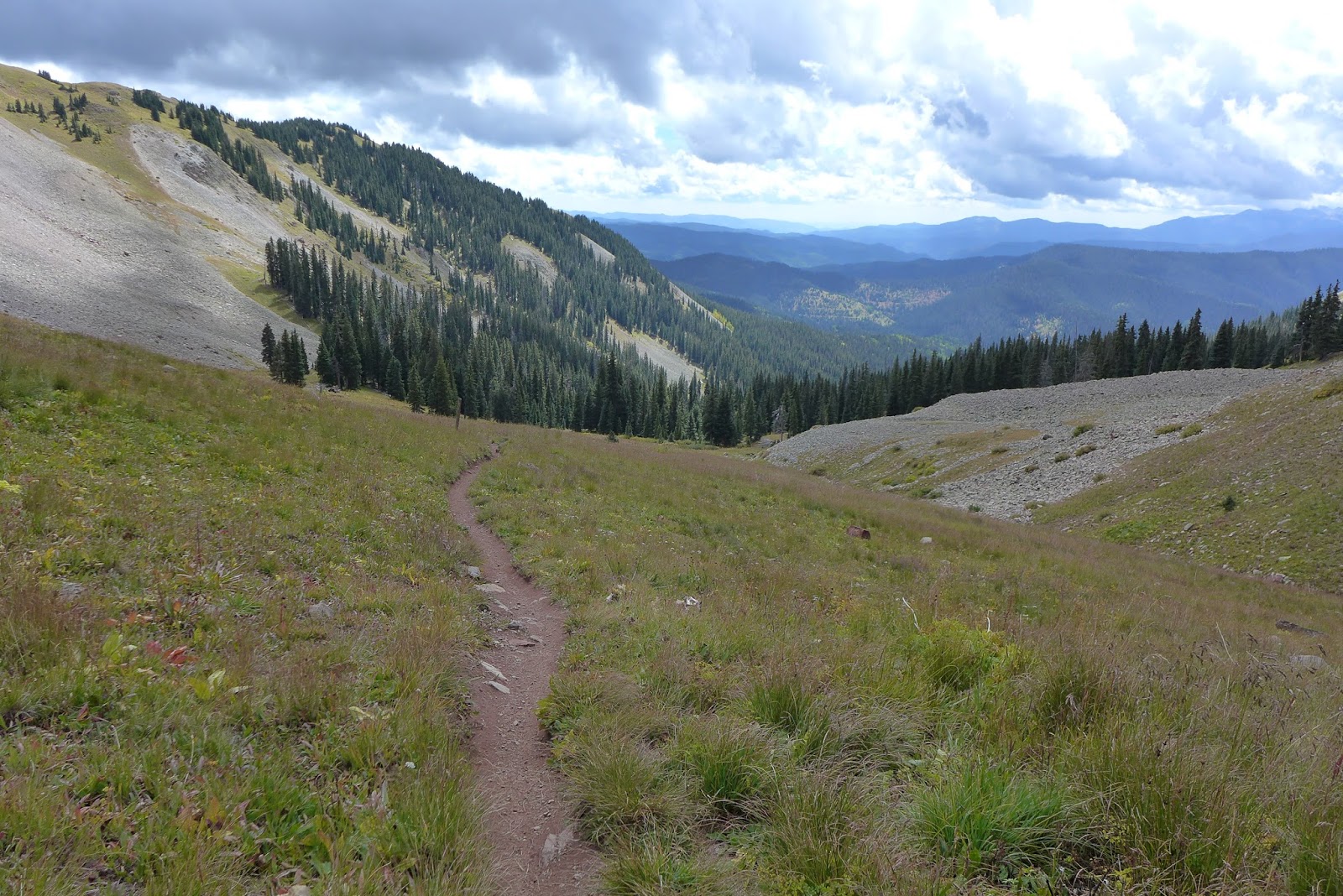
| Looking down the CT from Blackhawk |
 |
| Looking up the CT towards Blackhawk Pass |
 |
| There were some very chunky sections on the descent, but mostly buff |
 |
| Back in the pines on benchcut |


No comments:
Post a Comment