Tuesday, September 9, 2014

What to do on rainy days in Colorado

When I got up on Tuesday, no surprise, it was 50F and pouring outside. No place within driving distance was going to escape unscathed. Take a rest day? The Hill Junkie scoffs at rest. One reader suggested I check out one of Colorado's many hot springs. A web search didn't bring anything up particularly close, and the most accessible ones were developed. I really wasn't interested in hiking 18 miles round trip to Conundrum hot springs in between Crested Butte and Aspen, especially since I'd have to traverse a 13,000ft pass in rain and zero visibility. One thing I did have on this rainy day was time. A drive to Ouray (pronounced yur-RAY) was not beyond reason.

I really like Ouray. It is easily the prettiest town in the USA I have visited, on par with any picturesque town in the Alps.  There are two hot springs near Ouray, one right in town itself and one on the way, Orvis Hot Spings. Orvis is more of a resort and clothing optional. Mrs Hill Junkie would not approve! Can't bring any electronics in there either, so no blog fodder. Ouray Hot Springs is more of a public pool. I decided to check it out, and a couple other things in the area too.

I first visited Box Canyon. If you've visited the Flume Gorge in NH, you have an idea what Box Canyon is like. After copious rainfall, the water was really moving. It was so loud in the slot canyon you could not talk over the roar. The water must have been coming down over 100mph in the falls. It looked like chocolate milk.

Still pouring mightily, I dropped down to the hot springs. They open at noon and only a handful of cars were there. They had a large swimming lanes pool at 76F, a large warm pool at 96F and a smaller hot pool at 106F (current measured temps). The water is 100% naturally heated, although I detected a hint of chlorine. I asked about the water. Lifeguard on duty said regulations require chlorine in public pools. So not 100% natural, but it sure was nice to just lay back in the 96F pool, cool 50F rain coming down on my head, while the rest of my body felt like it had returned to the womb. I could have napped easily, gazing up at 2000ft cliffs all around me. Very quiet with just a few people there in such a large area, except for the main road which was close by. I was more wrinkled than a prune when I finally got out.

My friends and colleagues are always eager to bring Fat Doug back. Dave sent me an NPR story on a new hypothetical sandwich Arby's was offering to showcase how many meat choices they offer. It is called a Meat Mountain and contains every kind of meat Arby's offers on sandwiches. It is not so hypothetical. There's an Arby's in Montrose, so I stopped by on my way back from Ouray. I asked if I could order one. The counter clerk said no, that was just an advertising gimmick. Then another person came up, manager maybe, said "yeah, we can do that, but I have to figure how how to build it first." Score! It was $10 and took a while to make. Once they gave it too me, all eyes in the place were on me. The manager even made a phone call and jubilantly said "we sold one!" I was the first at that store to order a Meat Mountain. So was it good? Yeah, I would order one again.

The rain was breaking up as I started to head back. I've driven by the Black Canyon gorge before but didn't really know what it was about. I decided on a whim to drive around to the north rim since it looked like there'd be less people there. I stopped at a point above Curecanti Creek, which feeds into the Gunnison River almost 1000ft straight down. I saw a sign for a trail to the bottom. Sweet. Two miles, 900ft drop, how hard could that be? Harder than it looked at the kiosk. I bounded down until it became all slippery rock and very steep, almost like hiking in Tuckerman's Ravine. More than half the vertical is contained in the bottom quarter of the trail, I surmise. It was cool to stand in the bottom looking perfectly straight up to where I was less than 30 minutes earlier. If somebody kicked a rock over the edge and it hit you, you'd be deader than dead. The sun was starting to set has I bounded back up out of the gorge. Heading back out to US-50, deer were all over the place, and none too timid either. There was a freshly killed one on US-50.

Hill Junkie knows how to make the best of rainy days!  If there is no more rain overnight, I may try to hit the Colorado Trail near Lake City on Wednesday.

Blue Mesa Lake, backstop of big dam on Gunnison River.
On way to Ouray in morning.

Ouray looking south

Ouray looking north from second switchback

Loud cauldron of chocolate milk. Box Canyon Falls

Ouray from Box Canyon Falls high bridge

Box Canyon tunnel


Soaking in Ouray Hot Springs

Arby's Meat Mountain. Chicken Tenders on the bottom, bacon on the top, everything else in between.

Gonna be gone in no time. Could have eaten two.

Only meat item not on sandwich was the fish, which is a seasonal item.

Part way down Curecanti Trail looking up

Bottom of Curecanti Creek where it meets the Gunnison.

Yep, Curecanti Creek is 900ft straight down.
I was down there 30 minutes earlier.

Hill Junkie is still freaked out by heights.

Looking over the Gunnison River Gorge.
Hopefully last of the rain for the trip.

Got lucky, sort of

Day six of cycling Colorado had me wake up to rain in Gunnison. The rain was not supposed to move in until after lunch. Much rain over Monday/Tuesday is expected, with some flooding, due to remnants of hurricane Norbert. I did not want to get shut out of riding two days in a row. Perusing radar maps and looking out third floor hotel windows suggested it was not raining in Crested Butte just 30 minutes north. It did not appear to rain overnight there either. If I hurried, I might be able to get in at least a short ride on dry trails. I'd have to improvise a route, as my long routes I have planned for later in the week would be way too risky. My only other options was to drive 3hrs east to the rain shadow of the mountains, like Pueblo. Screw that.

After letting my wife know my game plan, I skedaddled to CB. 30 minutes is a long time to ponder route selection. I changed my plan by the time I got to CB. I would hit the optional extension I didn't do on yesterday's ride. Carbon Creek Trail/Green Lake Trail. I'd loop it by climbing Kebler Pass Rd. I thought that was a pretty safe weather bet, as the 1200ft road climb would go by quickly. I messaged Cathy with my new plan and split.

Temp was only around 45F, but I did not put any long layers on, since the climb begins immediately. I took full complement of winter clothing with me, however, as I pretty much expected to get caught in a frigid deluge. Wind resistant tights, thermal barrier jacket, Gortex shell, full gloves, even a balaclava. Only thing I didn't take was booties.

The TT up Kebler Pass Rd went well. I was suprised how good my legs felt after such a punishing ride the day before. From Kebler Pass, another dirt road is taken south, Ohio Pass Rd. A bit more climbing brought me to a frigid descent. I didn't study the profile for this particular loop, so I wasn't sure how much climbing was involved or how steep it was. So far, so good. There was zero wind and the dark clouds far to the south and west were not getting any closer.

Then I turned off onto Carbon Creek Trail. It began to climb a lot, including traversing large talus fields. Barely rideable. Thought I had enough of that on this trip already. What was particularly disconcerting was there were no mountain bike tracks in any of the wide, soft parts of the trail, only motorcycle tracks. Did I pull another loser track from Strava?

I reached the pass between Carbon Peak and Mt Axtell without too much difficulty. What I didn't remember was there was another big descent after this and I would have to make all that vertical up yet again. Being a moto trail, the descending was quite sketchy. Picture foot deep rut, about a foot wide, chocked full of large, loose rocks. Sometimes descending was almost as slow as climbing.

When the grade pitched up again, it did so with a vengeance. My Garmin told me I would pushing my bike up 18-24% grades on shit crud surface. My shoes are going in the dumpster when I get home. I have worn off all of the sticky rubber lugs on this trip, and they were my newest shoes. Ugh! There was one continuous section of hike-a-bike that took 20 minutes alone. Carbon Creek Trail is poorly maintained - lots of fall-line erosion, deep ruts, over-growth, trail braiding, you name it.  There were several other HAB sections on this climb. Six days in a row with significant HAB content. I guess that is a risk of exploring paths less ridden.

When I finally reached the top, the pass between Mt Axtell and Whetstone Mtn, the trail meandered and contoured for a while. It was not easy riding, the trail badly braided through wet spots and rutted everywhere. At least there was a nice view of Mt Crested Butte, a perspective I've not experienced yet.  When Carbon Creek Trail (actually called Para me y Para Te on the descent) finally pointed down, it did so almost as meanly as it went up. Rideable, but with considerable risk. I thought at least the hike-a-biking was done...

But no. I round a bend and another talus filled trench at neck tweaking gradient appears before me. F-bombs! I pushed up this like a stumbling drunk again. I came to a trail junction and woman hiking with a dog came by on a cross trail. She asked if I was ok. Oops. I apologized, said I was sick of stubbing my toes on this trail. The good news was the cross-trail she was on was the Green Lake Trail, a descent that gets rave reviews. Maybe the moto-rut BS was finally over and the rest of this 2000ft descent will go well.

Green Lake Trail was everything the reviews claimed it to be. I passed a guy in full downhill bike gear walking his bike up. I bet he was going to be a tad faster coming back down than I was. This trail was very well maintained, probably easy to keep it nice because motos are not allowed on it. The numerous tight switchbacks near the bottom were a test of wits. The descent made me almost forget how much misery I endured to get up there. Based on tire tracks, 99.9% of Green Lake Trail riders come up Wildcat Trail, which is off Kebler Rd just a bit out of town. But what fun would there be in no boondoggle?

After popping out back in town, the skies were still holding. A new trail near town was recently built that I hadn't ridden yet, the Lupine Trail. If I looped Lower Loop, Lupine, Upper Loop and Tony's, I could net another 15-20 miles I figured and never be far from town if it started to pour out.

Lupine is a marvelous trail, built in the same spirit as Trail 401. You see town most of the time down the valley from this trail. I clearly rode it in the wrong direction in terms of fun-factor, but it rides well either way nonetheless.  From now on when I ride 401, I will have to start my loop with this trail.

Lupine dumps out near the alpine ski village, From there I picked up Upper Loop trail and took Tony's trail back down to town. Still no rain, but the skies were sure getting dark all around. It was no doubt raining in the high country just north of town. I later learned it rained on and off all morning in Gunnison.  I finished with 40mi, 5000ft in 4.6hrs moving time. Another solid ride, hitting at least four named trails I've never been on.

I changed and headed up Elk Ave (the main drag in CB) to get a burrito at Teocalli Tamale's. As I sat down outside, it started to sprinkle. You couldn't ask for better timing.

It is a shame what town leadership did this past weekend with the town. They sold out to Budweiser for a commercial. The whole town was painted blue and they chartered in over 1000 punks to consume free beer for three days. There were concert stages, goofy contests set up, whatever. That was the theme, Whatever, USA. The whole town was shut down for this. It is why I could not book a room in CB over the weekend. Budweiser made a "donation" to the town of $500,000 to take over the town for three full days. Even today, Monday, they still haven't opened everything back up. And Elk Ave? Yeah, it's still painted blue. I really liked Crested Butte, but this idiotic stunt the town leadership secretly pulled will have me looking for other Colorado locales to plan my next trip. The locals didn't even know this was happening until just days before setup started.  Here are a couple links (1, 2) with photos from the event. So what made state news about this event? The local Gunnison airport was overwhelmed when it was time for everybody to go home. Many missed connecting flights. And these stupid kids thought it was ok to bring the weed they legally bought here on the plane with them. Whiny bitches.

Tuesday looks like total wash-out. Mike T suggested visiting a hot spring, but there doesn't appear to be any close by. Could do Conundrum hot spring, but I have to hike 8.6 miles one way over a 13,000ft pass in wilderness area to get to it. That could be high risk if the weather is bad. Going to see what radar map looks like in the morning and wing it again. Here's today's photo dump from my shity weatherproof TS4 camera.

Ohio Pass Rd. The views weren't bad.

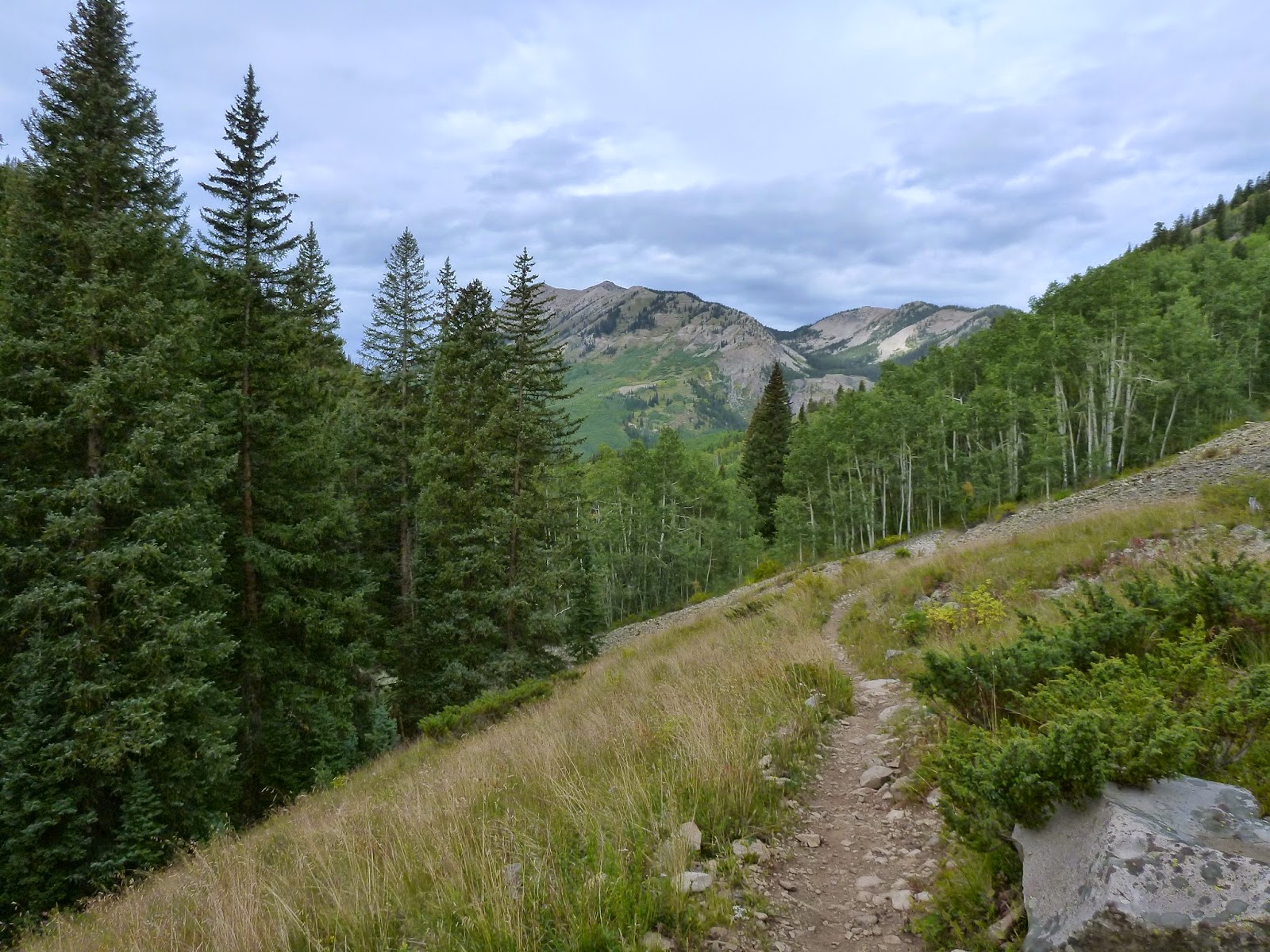
Carbon Creek Trail. Rideable, sort of, but I'd rather be done with talus fields.

I think this is Ohio Peak, looking back down Carbon Trail.

This might be Whetstone Mtn, looking up Carbon Creek Trail.

Carbon Creek Trail. Seems pretty enough. But trail was very deep rut here, water running down it in places, and those bushes you see back a ways - they were growing over the trail. You couldn't get out of the rut to avoid them.

Mt Crested Butte and the town below. A perspective you don't get from other rides around CB.

"Steeper than it looks." See trail angle up to right behind trees? F-bombs, as I thought it was all downhill from here on back.

The new Lupine Trail, looking north away from CB. That might be Scarp Ridge in wee background on left side of image.

Another of Lupine Trail with two riders that passed me.

Lupine looking towards town and rain just beyond to the south.

Descending Tony's trail with Mt Crested Butte in background.

Section of Elk Ave still cordoned off after the Budweiser bash. I wonder how many tourist won't be back? Will the street and lamp posts stay that stupid Budweiser blue color forever? If I lived here, I'd be sending town politicians scampering for cover.

Sunday, September 7, 2014

Scarp Ridge - I thought you were an alien!

Every trip I try to pick one or maybe two rides that define the trip. On my current trip, these would be Scarp Ridge by Crested Butte and the Colorado Trail from Cataract Lake to Lake City. These rides follow ridges at 12,000ft and 13,000ft respectively. There are always risks riding up this high, as it takes a long time to get up there, you can't get off just anywhere, and the weather can turn in a heartbeat.

Scarp Ridge is not a mainstream riding trail. In fact, there's really not an official trail on the ridge, but hikers and a few riders have defined a trail along most of the ridge. It is really, really hard to get up there. Gunsight Pass road, a rough jeep road is about the only way. With its large talus fields, I suspect most riders will incur significant hiking time. Not what gravity challenged riders are looking for these days. I expected a fair amount of hike-a-bike on this ride, but I had to endure much more than I expected.

The temp was still in the 30's starting out. The sky was pristine bluebird. I thought surely with such an early start I couldn't possibly have to rush to beat unstable afternoon weather. After an easy(ish) day Saturday, climbing felt pretty good. Gunsight Pass Rd hovered in the 9-12% grade most of the time. Pretty loose and chunky, but with 2.35" 29er tires run at low pressure, it wasn't a problem. I also kept the suspension fully active, which helped a lot.

Then I got to Redwell Basin. The grade pitched up to 18-22% and the surface became very large, loose talus. Not only was I unable to ride this, I must have looked like a total drunk stumbling my way up. My average speed dropped to 2mph. What was disheartening was you could see to eternity on this grade and it all looked the same. I still had something like 1000ft of vertical to go just to reach Gunsight Pass. The pristine weather and drop-dead scenery kept me from developing a sour attitude.

As I reached the pass, which is really just a tiny notch in the ridgeline at 12,000ft (thus the name gunsight), I saw movement on Scarp Ridge. I looked again, couldn't make anything out. But then I surely saw movement. What was it? Creepy. We were approaching each other, I from below heading up to the pass, the other dropping down to the pass on really rough terrain. It was a guy in full camo that blended in perfectly with the terrain he was walking in. What would a hiker be doing up here in full camo? And if it was a hunter, there surely wasn't game up this high. But as we met, he had a large rack from an elk on his backpack. He was a bow hunter.

He was quite happy to meet somebody and asked if I could take his picture on the ridge, as he could only take goofy selfies with is phone. I asked why elk would be way up here. He said to get away from the flies. Then I asked how on earth do you bring your harvest back? He said just what he was doing. It was his second trip with 60 pounds of meat in his backpack. That's some dedication, I tell you.

The hunter continued down the way I came up. Presumably the truck I saw parked at the bottom of the talus fields was his.  I ambled up to the ridgeline proper. It was freakishly scary on this section, as in no matter which line you took, it would be way too easy to slip and tumble potentially 1000ft. It was hands and feet climbing with a bike, each foot hold carefully placed.

Once on the ridge, the bluebird sky filled in with dark gray overcast at an alarming rate. I only had three miles to traverse on the ridge before heading back down. But dang, was I at risk? I wanted to hang out up there for a while, set up carefully for some nice photos, but there would be little time for that. It was clearly raining already in certain directions.

I presumed the ridge would be mostly rideable, a recurring Hill Junkie blunder. Maybe at sea level with fresh legs the climbs would be rideable. The deal was, looking at the profile ahead of time, you barely notice the bumps on the ridge.  They just pale in comparison to the 3400ft climb to get up there. But once up there, the bumps are 100-200ft walls. Lots more hike-a-bike ensued. If the sky had stayed clear, I wouldn't have stressed over this. I did not bring any thermal layers along, just a lite Goretex shell. It was pretty windy too.

As I approached my ridge line exit, I noticed movement again. This time a solo woman hiker was approaching me. A few moments earlier I was fussing with my camera on a short tripod to get a selfie along the ridge. She could only make out my silhouette against a bright cloudy background. She was confounded what I was with pointy helmet, what I was messing with, thinking maybe I was a alien. Ha! First I'm the confounded one starting along the ridge, then I do the confounding as I get off the ridge. These were the only two people I saw in three hours moving time.

Just as I pointed my front wheel down, the sky opened up with snow and sleet. You gotta be shitting me! I was still in short sleeves and the Garmin said it was 46F. I could see the Erin Lake Lodge (shuttered) about 1500ft below me. I have to get down there fast. I knew nothing of the descent, only that it was steeper than the climb. Would it even be rideable? Yes! It was all rideable singletrack. A few bits were wicked sketchy at speed, but it was a bombable descent. I can't believe my brake rotors didn't melt or the brake fluid boil. The air got warmer as I dropped, and the precip changed to just spitting rain.

I now had to think about jumping on Kebler Pass Rd and bailing on the Dyke Trail or risk getting soaked, cold and very dirty. It was clearly raining pretty good across Kebler Pass. But there was big patches of blue sky all over too. The mountains make precip depending on wind direction, temp, how much moisture is in the air and how many hours of convective heating has gone on. In other words, the precip tends to cling to certain spots unless it is a weather system moving through. So if it wasn't really raining much at the lodge at the moment, I might be ok hitting Dyke Trail. Dyke is locally very popular and I've never ridden it. I gave it a go.

Initially, you descend, descend, descend. Wicked fun, lightly bermed, in and out of aspen groves and open meadows. But what goes down must eventually go up. You have to ride over the "dyke," a natural geological feature that resembles a man-made dyke. The grade was non-trivial, and my sorry tired legs capitulated to more walking on the steepest bits that approached 20% grade. From the top though, was an insane descent to Kebler Pass Rd. This required even more heavy braking than dropping off Scarp Ridge. I was beginning to really like this ride. Brutal climbing with oh-so-fun descents.

I knew once I popped out on Kebler Pass Rd there would be a 1200ft climb awaiting me on the mostly gravel road. I had to go over the 10,000ft pass.  The upper portion over the pass was paved. I thought years ago when I drove over this it was all gravel. Anyway, from the pass there is the Kebler Wagon Trail to take half of the way back down to town that keeps you off the road, which can be a bit busy this time of year. It roughly parallels the road, presumably the original wagon route before the modern road was constructed. The 1200ft descent back to CB was a nice way to finish the ride.

I did have an extended route loaded into my GPS. My water was almost gone, my food was completely gone, and my legs went AWOL after 6000ft of climbing. They did not have another 2000ft left in them to hit Carbon Trail and the highly rated Green Lake descent. That will have to wait for another trip. I finished with 38mi, 6100ft in 5hrs riding time on the Garmin. Much slower average than I anticipated, but I was thoroughly satisfied with this bucket list ride.

A major weather event is in the forecast for Monday and Tuesday, as the remnants of hurricane Norbert move through. We could get inches of rain, which rarely happens in September. It could shut down trail riding for the rest of my trip. If it is still dry in the morning, I may hit Hartman Rocks here in Gunnison on Monday. I'll leave you with a bunch of photos from today's ride that took nearly an hour to upload with my hotel's crappy internet service. Thanks for reading.


This is what I like about Crested Butte. This is what you get riding five minutes out
of town on Upper Lower Loop.

Lots of flower climbing jeep road up to Gunsight Pass.

Object of my destination on the horizon. After much climbing, it doesn't seem any closer.

20% grade and loose talus. Utterly unrideable. You can just make out this diagonal cut in image above. Let the hiking begin.

Redwell Basin. Scarp Ridge on left.

Nearing 12,000ft and still too steep, too loose, and not enough oxygen to ride.

The hunter I met at Gunsight Pass.

Redwell Basin. Mostly hike-a-bike in this image.

Looking north(ish) along Scarp Ridge.
Top of the world.

Quick selfie on the ridge with dark clouds building off right side of image.

Off-camber, loose with a 1000ft drop.

Slightly different perspective. Creepy riding long here.


One more with some of the sky. It went from mostly blue three photos above to this in just a few minutes.

One of the few flat parts along the ridge.

Looking back on what I traversed, climbing the next rise.

Most of the way across the ridge now.

The area to the north of the ridge is the Raggeds Wilderness.

Starting out on the Dyke Trail.

Many mature aspen stands on the Dyke Trail. Bet it gets pretty in a couple weeks.

The Kebler Wagon Trail that parallels Kebler Pass Rd part way back to Crested Butte.
Almost no pedaling and no brakes.

Saturday, September 6, 2014

An expensive hike-a-bike

Nothing went right today. I overslept an hour. During the night, I realized breakfast isn't served until 7am on weekends, so I had an extra 30 minutes to sleep. I set my iPhone alarm for 30 minutes later, not realizing I also switched the AM to PM. When I did get up, I looked out my window at a pretty rainbow in the west. WTF! What happened to the 0% chance of rain for Saturday? Checking the forecast again, somehow 0% changed to 40% or greater in just 10 hours time. Between late start and risk of afternoon thunder, I had to abandon hitting the Colorado Trail near Lake City, the ride I most want to do on this trip.

I had a couple dry country (low, arid and hot) rides reserved as back-up plans for rainy days. One of those was the Sidewinder Trail near Montrose, about 90 minutes west of Gunnison. The multi-use trail was constructed in 2010 and is open to dirt bikes. Strava's heat map suggests it was getting a fair amount of MTB traffic.

The temp was expected to rise into the upper 80's in Montrose. The full loop was "only" about 40 miles. Should be able to knock that off in less than five hours, right? Especially when a third of it would be on dirt roads to close the loop. Hydrate well before the ride and embark with 100oz in the Camelbak was the plan.

The parking area was abuzz with trail bikes. Dozens of them. Would Sidewinder be like that? I began to think I made a huge mistake. There area looked just like the Bookcliffs area of Fruita. There was a huge terrain park there for trail bikes, and whole families were out tearing it up. I bet some kids weren't even five years old. Looked like fun, actually, but I sure didn't what that noise and exhaust fumes on my ride.

Heading out on Eagle Valley Trail, I quickly gained further doubts in my ride selection. The trail went up, at no minor grade and no lack of challenging terrain. In other words, I found myself figuring out how to haul my bike up through some of the narrow passages in the slot wash. If it wasn't big steps of ledge, it was loose rocks and sand. 700ft was quickly gained on this trail before start of Sidewinder.

On paper, Sidewinder looked like a relatively flat, flowy trail. I had visions of Bookcliffs material. The trail was anything but. It had more in common with the most advanced trails in the Moab area, trails like Porcupine Rim and the Sovereign Trails. I rarely was able to ride more than a minute without getting off the bike. Sure, part of this was due to riding alone in a remote area and not taking any risks.  A dab almost anywhere could result in a tens-of-feet tumble on sharp rocks.

Every time the trail cut in to the right, it was to climb a rugged wash. When it cut back to the left, it descended the same wash on the other side. It seemed the trail designers went out of their way to integrate "interesting" terrain into the route. I could see how some riders would really get off on terrain like this, but it didn't mesh well with my riding style. I was a bit freaked out about crashing most of the time, and you simply can't ride terrain like this defensively. You either committed to the non-stop technical features, or you dismounted and carried your bike over them. I did a lot of the latter.

I was sweating profusely. Even though it was a "dry heat," most of my perspiration was being wasted by dripping off me. Averaging about 5mph on the trail meant the singletrack portion alone was going to take four hours. I was not going to have enough water for the whole ride.

Fortunately, there are a few cut-offs to Peach Valley Rd below. The last one, Ute Road, was roughly at the half way point and there were no more cut-offs beyond it. I was not going to commit to the whole route. Riding the last two hours with no water in full sun would result in severe dehydration. I could call it a semi rest day (even though the numerous punchy climbs beat me up badly).

Bombing down Ute Road finally produced some air movement. There was no breeze otherwise. Riding back on clay-based Peach Valley Rd was actually enjoyable. I hadn't seen a soul since leaving the parking area and that would hold until I got back to the car. I finished with 21 miles, 2200 feet of climbing in 2.6 hours moving time. Short ride, but my body needed the break.

So why was this ride expensive? Well, you see, speed limits on US-50 vary all over the place. Some curvy sections are posted 65mph. Some straightaways are posted 55mph. Seems no rhyme or reason. On a particular downhill section that was wide open, the speed limit was posted 55. I must have missed the sign.  A statie was lying in wait. I was doing 75mph. $250. Speed trap, pure and simple.  That puts the cost of my ride/hike-a-bike at about $100 per hour.

The Sidewinder Trail was something I had to try for myself, so no regrets heading over there. I avoided rain, didn't get hurt and had the whole trail to myself. Would have been more satisfying if risk of injury were lower or I had a riding partner.  Here are a few photos from the ride.

Heading out. Are we still in Colorado?

Eagle Valley Trail. This slot was too steep to ride up in places.

Sidewinder Trail. Always rocky, always exposed to a steep drop.

Sidewinder confounded me. The trail actually passes through that mess,
and it is anything but buff.

A rare, buff slickrock drop in a wash.

Now this is more like it. Lasted less than a minute before dropping into the next wash.

Coming out of a wash. You can just see trail dropping into it on far bank.
Usually where a trail crosses a wash was super steep and rocky.

Many tight rock squeezes on Sidewinder.

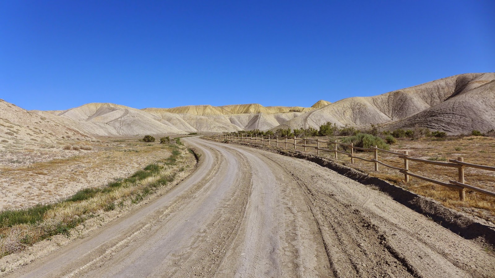
Peach Valley Rd heading back to the trail head. The road was buttery smooth clay.
Utterly barren landscape, quite pretty actually.

I don't think it ever rained in Lake City, but rain popped up all over in the mountains elsewhere. Sunday I may just ignore the forecast and go for one of my shorter high-country rides in CB, Scarp Ridge. I should be able to get up and over the ridge in less than three hours.