I had a couple dry country (low, arid and hot) rides reserved as back-up plans for rainy days. One of those was the Sidewinder Trail near Montrose, about 90 minutes west of Gunnison. The multi-use trail was constructed in 2010 and is open to dirt bikes. Strava's heat map suggests it was getting a fair amount of MTB traffic.
The temp was expected to rise into the upper 80's in Montrose. The full loop was "only" about 40 miles. Should be able to knock that off in less than five hours, right? Especially when a third of it would be on dirt roads to close the loop. Hydrate well before the ride and embark with 100oz in the Camelbak was the plan.
The parking area was abuzz with trail bikes. Dozens of them. Would Sidewinder be like that? I began to think I made a huge mistake. There area looked just like the Bookcliffs area of Fruita. There was a huge terrain park there for trail bikes, and whole families were out tearing it up. I bet some kids weren't even five years old. Looked like fun, actually, but I sure didn't what that noise and exhaust fumes on my ride.
Heading out on Eagle Valley Trail, I quickly gained further doubts in my ride selection. The trail went up, at no minor grade and no lack of challenging terrain. In other words, I found myself figuring out how to haul my bike up through some of the narrow passages in the slot wash. If it wasn't big steps of ledge, it was loose rocks and sand. 700ft was quickly gained on this trail before start of Sidewinder.
On paper, Sidewinder looked like a relatively flat, flowy trail. I had visions of Bookcliffs material. The trail was anything but. It had more in common with the most advanced trails in the Moab area, trails like Porcupine Rim and the Sovereign Trails. I rarely was able to ride more than a minute without getting off the bike. Sure, part of this was due to riding alone in a remote area and not taking any risks. A dab almost anywhere could result in a tens-of-feet tumble on sharp rocks.
Every time the trail cut in to the right, it was to climb a rugged wash. When it cut back to the left, it descended the same wash on the other side. It seemed the trail designers went out of their way to integrate "interesting" terrain into the route. I could see how some riders would really get off on terrain like this, but it didn't mesh well with my riding style. I was a bit freaked out about crashing most of the time, and you simply can't ride terrain like this defensively. You either committed to the non-stop technical features, or you dismounted and carried your bike over them. I did a lot of the latter.
I was sweating profusely. Even though it was a "dry heat," most of my perspiration was being wasted by dripping off me. Averaging about 5mph on the trail meant the singletrack portion alone was going to take four hours. I was not going to have enough water for the whole ride.
Fortunately, there are a few cut-offs to Peach Valley Rd below. The last one, Ute Road, was roughly at the half way point and there were no more cut-offs beyond it. I was not going to commit to the whole route. Riding the last two hours with no water in full sun would result in severe dehydration. I could call it a semi rest day (even though the numerous punchy climbs beat me up badly).
Bombing down Ute Road finally produced some air movement. There was no breeze otherwise. Riding back on clay-based Peach Valley Rd was actually enjoyable. I hadn't seen a soul since leaving the parking area and that would hold until I got back to the car. I finished with 21 miles, 2200 feet of climbing in 2.6 hours moving time. Short ride, but my body needed the break.
So why was this ride expensive? Well, you see, speed limits on US-50 vary all over the place. Some curvy sections are posted 65mph. Some straightaways are posted 55mph. Seems no rhyme or reason. On a particular downhill section that was wide open, the speed limit was posted 55. I must have missed the sign. A statie was lying in wait. I was doing 75mph. $250. Speed trap, pure and simple. That puts the cost of my ride/hike-a-bike at about $100 per hour.
The Sidewinder Trail was something I had to try for myself, so no regrets heading over there. I avoided rain, didn't get hurt and had the whole trail to myself. Would have been more satisfying if risk of injury were lower or I had a riding partner. Here are a few photos from the ride.
Heading out. Are we still in Colorado?

Eagle Valley Trail. This slot was too steep to ride up in places.

Sidewinder Trail. Always rocky, always exposed to a steep drop.

Sidewinder confounded me. The trail actually passes through that mess,
and it is anything but buff.

A rare, buff slickrock drop in a wash.

Now this is more like it. Lasted less than a minute before dropping into the next wash.

Coming out of a wash. You can just see trail dropping into it on far bank.
Usually where a trail crosses a wash was super steep and rocky.

Many tight rock squeezes on Sidewinder.

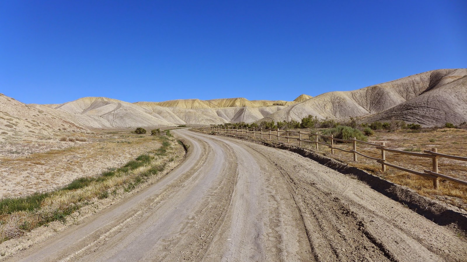
Peach Valley Rd heading back to the trail head. The road was buttery smooth clay.
Utterly barren landscape, quite pretty actually.
I don't think it ever rained in Lake City, but rain popped up all over in the mountains elsewhere. Sunday I may just ignore the forecast and go for one of my shorter high-country rides in CB, Scarp Ridge. I should be able to get up and over the ridge in less than three hours.
No comments:
Post a Comment