There were two new sections of trail to sample. One was Double Rainbow, an extension to the popular Little Rainbow trail completed last year. The other was brand spanking new singletrack that effectively extends the Cottonwood Gulch trail. Scott on the Monarch Crest told me about this yesterday. It is not on any maps yet. These by themselves don't super-size the loop. Climbing up CR-49 to the original Rainbow trail, and then follow this all the way across to Double Rainbow does. Nothing like a 2000ft jeep road climb before the sun even pokes over the mountains to wake up the legs. This section of Rainbow Trail contours at 8600-8900ft. It is open to motos, but the Strava Global Heat Map says it is very popular with mountain bikers. At least the first 6 miles were...
I'll let photos describe the ride, as I'm tired and have no words of wit. Total riding was almost a repeat of the day before, 54 miles, 6300 feet of climbing in 6.4 hours riding time. I saved each loop as separate tracks on Strava:
http://app.strava.com/activities/189958239
http://app.strava.com/activities/189958223

County Route 49. Felt like it was >10% grade most of the time but I bet it was just
my tired legs.
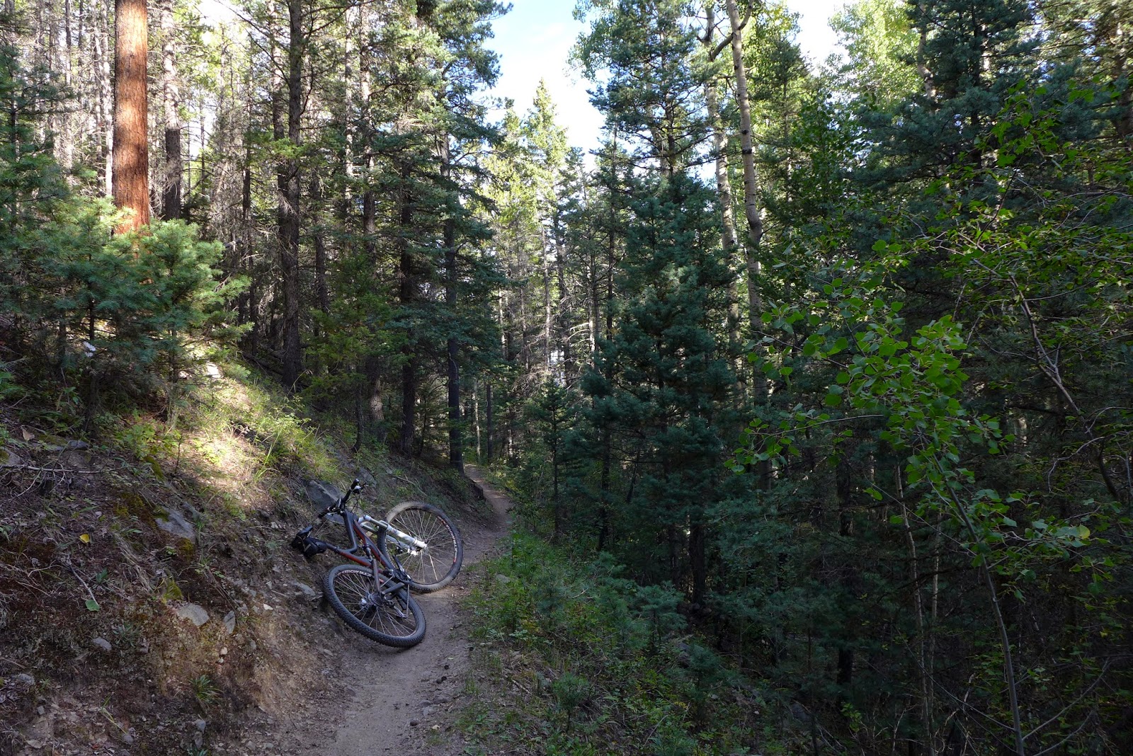
Beginning of Rainbow Trail from CR 49. The next 6 miles were wicked sweet.

Every now and then great vistas would open up.

Salida and the big "S" from the Rainbow Trail

The not so fun section of Rainbow Trail, the portion west of FS 108.
This was probably 30% grade and utterly unrideable (by me). Loose stone
was a recurring theme for this 3mi section.
.bmp)
Screen shot from Strava's global heat map. Rainbow Trail forms an arc around Methodist Mtn in the center. I rode from lower right to upper left. The first 6 miles are bright blue, which means lots of MTB traffic. The next 3 miles are barely visible blue, which means little MTB traffic. Now I know why.

Plenty of exposure on Rainbow. Always risk of banging up-slope side pedal on
the ground too. The bench was cut into that steep of terrain in many places.

Backbone Trail from the Arkansas trail system.

Should not be riding trails like this out here alone. I walked this section.

Another shot from Backbone trail.

Shot from the endless descent that Cottonwood Gulch is. With heavy clouds
closing in, I questioned the wisdom of riding in a wash with no easy way out. With
The new trail up top, there is almost 10 miles of singletrack back down to town.

Mesa Trail that Cottonwood Gulch dumps out onto. Note rain squalls just beyond Salida.
I hit rain going over Monarch Pass on my way to Gunnison.
No comments:
Post a Comment