The obligatory start of the ride photo. Dropped into 20's overnight with frost on everything.

Climbing the newly constructed Point Lookout trail. No motos. Dream to climb. Mt Crested Butte in background. Almost 2000ft gain from Crested Butte where I started.

Point Lookout tops out on Double Top trail. Open to motos. Ugh, had to walk this section. Wicked steep fall-line chunder in a chute.

To be fair, much of Double Top was quite good.

Think this was still Double Top. Hit pockets here and there where flowers are still in bloom.

Along Waterfall Cutoff trail. Closed to motos. This trail was a masterpiece in design and construction but seriously challenging to ride. Exposure, non-stop undulations in elevation. A huge amount of up-down climbing took place on this trail although almost none of it registered on my Garmin.

Nearing the end of Waterfall Cutoff trail with Cement Creek road in valley below.

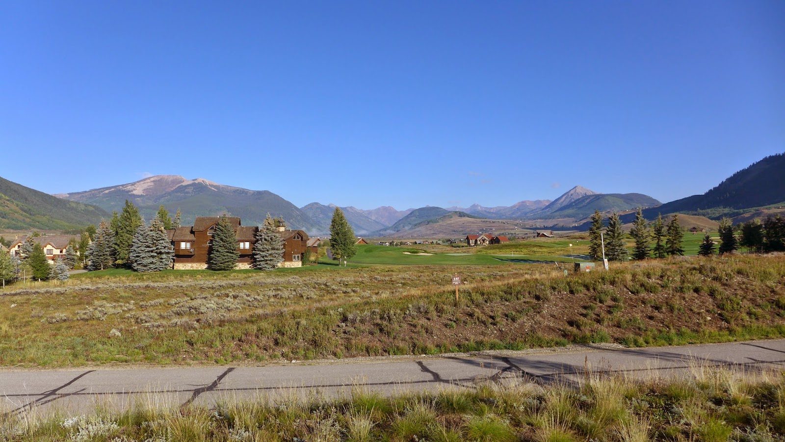
Cement Creek Trail, which loosely parallels the road in the Cement Creek drainage.

Just starting up Crystal Peak trail looking back at Italian Mountain. It is silvery like that. Not snow.

At the Cyrstal Peak trail saddle, with Star Peak on left and Taylor Peak on right. Smiling. I thought this was the top. I had no idea I had to climb many hundreds more feet with a lot of hike-a-bike.

Continuing on Crystal Peak trail to Star Pass straight ahead and high above. Another rider is in this image roughly center one-third from right.

Max zoom on the LX7. There Rodney from SoCal is.

Looking back at Crystal Peak trail coming over the saddle. I thought that was the top when I got there and it was all downhill back to town. Now I was in the midst of another big chunk of climbing on Brush Creek Trail to get over Star Pass.

Rodney in the final push to Star Pass. I doubt I could ride this even with fresh legs. I bet DaveP could ride it. I've seen him do it on climbs like Black Hawk Pass and Imogene Pass. I have a sneaking suspicion than fast twitch muscle composition does not work in my favor at altitude.

Nothing but high peaks from Star Pass. I think you can coast into Aspen from here.

At Star Pass. This time I knew it was the top. Photo credit: Rodney from SoCal

The other side of Star Pass, my life saving descent back to CB. I developed descent fatigue, it went on so long without pedaling and required much focus. Open to motos, badly rutted up. With heavy rain two days ago, the rutted moto trails were still holding water. This was the descent of 1000 puddles. After a while, I realized it was pointless to try to keep bike and body clean. Red clay got into everything.

I thought Brush Creek Trail just magically turned into Brush Creek Rd at some point. But the route I was following from JuicyTrails.com had other plans. I believe this is called Canal Trail. There was considerable exposure in spots with some very techy bits. The climbing was not done either. There was a good size rise near the bottom that I was too tired to pedal. One last insulting hike-a-bike.
I'd probably do this ride again, but not alone. On singletrack almost whole time and the scenery is among the best of any ride in Colorado. Probably take a filter along too if it was any warmer. Good streams to filter from.
3 comments:
Sold! Your post just put this on my bucket list. Looks dreamy and flowey.
How would you rate this trip compared to others?
I'd rate this trip pretty high, top 3 at least. Any time you can spend 10 days in Colorado and ride 9 of them without getting rained on is a good trip. There were several new trails I hit I won't need to do again and a couple that I must do again. I may do a follow-up post with thoughts about moving to Colorado.
Post a Comment