Thursday, September 11, 2014

Star Pass Loop - photos only

Select photos from 82 captured during the ride:

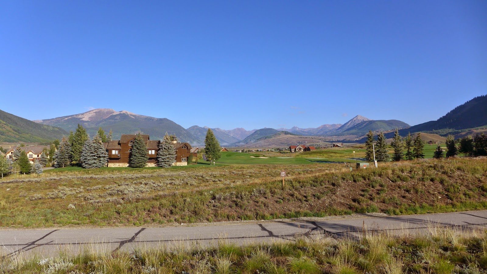
The obligatory start of the ride photo. Dropped into 20's overnight with frost on everything.

Climbing the newly constructed Point Lookout trail. No motos. Dream to climb. Mt Crested Butte in background. Almost 2000ft gain from Crested Butte where I started.

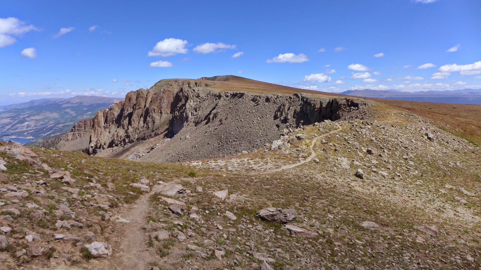
Point Lookout tops out on Double Top trail. Open to motos. Ugh, had to walk this section. Wicked steep fall-line chunder in a chute.

To be fair, much of Double Top was quite good.

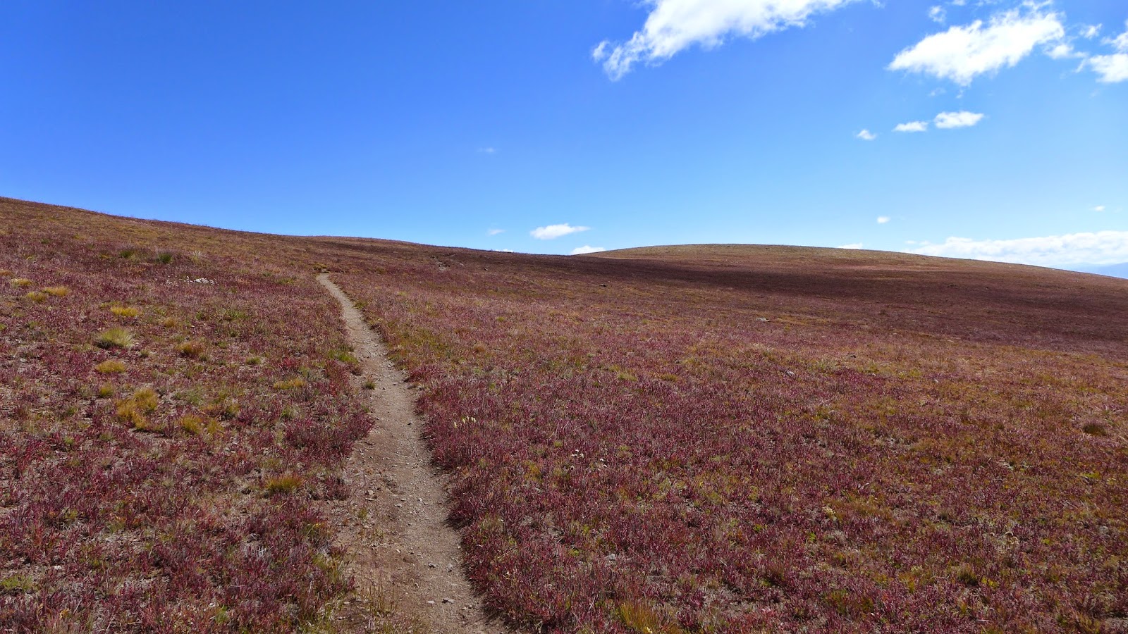
Think this was still Double Top. Hit pockets here and there where flowers are still in bloom.

Along Waterfall Cutoff trail. Closed to motos. This trail was a masterpiece in design and construction but seriously challenging to ride. Exposure, non-stop undulations in elevation. A huge amount of up-down climbing took place on this trail although almost none of it registered on my Garmin.

Nearing the end of Waterfall Cutoff trail with Cement Creek road in valley below.

Cement Creek Trail, which loosely parallels the road in the Cement Creek drainage.

Just starting up Crystal Peak trail looking back at Italian Mountain. It is silvery like that. Not snow.

At the Cyrstal Peak trail saddle, with Star Peak on left and Taylor Peak on right. Smiling. I thought this was the top. I had no idea I had to climb many hundreds more feet with a lot of hike-a-bike.

Continuing on Crystal Peak trail to Star Pass straight ahead and high above. Another rider is in this image roughly center one-third from right.

Max zoom on the LX7. There Rodney from SoCal is.

Looking back at Crystal Peak trail coming over the saddle. I thought that was the top when I got there and it was all downhill back to town. Now I was in the midst of another big chunk of climbing on Brush Creek Trail to get over Star Pass.

Rodney in the final push to Star Pass. I doubt I could ride this even with fresh legs. I bet DaveP could ride it. I've seen him do it on climbs like Black Hawk Pass and Imogene Pass. I have a sneaking suspicion than fast twitch muscle composition does not work in my favor at altitude.

Nothing but high peaks from Star Pass. I think you can coast into Aspen from here.

At Star Pass. This time I knew it was the top.  Photo credit: Rodney from SoCal

The other side of Star Pass, my life saving descent back to CB. I developed descent fatigue, it went on so long without pedaling and required much focus. Open to motos, badly rutted up. With heavy rain two days ago, the rutted moto trails were still holding water. This was the descent of 1000 puddles. After a while, I realized it was pointless to try to keep bike and body clean. Red clay got into everything.

I thought Brush Creek Trail just magically turned into Brush Creek Rd at some point. But the route I was following from JuicyTrails.com had other plans. I believe this is called Canal Trail. There was considerable exposure in spots with some very techy bits. The climbing was not done either. There was a good size rise near the bottom that I was too tired to pedal. One last insulting hike-a-bike.

This ride went 45.6mi in 6.4hrs moving time. Garmin says 6700ft of climbing, but when I bumped this against what Topo computes from the same track, I get 8800ft of climbing. There's no way it was only 6700ft. I'm going with 8800ft.

I'd probably do this ride again, but not alone. On singletrack almost whole time and the scenery is among the best of any ride in Colorado.  Probably take a filter along too if it was any warmer. Good streams to filter from.

Wednesday, September 10, 2014

Colorado Trail on the Divide

My favorite rides involve state multi-use recreation trails. Two notable such trails are the Arizona Trail and the Colorado Trail. Both of these trails traverse hundreds of miles in their respective states, occasionally passing through wilderness areas. The parts that are not in wilderness areas are open to bicycling.

There are several sections of Colorado Trail (CT) that fellow cyclists rave about. One section is from Silverton to Lake City, which follows the Continental Divide at 10,000-13,000ft above sea level.  I can't ride this whole section alone without bike packing (spending the night on the trail) or with a massive shuttle to start an all day ride. So I must carefully carve out a section I can "self shuttle."

Self shuttling means earning my turns and making a complete loop out of the ride. There are very few access points to this section of the CT. One near Cataract Lake is closed to bikes. I'd love to ride that section too, but it wasn't going to work on this trip. Another route up is Wager Gulch Rd, a jeep road open to the public. It climbs from roughly 9300ft to 12,300ft. I had no intel on suitability for climbing by bicycle. It could have been all hike-a-bike for all I knew. I did know average grade was about 12%. This meant I had a good chunk of a Mt Washington climb with 30 pound bike, on rough surface carrying 15# pack, in very thin air just to start the ridge riding.

I also chose a speculative way down from the ridge, one map calling the route 56. Was that a Forest Service road number? County road? No idea. All I knew was the riding up top was supposed to be special. Most that have ridden it get on near Silverton via Stony Pass and get off on Hwy 149. I could have ridden through to Hwy 149, but then I'd add many paved miles on shoulderless state highway to get back to my car. What fun would there be in that? I'd rather risk a massive Hill Junkie style boondoggle.

It was frigid driving over to Lake City. I saw dusting of snow on the highest peaks. Yikes! Would I be riding in snow? I started out with near winter clothing on this time, as there is a nearly flat 9 mile lead-in before the real climbing started. The Garmin recorded a low of 36F for the ride.

I get to Wager Gulch Rd (aka County Route 36) and see right way it was not going to be a picnic. The first two miles were unbelievably difficult. The grade rarely dropped below 15%, and there were extended sections of 18-20%. Fortunately, the surface was well packed. Maybe the recent rains helped. That just meant there were no excuses. You just had to pedal, dammit! Two 4WD's and one moto passed me on the way up. One in a ordinary SUV stopped at a fork later and asked me for directions to Carson, an old mining ghost town that has been preserved. I said I was going by that way, so it had to be the fork to the right.

I was dismayed every time the grade dropped less than 12%. That just meant the grade had to exceed 12% to make up for it. I cleaned the whole climb, but dang that took a lot out of me.

I reached the divide in less time than I budgeted. But the sky told me that finally, today, I would not have to worry about bad weather popping up. I could take my time on the crest. This was good, as the visibility must have been over 100 miles.

From the Carson pass at 12,300ft, CT/CDT singletrack is picked up. Sweet! It switch-backed to near the summit of Coney Peak at 13,300ft. The view in all directions was unbelievable. This was clearly the most "in the mountains" sensation I've experienced.

There were three small climbs and one major climb along the divide. I passed a total of five backpackers along the way, a group of three and two singles. Not only did I see no bikes, there were no bike tracks. There were brief hike-a-bikes along the way, a couple places where the trail traversed talus fields. Small price to pay to be up here with your bike. There was a moderate breeze. The temp hovered around 50F, a little too cool for short sleeves, but I resisted the urge to put long layers back on.

I was sad when it was time to head back down. The descent was extremely sketchy at times, very loose and rutted. All rideable, but great care with death grip on brakes was needed. I'd never be able to ride up the way I went down.

I finished the 35mi loop with 5800ft of climbing in 4.5hrs moving time. Almost an hour of stopped time was logged shooting photos. I took 85 photos on this ride. Enough words. Here are a few cherry-picked photos from the ride.

Lake San Cristobal reflecting the continental divide at start of ride.

Carson ghost town from Wager Gulch Rd. Vehicle parked there is from guy who asked for directions.

From the divide looking across valley I started in.

On the CT at 13,200ft looking south.

Sometimes this is all you see. Around 13,000ft elevation.  I love it!

Looking north along the divide.

Red Mountain.

Heading north along the divide.

Wager Gulch Rd, my route up, faintly visible.

Looking back south.

Lake San Cristobal where I started and Red Mountain on left.

Another perspective catching singletrack below after traversing some very steep talus switchbacks.

Looking north along the divide, about to descend some very steep swichbacks in talus (brief hike-a-bike).

I had just come down from up there on some pretty sketchy switchbacks in that talus field.

Heading north along the rim.


Beginning descent. Red Mountain in foreground and Uncompahgre Peak in background. Like to hike that one some day.

Uber steep and often sketchy County Road 56.
Touch of color in the aspens.

From Hwy 149 switchback looking at the divide, pretty much the stretch I did on one frame.
Shooting into the sun washes image out a bit.

Tuesday, September 9, 2014

What to do on rainy days in Colorado

When I got up on Tuesday, no surprise, it was 50F and pouring outside. No place within driving distance was going to escape unscathed. Take a rest day? The Hill Junkie scoffs at rest. One reader suggested I check out one of Colorado's many hot springs. A web search didn't bring anything up particularly close, and the most accessible ones were developed. I really wasn't interested in hiking 18 miles round trip to Conundrum hot springs in between Crested Butte and Aspen, especially since I'd have to traverse a 13,000ft pass in rain and zero visibility. One thing I did have on this rainy day was time. A drive to Ouray (pronounced yur-RAY) was not beyond reason.

I really like Ouray. It is easily the prettiest town in the USA I have visited, on par with any picturesque town in the Alps.  There are two hot springs near Ouray, one right in town itself and one on the way, Orvis Hot Spings. Orvis is more of a resort and clothing optional. Mrs Hill Junkie would not approve! Can't bring any electronics in there either, so no blog fodder. Ouray Hot Springs is more of a public pool. I decided to check it out, and a couple other things in the area too.

I first visited Box Canyon. If you've visited the Flume Gorge in NH, you have an idea what Box Canyon is like. After copious rainfall, the water was really moving. It was so loud in the slot canyon you could not talk over the roar. The water must have been coming down over 100mph in the falls. It looked like chocolate milk.

Still pouring mightily, I dropped down to the hot springs. They open at noon and only a handful of cars were there. They had a large swimming lanes pool at 76F, a large warm pool at 96F and a smaller hot pool at 106F (current measured temps). The water is 100% naturally heated, although I detected a hint of chlorine. I asked about the water. Lifeguard on duty said regulations require chlorine in public pools. So not 100% natural, but it sure was nice to just lay back in the 96F pool, cool 50F rain coming down on my head, while the rest of my body felt like it had returned to the womb. I could have napped easily, gazing up at 2000ft cliffs all around me. Very quiet with just a few people there in such a large area, except for the main road which was close by. I was more wrinkled than a prune when I finally got out.

My friends and colleagues are always eager to bring Fat Doug back. Dave sent me an NPR story on a new hypothetical sandwich Arby's was offering to showcase how many meat choices they offer. It is called a Meat Mountain and contains every kind of meat Arby's offers on sandwiches. It is not so hypothetical. There's an Arby's in Montrose, so I stopped by on my way back from Ouray. I asked if I could order one. The counter clerk said no, that was just an advertising gimmick. Then another person came up, manager maybe, said "yeah, we can do that, but I have to figure how how to build it first." Score! It was $10 and took a while to make. Once they gave it too me, all eyes in the place were on me. The manager even made a phone call and jubilantly said "we sold one!" I was the first at that store to order a Meat Mountain. So was it good? Yeah, I would order one again.

The rain was breaking up as I started to head back. I've driven by the Black Canyon gorge before but didn't really know what it was about. I decided on a whim to drive around to the north rim since it looked like there'd be less people there. I stopped at a point above Curecanti Creek, which feeds into the Gunnison River almost 1000ft straight down. I saw a sign for a trail to the bottom. Sweet. Two miles, 900ft drop, how hard could that be? Harder than it looked at the kiosk. I bounded down until it became all slippery rock and very steep, almost like hiking in Tuckerman's Ravine. More than half the vertical is contained in the bottom quarter of the trail, I surmise. It was cool to stand in the bottom looking perfectly straight up to where I was less than 30 minutes earlier. If somebody kicked a rock over the edge and it hit you, you'd be deader than dead. The sun was starting to set has I bounded back up out of the gorge. Heading back out to US-50, deer were all over the place, and none too timid either. There was a freshly killed one on US-50.

Hill Junkie knows how to make the best of rainy days!  If there is no more rain overnight, I may try to hit the Colorado Trail near Lake City on Wednesday.

Blue Mesa Lake, backstop of big dam on Gunnison River.
On way to Ouray in morning.

Ouray looking south

Ouray looking north from second switchback

Loud cauldron of chocolate milk. Box Canyon Falls

Ouray from Box Canyon Falls high bridge

Box Canyon tunnel


Soaking in Ouray Hot Springs

Arby's Meat Mountain. Chicken Tenders on the bottom, bacon on the top, everything else in between.

Gonna be gone in no time. Could have eaten two.

Only meat item not on sandwich was the fish, which is a seasonal item.

Part way down Curecanti Trail looking up

Bottom of Curecanti Creek where it meets the Gunnison.

Yep, Curecanti Creek is 900ft straight down.
I was down there 30 minutes earlier.

Hill Junkie is still freaked out by heights.

Looking over the Gunnison River Gorge.
Hopefully last of the rain for the trip.