Monday, September 29, 2014

2014 Vermont 50

Did over two weeks fly by without a post? My 10 days in Colorado is already a distant memory. Races were always good for blog fodder. Without trips and races, what is there to talk about here? Even though I was never really a hard core bicycle racer, it seems I have slipped almost completely into the realm of recreational cyclists. There has been no structure or discipline in my training this summer. Sure, I rode lots, mostly off-road, but almost no focused intensity work. I've been riding purely for enjoyment and health, both physical and mental. I have enough stressors in my life right now without adding regimented training to the heap of worries.

I loves me a good sufferfest though, and the Vermont 50 miler is a good one. I've raced the VT50 five times previously in both good and bad weather, going back to 2000. I was not stressing over how I was going to do this year in the race. It was just going to be whatever it was.

I did stress a little over which bike to bring. I've always raced the VT50 on a hardtail. A hardtail may not always be the most enjoyable bike to ride over mixed terrain, but it certainly makes for an efficient climber. There is over 8000ft of climbing in the course. Having so many riding hours on my long-travel Santa Cruz Tallboy LTc since I bought it last year, I pondered how well that bike would do on the course. Overkill, to be sure. It weighs several pounds more than my hardtail with monster truck 2.35" tires.  But damn, that bike is fun to ride. Fun overruled efficiency. The sofa bike was hitting the VT50 course this year.

I lost a lot of time early in the race last year. The fog was bad and my glasses fog up horribly. This was compounded by a completely worthless nickle-battery light to illuminate my way. I think the whole field passed me in the first couple downhills of the race. I falsely assumed I could scavenge off other's lights. But no, bight lights behind me just left me riding into a huge, pitch black shadow of myself. My 0.000001 lumen light could not fill the shadow. So this year I brought my 1200 lumen DiNotte light. Again, overkill, but somebody else was going to be riding in their shadow from my light. The half pound of added weight would totally be worth it. To mitigate glasses fogging up, I applied some windshield anti-fog compound to an old pair glasses. Not recommended for plastic, but I thought I'd give it a try.

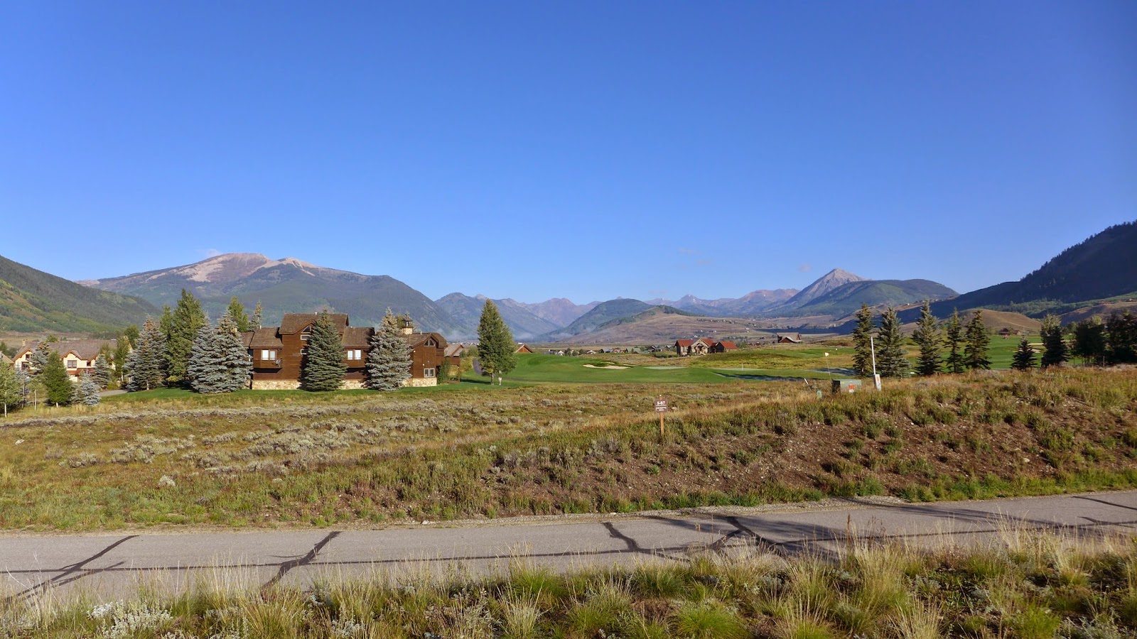
Stellar weather was on tap for Sunday. Lining up for 6:05am start, it wasn't even cold out. Most years there is frost on the ground or it is raining. Staying hydrated was a bigger concern, as temps were expected to rise above 80F later in the day.

My second wave of experts go off, a very large field, probably 100+ riders. The pace was ballistic right from go. I don't ever recall having to drill it on the paved downhill to stay with the field in such a huge draft in this race. I let my self get a bit far back. When we got to the first truly off-road climb, it turned into a 3-cross conga line. Argh, it should be all quite rideable. At least on the initial plummets I could see this year!

There were a few riders I don't typically beat in MTB races, maybe never, that I thought I'd keep my eye on. I figured if I could beat all three of these guys, I had slight chance at age group podium. They were Tyler, Zane and Mike. In the dark, I had no idea where these guys ended up, and I don't really know Mike.  As it started to get light, I passed Tyler. Later I learned he suffered some kind of mishap. Zane, I was trading places with the whole race. Mid race he seemed to find turbo boost and I thought he was gone for good.

I have a love-hate relationship with these endurance events. I almost always cramp up 3hrs in or so. The duration is way beyond my sweet spot, such as the 30 minute hillclimb efforts I don't suck at. But an endurance race is an adventure, especially a single loop course like the VT50. At the 30 mile stop where I swapped Camelbaks, my hamstrings felt well along the path to cramping at any time. I started deliberately hopping off my bike on some of the steepest pitches to "run" up them, stretching my hammies in the process. This seemed to stave off cramping last year.

The sofa bike was absolutely crushing the downhills. I scared myself shitless multiple times.  In fact, two riders were like "WTF Hill Junkie, you're killing the descents!" My response was it was the bike, not me, it lets me ride beyond my skill level. Nobody was passing me on the descents. That never happened in the VT50 before. Was the time gained going down making up for carrying all that extra heft up? Probably not, but it was more than worth it in fun-factor. Plus I was not getting beat to shit in the process. That 5+ inches of travel front and rear just soaked everything up.

I was on the hairy cusp of total cramping with about five miles to go. I caught a glimpse of one of my nemesis, Zane, on a switchback or two ahead. I thought at the time that could be a podium spot. Game on, cramping or not. Fortunately there was a lot of high speed technical downhill involved. The sofa bike knows what to do! I caught and passed Zane. Now the big worry was how do I keep him behind me with the big finishing climb coming up, while cramping, and he's on a skinny whippet hardtail that probably weighed 10 pounds less then my tank? I reached the point I couldn't even pedal while seated without my inner thighs locking up. Stand it would have to be. I reached the contouring rollers up top with my gap still intact. Now I just had to not screw up.

As the plummet to the finish line drew near, I noticed another rider gaining on me. Dang, a potential threat? No idea. The pressure was still on. I had to take risk all the way down. Strava later showed me I PR'd that last piece of the course too. I held him off.

I crossed the line in 4:36, five minutes faster than last year and a new personal fastest for me in the VT50. I was pretty happy with that. I've always treated the VT50 more as a personal individual time-trial rather than a race against others. This is how the course is optimally ridden in my opinion. I was surprised to see this time netted me only 6th place in the 45-54 year old age group and 30th overall out of 700 or so. I had a clean race, came out ahead of guys that normally beat me, and still came out further down than expected. Not disappointed though.

Repeat perfect weather of last year

When I first started racing the VT50 in 2000 and 2001, a sub-5hr finish would net you a top-10 overall finish. Now a sub-5hr finish will barely get you into the top 100 finishers. The course is even more technical, with more climbing, and with more singletrack today than in the early years. So what gives? The caliber of riders showing up at this event, that's what gives. Pretty cool that Mike Silverman and staff have built this stand-alone race up to this level. Getting in has become increasingly difficult. The race filled in 12 minutes this year.

With improvements in suspension design and technology, I'm finding less reason to keep a hardtail in the quiver. My Tallboy is the go-to bike for all trail riding. And now I posted my best on a "heavy", long-travel bike on a climbing course that I thought was the exclusive domain of hardtails and rigids. Maybe a racier 29er build should be in my plans for next year.

Saturday, September 13, 2014

Final Ride: Hartman Rocks

Even though I buried myself during a brutal 6.4hr ride on Thursday, I wasn't going to get cheated out of a couple more rides I had planned for the trip. That meant a double on Friday. You can always rest when you're dead, right?

My last post featured photos with some commentary from the morning ride. The Reno/Flag/Bear/Deadman loop is a worthy ride in its own right. How was I physically and mentally going to do a second ride almost as hard in the same day? At least Saturday was a travel day, so I didn't have to awake in a beat-up state and ride.

After a four-course chicken dinner for lunch, I headed over to Hartman Rocks. A stomach full of heavy food does not seem to bother me riding, especially after blowing 2000 calories during the morning ride.

I've ridden Hartman Rocks just outside Gunnison a couple times already. It is a pretty cool place to ride, especially for the less gravity gifted set who like technical riding. There is no shortage of tech at Hartman Rocks. Trail designers went out of their way to weave singletrack through every rocky outcropping poking out of the sagebrush desert. There are many big commitment moves out there. With tired legs, tired mind, frail bones and generally lack of skill, dismounts were frequent on a couple of the trails. I rode a few trails for the first time, like Ridge and Top of the World. Non-stop rock features is the best way to describe these trails.

The soil seems to be decomposed granite, so when you get away from the rock outcroppings, things roll smooth and fast. That's what I was looking for on this ride, but I pulled a loop from Strava that seems to be a local favorite linkage of tech trails. It was anything but smooth and fast.

Starting this ride late in the afternoon meant I was not going to have enough daylight to do the full planned route.  I was more than ok with that. The lower and upper parking areas had lots of cars, but I encountered other riders only a couple times. Hartman Rocks is a pretty vast riding area. As I was bailing on remaining singletrack and taking a double track back to the trailhead near dusk, I noticed my shadow stretched out far to the east. How fitting to end my longest Colorado cycling trip to date.  Led Zeppelin's lyrics from Stairway to Heaven came to mind: "Our shadow's taller than our soul." Yeah, I was feeling pretty depleted, in a good way. I needed an extended break away from work. My shadow was no doubt taller than my concerns in the corporate world, a faint memory at this point in the trip.

My Garmin logged 23.3mi with 3000ft of climbing in 2.9hrs of riding. That made for 6.7hrs with 7200ft of off-road climbing for the day, my biggest day of the trip. Going back into the office grinder on Monday is going to suck.

Gunnison from Ridge Trail

Ridge Trail. A couple places offered serious exposure.

This was probably Top of the World Trail. Lots of big rock moves here.

Nothing but a sea of sage at the height of land. Bombing down Skyline Trail was an absolute rush.

Shadow's getting tall. Time to head back.

Reno-Flag-Bear-Rosebud-Cement-Deadman photo dump

Friday morning ride, last day of the trip. Classic loop near Crested Butte.

Starting out up Cement Creek Rd. Temp was 28F.

Nice for this guy to pose for me while climbing Reno Ridge Rd.

View from near the Reno Divide at 11,100ft.

Beginning descent on Flag Creek Trail. Five mud puddles in this photo. You couldn't just skirt edge, as clay based soil was super slippery. You'd just slide in anyway. Hasn't rained in three days. Whoop pits don't drain.  Bacon strips slabs of mud would fling off my front tire and slap me in the face.  Don't have this problem on non-motorized trails. More and more trails in the Crested Butte area are becoming non-motorized. May have to stick to them next time.

Bear Creek descent. This makes putting up with motorized trail riding worth while. This is an endless descent, 4+ miles with almost no pedaling and very little hard braking. There was a lot of recent work on this trail making it even nicer.

Further down the Bear Creek descent.

Looking back up the Bear Creek descent from near the bottom. To be sure, there were some challenging sections in the woods along the stream.

Looking up Rosebud Gulch Trail. This becomes quite a hike-a-bike for an old guy like me.

Awkward attempt at selfie on Rosebud Gulch Trail part way up.

Cement Mountain Trail. This makes the death slog up Rosebud worthwhile.

Looking back on Cement Mountain Trail at Cement Mountain.

These flowers were deep purple but I think they kind of wash out against that sky. Today was the first truly cloudless day of the trip. Figures, today is my last riding day.

Initial descent on Cement Mtn trail. There were several braided sections like this with no way to avoid it and impossible to ride through it. There are one foot deep ruts hidden in there. Hard to see, but it is puddles like this all the way down the trail in this image. Frustrating. Note to self: Either avoid moto trails entirely or at least avoid them within, say, a month of last rain.

Final view of horizon before bombing down the 30+ switchbacks on Deadman Gulch Trail. At least Deadman was well maintained and a blast to carve down. Descent fatigue for sure.

This ride went 25.5 miles in 3.8 hours moving time with 4200ft of climbing. Should not have taken that long, but I was dead f'n tired. This is a CB classic loop, except maybe for the Rosebud extension. In over 4hrs out on the trail, I never saw another soul. Guess maybe the views and solitude make up for sections of quagmire. This was ride #1 of the day. In the afternoon I hit Hartman Rock in Gunnison.

Thursday, September 11, 2014

Star Pass Loop - photos only

Select photos from 82 captured during the ride:

The obligatory start of the ride photo. Dropped into 20's overnight with frost on everything.

Climbing the newly constructed Point Lookout trail. No motos. Dream to climb. Mt Crested Butte in background. Almost 2000ft gain from Crested Butte where I started.

Point Lookout tops out on Double Top trail. Open to motos. Ugh, had to walk this section. Wicked steep fall-line chunder in a chute.

To be fair, much of Double Top was quite good.

Think this was still Double Top. Hit pockets here and there where flowers are still in bloom.

Along Waterfall Cutoff trail. Closed to motos. This trail was a masterpiece in design and construction but seriously challenging to ride. Exposure, non-stop undulations in elevation. A huge amount of up-down climbing took place on this trail although almost none of it registered on my Garmin.

Nearing the end of Waterfall Cutoff trail with Cement Creek road in valley below.

Cement Creek Trail, which loosely parallels the road in the Cement Creek drainage.

Just starting up Crystal Peak trail looking back at Italian Mountain. It is silvery like that. Not snow.

At the Cyrstal Peak trail saddle, with Star Peak on left and Taylor Peak on right. Smiling. I thought this was the top. I had no idea I had to climb many hundreds more feet with a lot of hike-a-bike.

Continuing on Crystal Peak trail to Star Pass straight ahead and high above. Another rider is in this image roughly center one-third from right.

Max zoom on the LX7. There Rodney from SoCal is.

Looking back at Crystal Peak trail coming over the saddle. I thought that was the top when I got there and it was all downhill back to town. Now I was in the midst of another big chunk of climbing on Brush Creek Trail to get over Star Pass.

Rodney in the final push to Star Pass. I doubt I could ride this even with fresh legs. I bet DaveP could ride it. I've seen him do it on climbs like Black Hawk Pass and Imogene Pass. I have a sneaking suspicion than fast twitch muscle composition does not work in my favor at altitude.

Nothing but high peaks from Star Pass. I think you can coast into Aspen from here.

At Star Pass. This time I knew it was the top.  Photo credit: Rodney from SoCal

The other side of Star Pass, my life saving descent back to CB. I developed descent fatigue, it went on so long without pedaling and required much focus. Open to motos, badly rutted up. With heavy rain two days ago, the rutted moto trails were still holding water. This was the descent of 1000 puddles. After a while, I realized it was pointless to try to keep bike and body clean. Red clay got into everything.

I thought Brush Creek Trail just magically turned into Brush Creek Rd at some point. But the route I was following from JuicyTrails.com had other plans. I believe this is called Canal Trail. There was considerable exposure in spots with some very techy bits. The climbing was not done either. There was a good size rise near the bottom that I was too tired to pedal. One last insulting hike-a-bike.

This ride went 45.6mi in 6.4hrs moving time. Garmin says 6700ft of climbing, but when I bumped this against what Topo computes from the same track, I get 8800ft of climbing. There's no way it was only 6700ft. I'm going with 8800ft.

I'd probably do this ride again, but not alone. On singletrack almost whole time and the scenery is among the best of any ride in Colorado.  Probably take a filter along too if it was any warmer. Good streams to filter from.

Wednesday, September 10, 2014

Colorado Trail on the Divide

My favorite rides involve state multi-use recreation trails. Two notable such trails are the Arizona Trail and the Colorado Trail. Both of these trails traverse hundreds of miles in their respective states, occasionally passing through wilderness areas. The parts that are not in wilderness areas are open to bicycling.

There are several sections of Colorado Trail (CT) that fellow cyclists rave about. One section is from Silverton to Lake City, which follows the Continental Divide at 10,000-13,000ft above sea level.  I can't ride this whole section alone without bike packing (spending the night on the trail) or with a massive shuttle to start an all day ride. So I must carefully carve out a section I can "self shuttle."

Self shuttling means earning my turns and making a complete loop out of the ride. There are very few access points to this section of the CT. One near Cataract Lake is closed to bikes. I'd love to ride that section too, but it wasn't going to work on this trip. Another route up is Wager Gulch Rd, a jeep road open to the public. It climbs from roughly 9300ft to 12,300ft. I had no intel on suitability for climbing by bicycle. It could have been all hike-a-bike for all I knew. I did know average grade was about 12%. This meant I had a good chunk of a Mt Washington climb with 30 pound bike, on rough surface carrying 15# pack, in very thin air just to start the ridge riding.

I also chose a speculative way down from the ridge, one map calling the route 56. Was that a Forest Service road number? County road? No idea. All I knew was the riding up top was supposed to be special. Most that have ridden it get on near Silverton via Stony Pass and get off on Hwy 149. I could have ridden through to Hwy 149, but then I'd add many paved miles on shoulderless state highway to get back to my car. What fun would there be in that? I'd rather risk a massive Hill Junkie style boondoggle.

It was frigid driving over to Lake City. I saw dusting of snow on the highest peaks. Yikes! Would I be riding in snow? I started out with near winter clothing on this time, as there is a nearly flat 9 mile lead-in before the real climbing started. The Garmin recorded a low of 36F for the ride.

I get to Wager Gulch Rd (aka County Route 36) and see right way it was not going to be a picnic. The first two miles were unbelievably difficult. The grade rarely dropped below 15%, and there were extended sections of 18-20%. Fortunately, the surface was well packed. Maybe the recent rains helped. That just meant there were no excuses. You just had to pedal, dammit! Two 4WD's and one moto passed me on the way up. One in a ordinary SUV stopped at a fork later and asked me for directions to Carson, an old mining ghost town that has been preserved. I said I was going by that way, so it had to be the fork to the right.

I was dismayed every time the grade dropped less than 12%. That just meant the grade had to exceed 12% to make up for it. I cleaned the whole climb, but dang that took a lot out of me.

I reached the divide in less time than I budgeted. But the sky told me that finally, today, I would not have to worry about bad weather popping up. I could take my time on the crest. This was good, as the visibility must have been over 100 miles.

From the Carson pass at 12,300ft, CT/CDT singletrack is picked up. Sweet! It switch-backed to near the summit of Coney Peak at 13,300ft. The view in all directions was unbelievable. This was clearly the most "in the mountains" sensation I've experienced.

There were three small climbs and one major climb along the divide. I passed a total of five backpackers along the way, a group of three and two singles. Not only did I see no bikes, there were no bike tracks. There were brief hike-a-bikes along the way, a couple places where the trail traversed talus fields. Small price to pay to be up here with your bike. There was a moderate breeze. The temp hovered around 50F, a little too cool for short sleeves, but I resisted the urge to put long layers back on.

I was sad when it was time to head back down. The descent was extremely sketchy at times, very loose and rutted. All rideable, but great care with death grip on brakes was needed. I'd never be able to ride up the way I went down.

I finished the 35mi loop with 5800ft of climbing in 4.5hrs moving time. Almost an hour of stopped time was logged shooting photos. I took 85 photos on this ride. Enough words. Here are a few cherry-picked photos from the ride.

Lake San Cristobal reflecting the continental divide at start of ride.

Carson ghost town from Wager Gulch Rd. Vehicle parked there is from guy who asked for directions.

From the divide looking across valley I started in.

On the CT at 13,200ft looking south.

Sometimes this is all you see. Around 13,000ft elevation.  I love it!

Looking north along the divide.

Red Mountain.

Heading north along the divide.

Wager Gulch Rd, my route up, faintly visible.

Looking back south.

Lake San Cristobal where I started and Red Mountain on left.

Another perspective catching singletrack below after traversing some very steep talus switchbacks.

Looking north along the divide, about to descend some very steep swichbacks in talus (brief hike-a-bike).

I had just come down from up there on some pretty sketchy switchbacks in that talus field.

Heading north along the rim.


Beginning descent. Red Mountain in foreground and Uncompahgre Peak in background. Like to hike that one some day.

Uber steep and often sketchy County Road 56.
Touch of color in the aspens.

From Hwy 149 switchback looking at the divide, pretty much the stretch I did on one frame.
Shooting into the sun washes image out a bit.